A day on the White Pass & Yukon Route railway
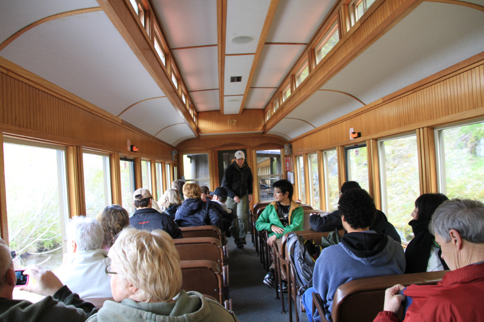
Every Victoria Day long weekend, the White Pass & Yukon Route railway offers Yukoners discounted rides on the railway, and on Saturday Cathy, my nice Bobbie and I joined hundreds of other Yukoners on the trains. We chose to drive to Skagway and take the longest trip available, from Skagway to Fraser and back, a total of 56 miles. It was an amazing day! I figure that it would take about 62,000 words to properly tell you about it, but since a picture is worth 1,000 words I’m posting 61 photos and some commentary instead 🙂
I was shooting with a Canon EOS 7D with a Tamron 18-270mm zoom lens.
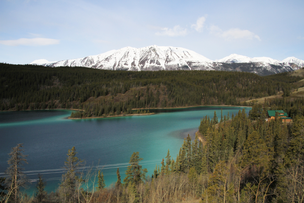
We left the house and 9:00 and our first stop was at Emerald Lake. The ice has melted off in the past couple of days and the gorgeous colours are now visible.
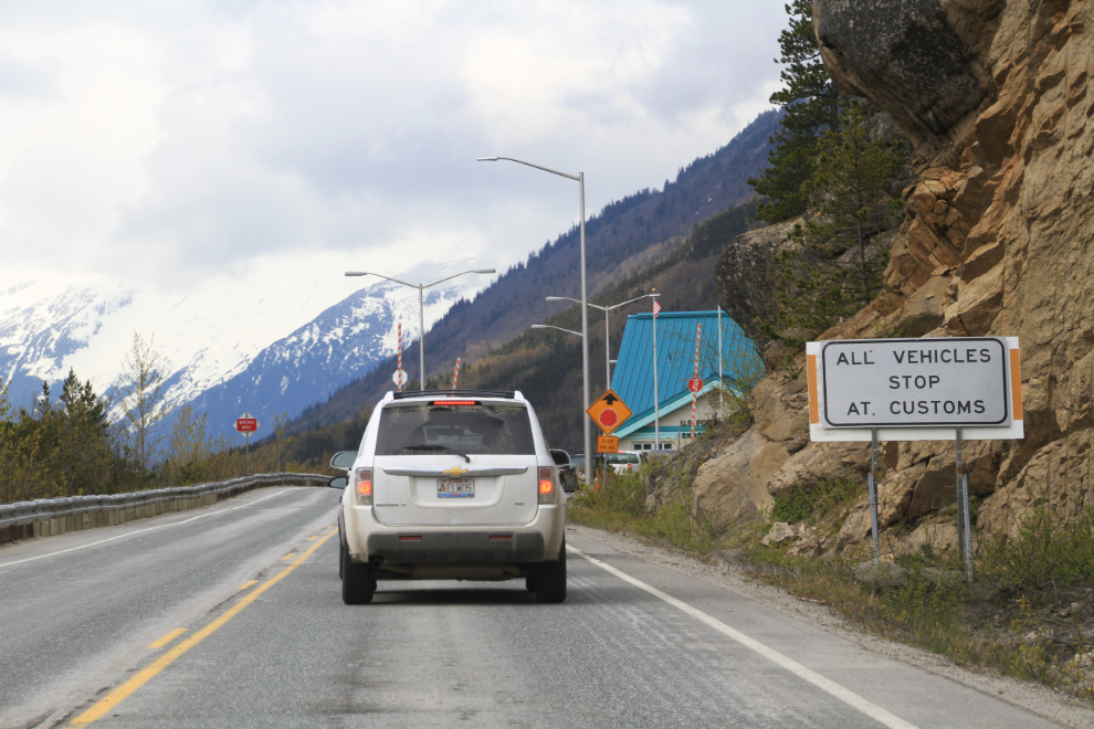
We expected a delay at the border but we certainly didn’t expect a 40-minute delay with this few vehicles! Our crossing was as quick and friendly as usual, so I don’t know who/what had caused the delay.
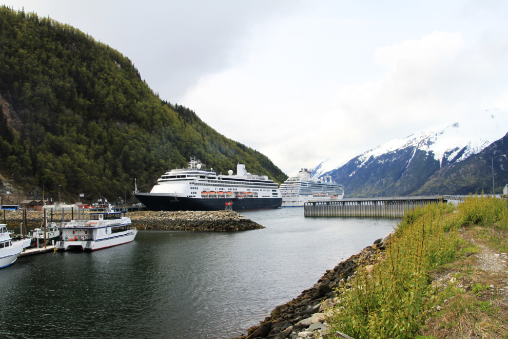
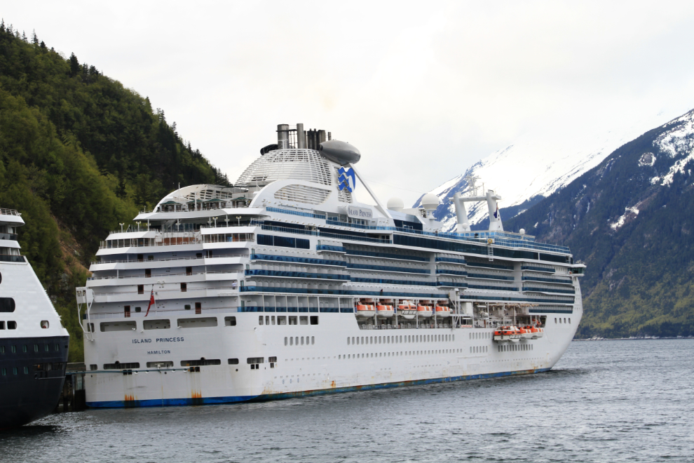
There were 2 cruise ships in port, Holland America’s Volendam and the Island Princess.
The Island Princess was looking very ratty – I don’t think I’ve ever seen a cruise ship this badly in need of a paint job.
We went to the Skagway Brewing Company for lunch but it was still closed so went to The Station instead. The quality of all 3 meals was so disappointing that I doubt I’ll be back. In my case, the pieces of halibut were extremely small inside extremely thick batter. Blah! for 15 bucks.
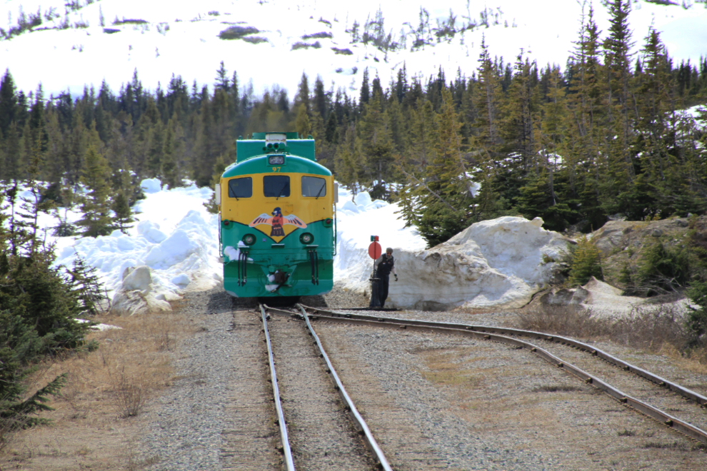
Engine #90 arrives at the depot with engineer John Westfall at the controls just after noon local time (that’s 1:00pm Yukon time). Many years ago I rode up to the summit with John in the cab of the locomotive. Very cool, but the view from the passenger cars is better.
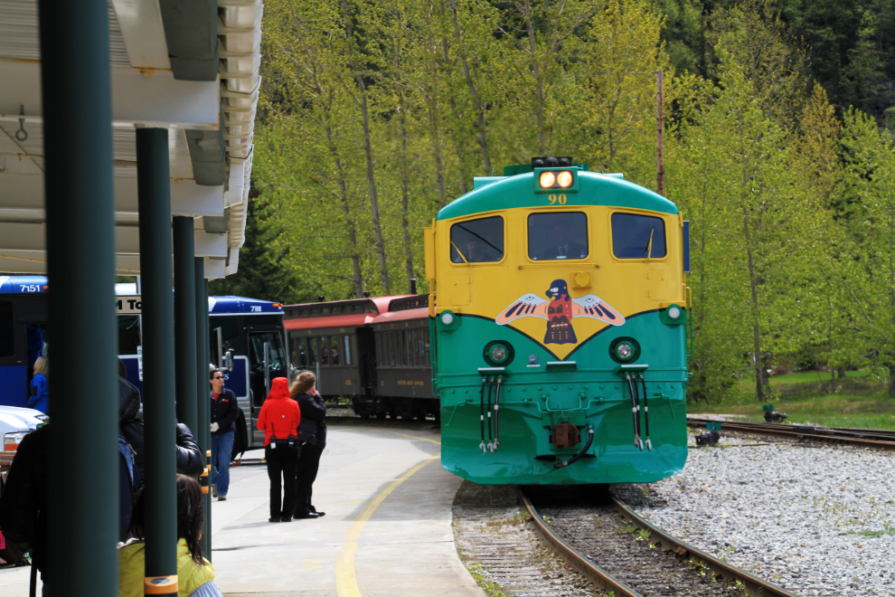
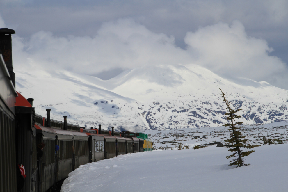
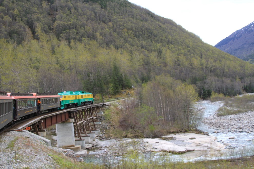
Right at the scheduled 12:30, we headed north with a string of about a dozen cars.
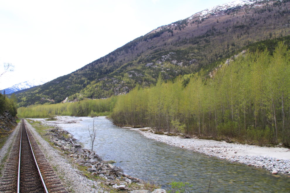
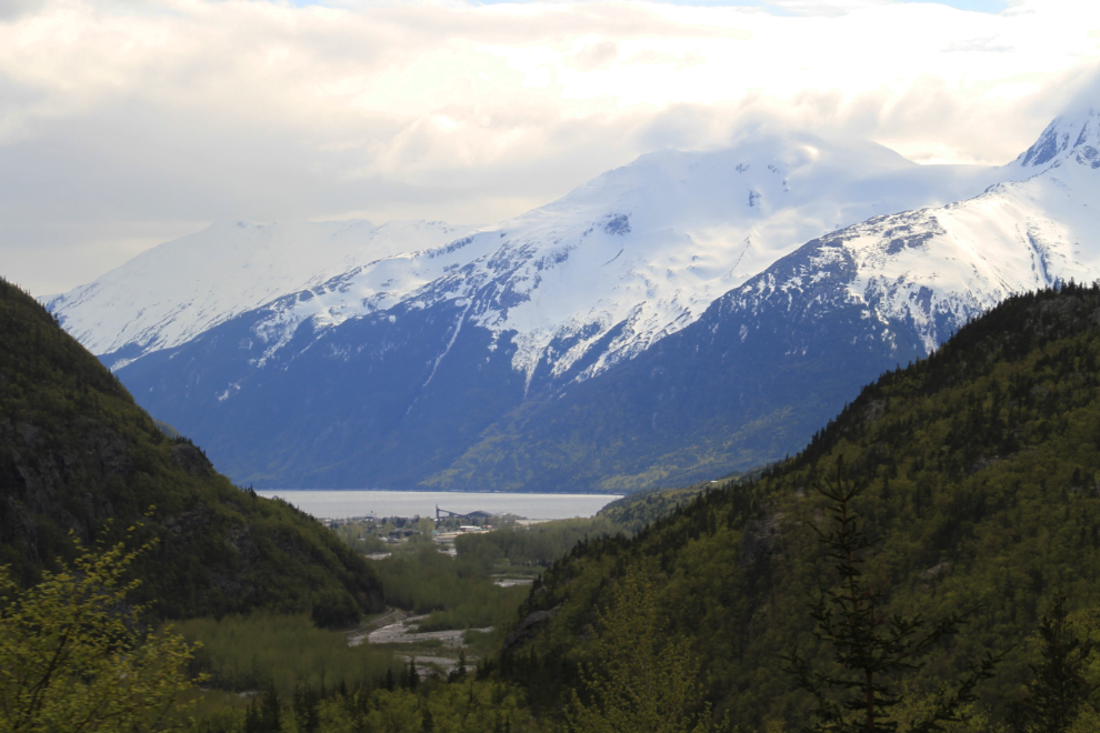
The peaceful lower Skagway River. The sight and smell of budding trees brings Yukoners by the hundreds (if not thousands) to Skagway, Dyea and Haines on this weekend every year.
Just north of the bridge over the East Fork of the Skagway River at Milepost (MP) 6.
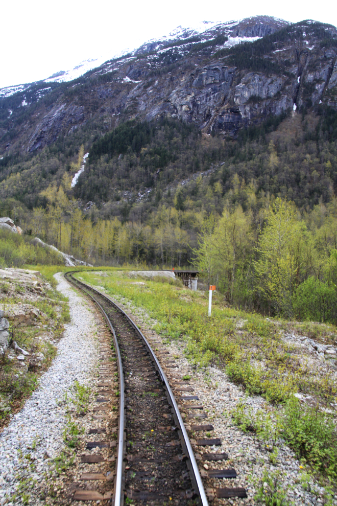
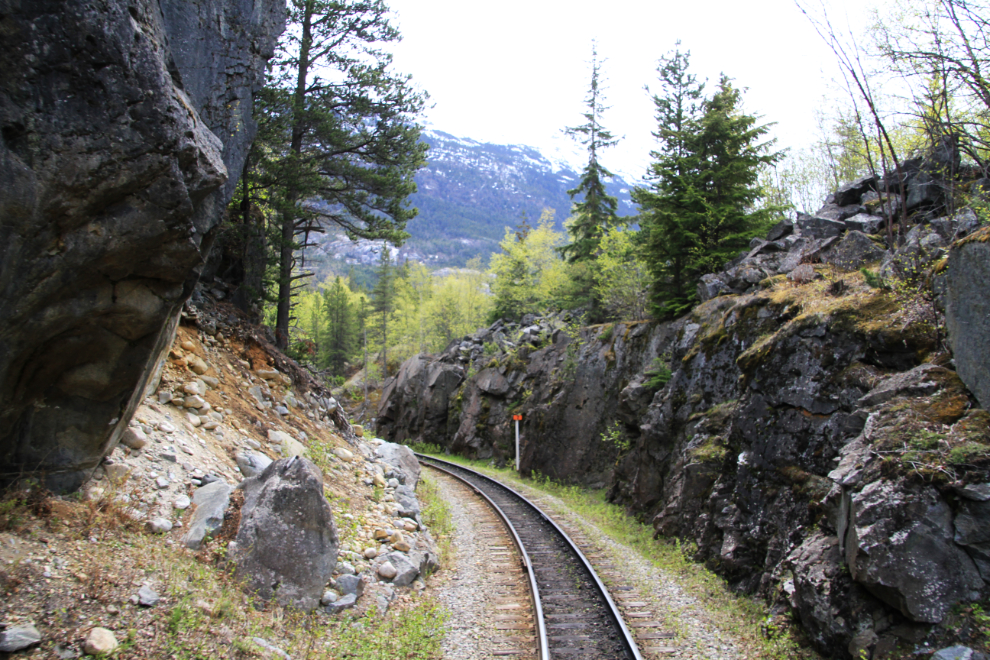
The cut through Rocky Point at MP 7.
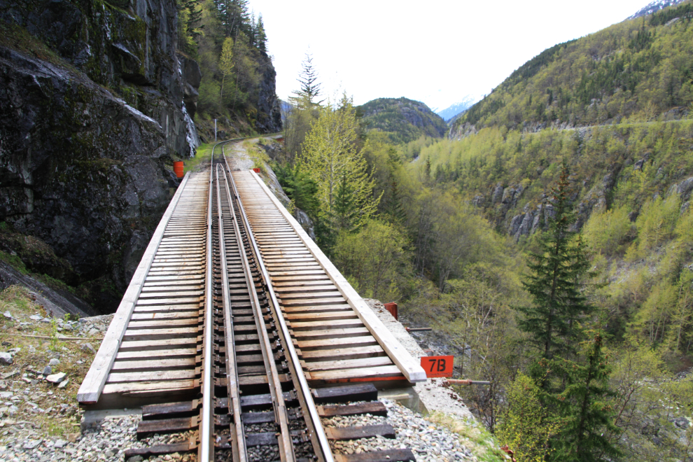
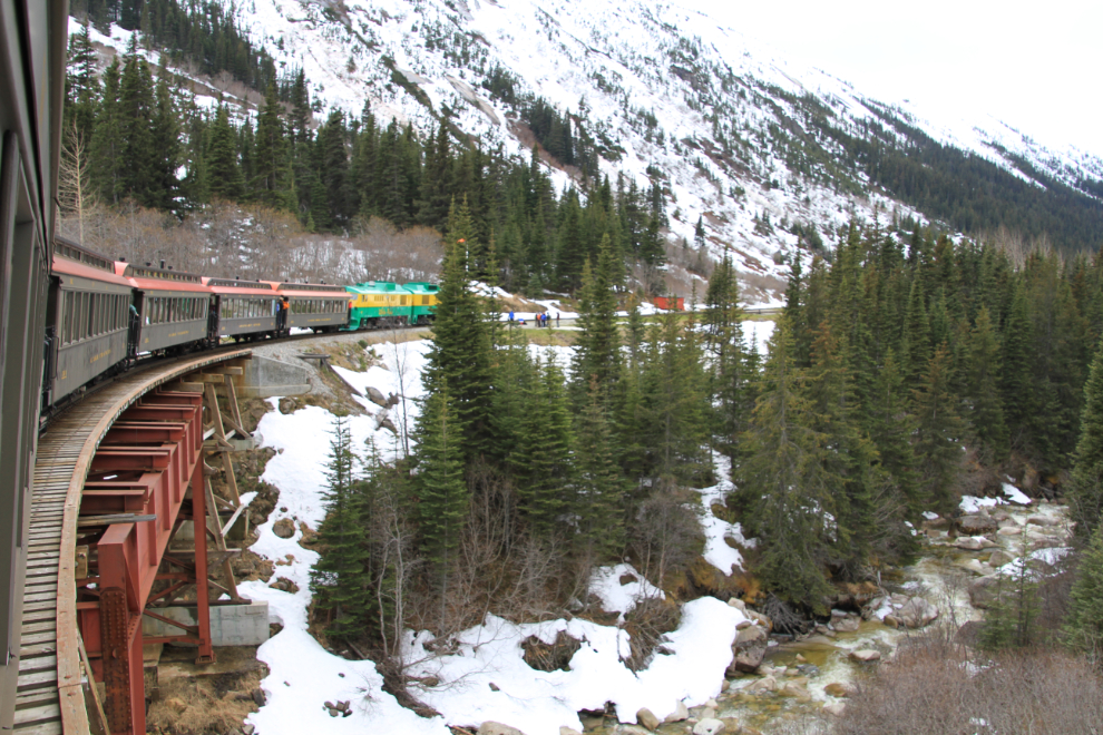
By the standard naming convention, Bridge 7B is the 2nd one past MP 7. This is where the steep drops from the edge of the tracks really begin.
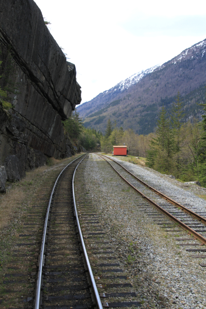
Clifton, MP 8.5.
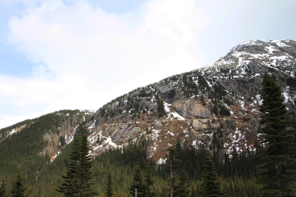
In just a little while we’d be waaaay up there!
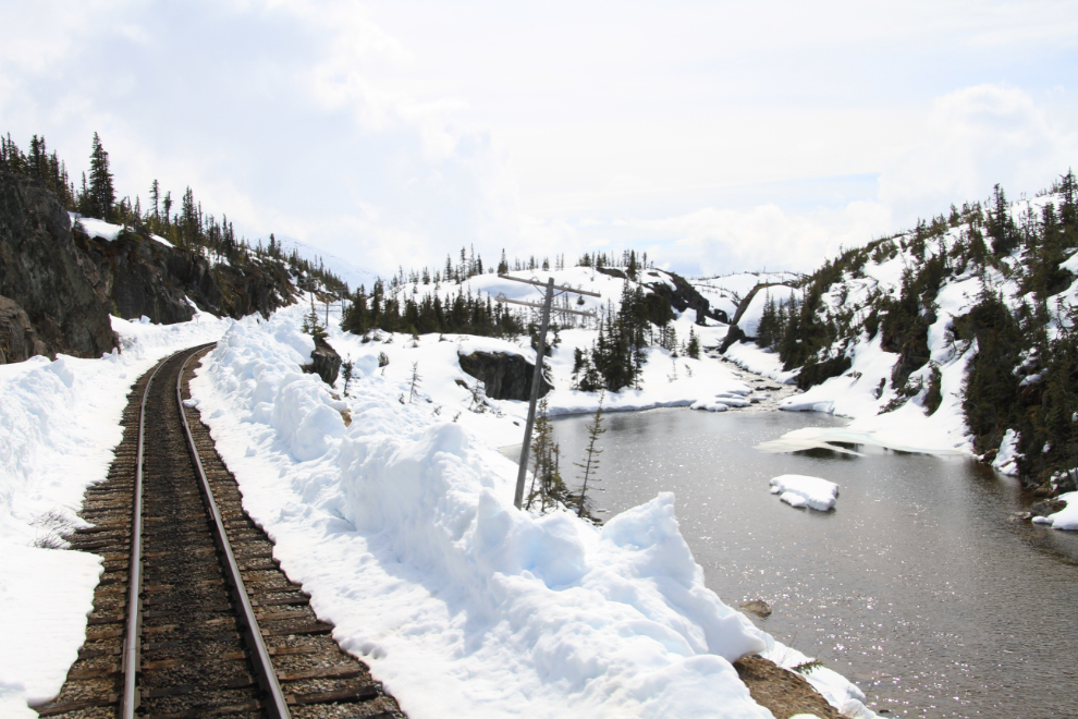
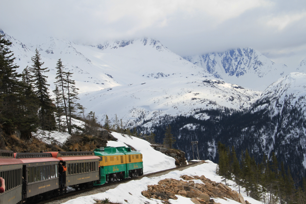
At Glacier, MP 14.1, there is another siding to allow trains to get by one another. The elevation at Glacier, which we reached at 13:28, is 1,871 feet above sea level.
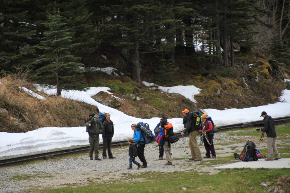
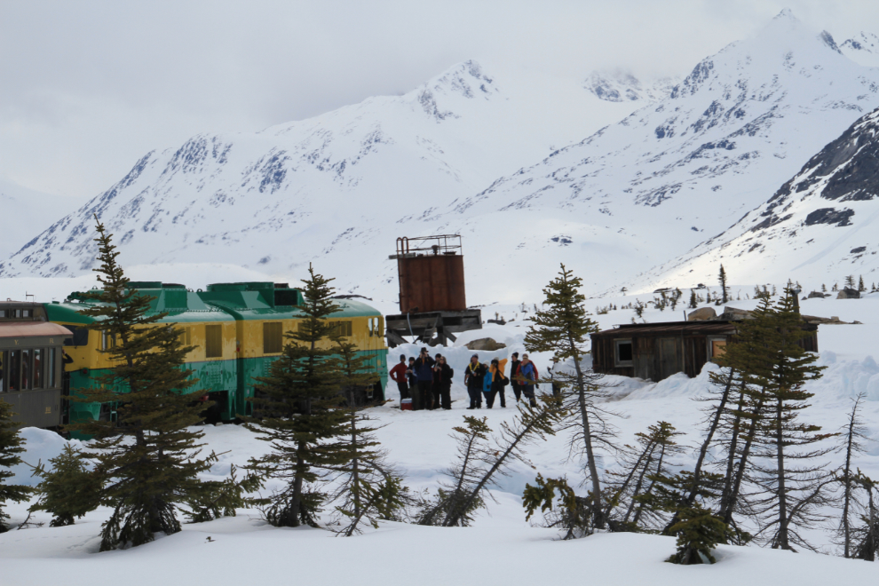
At Glacier, we dropped off a group of hikers who were making the fairly easy snowshoe hike to the Laughton Glacier.
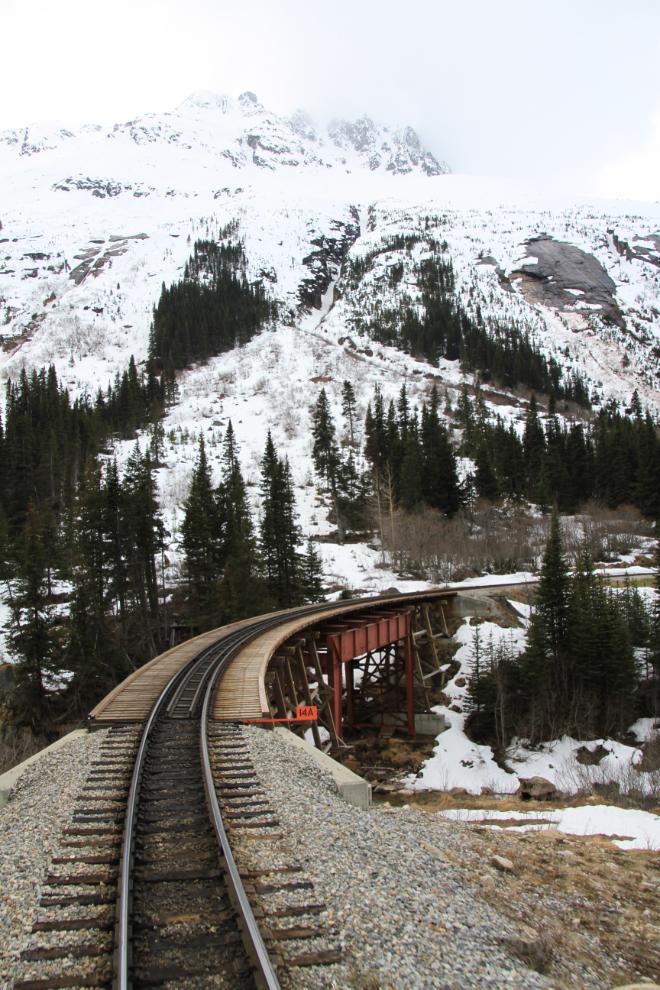
Just north of Glacier, Bridge 14A crosses the main fork of the Skagway River.
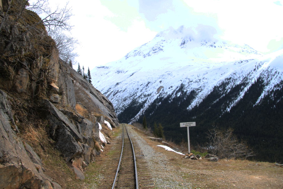
Slippery Rock, seen just to the right of center in the photo 4 above this one, was a particularly difficult section to blast a ledge wide enough to build a railway on.
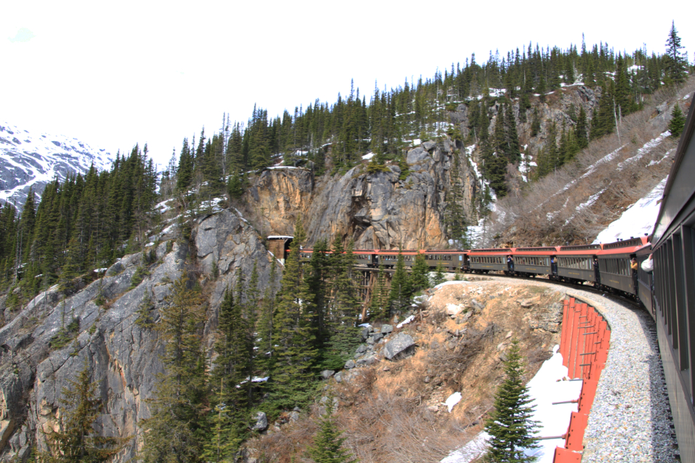
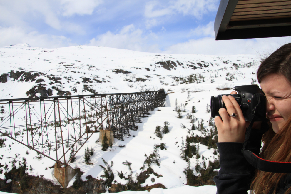
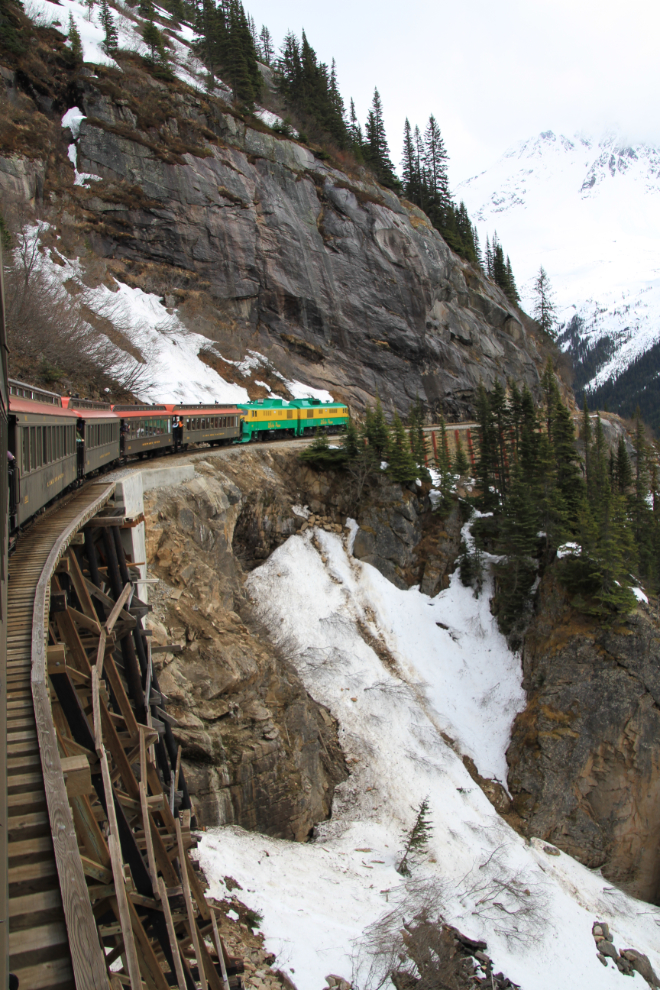
The approach to the tunnel through Tunnel Mountain is one of the classic views along the rail line, one that every serious photographer has to have in their collection, so the outside platforms get very crowded. 🙂
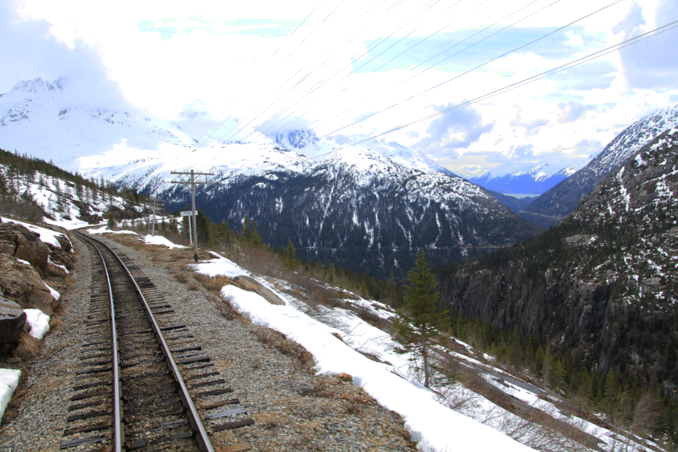
The view back to Skagway and Taiya Inlet from Inspiration Point at Mile 16.9 – the elevation here is 2,475 feet. When only one or two trains were running each day, a 15-minute stop used to be made here, but schedules are much too tight to allow that now.
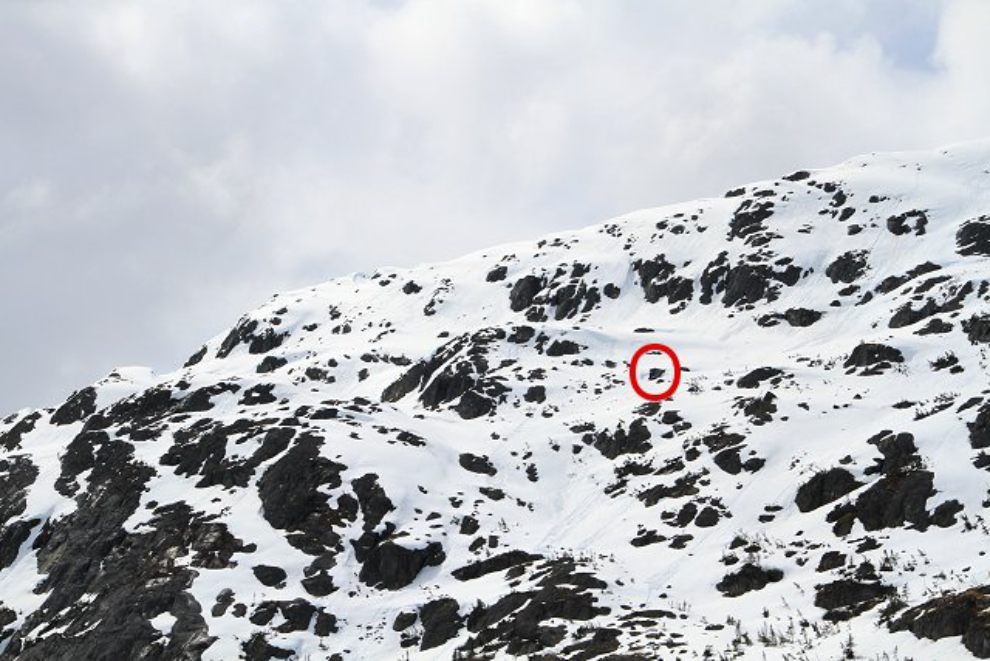
Across the canyon from Inspiration Point is Mine Mountain, site of the Inspiration Point Mine which operated for a short while in the 1920s. The upper terminus of an aerial tramway that connected the mine and the railway is circled.
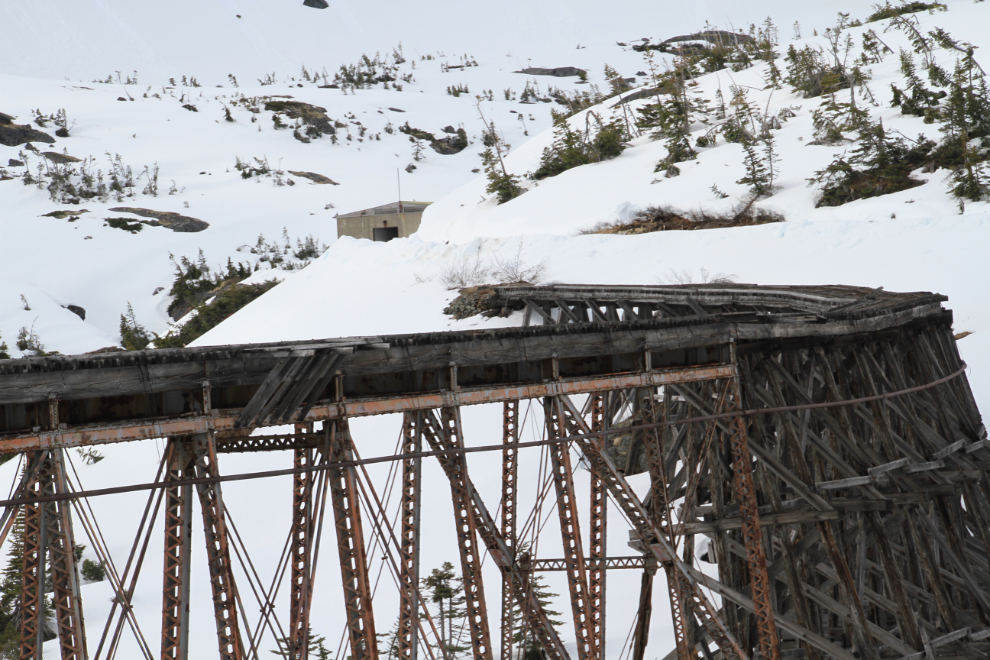
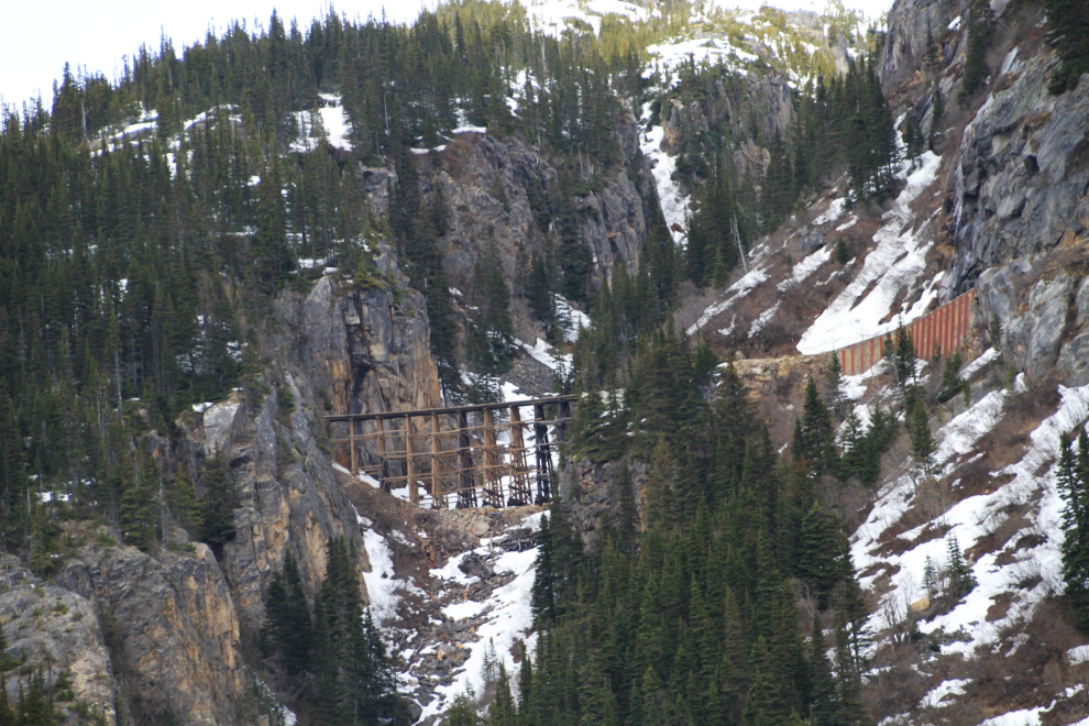
MP 17.6 was the site of the Hannan Snow Shed which kept snowslides off the tracks until 1992 when it was demolished because it was in very poor condition.
A 215-foot-long cantilever bridge sits at MP 18.5. The tallest of its kind in the world when it was constructed, it opened in 1901 and served the line until 1969 when the use of much heavier trains carrying ore from the Yukon to tidewater forced a new, stonger bridge to be built.
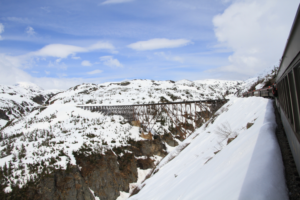
Bridge 18A is another photo “must”!
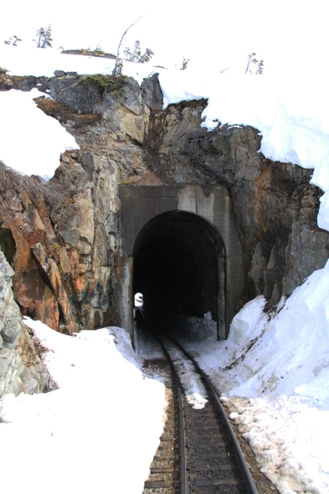
This 675-foot-long tunnel is at the north end of the bridge that replaced the old cantilever bridge.
The American Snow Shed at MP 19.4 was demolished in the late 1980s.
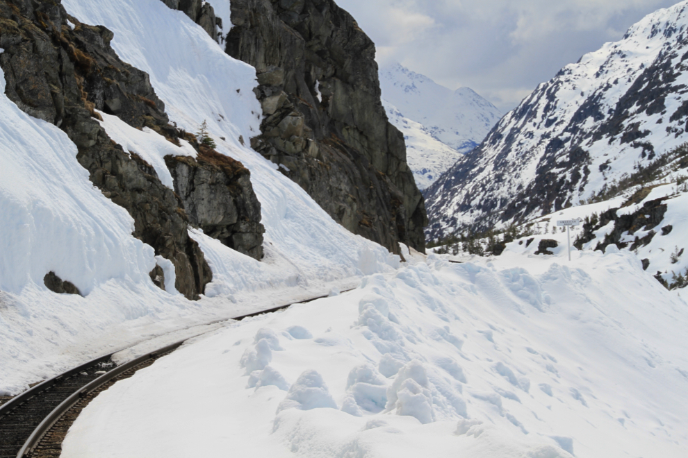
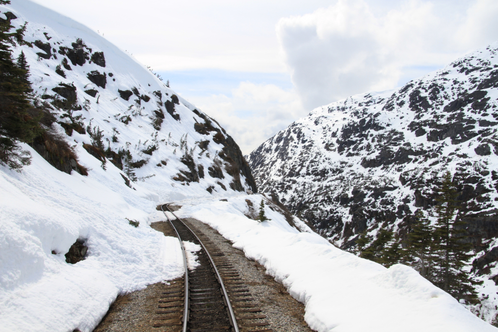
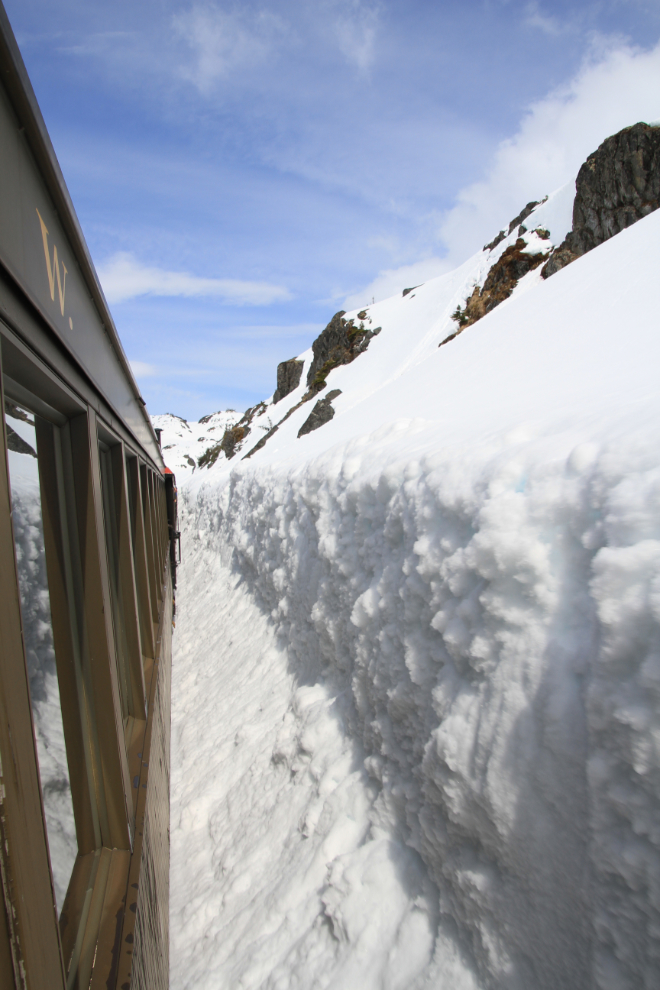
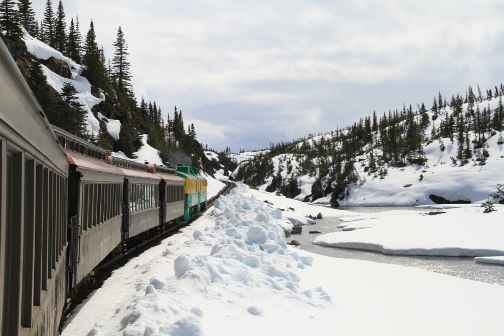
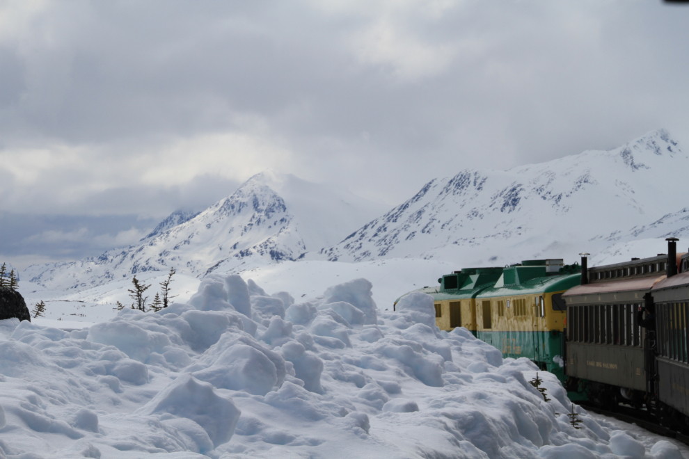
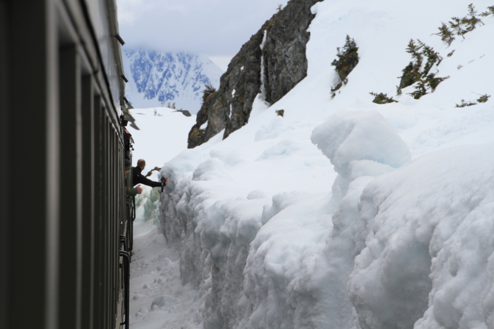
The snow beside the tracks was as high as the cars as we neared the White Pass summit.
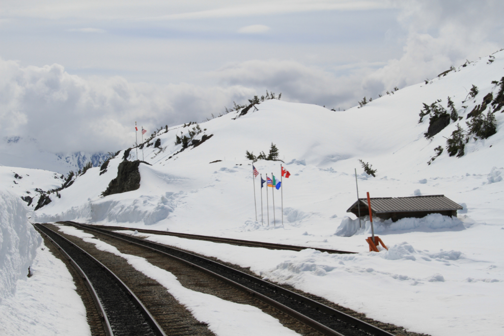
White Pass summit is the border between Alaska and British Columbia. Although a map on the WP&YR Web site says that the summit is 2,865 feet high, many books use the figure 2,856 feet, Wikipedia says 2,885 feet and I’m almost certain that the sign at the summit says 2,888 feet! Despite the presence of snow here for much of the year, the pass isn’t named for The White Stuff but for Thomas White, who was Canada’s Minister of the Interior when the pass was named in 1888.
The line actually climbs another 75 feet just past the summit.
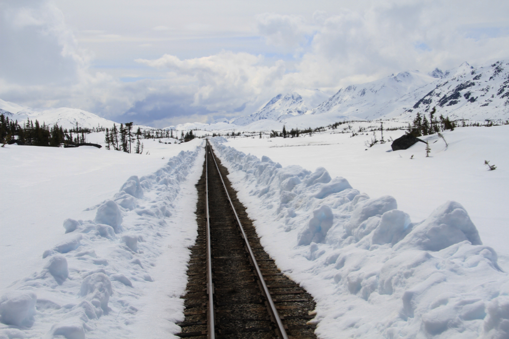
The broad Meadows area at MP 25 is beautiful when the snow finally melts, with lots of ponds surrounded by grasses and wildflowers.
The train crawls down the 3.8% grade (the steepest on the line) at Fraser Hill.
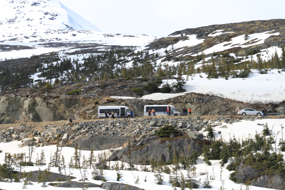
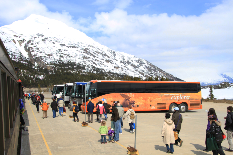
Tour buses stop to watch our train cross the small bridge over the Thompson River. From the highway this is one of the most scenic spots to get photos of the rail line.
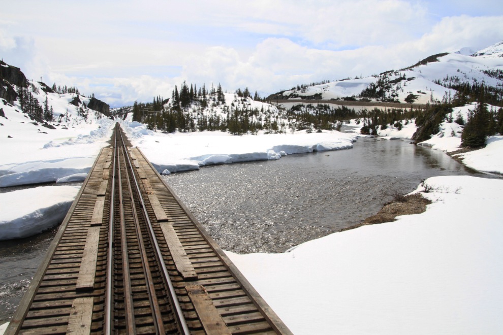
Bridge 26A over the Thompson River.
At Fraser, rather than turn the entire train, the locomotives are simply moved to what had been the back of the train. Here Engineer John Westfall, having gone around us on the siding, throws the switch to get back on the main line and re-connect to our string of cars.
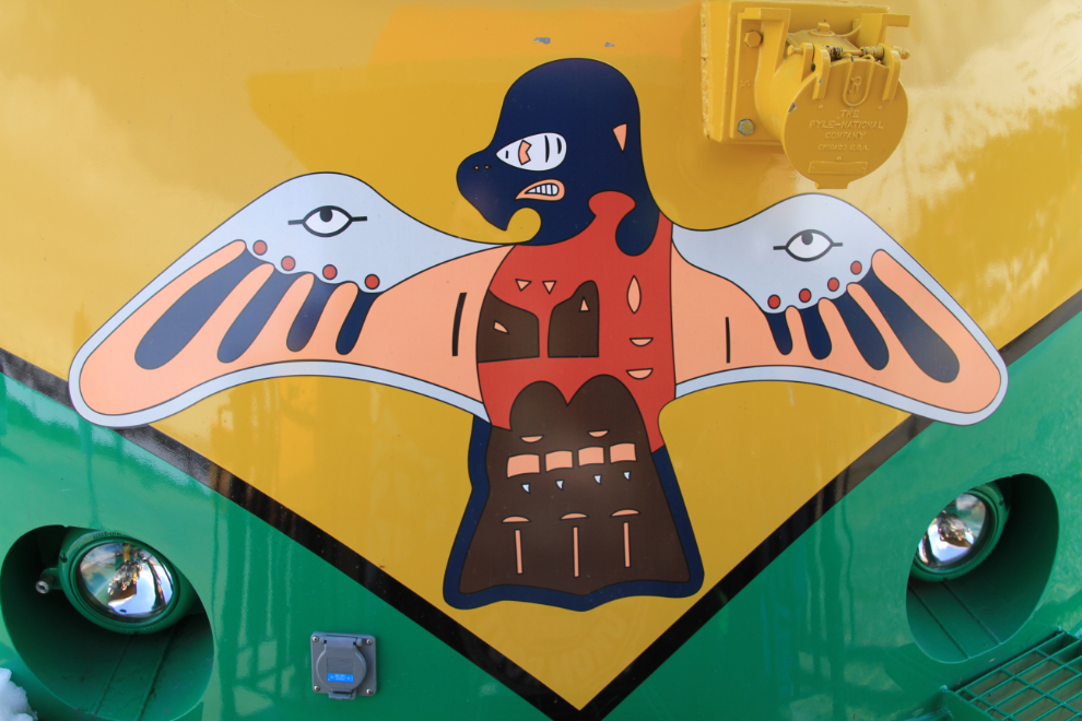
A closeup of the thunderbird on the locomotive as it backed up to our car.
Most people only go one way on the train to or from Fraser, and connect with buses or motorcoaches.
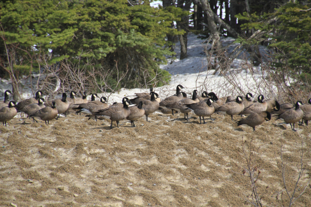
While we sat at Fraser, a large flock of Cackling Geese landed close by. These are Branta hutchinsii minima, the smallest of all Cackling Geese (many thanks to Cameron Eckert for the subspecies identification).
At 14:45 we started the journey back to Skagway. Here the train climbs the steep Fraser Hill.
Back in deep snow country across the top of the pass.
We stopped at the former Meadows station to pick up this group of people who had snowshoed over from the highway.
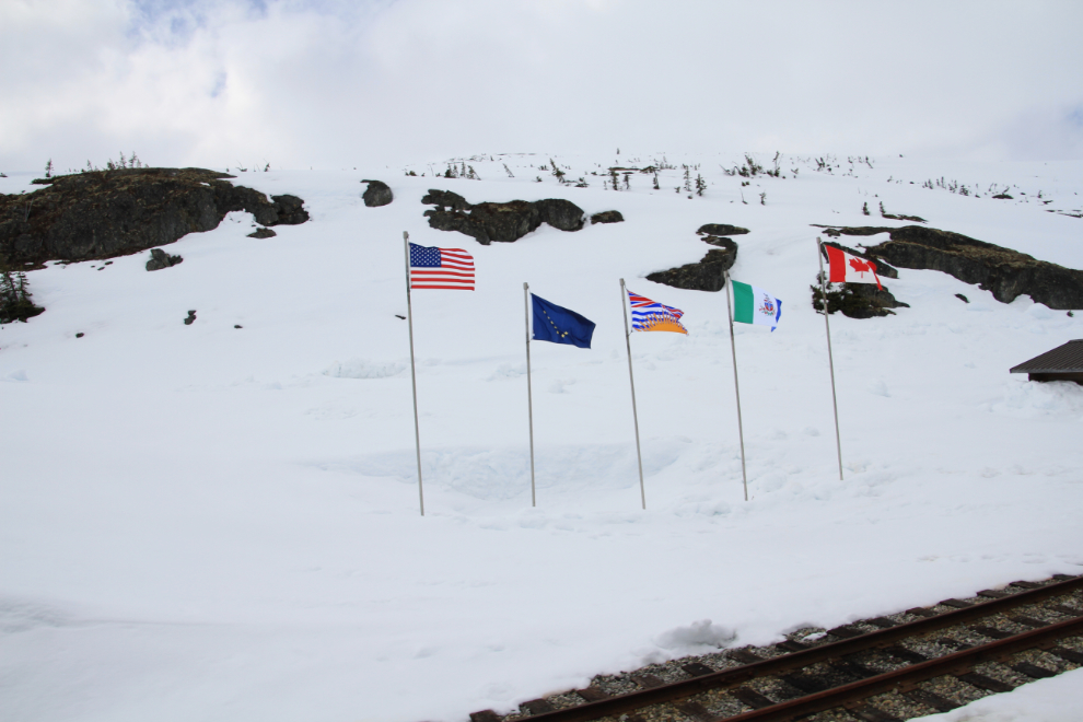
The flags at the summit/border are those of the United States, Alaska, British Columbia, the Yukon, and Canada.
People apparently shooting video of the snow going by.
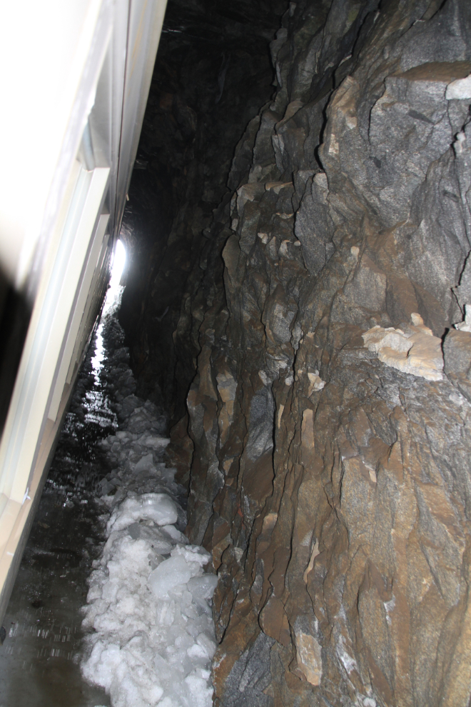
An off-kilter flash-lit look at the inside of the tunnel at MP 18.7.
A closer look at the cantilver bridge. I tried to walk across it a few years ago but quickly lost my nerve – it’s a very long way to the creek below!
Nearing Inspiration Point.
Looking south from Tunnel Mountain across Bridge 15C.
Crossing the Skagway River at Glacier.
Looking back up at Tunnel Mountain – what incredible engineering 114 years ago!
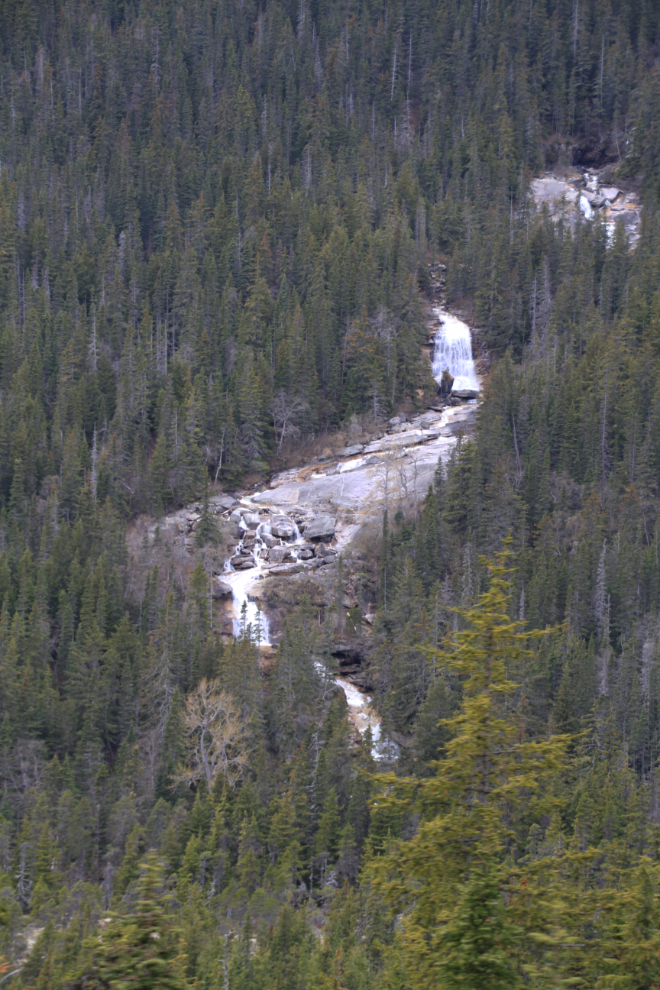
Bridal Veil Falls on Moore Creek can be seen across the valley. Due to the fact that the high country is still frozen, none of the waterfalls are very impressive yet.
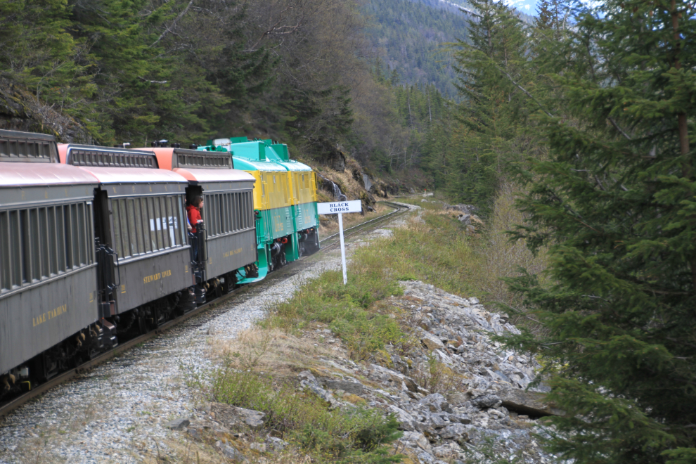
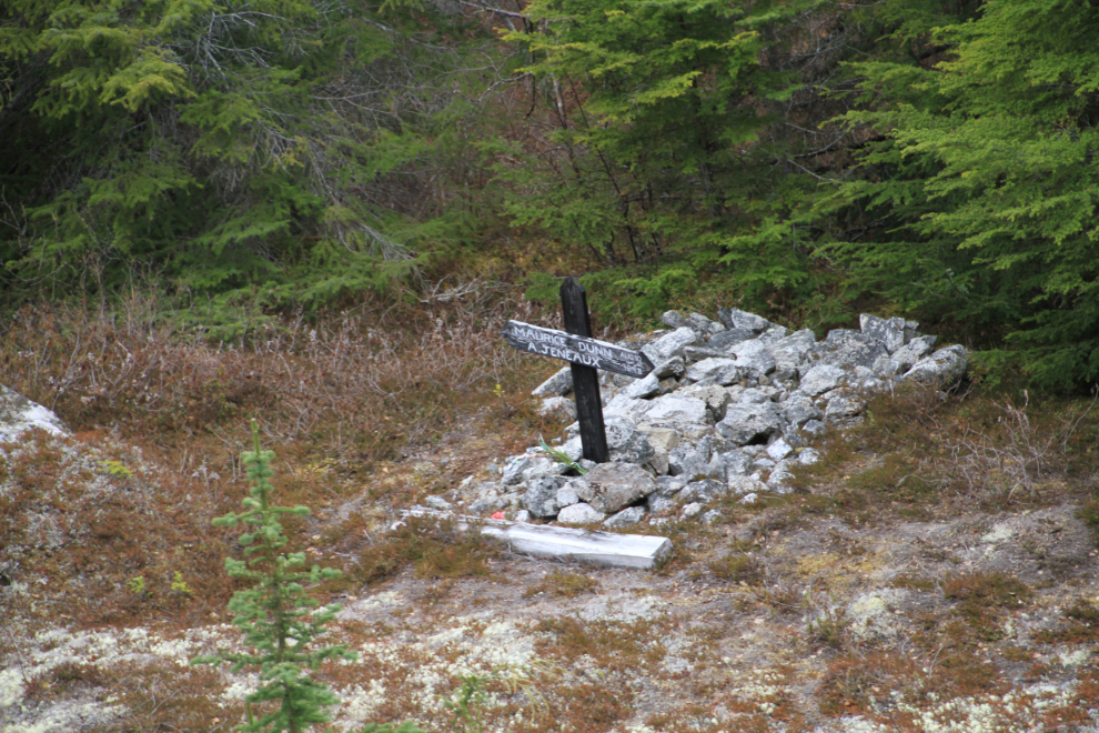
One of the locations that I had yet to get photos of on my many trips is Black Cross Rock – it always sneaks up on me. This time I was ready, though, with a clear spot on the open platform.
On August 3, 1898, Maurice Dunn and A. Jeneaux were killed when a huge rock dislodged by a blast fell on them. Their bodies were never recovered.
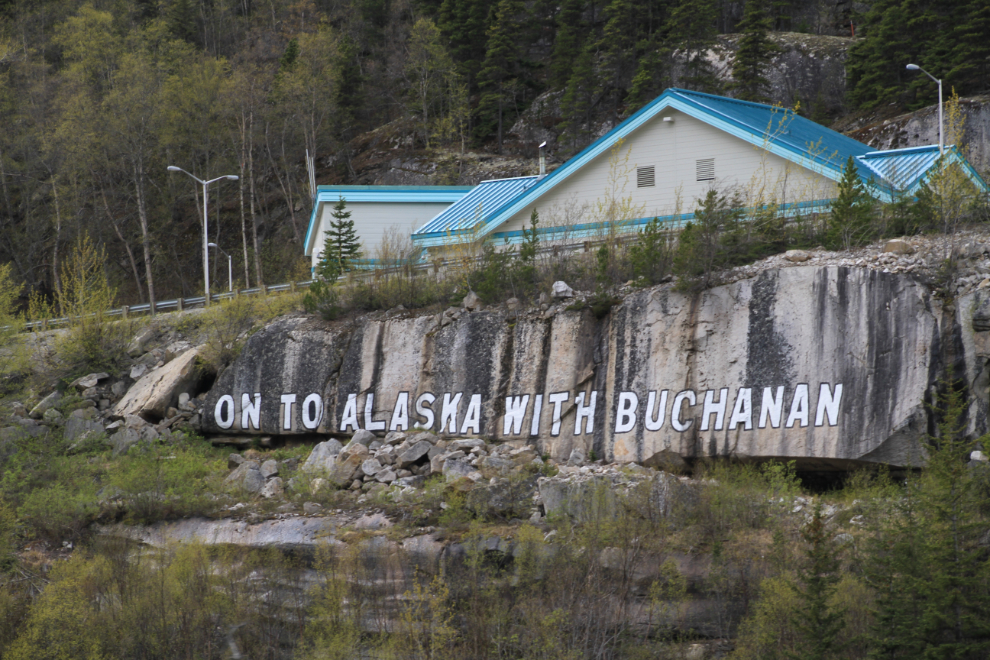
“On To Alaska with Buchanan” – for about 10 years through the 1920s and early ’30s George Buchanan, a successful Detroit businessman, brought groups of boys to Alaska, and one of those groups originally painted this sign on a cliff below the US Customs office.
Almost back to Skagway.
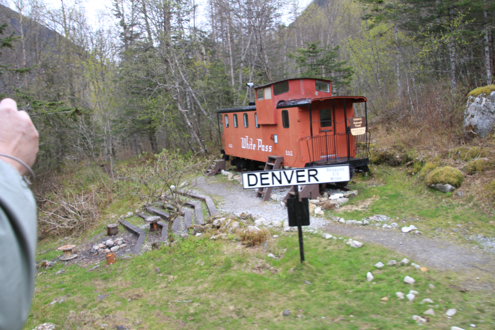
Bridge 5A over the East Fork of the Skagway River at Denver.
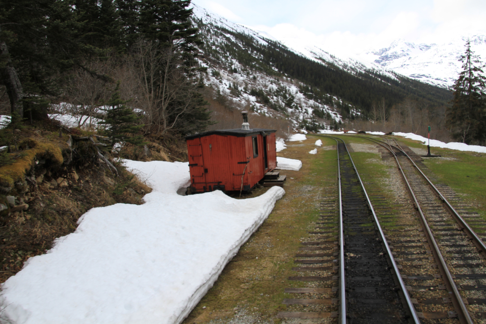
This caboose at Denver can be rented from the Forest Service – see the Denver Caboose Cabin listing at Recreation.gov.
We got back to Skagway at about 4:30. We had hoped to have dinner at the Sunfire Thai restaurant but couldn’t get in so went to the Skagway Brewing Company and had the usual excellent meal there.
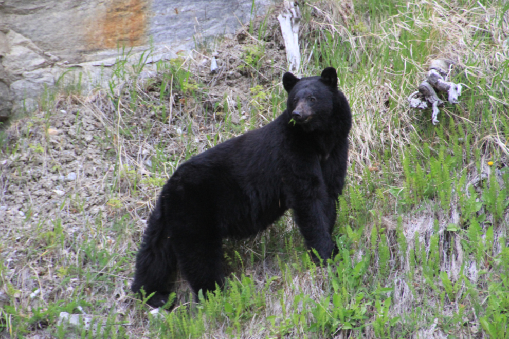
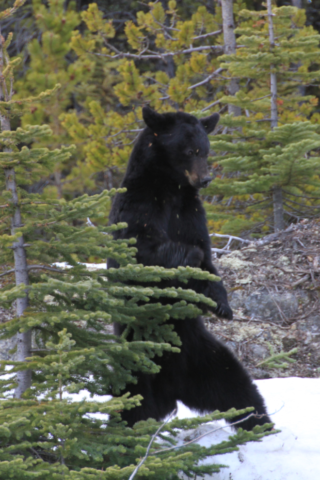
A mile out of town on our way home, I did a U-turn and went back tp spend a while with this black bear beside the road. He’d been hidden by a pile of gravel until I was well past the road into the gravel pit where he was feeding on new greens.
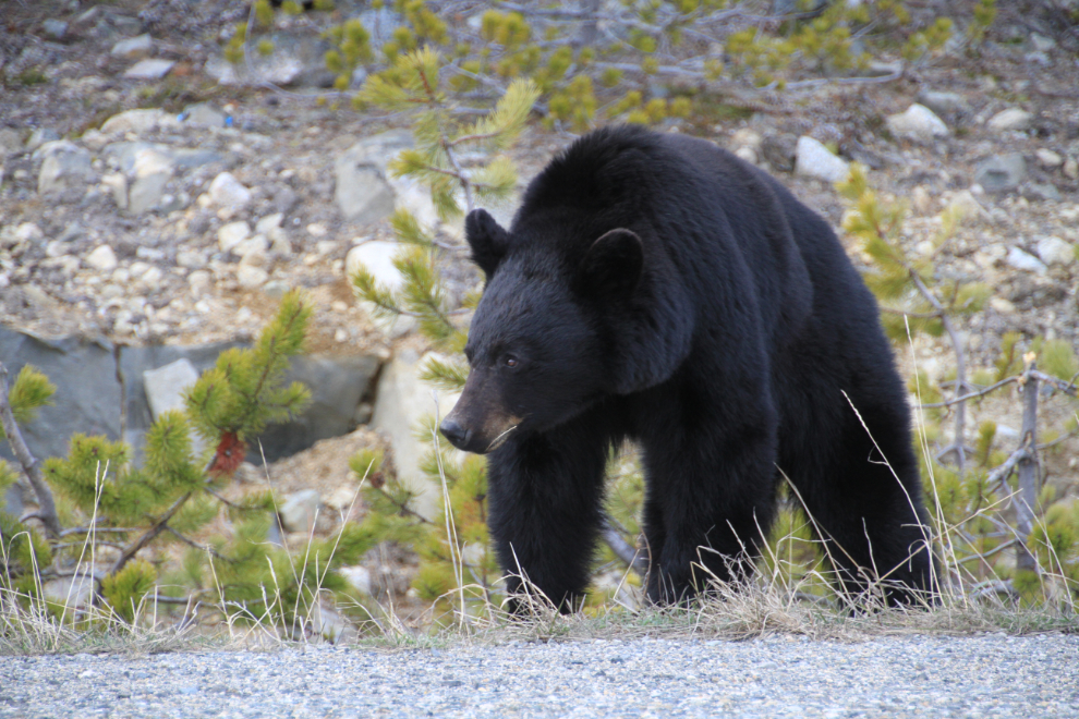
Just north of Log Cabin, there was another black bear beside the road.
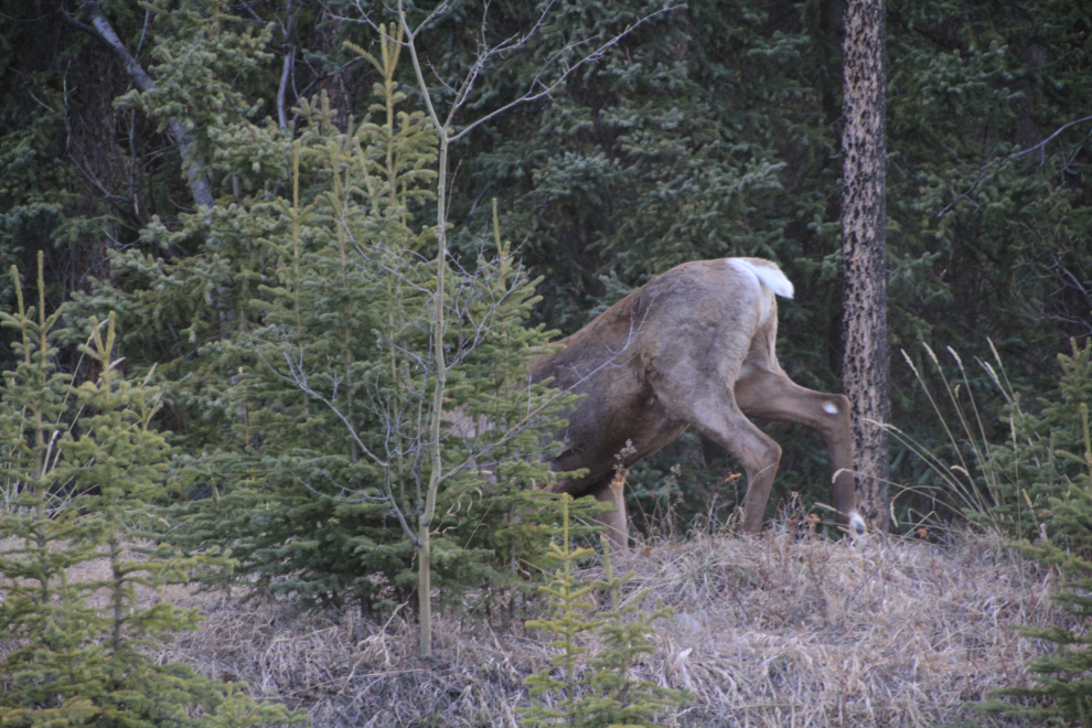
I have no idea what this bear was doing, bending this little tree over. A territorial display, perhaps?
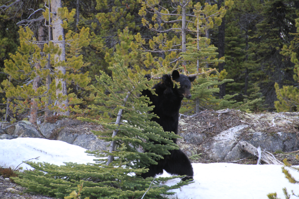
A dancing bear as he left the tree 🙂
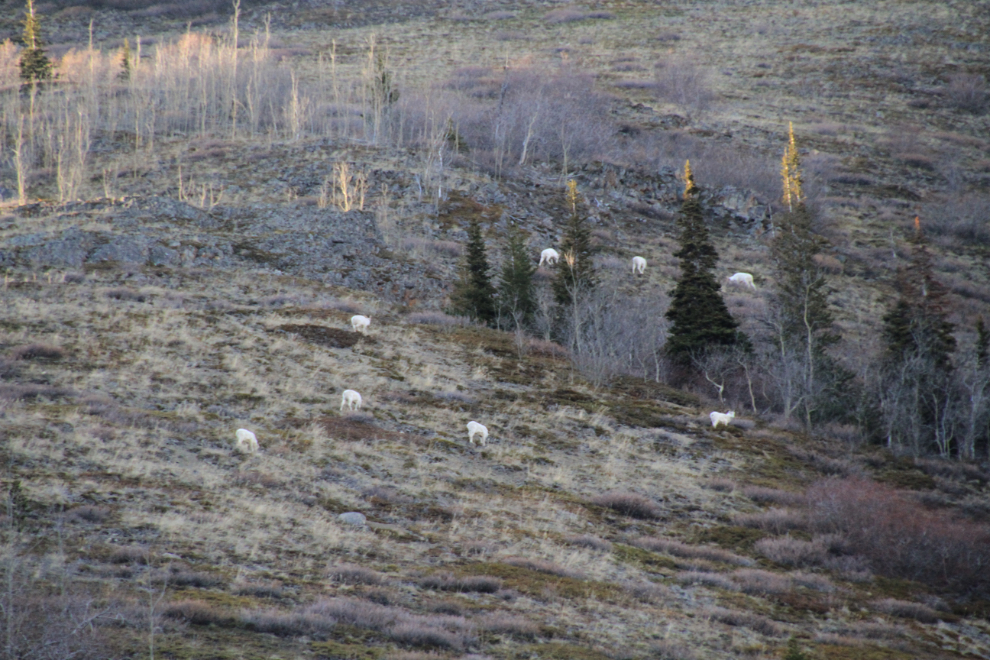
Back in the Yukon at Dail Peak, we watched 14 Dall sheep rams on the slope. A few minutes later, Cathy spotted some mountain goats fairly low at Pooley Canyon, but it was getting late and we didn’t stop for them.
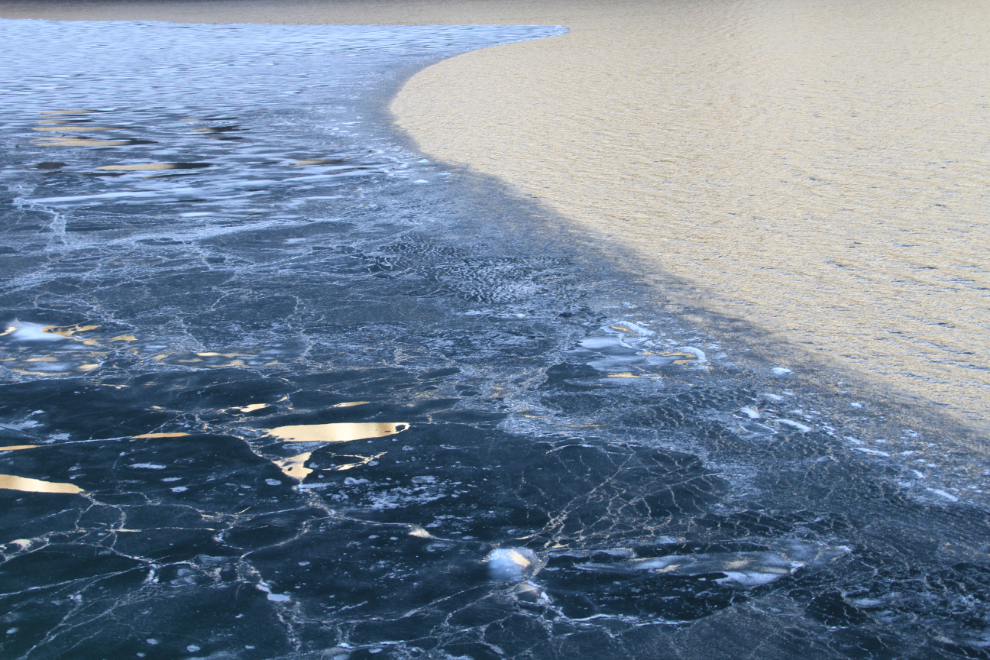
I had to stop along Windy Arm to capture these patterns and colours on the lake!
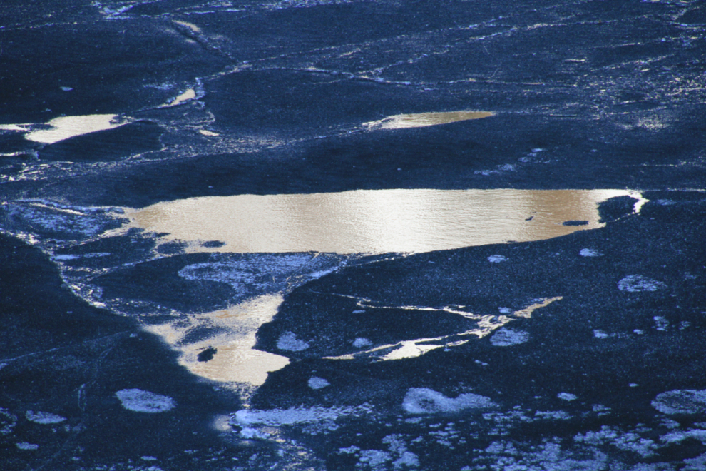
This broader view of the rotting ice shows where the photo above came from.
At 20:20, just south of the Alaska Highway, we saw 2 caribou, but there was a car blocking a good photo and when the car left, so did the caribou so all we got was a ‘bou bum 🙂
What an amazing 12 hours that had been. It’s not without good reasons that the White Pass & Yukon Route railway has been the top-selling tourist excursion available at Skagway for most of the last century-plus. Thanks, Whitepassers!