Canoeing the Yukon River, Part 1: Whitehorse to Lower Laberge
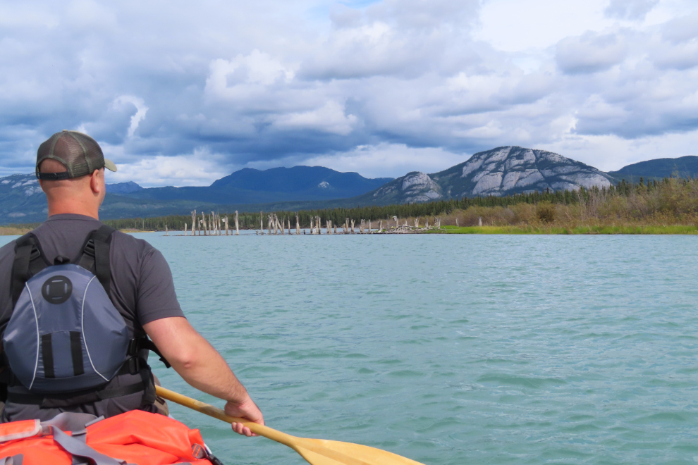
On Monday, August 11th, my son and I launched my canoe on the Yukon River at Rotary Park in downtown Whitehorse, and on August 21st we reached Dawson. Just before 10:00 am we met Cathy, who had driven down from Whitehorse the previous day. This post covers the first 2½ days, from Whitehorse down the river, and crossing 50-km-long Lake Laberge.
This was the second time Steve and I experienced this Adventure together. We did it 28 years ago, and I posted my first-ever illustrated article of this type on my new Web site on August 22, 1997 – see Our Time Machine is a Canoe. While that article focussed on the historic sites we visited, this series of blog posts is primarily about the Adventure, with commentary about the river, the campsites, the weather, etc, as well as a bit about the history. In the 1997 article I said “…the opportunity to spend almost 2 weeks alone with Steven while helping him to accomplish something that he can really be proud of, may never come again” – but we made it come again! Sometimes “stuff” happens, but on a good day, life is what you make of it 🙂
We had planned on launching on August 10th, but a weather forecast showing wind gusts to 40 km/h delayed us a day – that’s not good weather for a crossing of Lake Laberge. In 1997 we started from the Lake Laberge Campground halfway down the lake, but this time I wanted to do the same 715 km / 444 mile route as the Yukon River Quest race – my canoe was bought to run that race, though I never did.
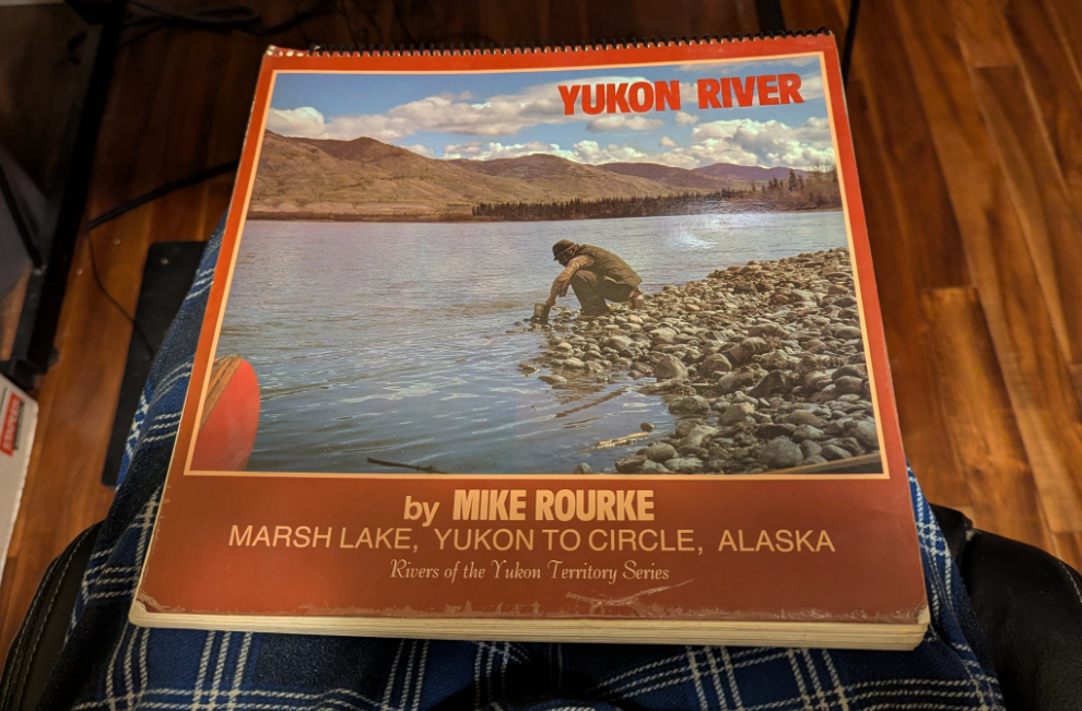
My route guide in ’97 was Mike Rourke’s exceptional “Yukon River.” I was going to take it again, then decided that this edition was too valuable to risk damaging. A friend said that the guide does get updated, so I went into town and bought a copy that was just printed (dated 2025). It’s also smaller, 7×9 inches instead of the original 11×11 inches, so is handier in the boat. Although Rourke’s book calls the Rotary Park boat launch “28.5 M/46 KM” because he starts at Marsh Lake, this is Km 0 for us, and mileages in these posts will be based on that. Also, Rourke shows the mileage to Dawson as 439 miles rather than the River Quest figure of 444 miles – I’ll be using the Rourke mileages. The photo below shows my 1985 edition of the guide.
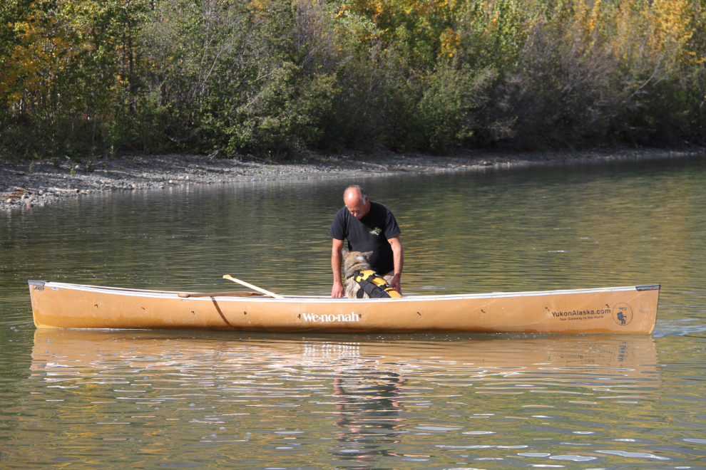
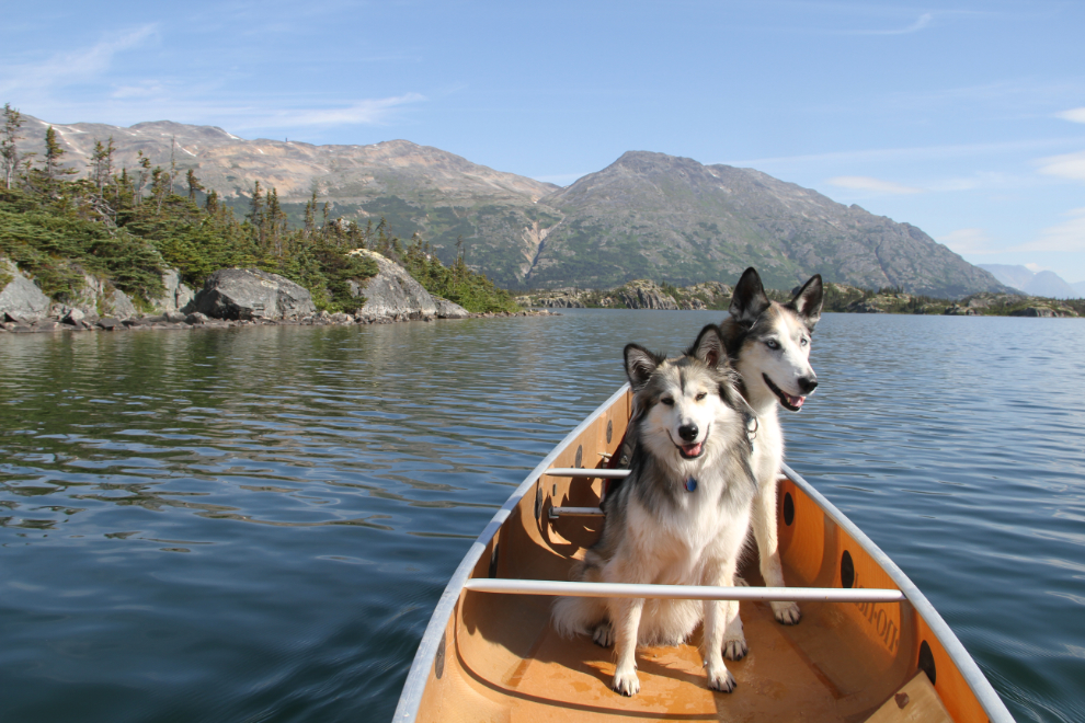
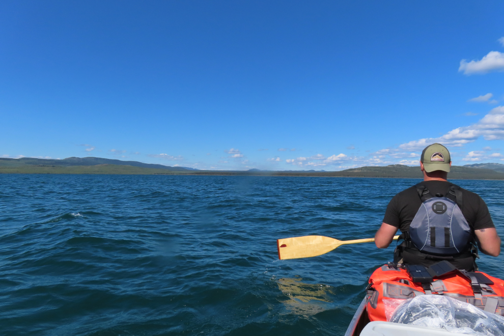
Our canoe is an 18-foot Wenonah-Jensen race-touring boat that I bought in 2001. It’s perfect for trips like this – the Wenonah site says “This nimble, fast canoe quickly became a favorite of participants in the Yukon Quest Race because of its seaworthiness.” They don’t publish a weigh limit, but 1,500 pounds seems to be the accepted figure. And it’s made of kevlar, so the boat weighs only 42.0 pounds (I just weighed it to be certain – I had 45 lbs in my mind). For weather or rough water (like Five Finger Rapids), it has a full spray cover. The first photo below was shot on Aishihik Lake, the second on Bernard Lake in the White Pass.
On Monday morning (August 11th), we were as ready as we were going to get, so loaded the Jeep and drove to Rotary Park in downtown Whitehorse. A friend came down to see us off, which was nice. I had Cathy take a few photos, and at 10:33 posted a couple on Facebook with the simple comment “And they’re off!”
What a wonderful feeling to be on the river, with no schedule of any kind. We had arranged for Cathy to meet us in Dawson the morning of the 21st, but could change that to anything that might work better. It was completely calm on the river, even though thousands of people live at the top of that cutbank, in the Whistle Bend community.
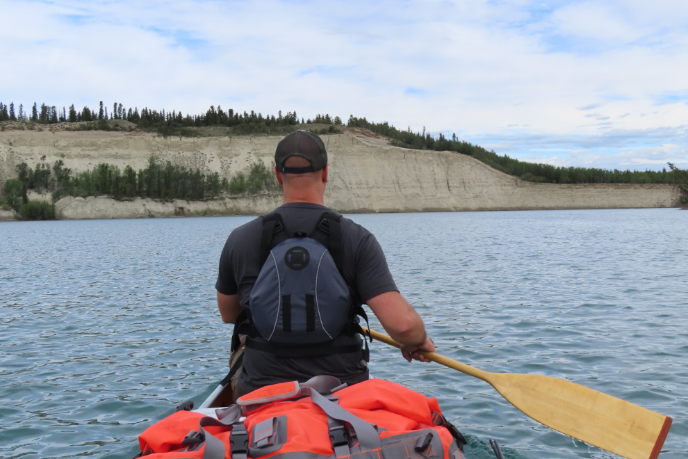
I was quickly glad that we had decided to paddle the whole route this time – the river has great variety. The pipeline to the Whitehorse sewage lagoons goes under the river here.
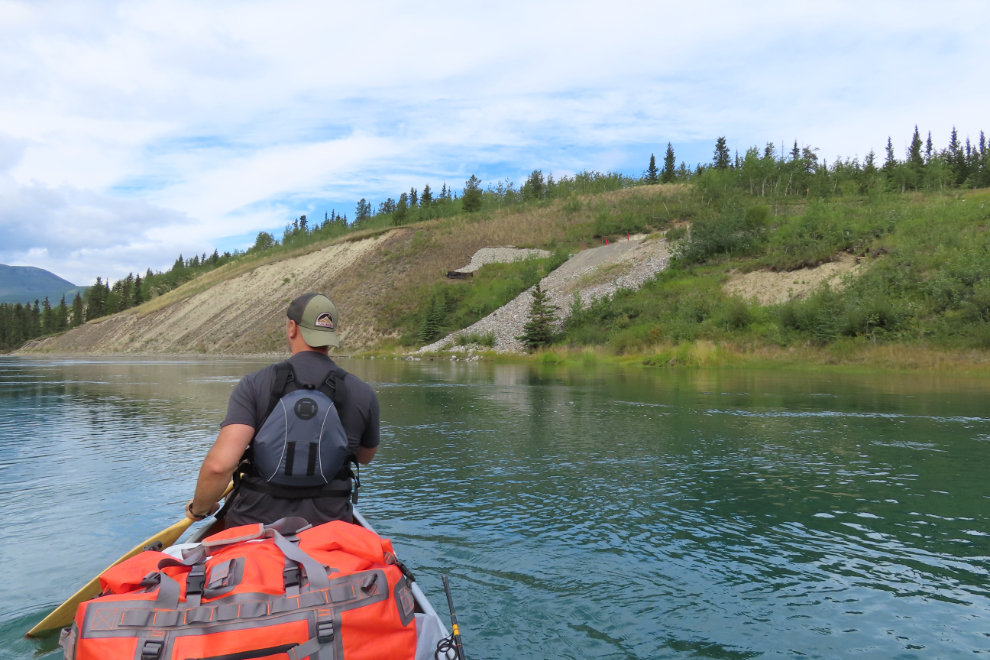
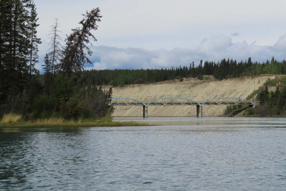
Just over 2 hours from launching, we passed the bridge that takes the North Klondike Highway over the Takhini River. There had been a few people paddling to that point, but they seemed to all be stopping here for a shuttle back to town. With Kanoe People, that half-day rental and shuttle costs $170 for 2 people – a fun way to get a bit of the Yukon River experience.
Just past the Takhini River, we stopped on Egg Island to stretch our legs. It was pretty mucky – not a good landing or walking site, and we didn’t stay long. The dark clouds behind us didn’t look very promising for the day.
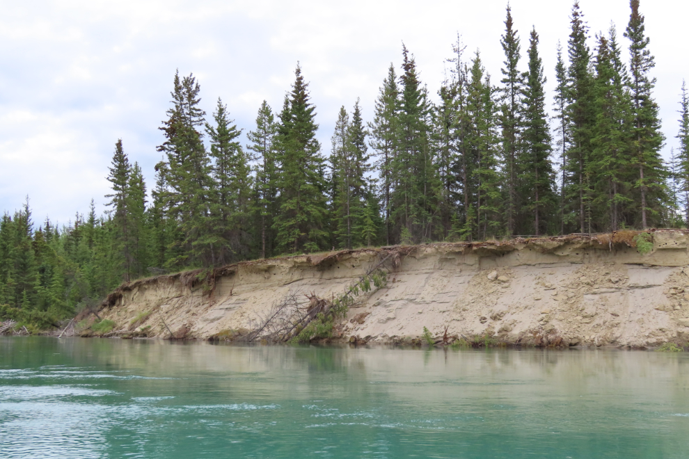
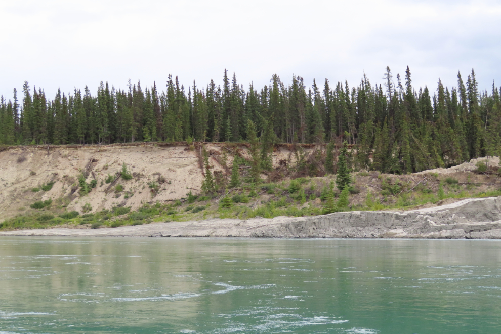
Major erosion of the riverbanks was soon evident, and would be all the way to Dawson. The amount of earth being moved and trees washed into the river is quite incredible.
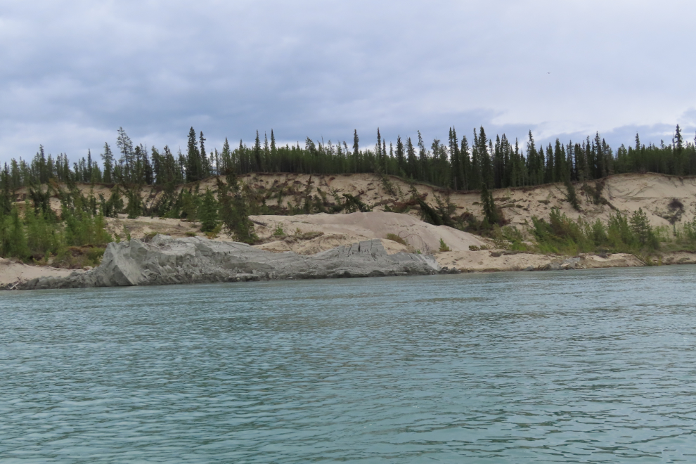
Just 3 months ago, a major landslide occurred on the riverbank near Burma Road, and we got a good look at it. The next two photos are from several I shot as we drifted past – the second photo shows the downstream end of it. The slide is about 950 meters wide and 250 meters long. The Yukon News posted a good article about it, with before-and-after photos.
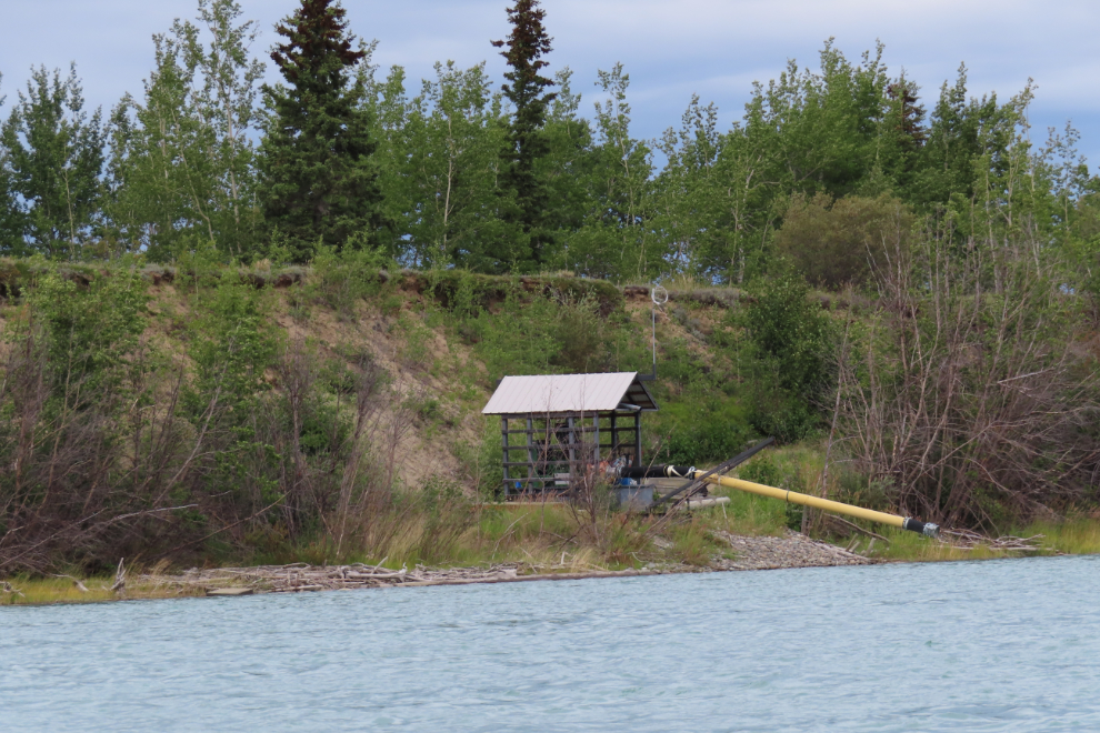
We passed the pumphouses and intakes for the irrigation systems of a couple of farms.
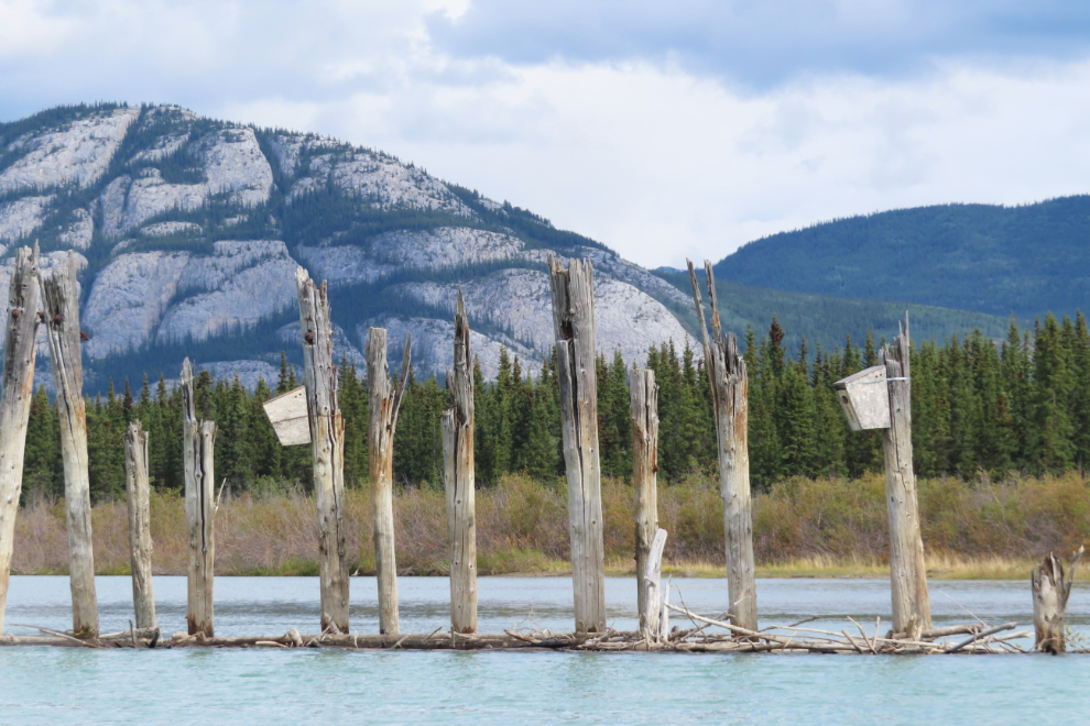
This was the first opportunity I had ever had to see the remains of a series of wingdams built at the head of Lake Laberge starting in 1899 to control the river into a main channel for better boat navigation. It was marginally successful over the next decade or so, then dredging was found to be more effective.
Now, the wingdam pilings are great places for birdhouses 🙂
By 3:00, storms were passing us on the west shore of the lake, but we started talking about an escape strategy.
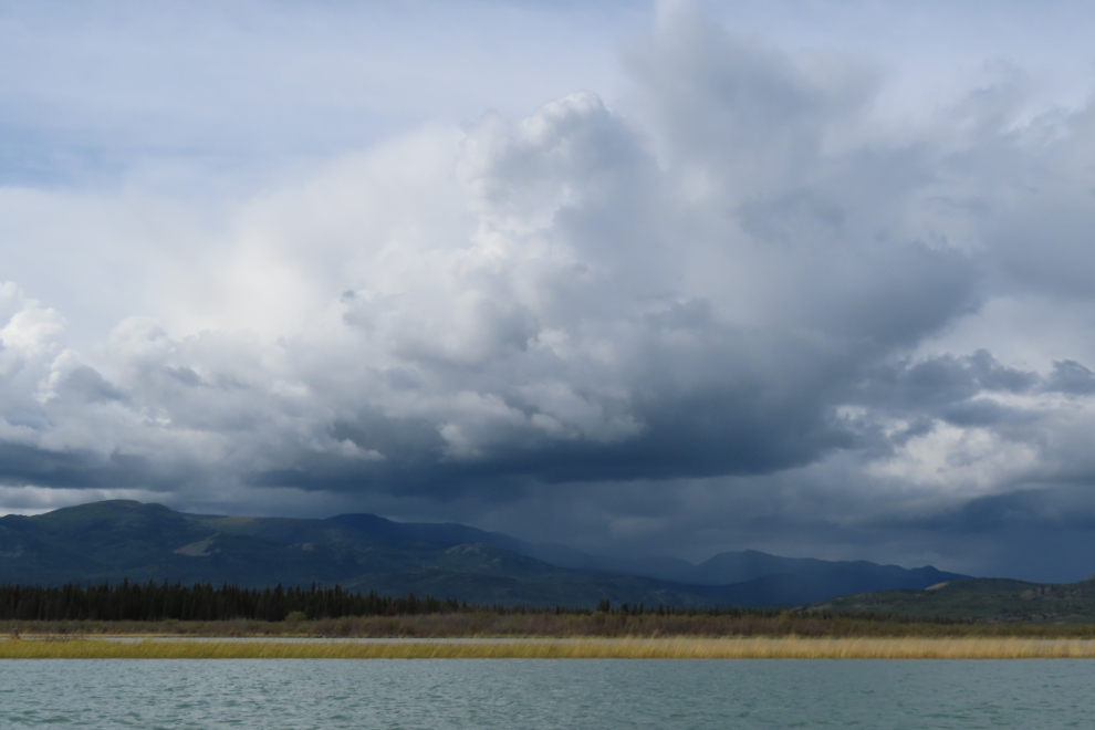
Things got ugly in a hurry, and we decided not to wait for a good campsite, but just get to shore (which we were staying close to).
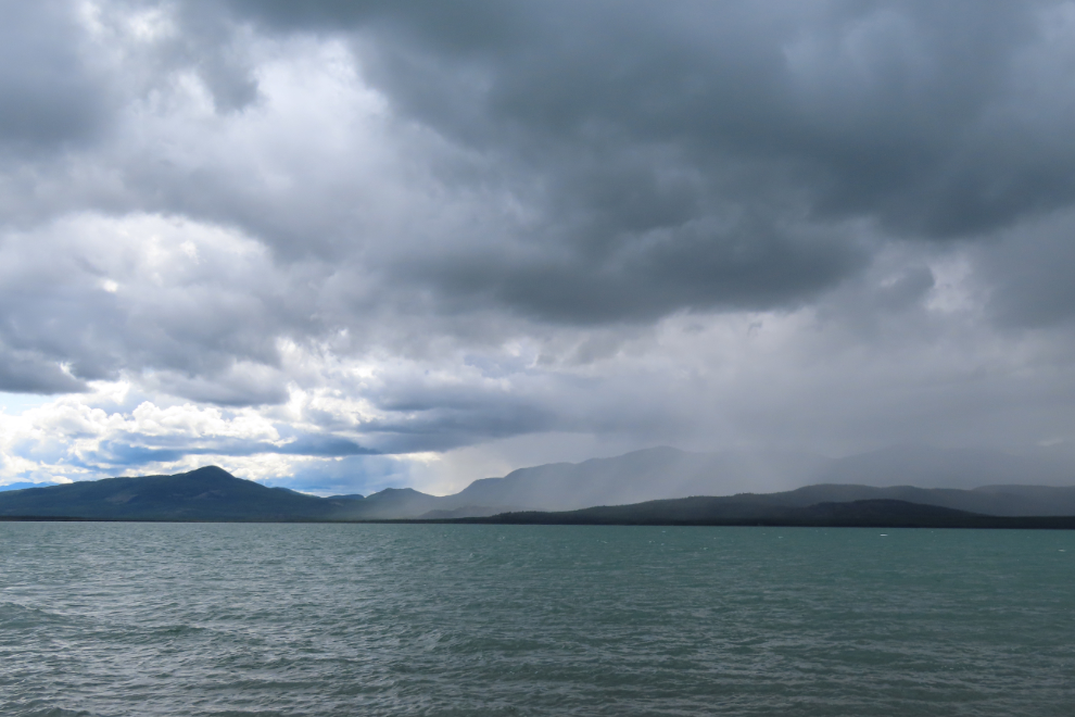
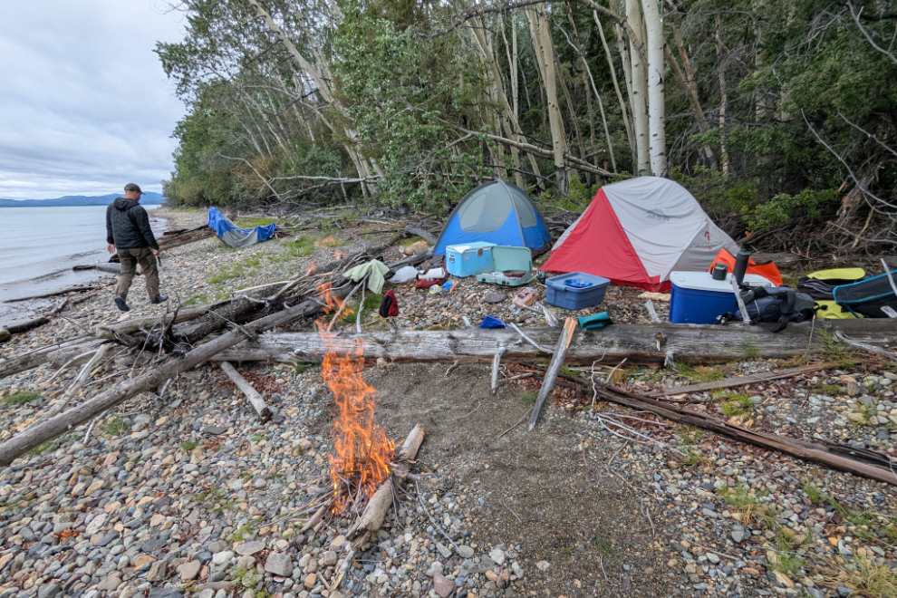
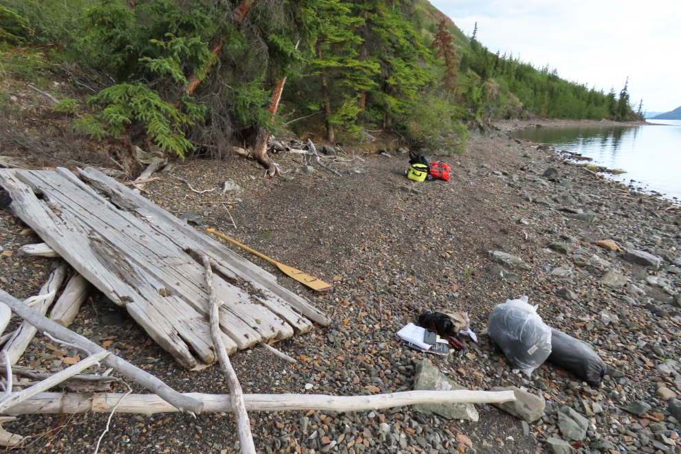
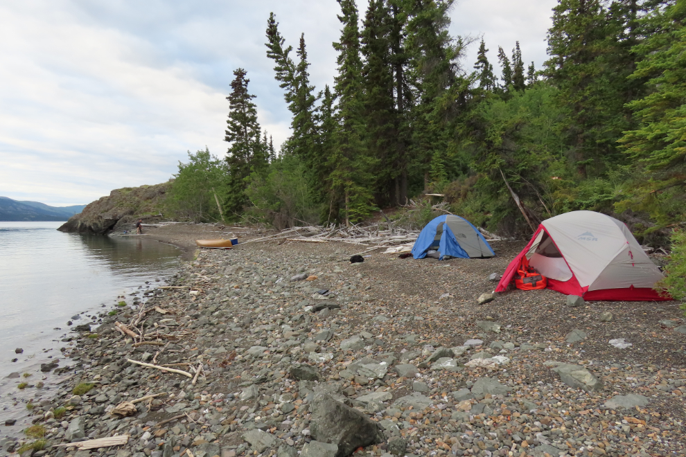
We stopped at a forested gravel beach at 3:30, and ten minutes after we set up our tents, a storm hit.
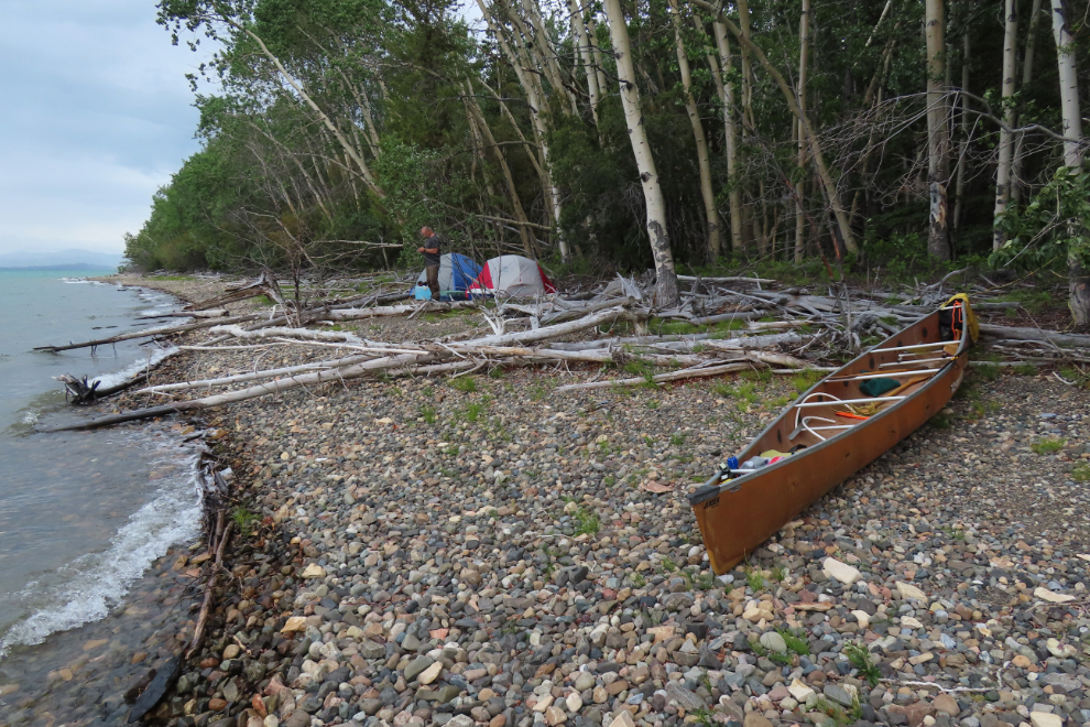
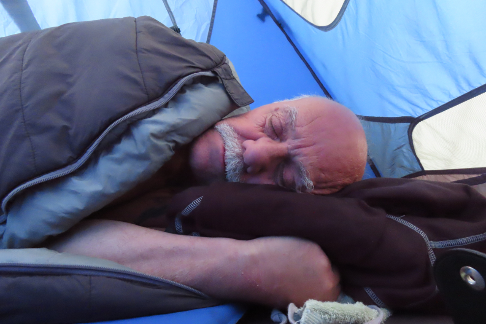
We went to bed and the storm got wild.
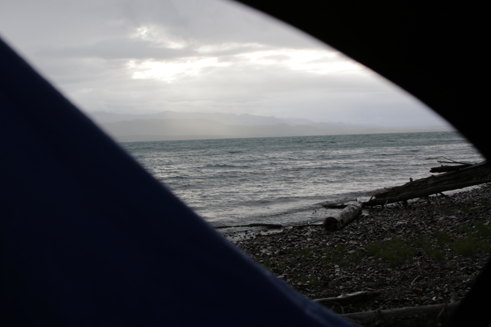
I woke up at about 8 pm and Steve wasn’t much later. We had a bit of dinner – reheated some of Cathy’s wonderful Mac & Cheese – but I ate very little. By 10 pm it was quite pleasant – 12°C with a light north wind and small waves. It was a very good day, though we only did about 24 miles total. The weather forecast for the next day had turned to shit, however, with wind N 20-40. Oh well, we would just have to wait and see what happens.
The next morning (Tuesday, August 12th) had potential to the north, but it was too rough and windy to launch our canoe.
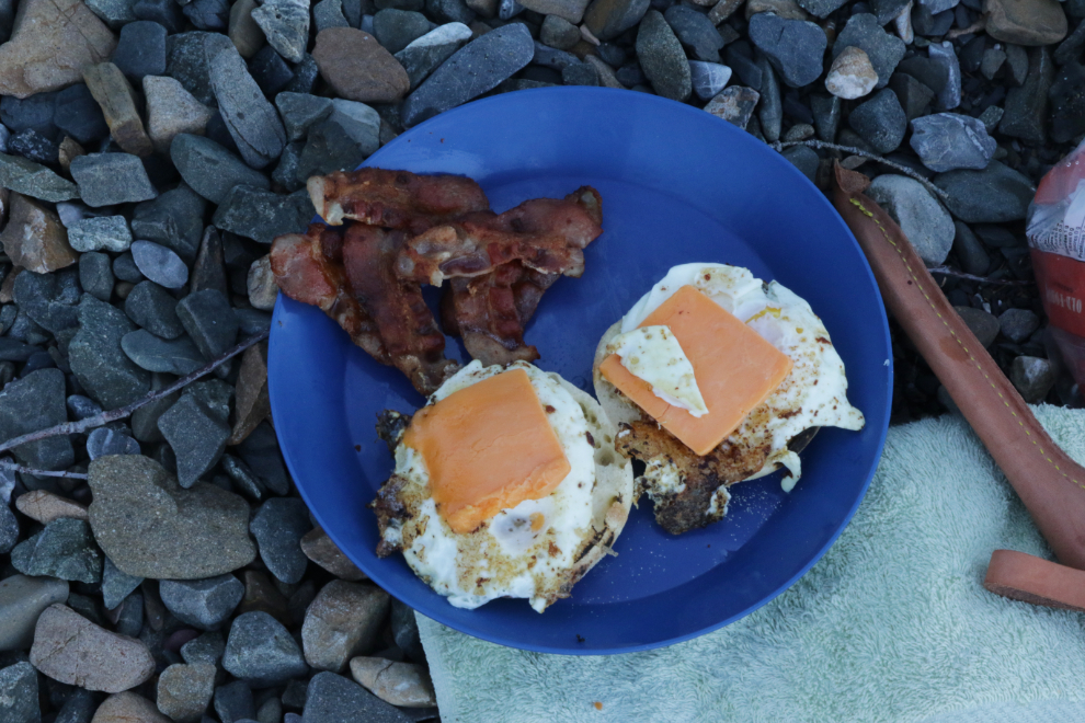
My gear wasn’t very organized and finding stuff was more work that it should have been, but I didn’t have any ideas to improve it. I did manage to put together good breakfast, though – always a good way to improve moods 🙂
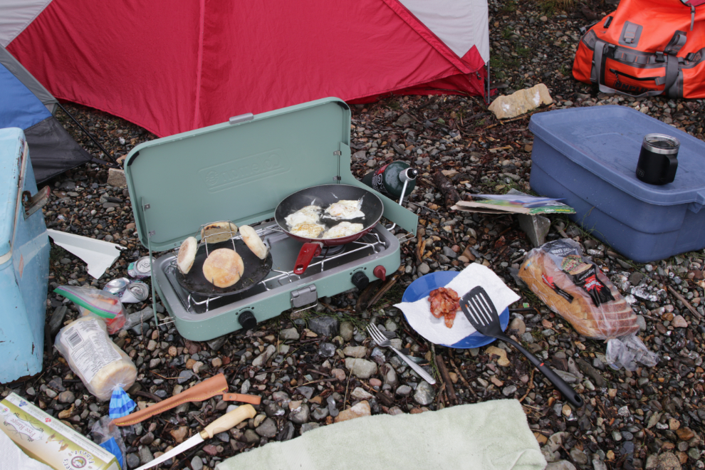
The other mood-booster is fire, and before making breakfast I had earned my Firestarter badge – one match, one piece of paper from my notepad, no firestarter or pitch-laden conifers, after a night of heavy rain 🙂
Steve had brought his little drone, and launched it for some photos – our camp can be seen toward the right of the shoreline.
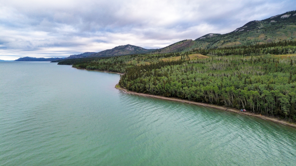
August 11/12: Camp #1 – Lat: 60.997241, Long: -135.038860. Elevation: 2,050 ft.
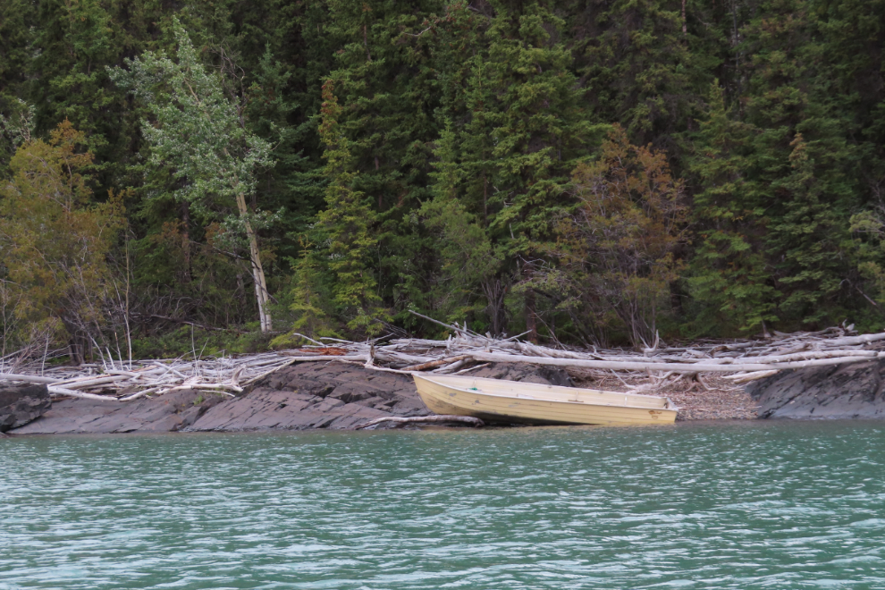
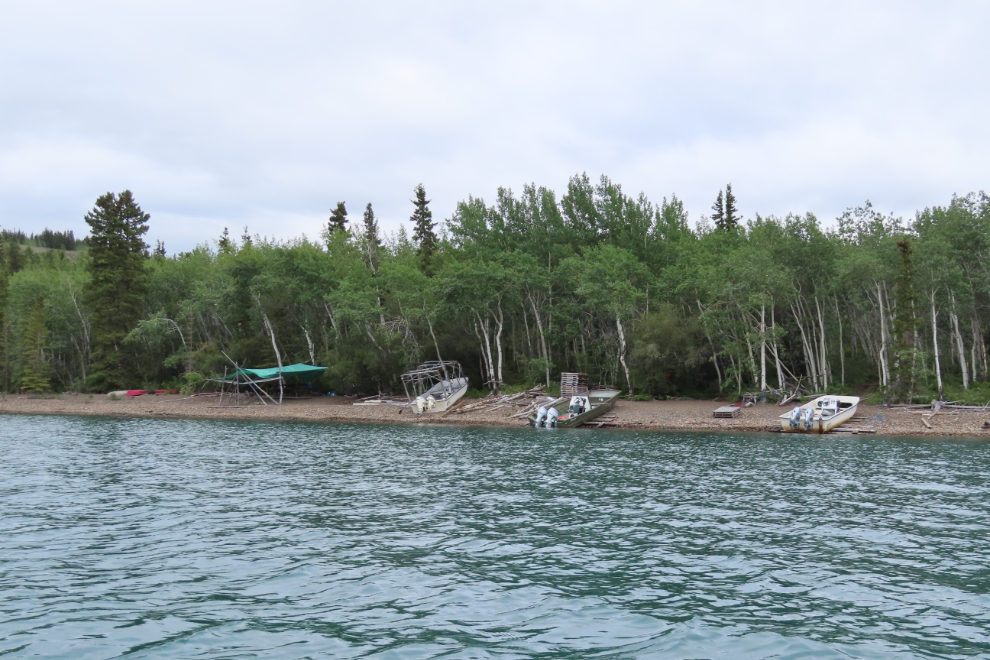
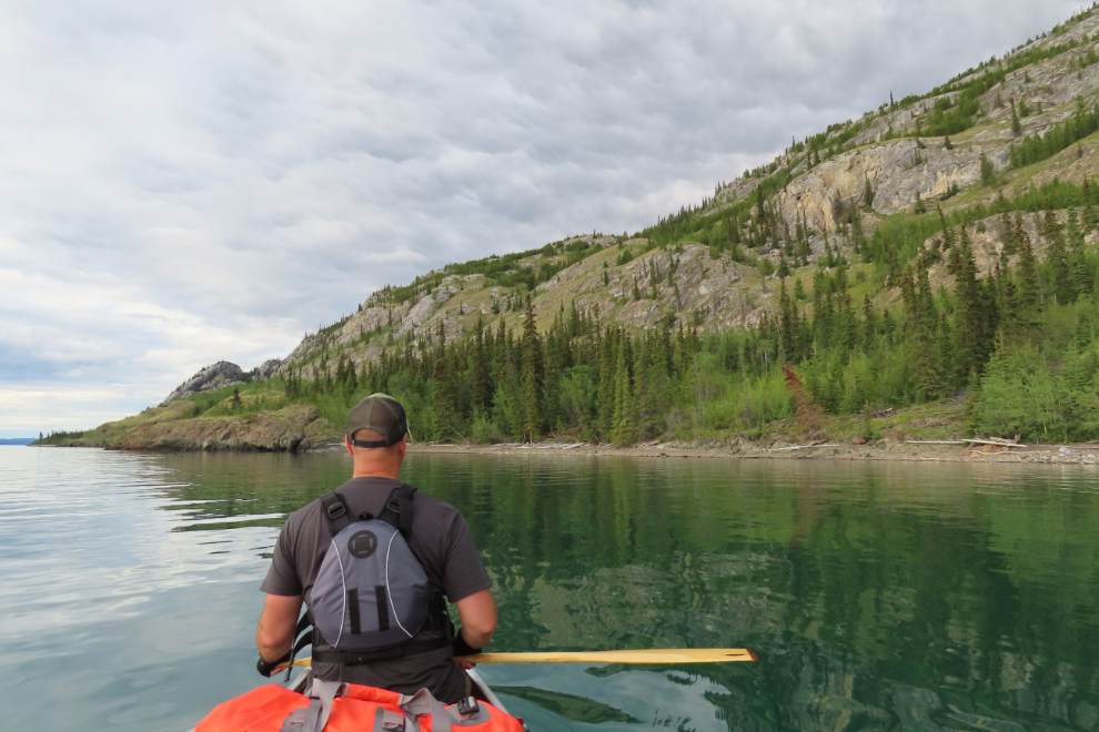
At about noon, after almost 20 hours in that camp, we decided to launch and see what we could do. We soon came to a power boat that had come to grief in some way.
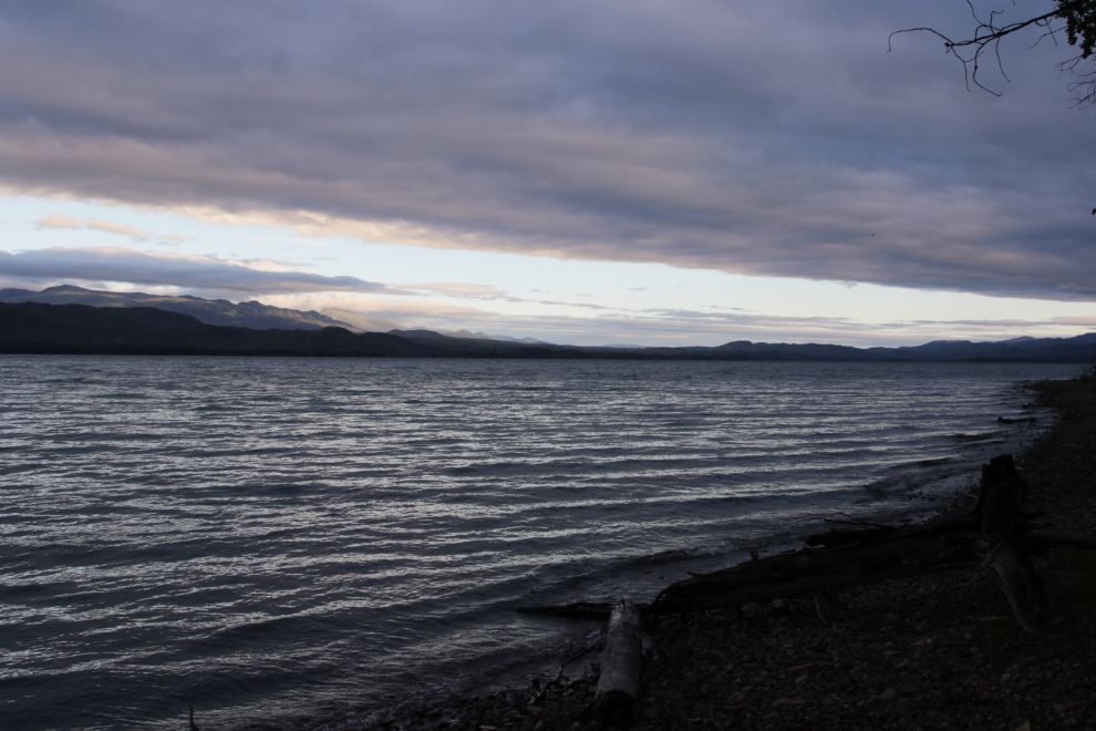
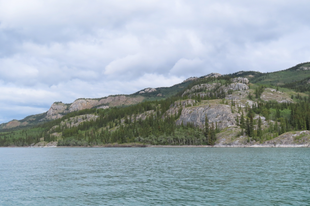
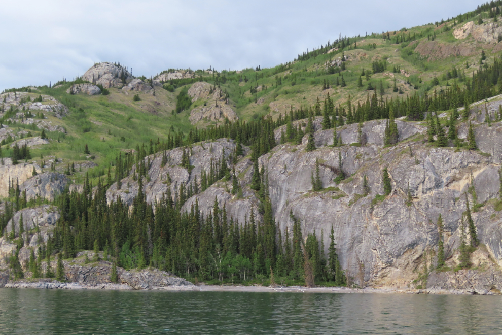
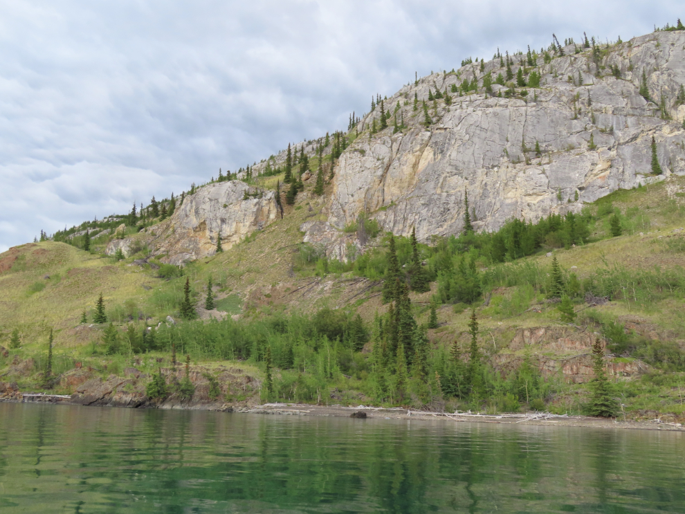
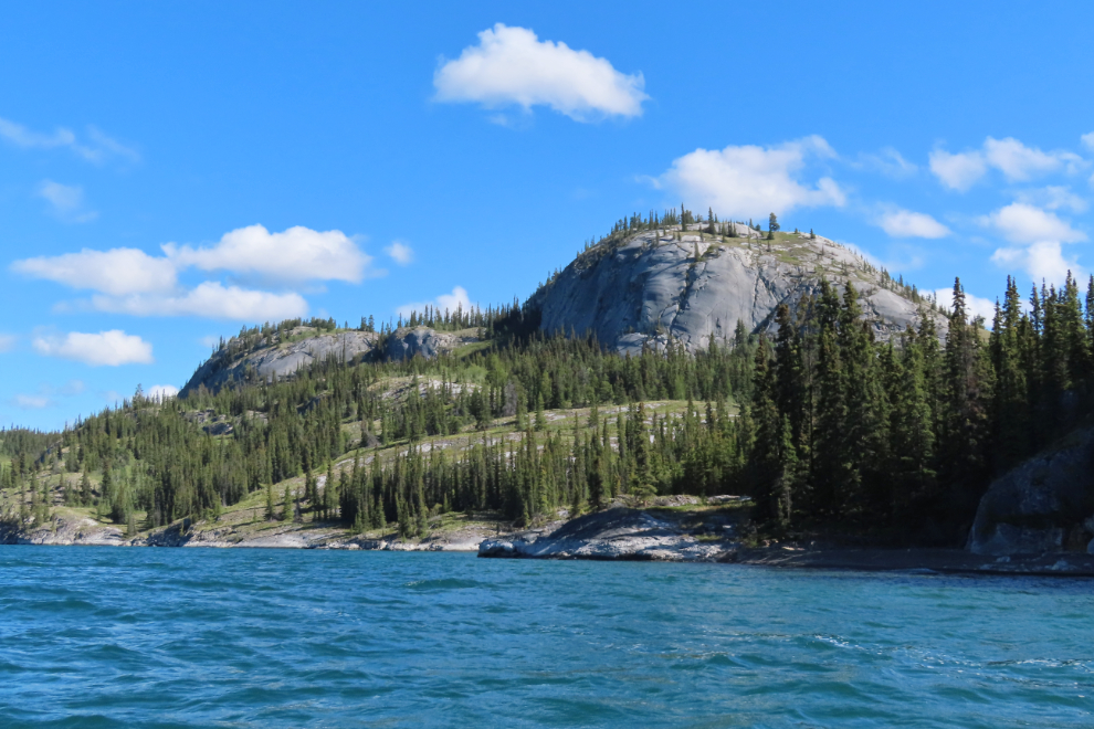
The eastern shore of Lake Laberge is extremely scenic, and there are beaches everywhere between the rocky cliffs and outcrops.
Halfway along Richthofen Island, we came to the base of Cathers Wilderness Adventures, a family business that has been offering year-round wilderness experiences for 50 years now. We used them for our mushing adventures on the Yukon Quest tours I drove/guided for, and Ned and Janine were always great to work with.
We saw a beach ahead noted in the book as a good campsite, and decided to check it out.
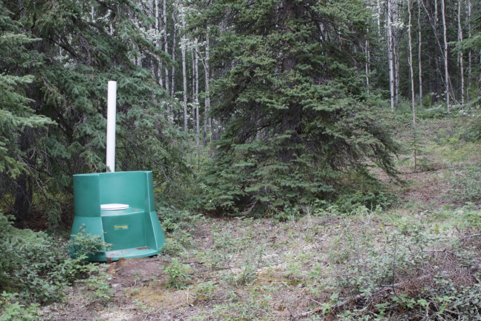
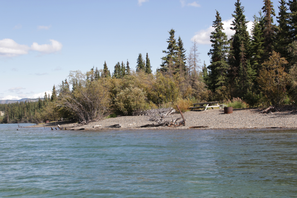
What we found was a site that even has a toilet installed by a group headed by the Laberge Renewable Resources Council. This is one of 18 sites along lake Laberge and the Thirty Mile section of the Yukon River where they have installed toilets. The next three photos show you this site.
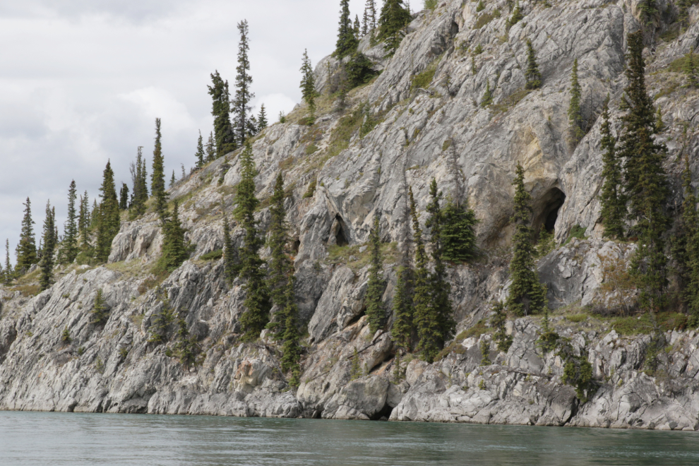
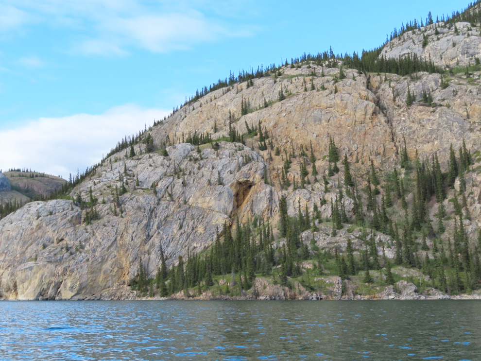
Back in the canoe, we came to a high limestone bluff pockmarked with caves, some of them quite a substantial size.
We decided to find a nice spot to have a quick dehydrated dinner, then continue paddling for a while. We spotted a lovely little bay with three coves. The furthest one had a fellow camped and he was quite appropriately naked, as was I. He walked off into the forest, and we beached in the nearest cove, had our dinner, and headed out again. He came out to wave goodbye but now had shorts on – sorry, bud. The next photo and a few others were shot in two versions – a truthful one and a more blog-friendly one where I was wearing clothes 🙂
The next three photos are among many I shot that evening as we paddled down the lake with no particular destination in mind.
At about 8 pm we spotted another good beach about 7 miles north of Richthofen Island and decided it was time to call it a day. We got a bunch of miles we hadn’t intended on (about 17 miles), so it was a bonus day given the weather.
Yes, this beach was perfect, and we were soon set up for night #2.
A little bit of good Yukon whisky before bed.
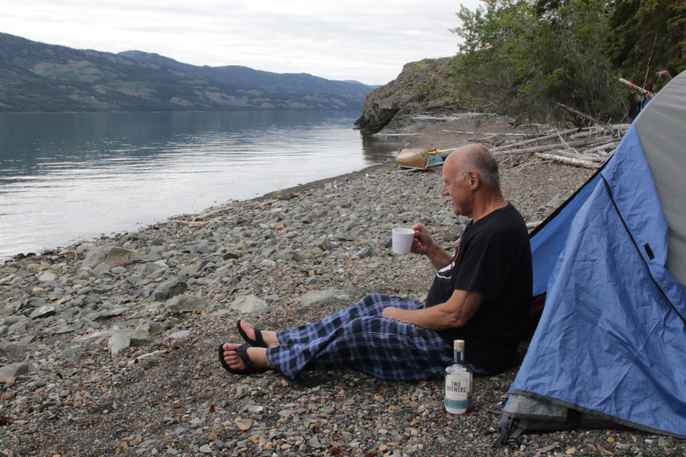
Fresh air, good exercise, great company, the sounds of gentle waves – ahhhh…
Day 3 – Wednesday, August 13th – began with another good breakfast.
August 12/13: Camp #2 – Lat: 61.225271, Long: -135.197281. Elevation: 2,050 ft.
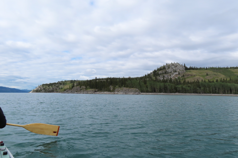
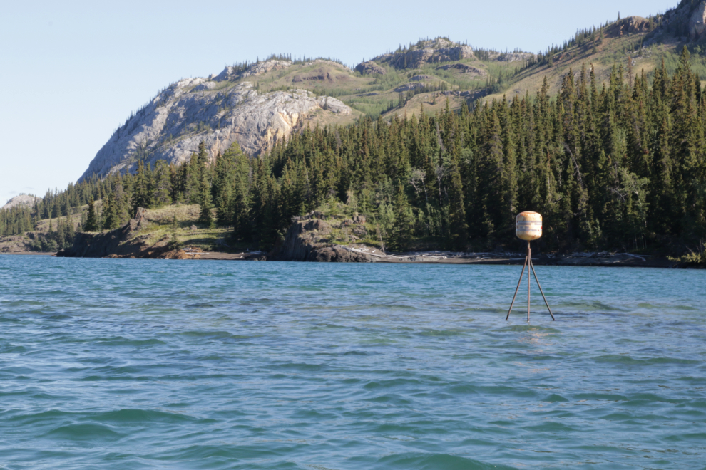
The wind, from the south, was building, so we were on the water as quickly as we could get our gear together. We soon came to a marker showing a well-hidden rock just below the surface.
None of the photos show it, but we were regularly hit by a series of large waves and swells that stressed us out and put some water over the gunwales. When they hit, I was too busy to photograph them. It was certainly beautiful, though.
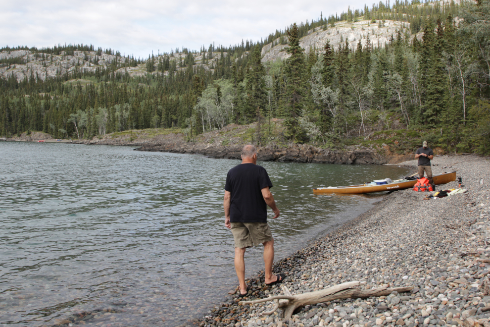
We spotted a large beach that offered a chance to drain the water from the boat and de-stress, and took it.
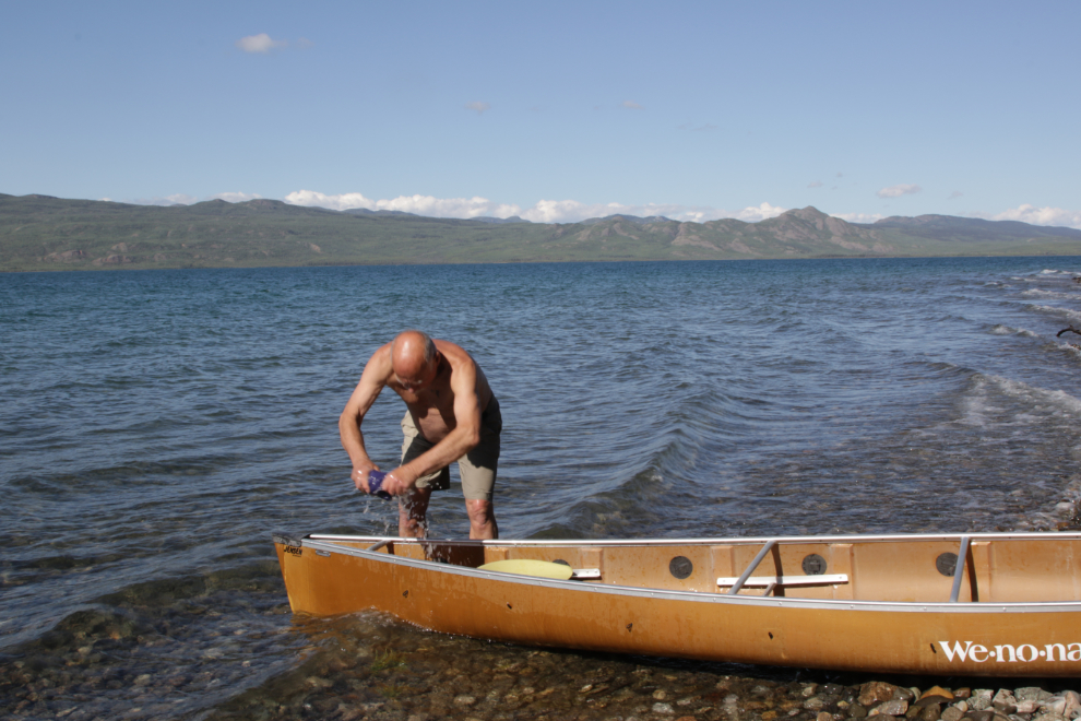
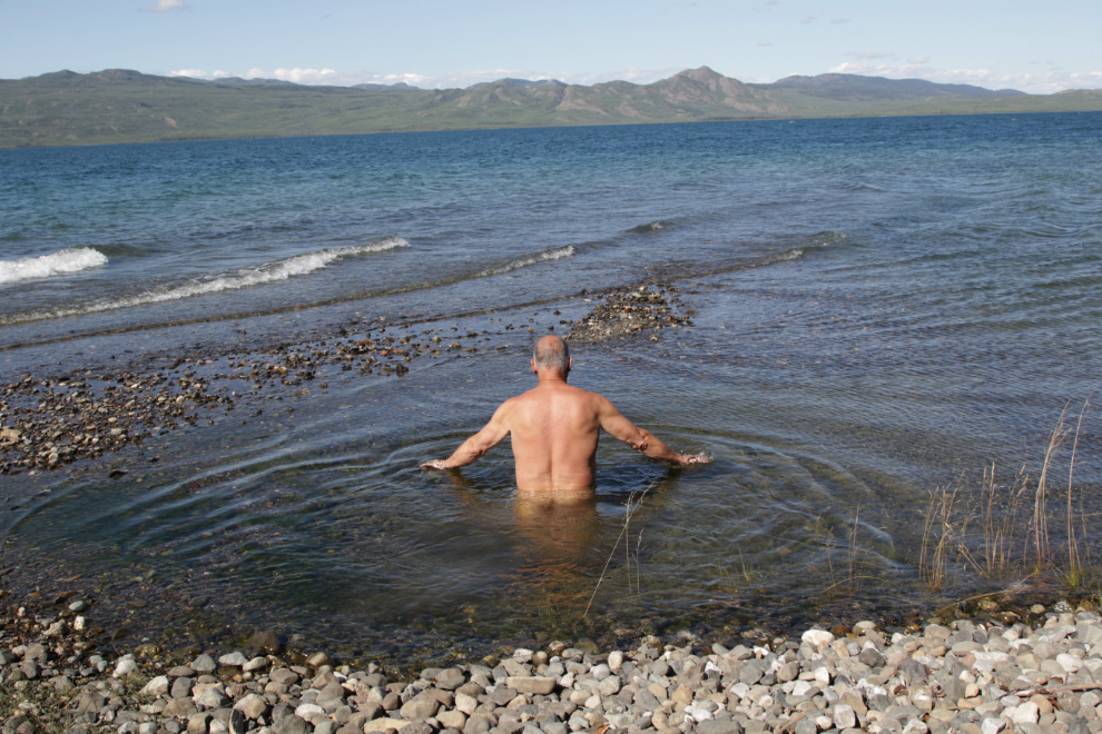
The beach curved around a point, and I went for a bit of exploring.
The natural bathtub was great 🙂
We were soon back in the boat, dealing with the lake. We were extremely glad to see the end of it at about 2 pm.
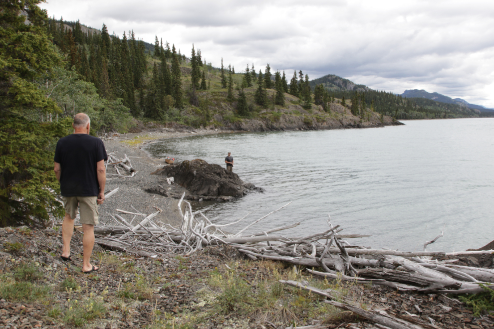
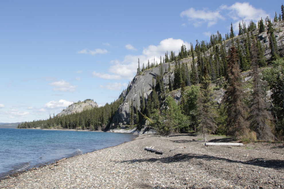
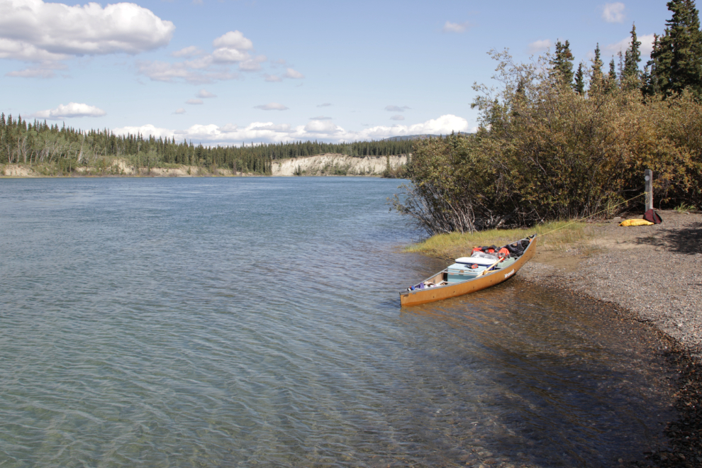
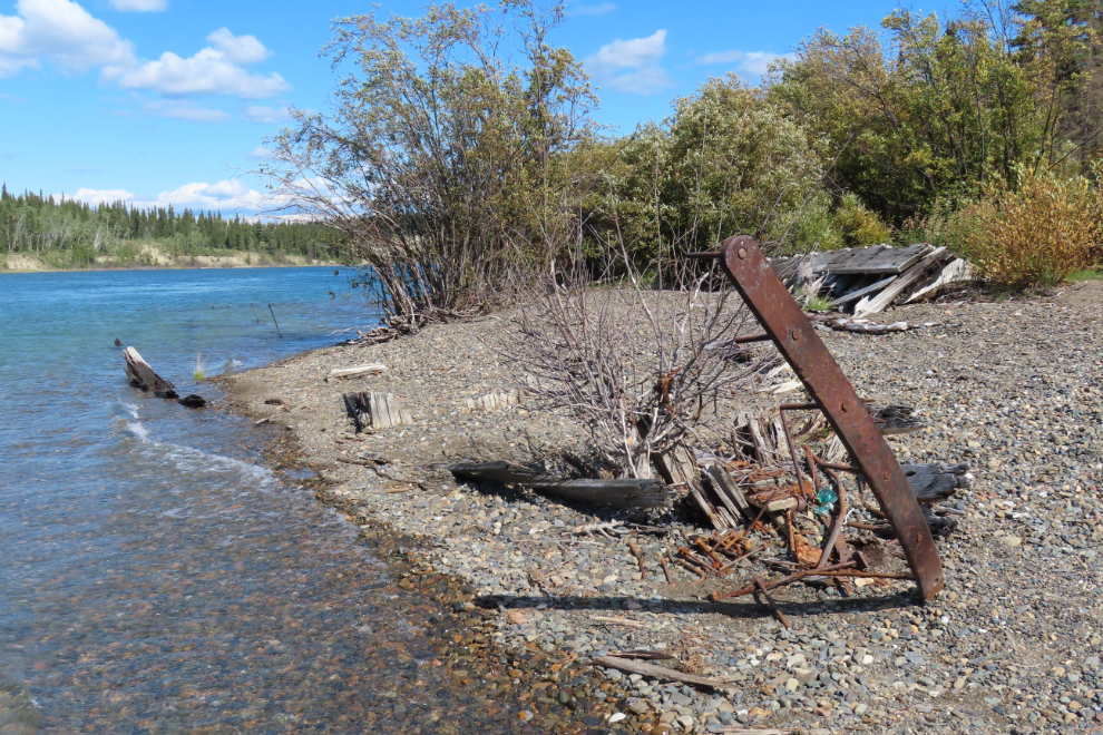
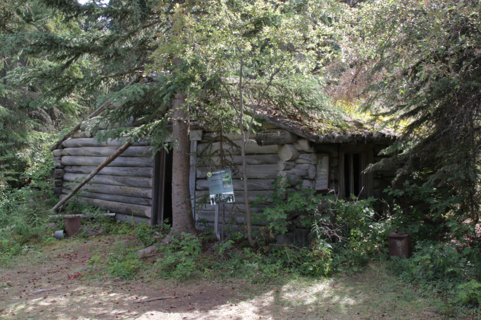
The long-abandoned community of Lower Laberge is at the foot of Lake Laberge and the head of the Thirty Mile section of the Yukon River. This was intended to be a fairly major historic-site stop.
We tied up and went exploring…
The 140-foot-long hull of the sternwheeler Casca (the first of that name) is no longer recognizable as a boat.
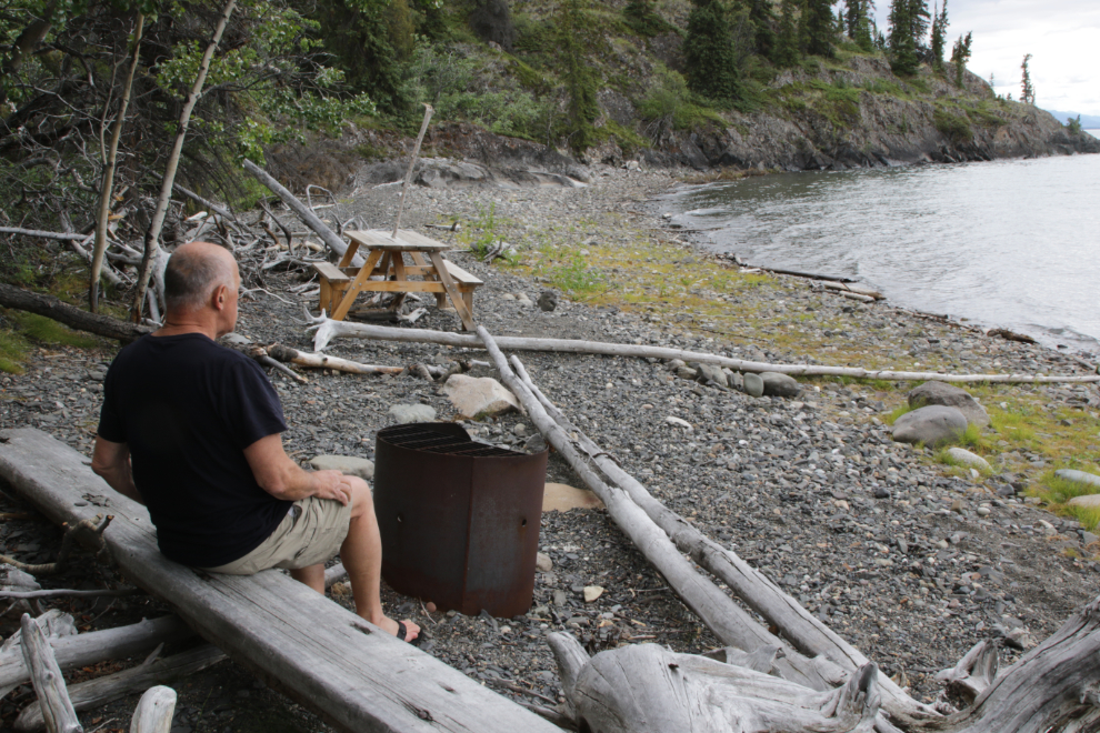
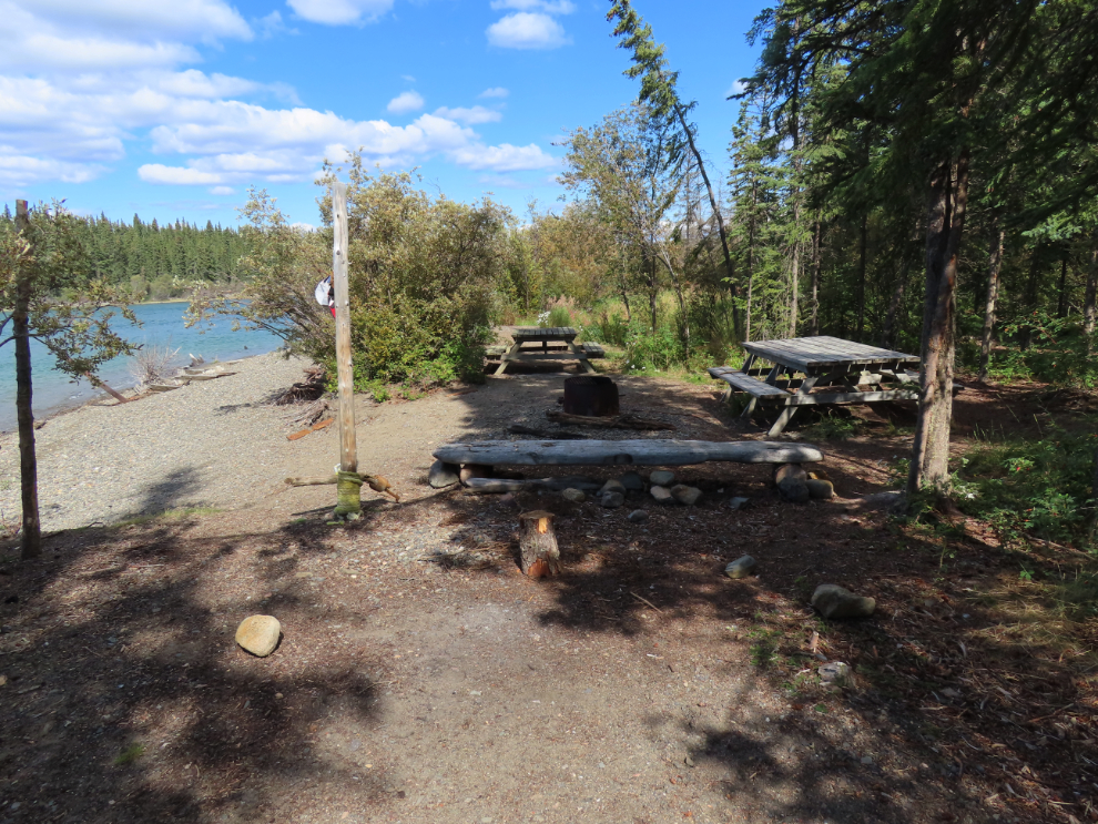
The campground was nice.
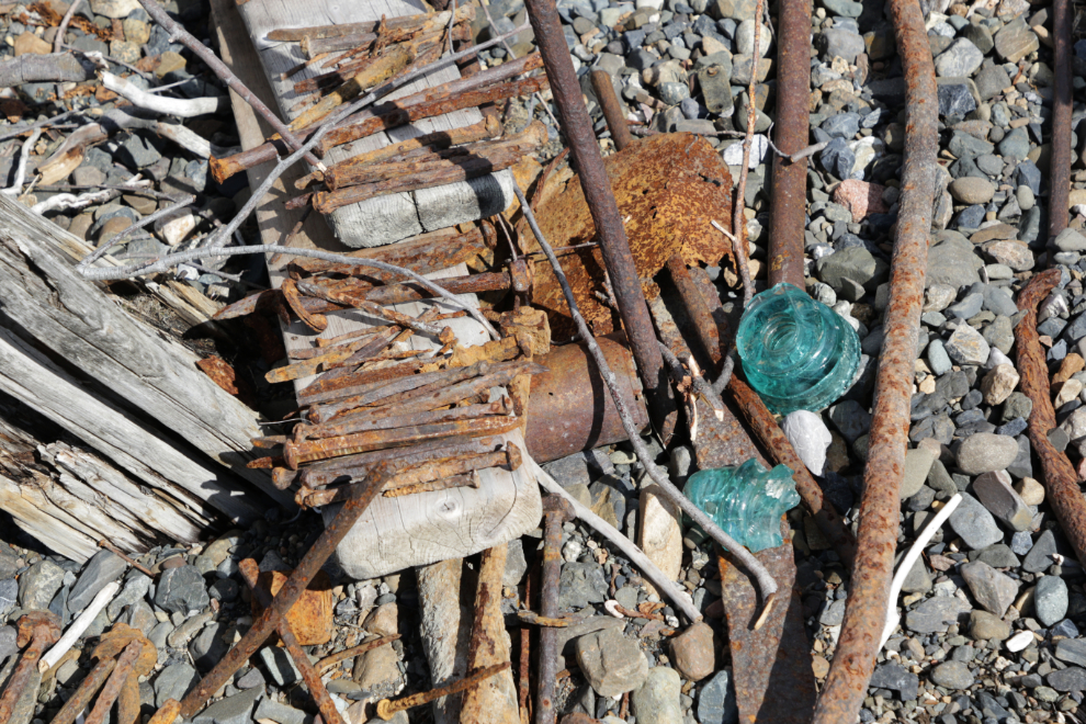
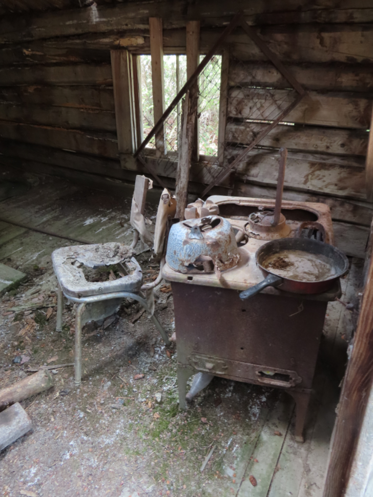
People have gathered artifacts and made a bit of a display of them.
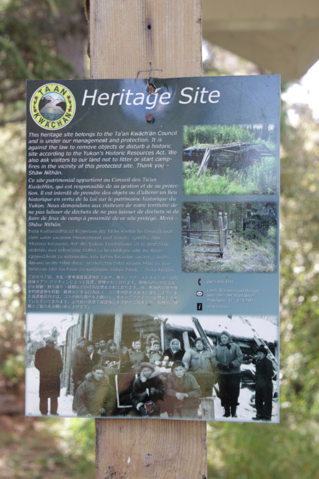
There are signs saying that the site belongs to the Ta’an Kwäch’än Council, but we saw no interpretation (and I hadn’t prepared any notes before the trip as I used to do).
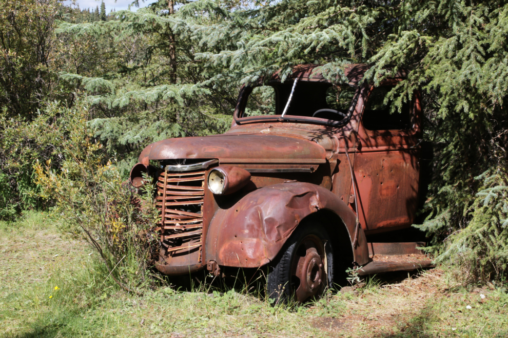
This truck used to haul cordwood for the steamboats from miles back in the hills into the 1950s.
There are a few trails and roads heading off into the forest, but we didn’t follow any very far. The final two photos show the Mounted Police Post.
Just after 3:00, we started down the Thirty Mile River, again with no destination in mind.
I should explain here that I am dating these posts as if they were done during the trip, as that makes the most sense long-term. So this one is dated August 13th instead of the 25th when I’m actually posting it.
Amazing…what a beautiful world we live in! Can’t wait to read the rest!
Ellen
Thanks, Ellen. The Yukon River is so beautiful, so powerful, and at times just plain magical. I am so blessed to have been able to do this twice.
SO glad Steve and you managed to do this trip again!
There were times during the planning and the actual trip when I didn’t know if I could, but a friend asked me 5 days in, when I had cell service at Carmacks, how I was feeling. I replied “We’re 5 days from Dawson so I’m at 100 per cent because that’s what it takes for this to happen.” I think it was a trip that neither of us will ever forget.