BC History: Heritage BC Stop of Interest signs
While I’m puppy-sitting so am not very mobile, I’m going through many thousands of photos from this past summer. They need to be captioned and put in categories so I can find them when I need them. I usually do this soon after shooting, but never sat still long enough this year. There are so many great memories in these files, and there are also lots of ideas for travel, for photo subjects, and for articles/posts.
This morning, I went through the files to see how many of BC’s heritage signs I’d gotten photos of over the years. I was surprised how few I have, and will try to rectify that in 2017.
In a program started to commemorate BC’s centennial in 1958, Stop of Interest signs were erected around the province to increase people’s knowledge of significant historic people, places, and events. At least 139 signs were erected between then and 2008, but many have been moved, damaged, and apparently even lost. A list of the 139 known signs can be downloaded here.
In September 2016, the B.C. Government announced its intention to create 75 new Stop of Interest signs around the province. Building on Heritage BC’s 2015 assessment project to locate all the existing signs, the government is also repairing signs that need work. The Ministry of Transportation and Infrastructure (TranBC) adds: “In some cases, they need to be replaced because the language is out of date. Really, really out of date. So we’ll work to update these signs and start replacing them this fall [2016].”
Until January 31, 2017, you can suggest sites, people, and/or events that you think should be included among the 75 new Stop of Interest signs – visit this Web site (now gone) to make your suggestions.
The signs that I’ve found in my files so far are below, listed roughly from the south to the north of BC. The location, the full text of the sign, and the date of installation when known, are included with each.
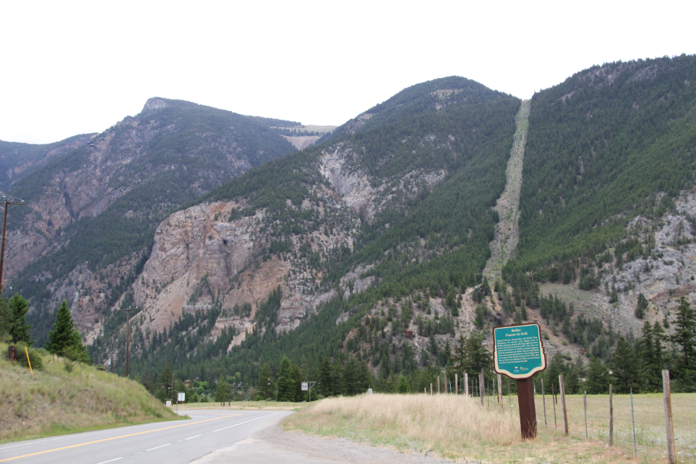
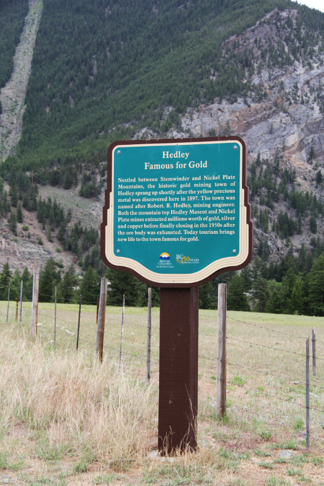
Hedley, Famous for Gold – located on Highway 3 at the western edge of Hedley, this sign was installed in 2008 to replace one from about 1958, “Gold in Nickel Plate”.
Nestled between Stemwinder and Nickel Plate Mountains, the historic gold mining town of Hedley sprang up shortly after the yellow precious metal was discovered here in 1897. The town was named after Robert R. Hedley, mining engineer. Both the mountain top Hedley Mascot and Nickel Plate mines extracted millions worth of gold, silver and copper before finally closing in the 1950s after the ore body was exhausted. Today tourism brings new life to the town famous for gold.
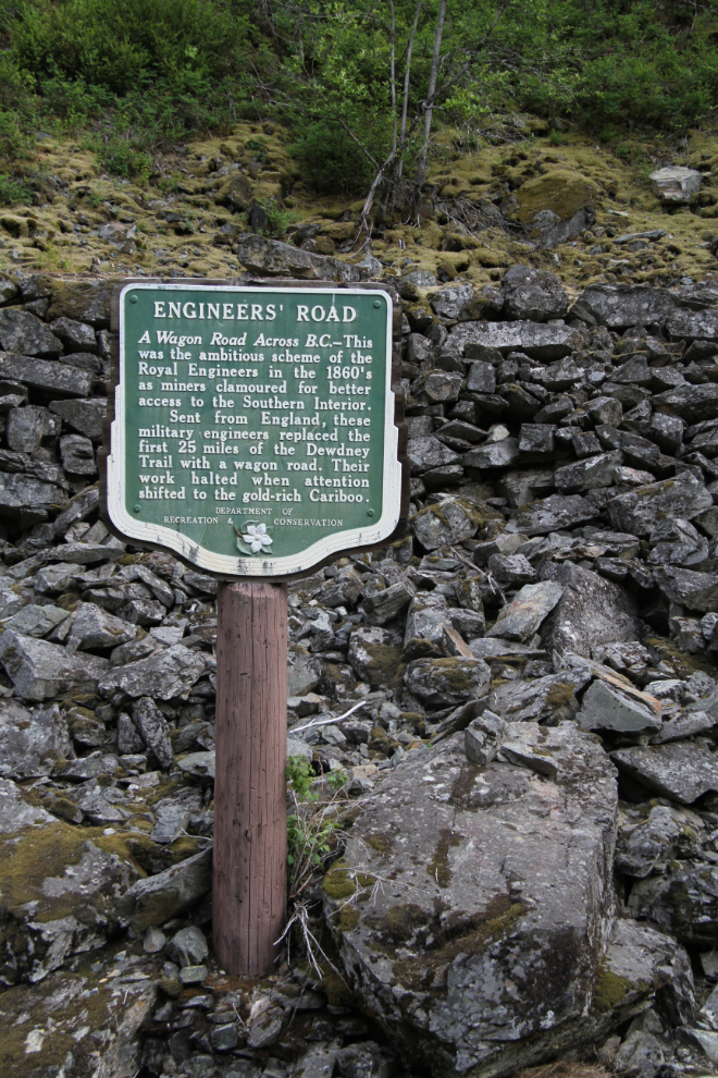
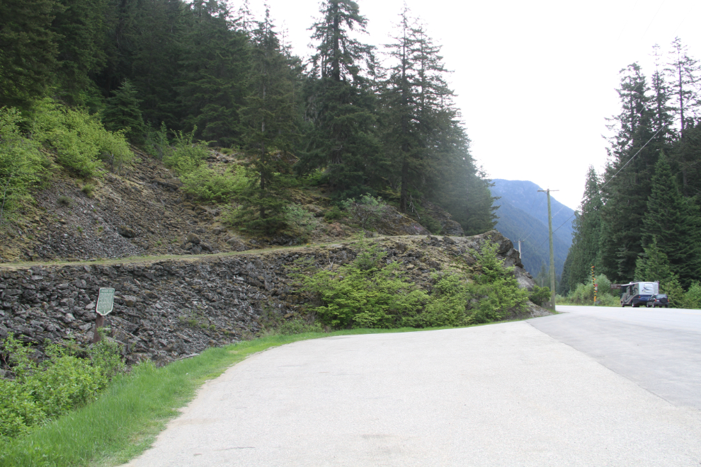
Engineers’ Road – located on Highway 3, sixteen miles east of Hope, this sign was installed in about 1958.
A wagon road across B.C. – this was the ambitious scheme of the Royal Engineers in the 1860s as miners clamored for better access to the Southern Interior. Sent from England, these military engineers replaced the first 25 miles of the Dewdney Trail with a wagon road. Their work halted when attention shifted to the gold-rich Cariboo.
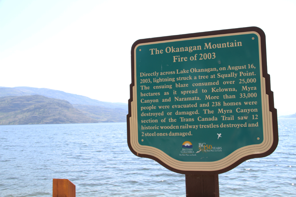
2003 Okanagan Mountain Fire – located on Highway 97 at Antler’s Beach Park, just south of Peachland, the sign was installed in 2008:
Directly across Lake Okanagan, on August 16, 2003, lightning 2008 struck a tree at Squally Point. The ensuing blaze consumed over 25,000 hectares as it spread to Kelowna, Myra Canyon, and Naramata. More than 33,000 people were evacuated and 238 homes were destroyed or damaged. The Myra Canyon section of the Trans Canada Trail saw 12 historic wooden railway trestles destroyed and 2 steel ones damaged.
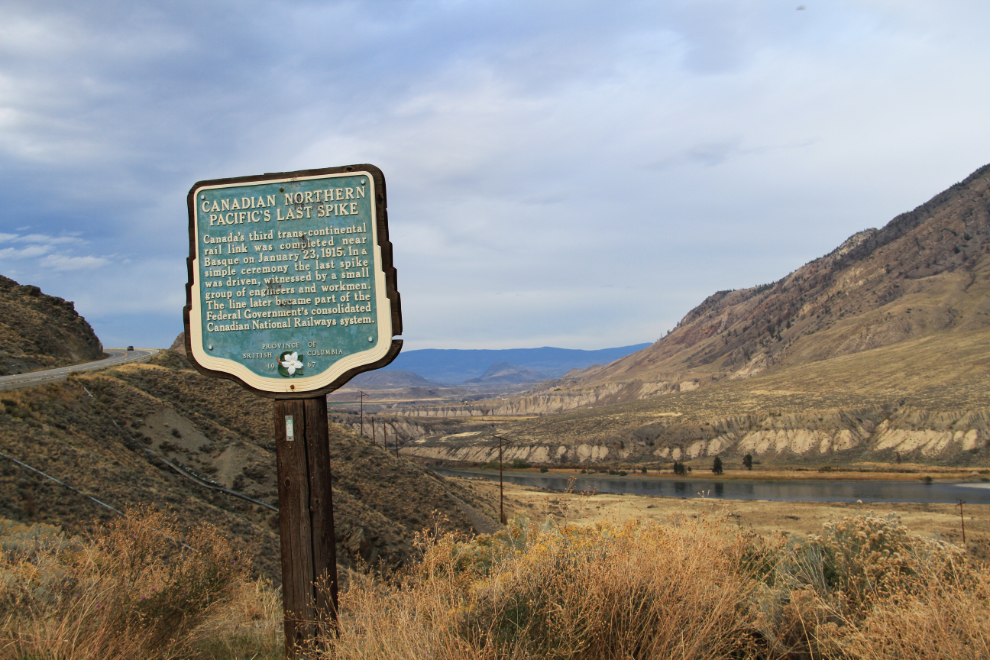
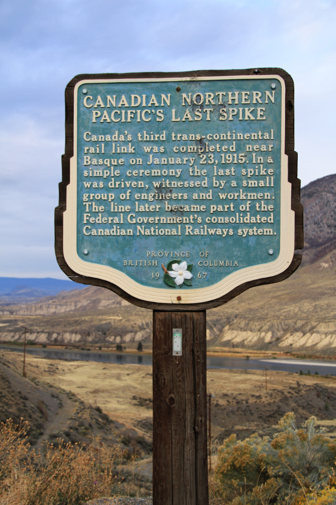
Canadian Northern Pacific’s Last Spike – located on Highway 97, ten miles north of Spences Bridge, the sign was installed in 1967:
Canada’s third trans-continental rail link was completed near Basque on January 23, 1915. In a simple ceremony the last spike was driven, witnessed by a small group of engineers and workmen. The line later became part of the Federal Government’s consolidated Canadian National Railways system.
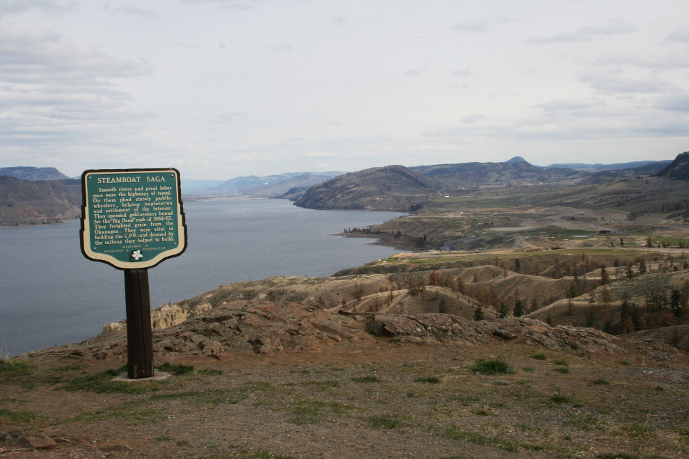
Steamboat Saga – located on Highway 1, fourteen miles east of Kamloops, overlooking Kamloops Lake:
Smooth rivers and great lakes once were the highways of travel. On them plied stately paddle-wheelers, helping exploration and settlement of the Interior. They speeded goldseekers bound for the ‘Big Bend’ rush of 1864-65. They freighted grain from the Okanagan. They were vital in building the C.P.R. – and doomed by the railway they helped to build.
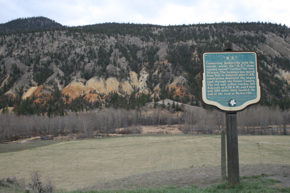
B.X. – located on Highway 97, six miles north of Cache Creek:
Connecting Barkerville with the outside world, the ‘B.X.’ stage coaches served ‘Cariboo’ for over 50 years. The terminus was moved from Yale to Ashcroft after the C.P.R. construction destroyed the wagon road through the Fraser Canyon. The red and yellow coaches left Ashcroft at 4:00 A.M., and 4 days and 280 miles later reached the end of the road at Barkerville.
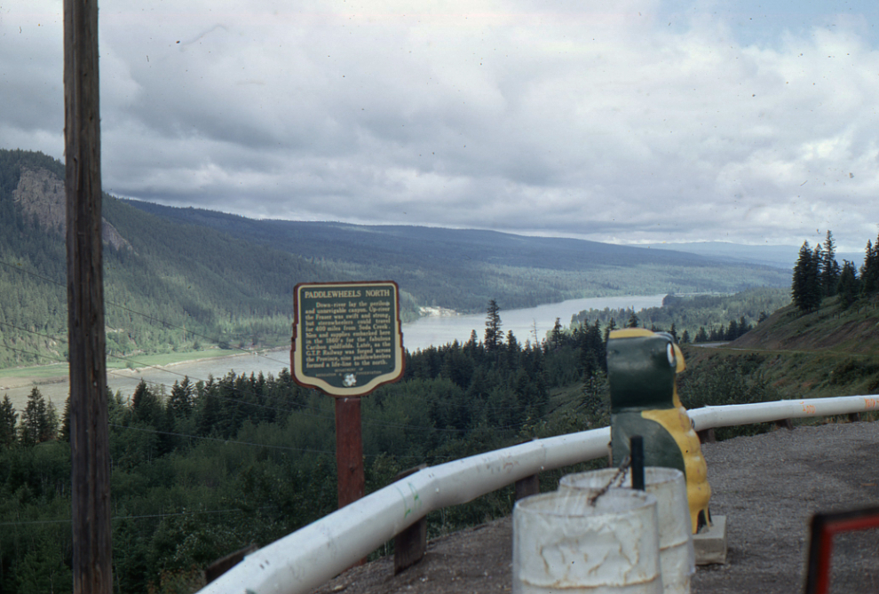
Paddlewheels North – located on Highway 97, ten miles north of Soda Creek and 32 miles north of Williams Lake (this photo with one of the famous “Garbage Gobblers” was shot in July 1997):
Down river lay the perilous and unnavigable canyon. Up-river the Fraser was swift and strong, but sternwheelers could travel for 400 miles from Soda Creek. Men and supplies embarked here in the 1860’s for the fabulous Cariboo goldfields. Later, and the G.T.P. Railway was forged across the Province, nine paddlewheelers formed a life-line to the north.
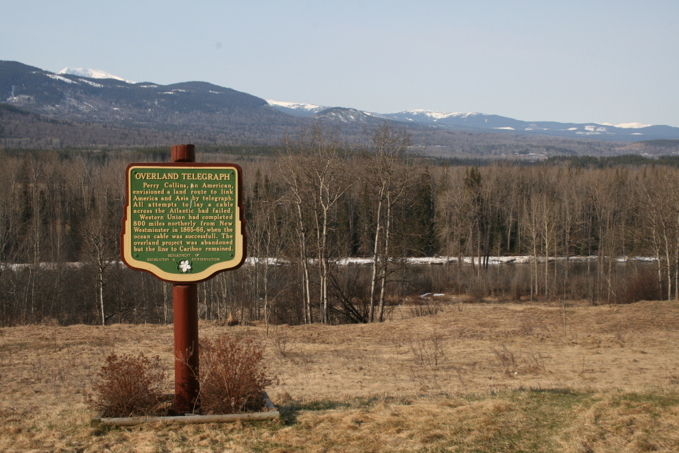
Overland Telegraph – located on Highway 16, three miles east of Burns Lake:
Perry Collins, an American, envisioned a land route to link America and Asia by telegraph. All attempts to lay a cable across the Atlantic had failed. Western Union had completed 800 miles northerly from New Westminster in 1865-66, when the ocean cable was successful. The overland project was abandoned but the line to Cariboo remained.
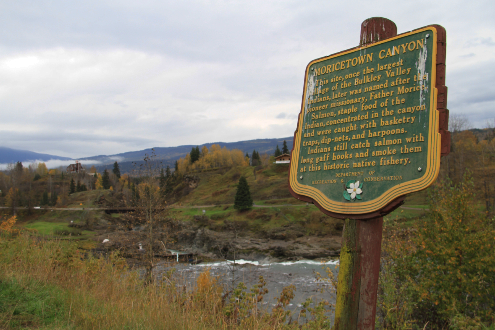
Moricetown Canyon – located on Highway 16, twenty miles west of Smithers:
This site, once the largest village of the Bulkley Valley Indians, later was named after the pioneer missionary, Father Morice. Salmon, staple food of the Indian, concentrated in the canyon and were caught with basketry traps, dipnets, and harpoons. Indians still catch salmon with long gaff hooks and smoke them at this historic native fishery.
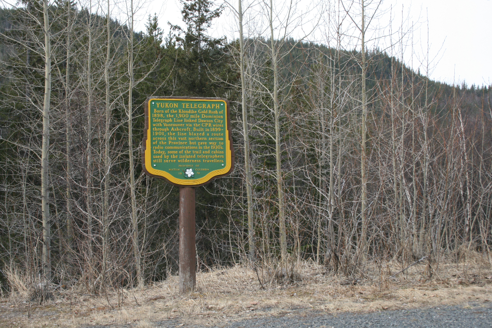
Yukon Telegraph – located on Highway 37 at Km 288 (from Highway 16), the sign was installed in 1974 (but it is not listed in the 2015 inventory):
Born of the Klondike Gold Rush of 1898, the 1,900 mile Dominion Telegraph Line linked Dawson City with Vancouver via the CPR wires through Ashcroft. Built in 1899-1901, the line blazed a route across this vast northern section of the Province but gave way to radio communications in the 1930s. Today, some of the trail and cabins used by the isolated telegraphers still serve wilderness travellers.
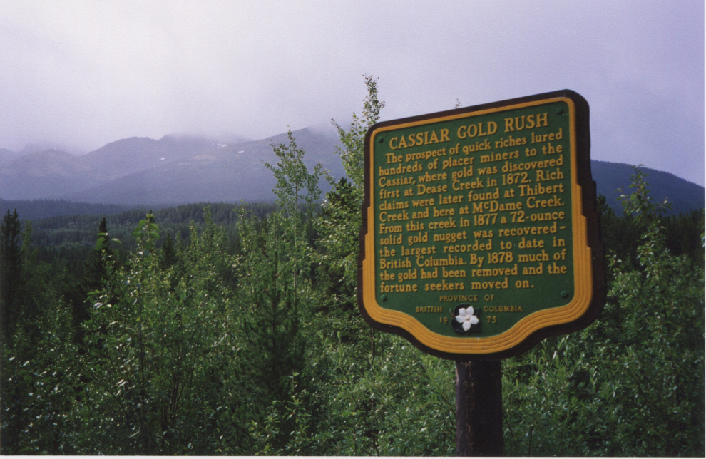
Cassiar Gold Rush – located on Highway 37 at Km 618 (from Highway 16), the sign was installed in 1975 (but it is not listed in the 2015 inventory):
The prospect of quick riches lured hundreds of placer miners to the Cassiar, where gold was discovered first at Dease Creek in 1872. Rich claims were later found at Thibert Creek and here at McDame Creek. From this creek in 1872 a 72-ounce solid gold nugget was recovered – the largest recorded to date in British Columbia. By 1878 much of the gold had been removed and the fortune seekers moved on.
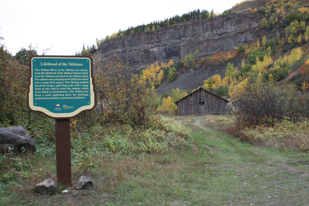
Lifeblood of the Tahltans – located on the Telegraph Creek Road at Tahltan (Km 91.3 from Dease Lake), the sign was installed in 2008 (but it is not listed in the 2015 inventory):
The Stikine River at the Tahltan has always been the lifeblood of the Tahltan Nation. Each year the Tahltan returned to the Stikine when the salmon were running as the fish it provided was a main food source. One fishing method involved using a gaff (long pole with a large hook at one end) to catch the salmon, which were dried in smokehouses. The Tahltan has been a main gathering place for meetings, potlatches and other ceremonial traditions.
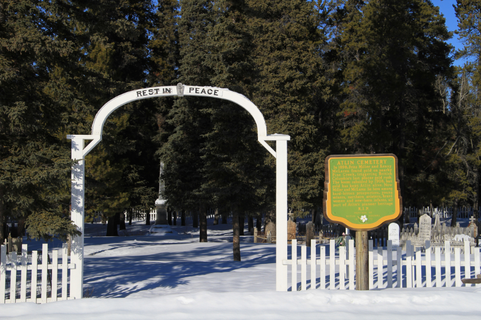
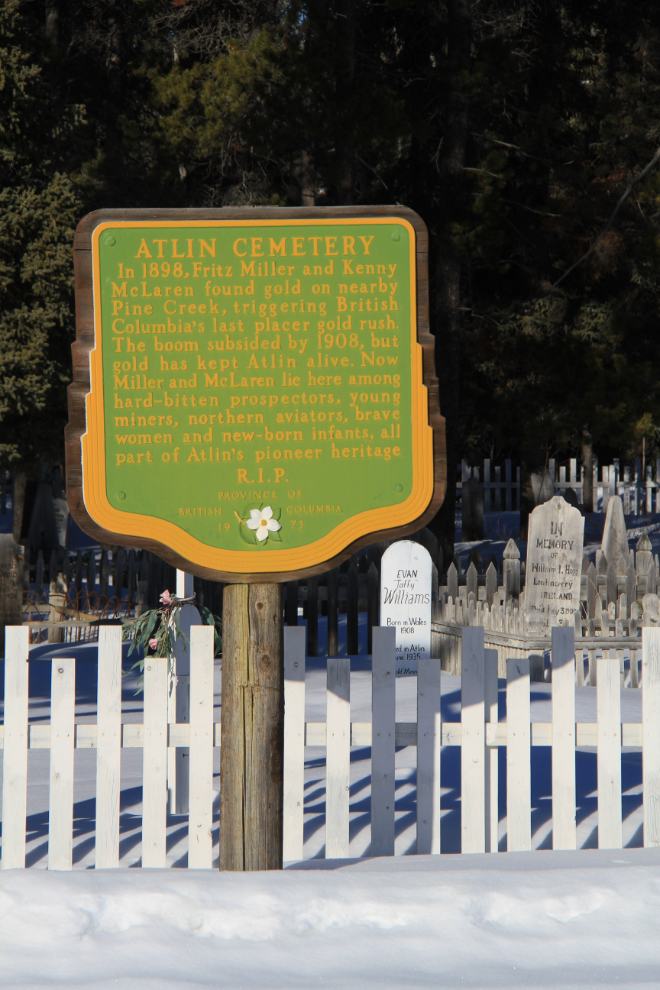
Atlin Cemetery – located at the Atlin cemetery, the sign was installed in 1973:
In 1898, Fritz Miller and Kenny McLaren found gold on nearby Pine Creek, triggering British Columbia’s last placer gold rush. The boom subsided by 1908, but gold has kept Atlin alive. Now Miller and McLaren lie here among hard-bitten prospectors, young miners, northern aviators, brave women, and new-born infants, all part of Atlin’s pioneer heritage. R.I.P.