Back in Dawson City again – never bored
My first stop in Dawson City when I arrived at noon on Wednesday (September 21st) was the Visitor Reception Centre. I had decided that the ghost towns of Forty Mile and Clinton Creek would be the first destinations, and I wanted to find out if they had any information about either site. Other than having an excellent brochure about the Forty Mile townsite, the answer was no.
As I was about to leave, the woman I was talking to mentioned a new model railway layout in a back room. That I had to see.
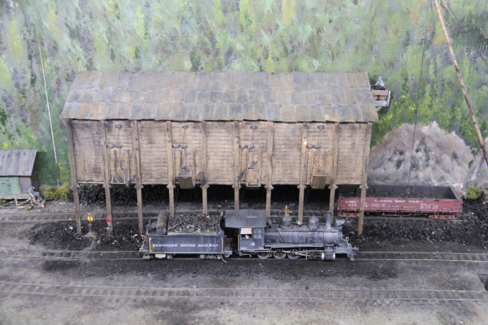
The railway layout shows various parts of the Klondike Mines Railway, and the detail is superb. I took a photo with my camera, posted it on Facebook, and one of my friends quickly said that it wasn’t new, that it was built years ago by a fellow from Vancouver. I had heard about a layout in North Vancouver, and Google quickly confirmed that this was indeed the layout bult by Brian Pate. Four years ago, Michael Gates published an article about the layout, and Brian has his own very detailed Web site about the railway and construction of the model.
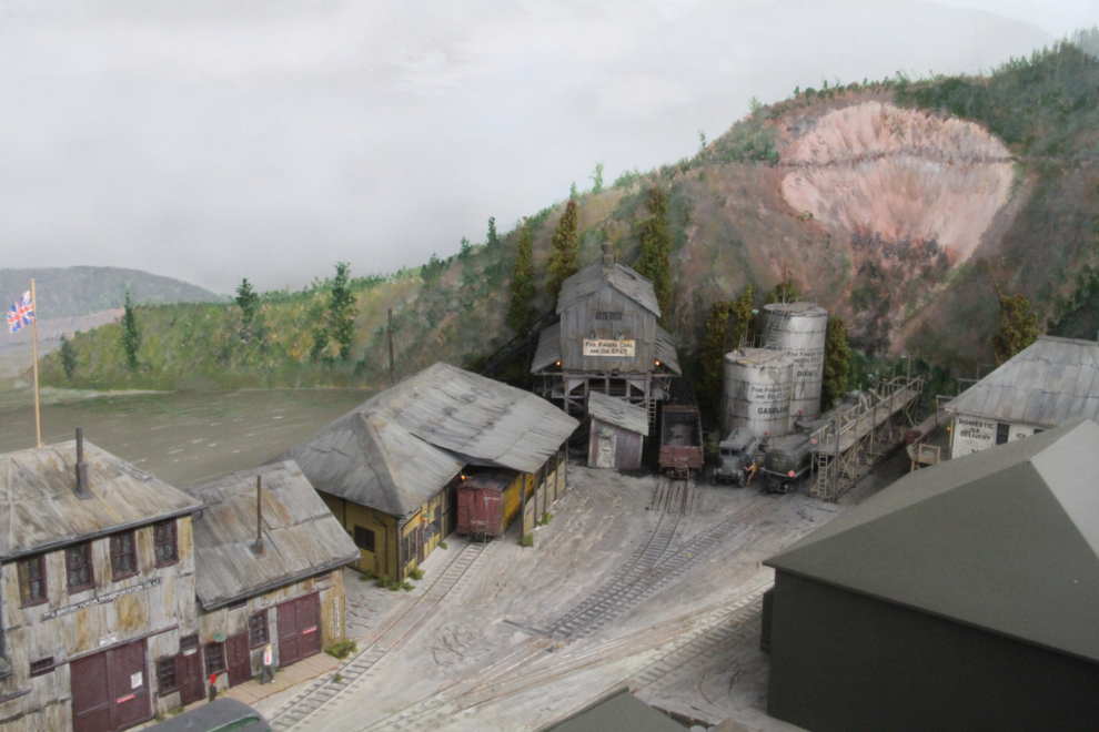
The fact that the railway model was now in the Visitor Reception Centre (VRC) made me think that Brian had perhaps died, but no, he’s just down-sizing, and the railway has now joined his large model of Dredge No. 4, which has been in the VRC for many years.
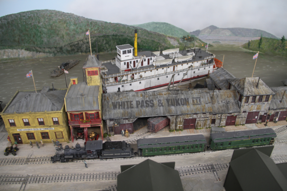
While some of the structures are educated guesses as to what the originals looked like, as no photos are known to exist, Brian’s Web site has close-up photos of his models with photos of the original buildings, and the detail really does have to be seen to be believed.
The new home of the model railway is, I hope, temporary, as it’s really not suitable. To visit it, you have to walk in front of people watching films, and the room isn’t nearly large enough. But it’s great to have it here.
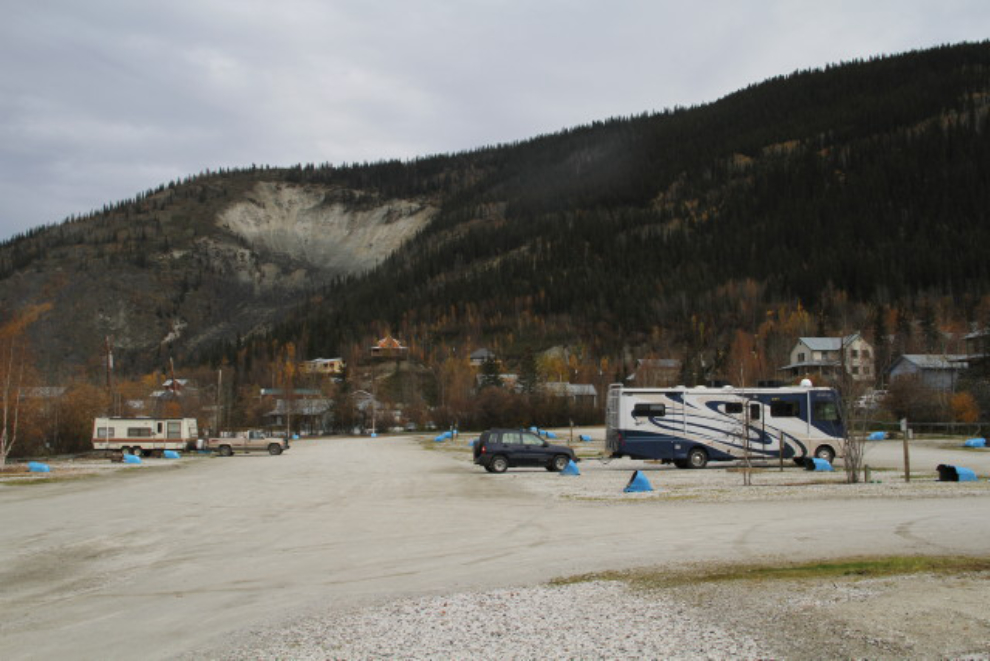
I learned at the VRC that the Gold Rush Campground in downtown Dawson allows RV parking for free after they close (services have all been shut off, of course). It was too late in the day to start for Forty Mile, so the location was perfect for a day of walking, as it was when we stayed there last June.
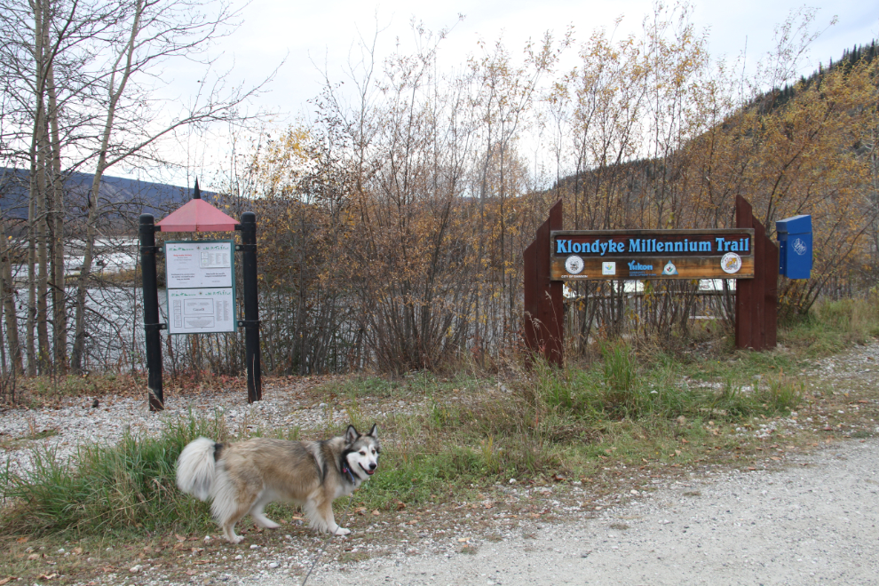
Bella and Tucker were now ready for a long walk, so we went to the south end of downtown, to the mouth of the Klondyke River. From there, we walked back along the high dyke that protects the town from the Yukon River.
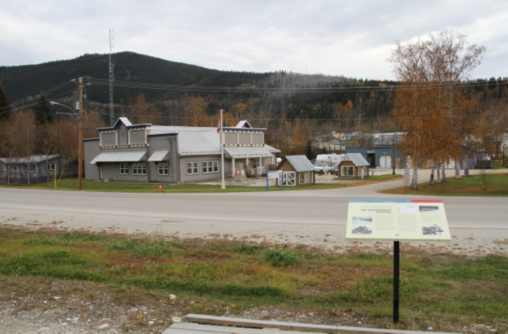
There are interpretive signs everywhere in Dawson. This one, in front of Royal Canadian Mounted Police (RCMP) detachment, describes the Government Reserve where all government buildings were located in the early years.
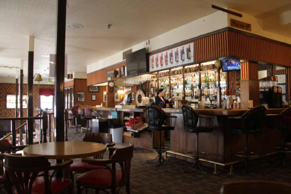
With the kids happy and ready for a nap, it was time for lunch for me, and I went to the Sourdough Saloon at the Downtown Hotel, for the hundredth time or so over the years 🙂 Despite the fact that the hotel has passed from the Van Nostrand family into the hands of a Yukon investment/development company, the character of the place hasn’t changed.
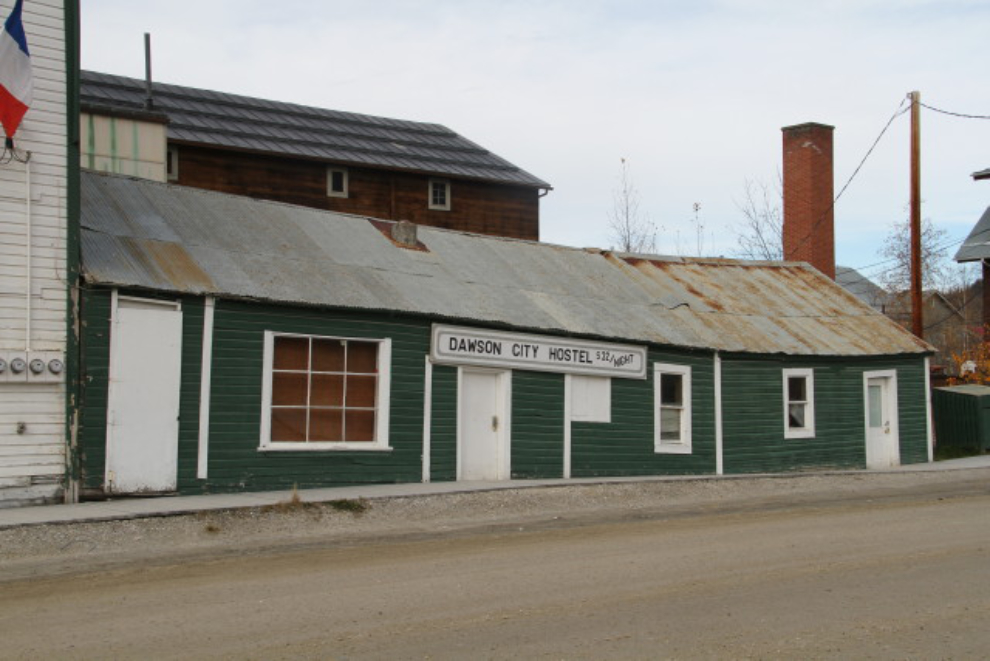
After a leisurely lunch, I went back to the motorhome to get Bella and Tucker, and we continued our walk. This building beside the Palace Grand Theatre has seen many uses over the years. For 3 years or so in the 1990s, it was the apartment for Atlas Tours’s highway drivers and local guides, and I spent many nights here. Now, it’s the Cat’s Pyjamas Travellers Hostel.
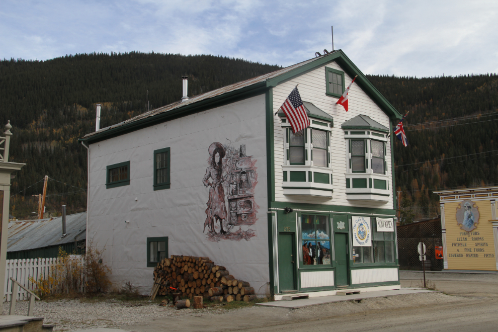
While I don’t think that this broken-backed building is actually part of the hostel, in Dawson you never know! The rate, $32/night, sounds good for a location like this.
One of the most loveable of Dawson’s old-timers was Newt Webster. He died in about 2010, in his 90s, but right until his last summer, he could be found sitting on the steps of the Masonic Lodge, across from Diamond Tooth Gertie’s casino, greeting visitors and locals. His photo still looks out from the lodger to the casino.
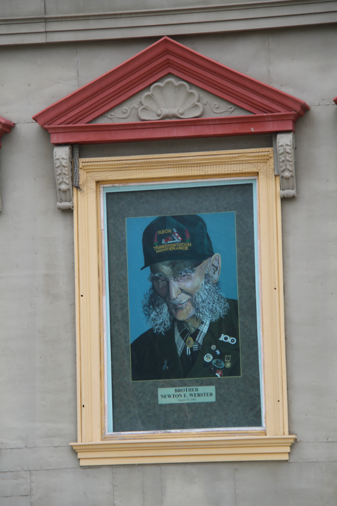
Newt came to Dawson in 1937, and was a collector. By the time I met him in the early 1990s, his house was so full of stuff that he had had to move a trailer onto the property to live in. At least that was his story 🙂 He would never show me any of his collection, but you could see through the windows that the house was indeed full of something.
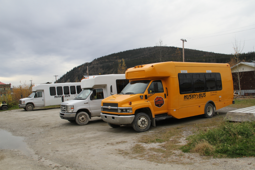
In business, timing is everything, and it’s really nice to see that Husky Bus (now closed) was in the right place at the right time with the right service.
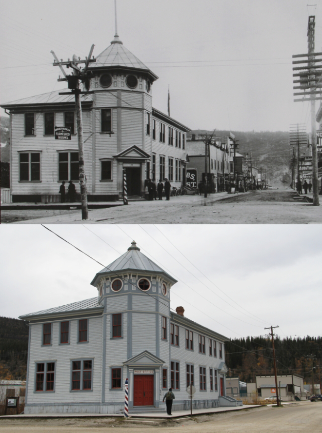
The Dawson City Post Office, then and now. While the old building stands, the operating post office has been in several other locations since moving out of this building in 1923, and is now a couple of hundred meters/yards to the left. This building, built in 1900, was designed by Thomas W. Fuller, who later became Chief Architect of the Department of Public Works.
At about 5:00, we went back to the RV, got the Tracker, and drove about 20 km (12 mi) out into the Klondike goldfields, to Dredge No. 4, at Claim No. 17 Below Discovery on Bonanza Creek, near the spot where its buckets quit scooping gold-bearing gravel in 1960.
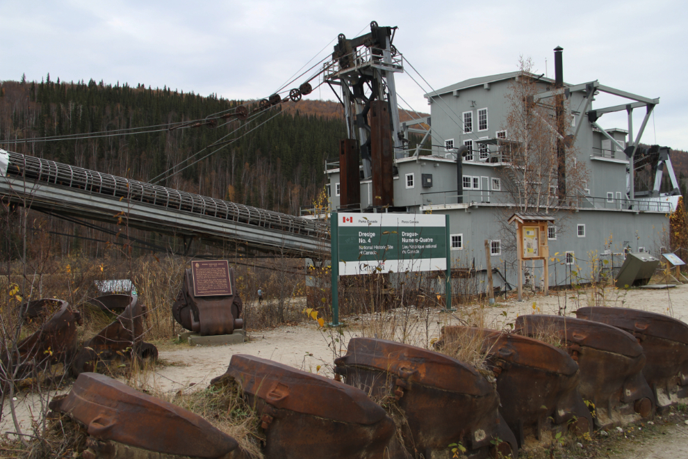
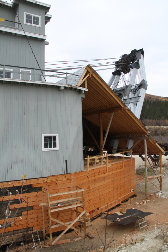
The bow section of the hull is currently being rebuilt, with timbers sawed at an on-site mill. I started taking tourists through the dredge in 1990, when it was sitting at about a 20-degree angle, filled with mud and ice, but was as complete as the workers walked away. The next summer, Parks Canada began the massive job of raising it, stabilizing it, and restoring it.
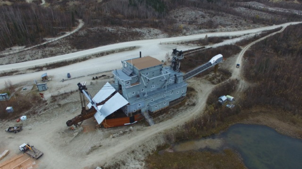
The dredge was a great place to launch the drone. The last time I got this view was 31 years ago when I flew my Cessna over her. The video I shot will take some time to edit. [Edit: the video is now posted at https://www.youtube.com/watch?v=_gZpXwAKXXk]
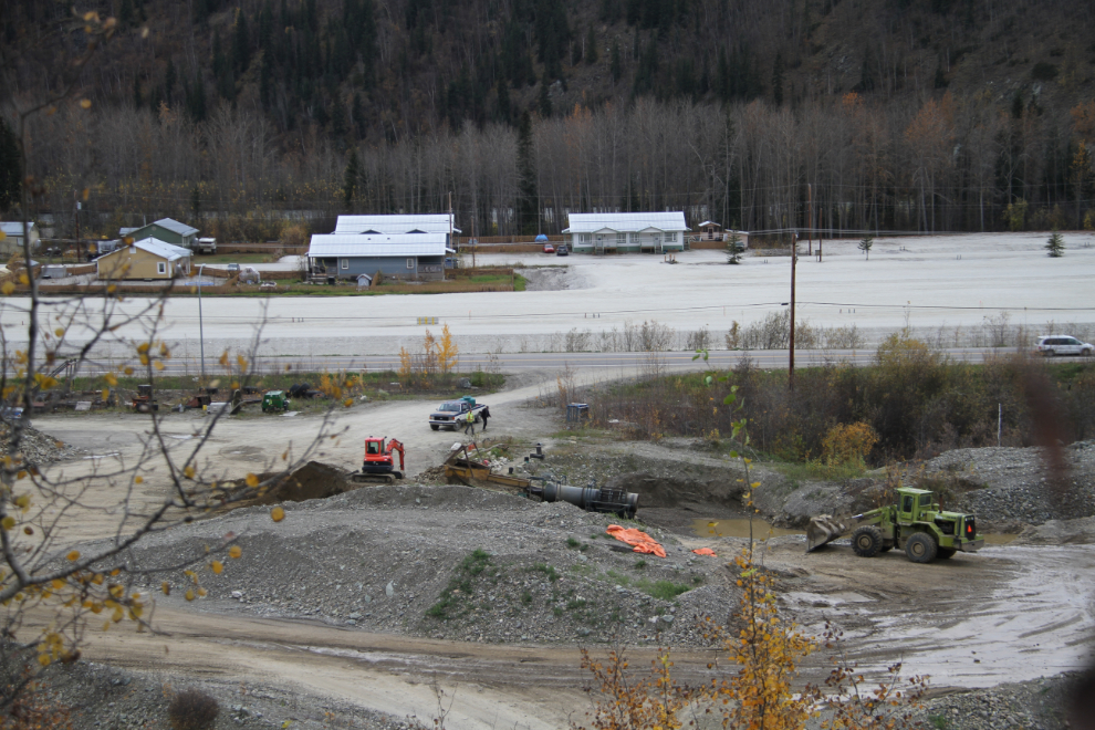
The gold mine just up Bonanza Creek from the dredge was going full tilt. In the 26 years I’ve been watching the property it’s been abandoned, and then had small crews for a few years, but this is the largest operation I’ve seen on it yet. Gold being at $1,332 USD at the moment continues to keep miners active.
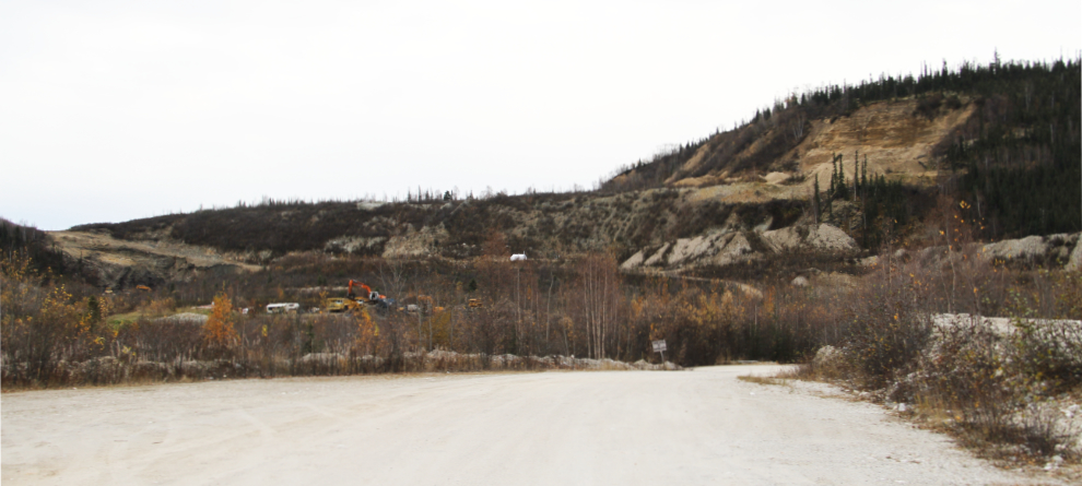
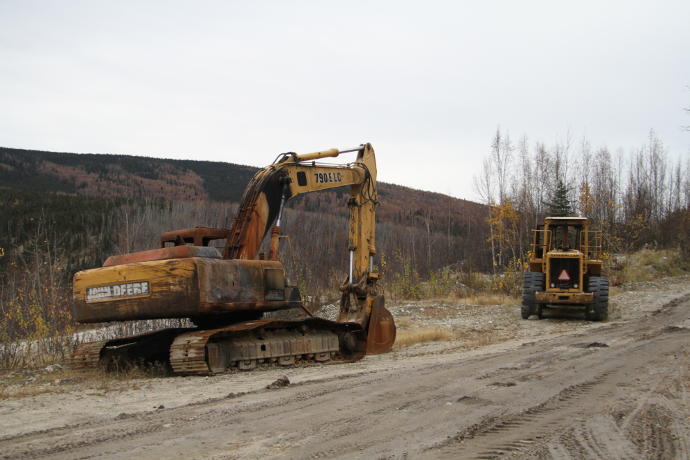
There’s apparently been an awful spell of vehicles and equipment being stolen and/or vandalized in the Dawson area. Just down from the dredge, this hoe and loader were torched.
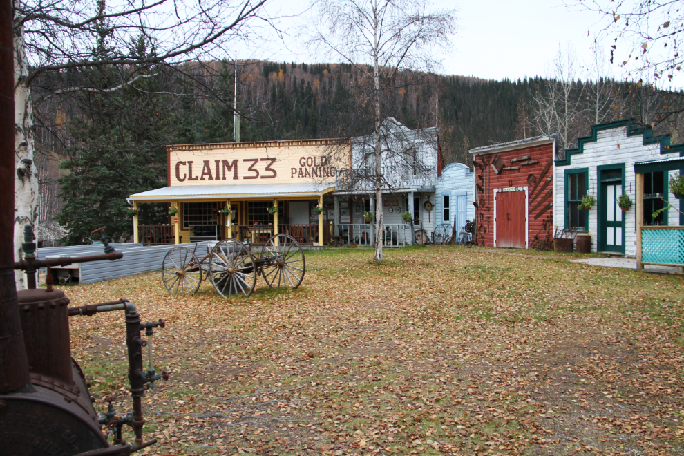
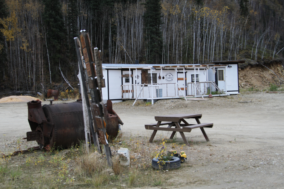
Claim 33 Goldpanning & Jerry Bryde Klondyke Mining Museum had closed a couple of days before my arrival, but I love looking over their collection.
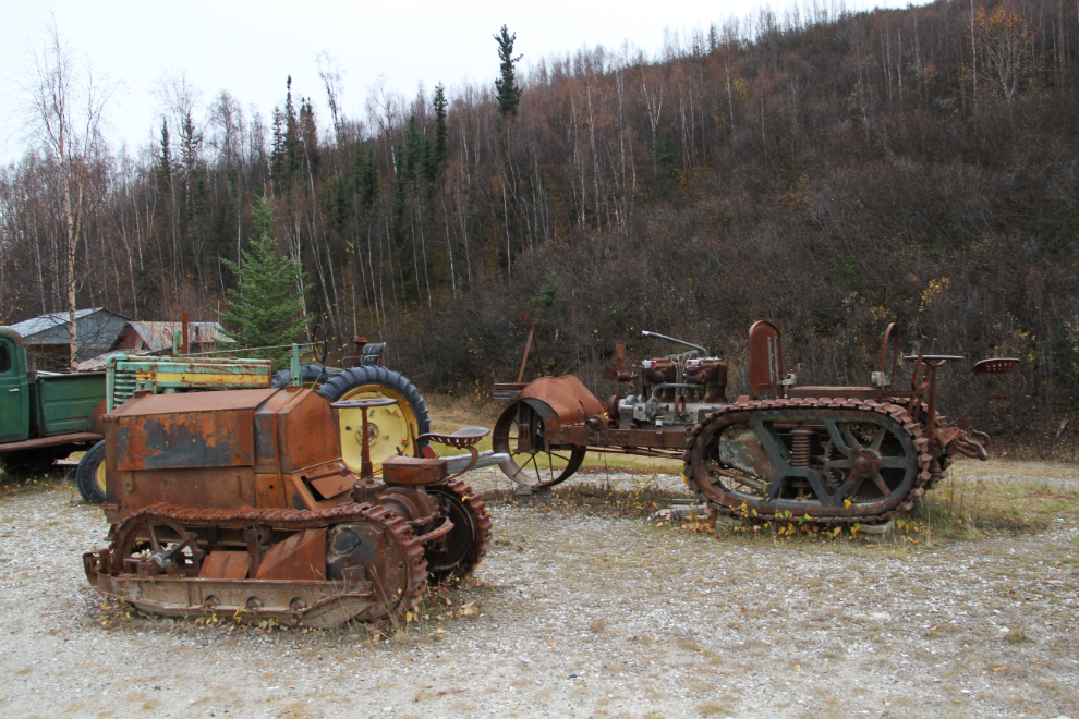
There’s some amazing equipment, such as this tiny bulldozer and oddly-configured tractor.
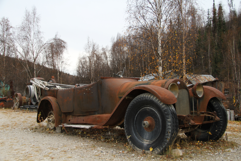
This early McLaughlin touring would be quite a car if a guy had $100,000 or so to put into it!
I’m not sure what goes on at Leo’s Corner when he’s there.
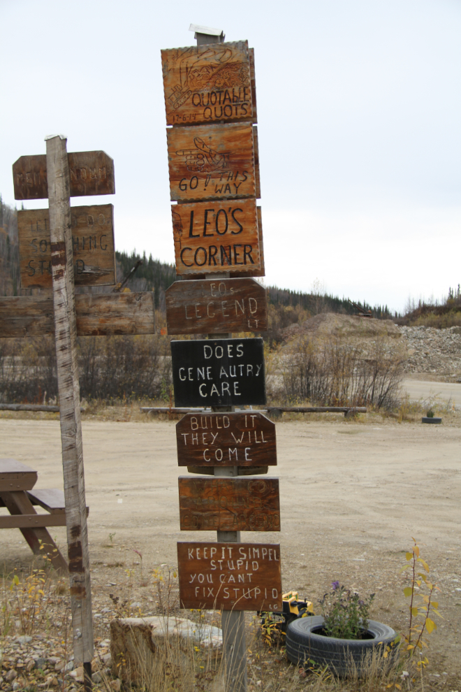
Leo certainly has a quirky sense of humour, though – his signposts are pretty interesting 🙂
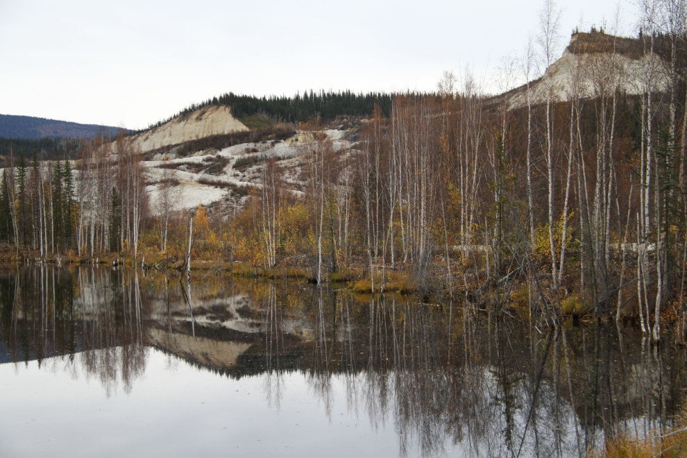
A quiet spot along the Bonanza Creek Road as we headed back to Dawson, with the road winding between a couple of ponds in the dredge tailings. The distant hills were the site of a large hydraulic gold-mining operation 20-odd years ago – it was very interesting to watch.
Some Dawson miners go out of their way to be jerks. A couple of weeks ago, Michel Vincent and Michael Heydorf applied to the Yukon Surface Rights Board to evict several families living in the Tr’ondëk Hwëch’in First Nation subdivision, which their gold claims overlap. This photo shows their claim and part of the subdivision. The Yukon clearly needs to revise some of the regulations, which regularly cause problems.
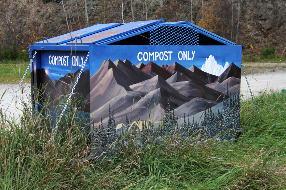
I don’t yet know who the artist is who paints the city’s compost bins, but they’re beautiful.
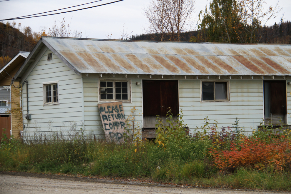
This guy has apparently had no luck getting the copper pipe stolen from his building returned – the sign has been there for a long time.
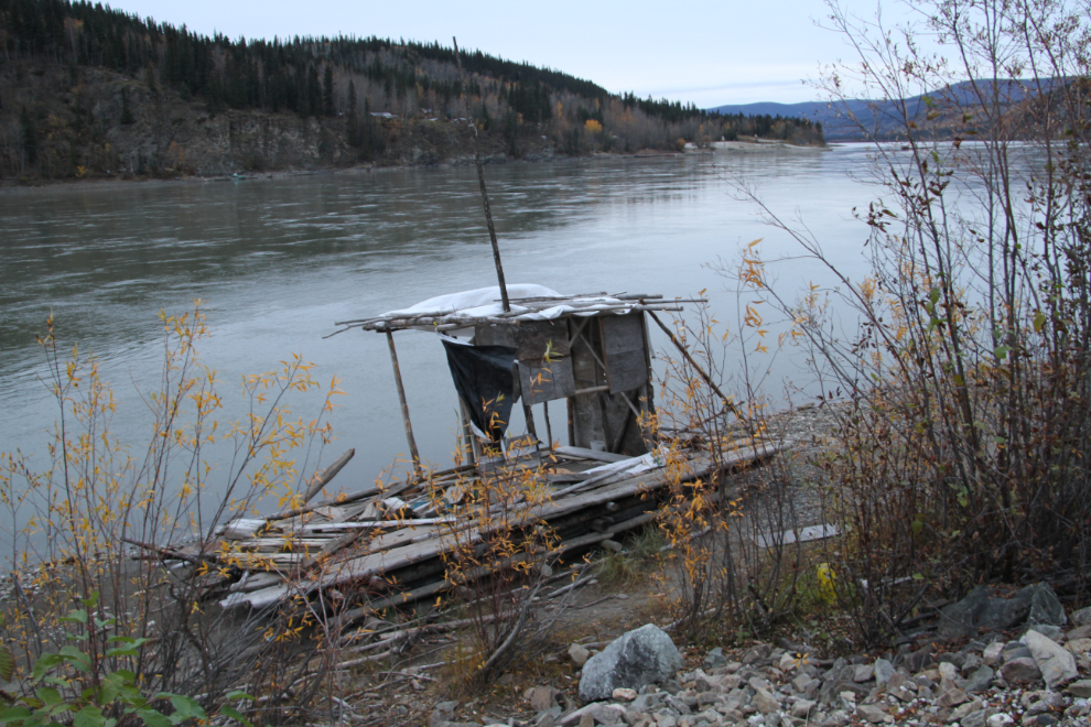
I had planned to go out for a good dinner and then to Diamond Tooth Gertie’s, but with Cathy not there, just couldn’t get into it. As the sun set at 8:00 pm, the kids and I went for a final walk, along the waterfront, always an interesting place. Some of this raft-home from the summer is being salvaged.
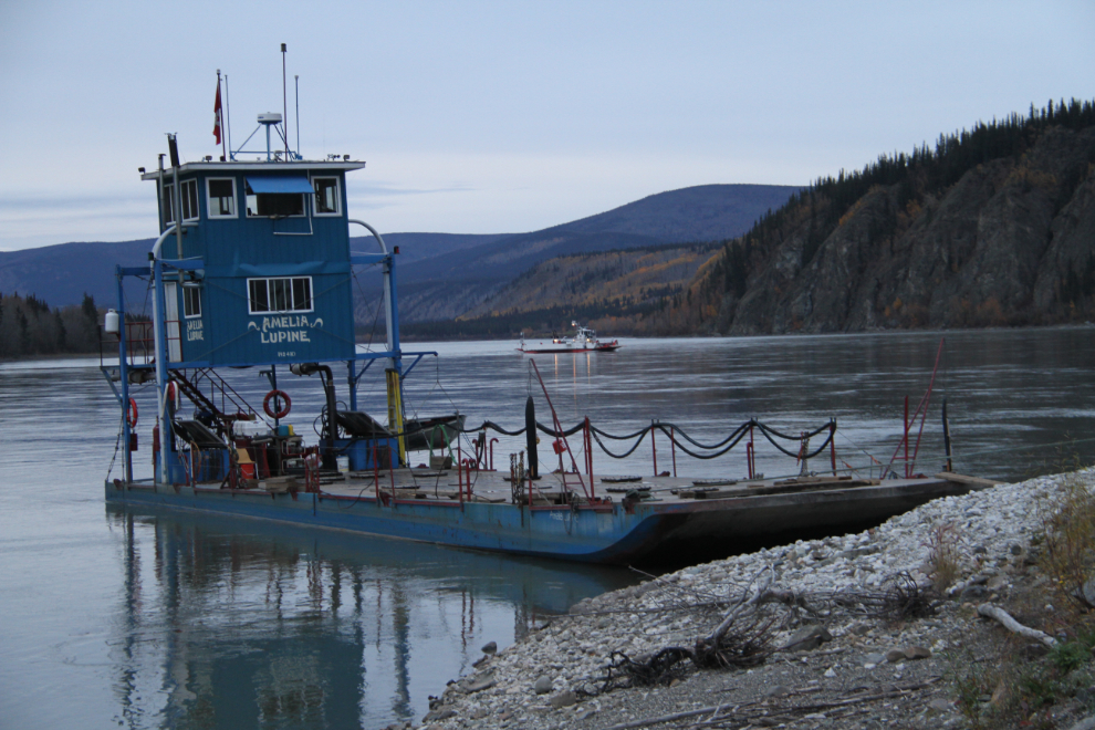
The freight barge Amelia Lupine, with the Dawson ferry crossing the river behind her. We’d start Thursday with a ride on the ferry.
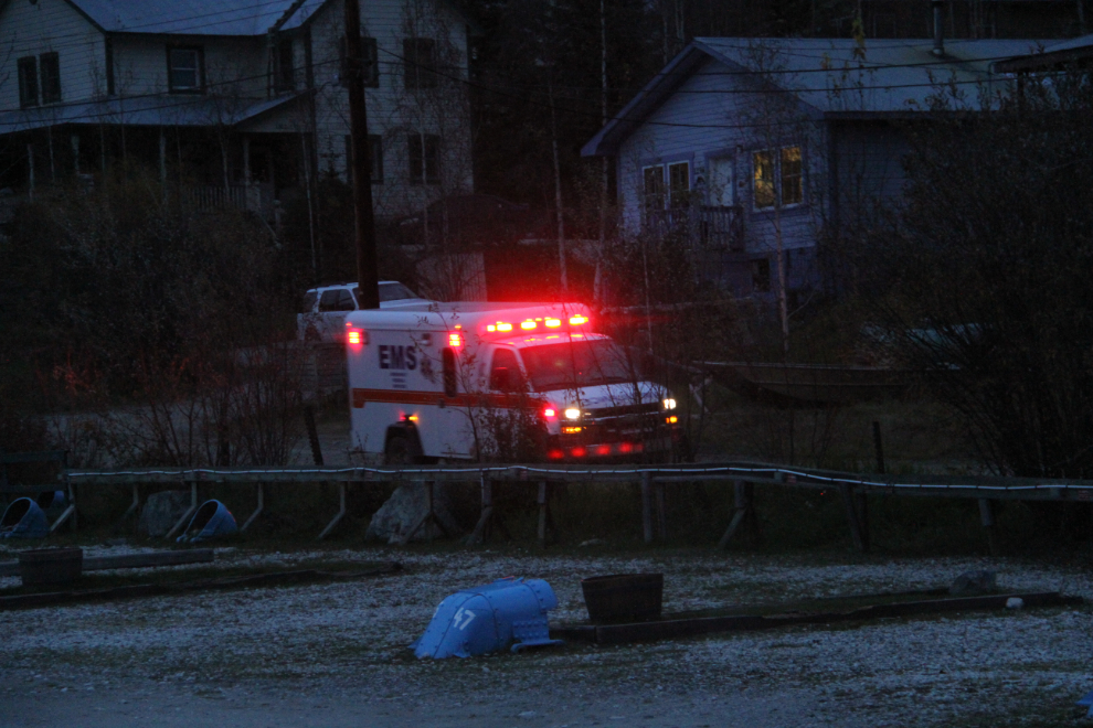
As we got back to the motorhome, this ambulance went screaming by. That’s certainly an unusual sight here.
The plan for Thursday was to visit Forty Mile and Clinton Creek ghost towns, and camp somewhere along the Top of the World Highway, perhaps at the summit, though the high chance of getting snow overnight at altitude made that a “maybe” still.