An icy drive to Kluane Lake and back
I needed to get away from the computer and snow shovels yesterday, and on the spur of the moment decided that a drive to Kluane Lake – a 500-km round trip – would be a good way to do that (see a map of the route). I see in my blog post archives that the last time I was out to Kluane was last September, on the motorcycle, and the last winter drives were in January and February 2024.
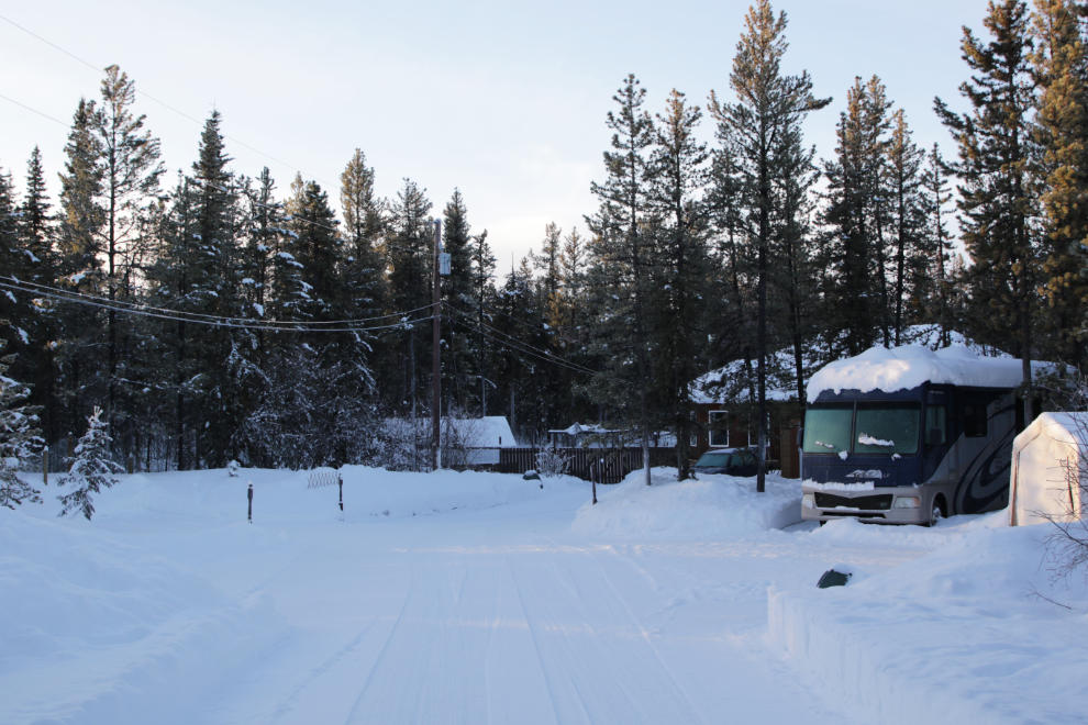
Sunrise was at 10:04, and I would have liked to be on the road by then then, but I didn’t get away until almost 11:00. Sunset would be at 6:25, so I wouldn’t likely be home until dark. The first photo, looking back down the driveway, is just a record of how much snow we have.
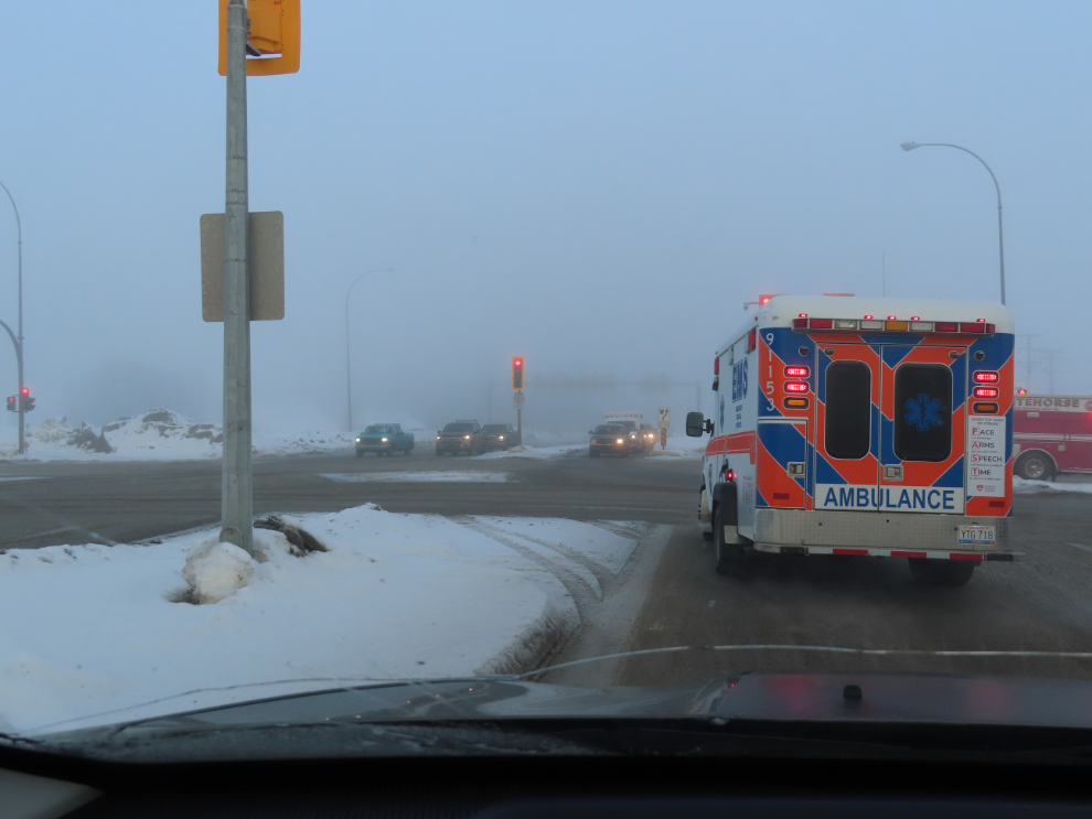
It was -7°C when I left, and within a few miles I hit fairly heavy fog, with a lot of it initially coming from snow-making equipment on our ski hill, Mount Sima. The fog was laying ice on the highway, and it was very slick. I shot the next photo was I was waiting for a very long light at Robert Service Way – the fire department had triggered red lights for everyone to get three trucks through the intersection.
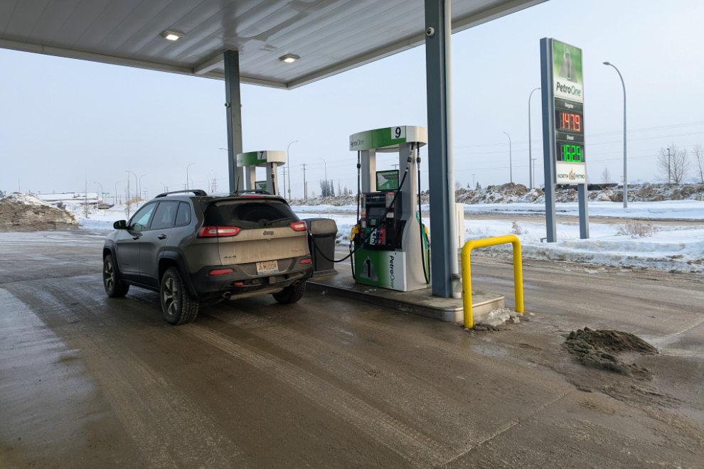
Before leaving town, I fueled up – it was going to be a fairly long day.
I drove out of the heavy fog in about 20 minutes, but was in and out of patchy fog for much of the next hour and a half or so. I had remembered to bring a note pad, so was writing down the exact locations of all the photos I was shooting – the next two were shot at Km 1444.7 and 1449.2. To possibly help orient you, the junction with the North Klondike Highway to Dawson is at Km 1437, and Haines Junction is at Km 1578.
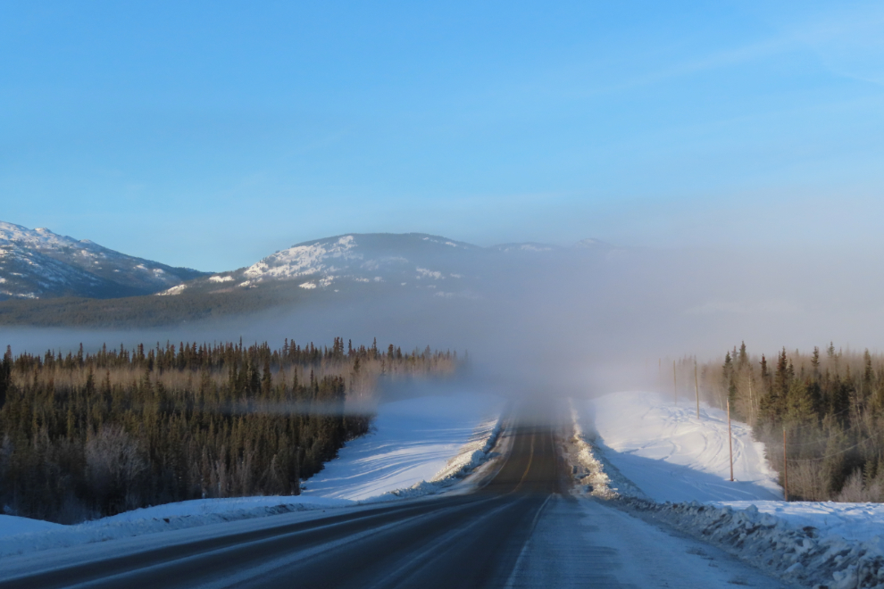
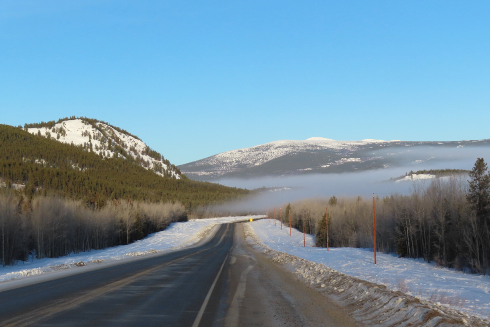
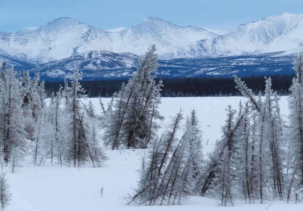
The view at Km 1453.3 often stops me for a photo – now we’re away from the city. Two things had now struck me – there was no traffic, and there was much less snow than at home. A bit further up, I actually stopped and checked the road reports to see if there was a travel advisory because of the ice, but no, there wasn’t. The lack of semis was particularly noticeable.
Right at noon, I reached the Takhini River Bridge – the temperature had now dropped to -14°C.
There were now a lot of elk tracks along the highway – a good-sized herd has been making its home here for many years. But I didn’t see any elk (yet!).
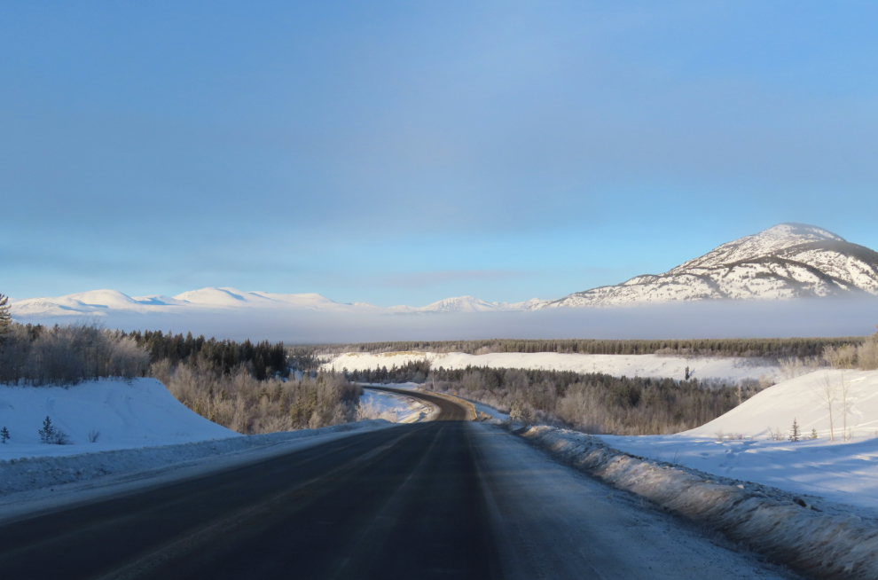
The next photo was shot looking back towards Whitehorse from Km 1497.3.
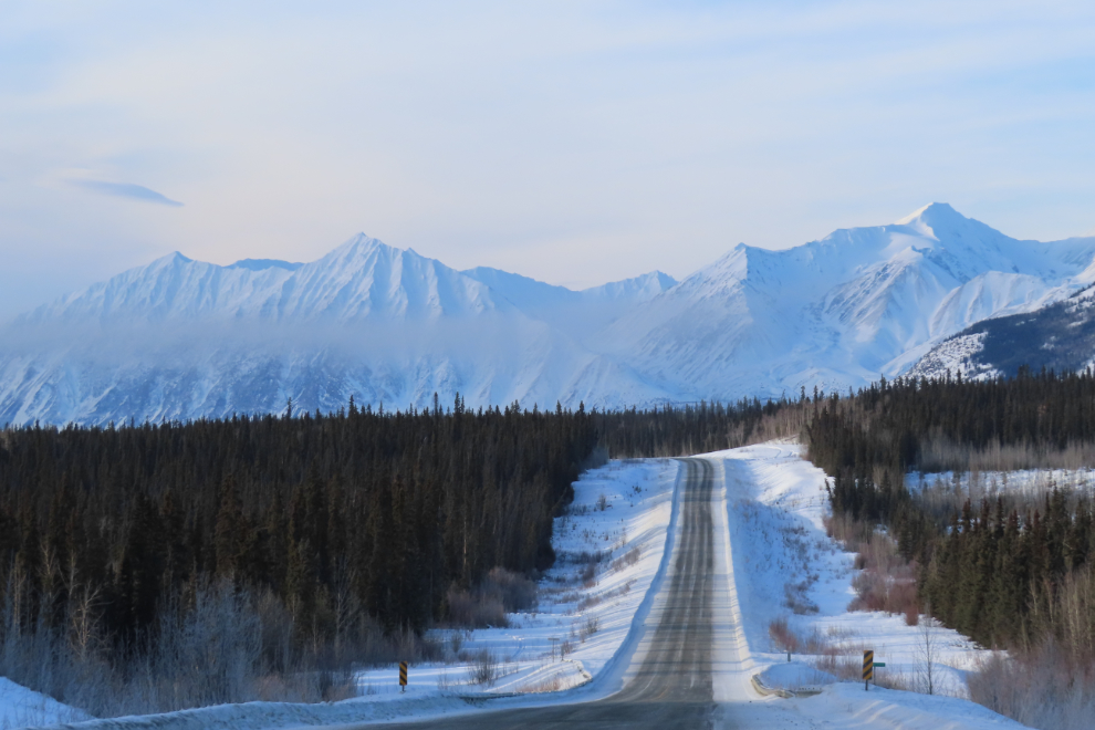
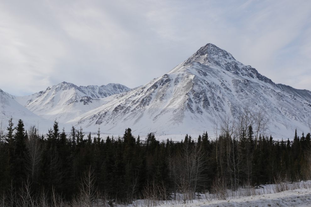
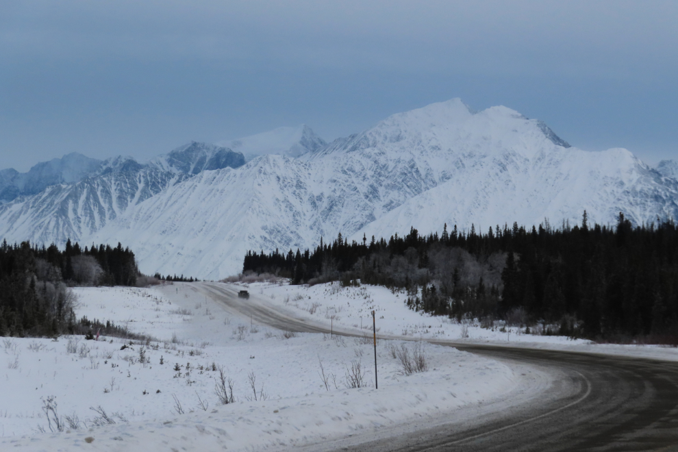
Ah, that’s the view I’d been craving – the first view of the Kluane Range, right at the Km 1526 milepost.
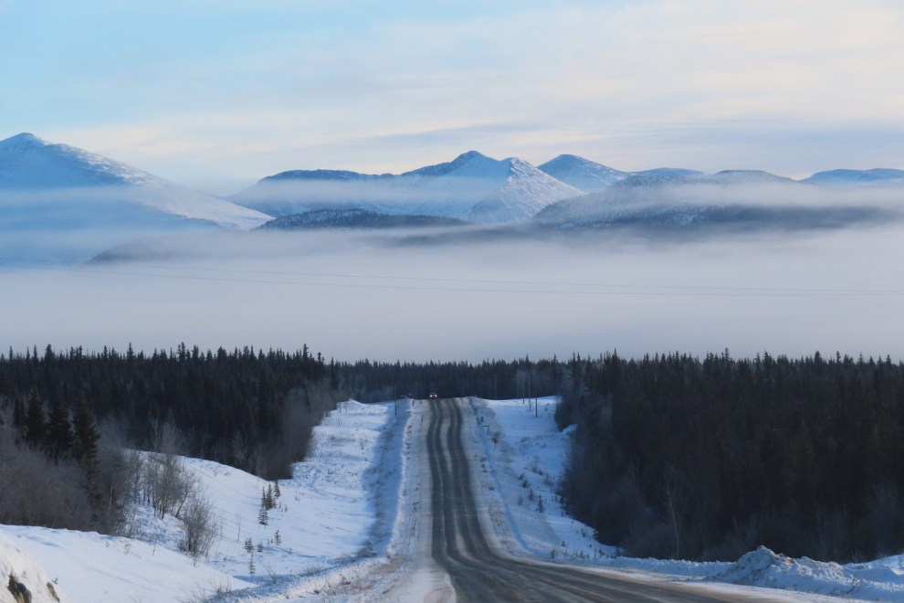
At Km 1562, the highway drops down to Marshall Creek then climbs back up again.
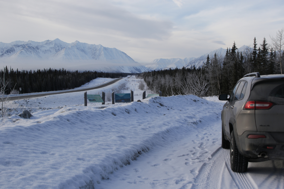
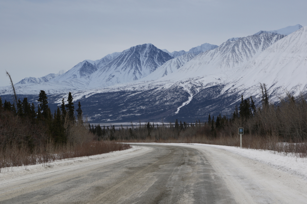
I pretty much always stop at the Kluane Range Rest Area at Km 1566, just to admire the view.
I’ve built a new section at ExploreNorth for “biographies” of Yukon’s historic places. There are 74 buildings now, but hundreds more could be added. In Haines Junction, the first place I’m going to add is Our Lady of the Way Catholic Church, so stopped to get a current photo or three. Edit: that page has now been posted, with 19 photos – see it here.
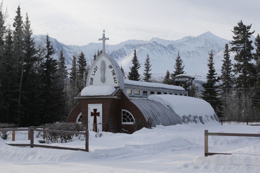
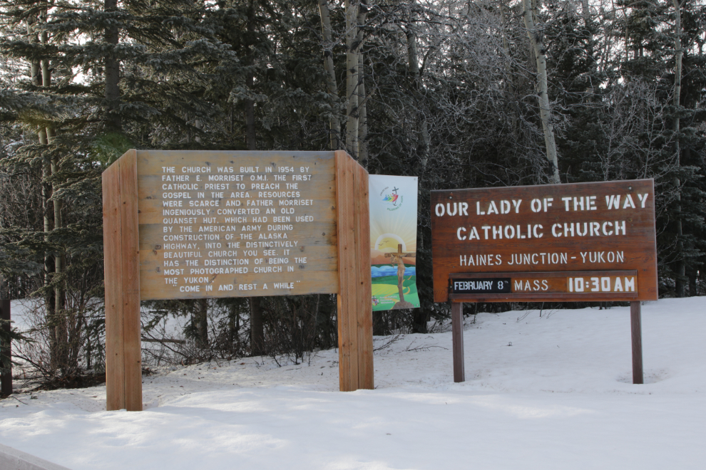
“The church was built in 1954 by Father E. Morriset, O.M.I., the first Catholic priest to preach the gospel in the area. Resources were scarce and Father Morriset ingeniously converted an old Quanset hut, which had been used by the American army during construction of the Alaska Highway, into the distinctively beautiful church you see. It has the distinction of being the most photographed church in the Yukon.” The last sentence, “Come in and rest a while,” encouraged me to try the door – I hadn’t done that in a couple of decades, as the two previous times it had been locked.
Churches fascinate me, and I spend quite a bit of time in them around the world. The passion and dedication it takes to build and operate them, and the beauty, from the magnificent cathedrals to humble structures like this, has resulted in many hundreds of photos.
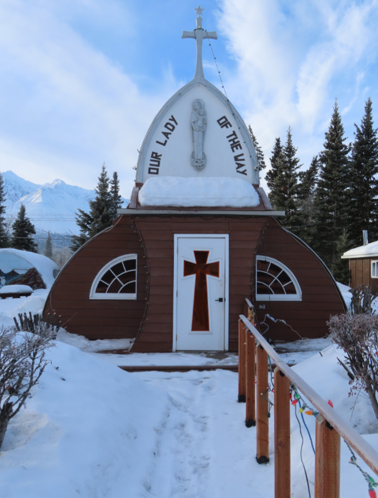
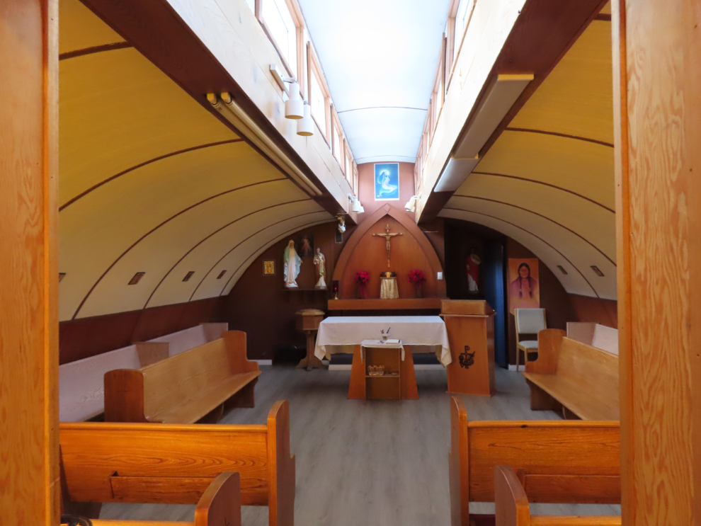
I was very pleased to find the door open, and I did “Come in and rest a while.” 🙂 And I got the photos I need for a proper biography of the building. There’s another quonset hut church in the Yukon, Our Lady of Grace Catholic Church in Beaver Creek (also built by Father Morriset), but it’s a bit too far for a day-trip. I don’t seem to have photographed it since 1999, though – I feel an overnighter coming 🙂
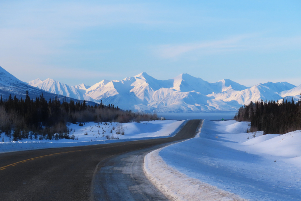
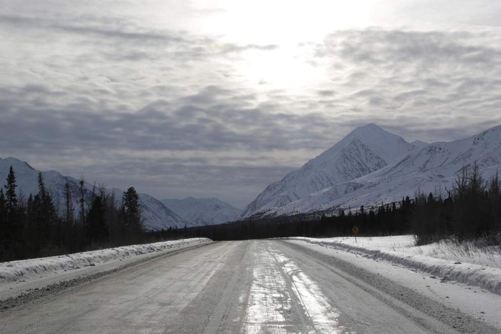
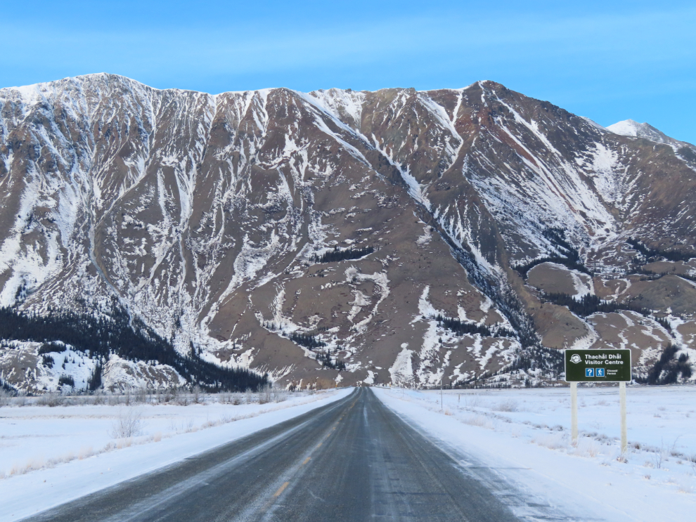
From Whitehorse to Haines Junction, the Alaska Highway runs pretty much west, but then turns to the northwest to run along the base of the Kluane mountains to Kluane Lake.
Looking back to the southeast from Bear Creek Summit. At 1,004 meters (3,294 feet), this is the highest point between Whitehorse and Delta Junction, the end of the Alaska Highway.
The abandoned Kluane Lake Lodge, on the shore of the lake at Km 1641. There are indications that an RV park may be getting built on the property, but work is slow. It would certainly be a great place for one. It would have been a great place for a nice lodge, too, but this one was always run on a shoestring budget and didn’t provide what people wanted.
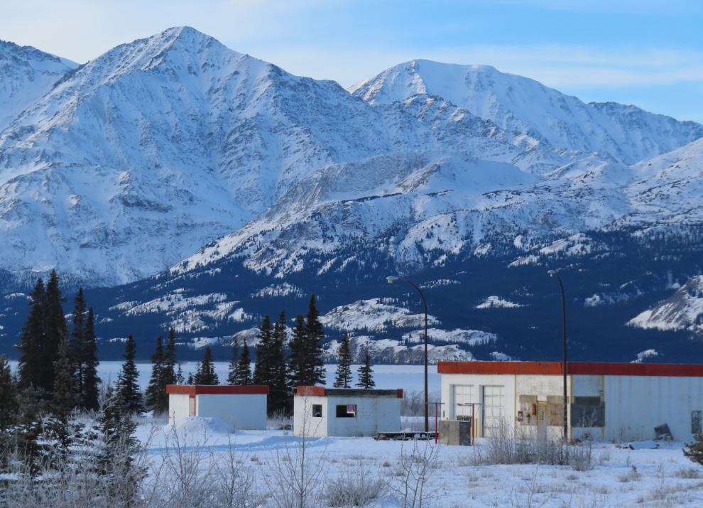
Just before reaching the lodge, I had seen a moose close to the road, but as soon as I started slowing down she slipped back into the forest. Oh well, it’s a start 🙂
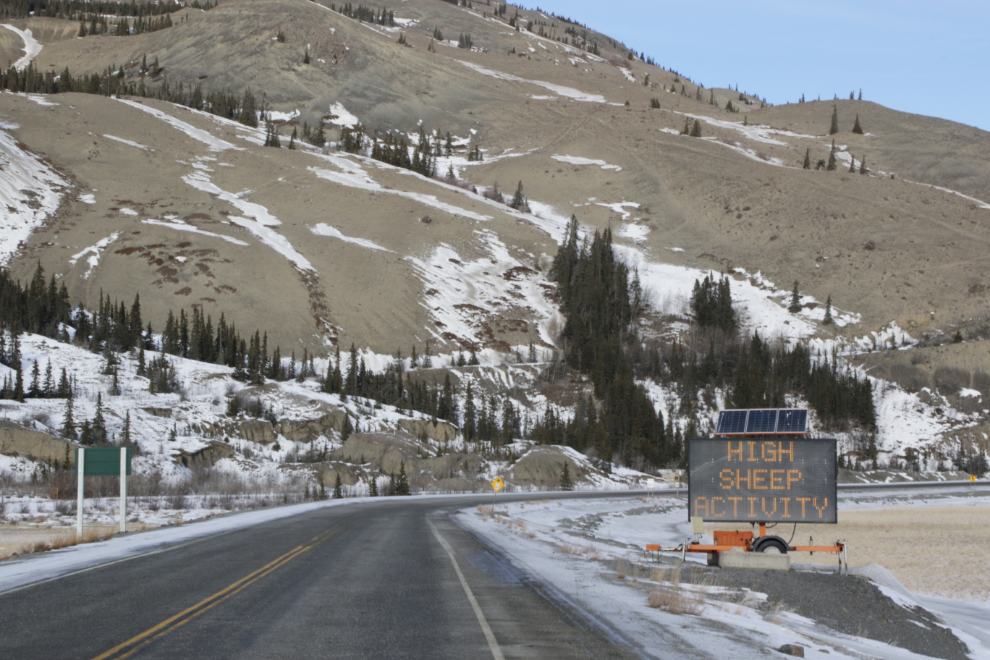
Sheep Mountain from Km 1646.9 – there’s really not much snow here!
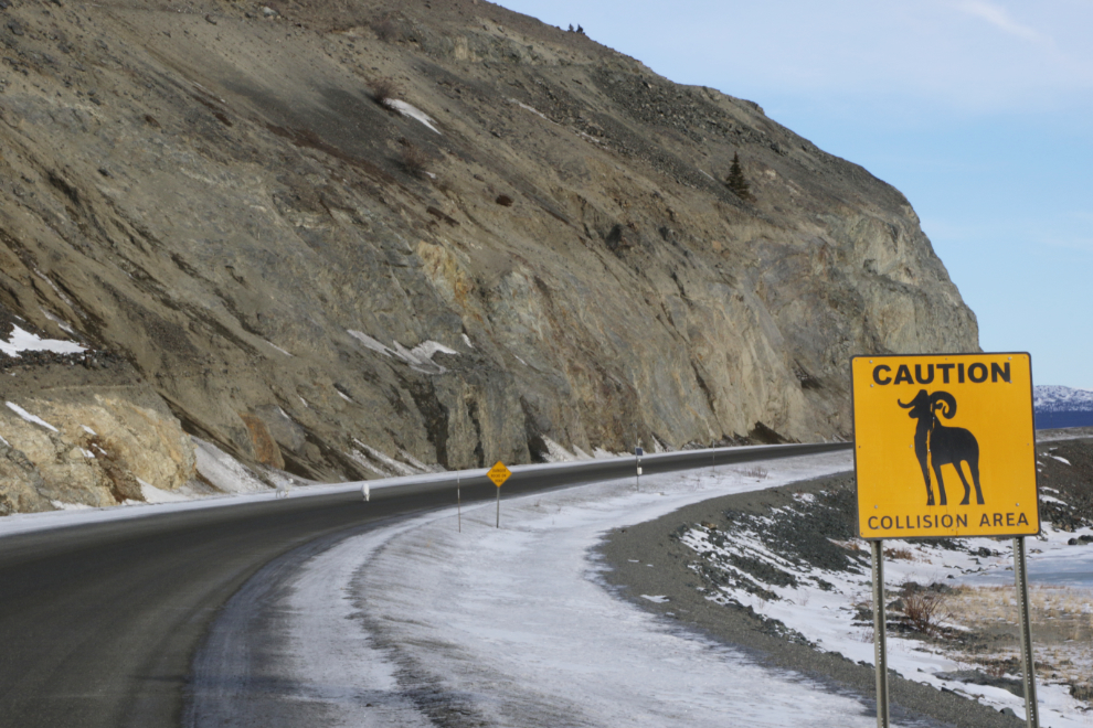
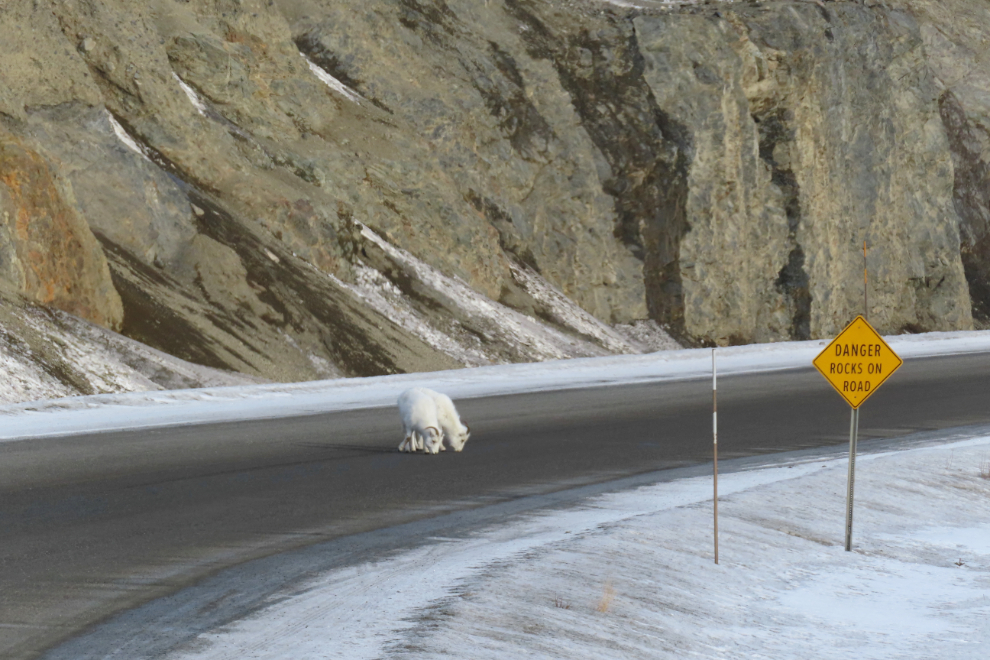
Sheep Mountain, as this large flashing sign says, has “HIGH SHEEP ACTIVITY,” and drivers are asked to slow to 60 km/h. I haven’t found any stats on how many sheep get killed here, but it must be significant. One legendary collision in 2019 killed 8 of the 12 sheep that were on the road 🙁
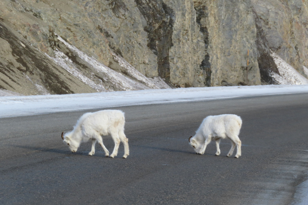
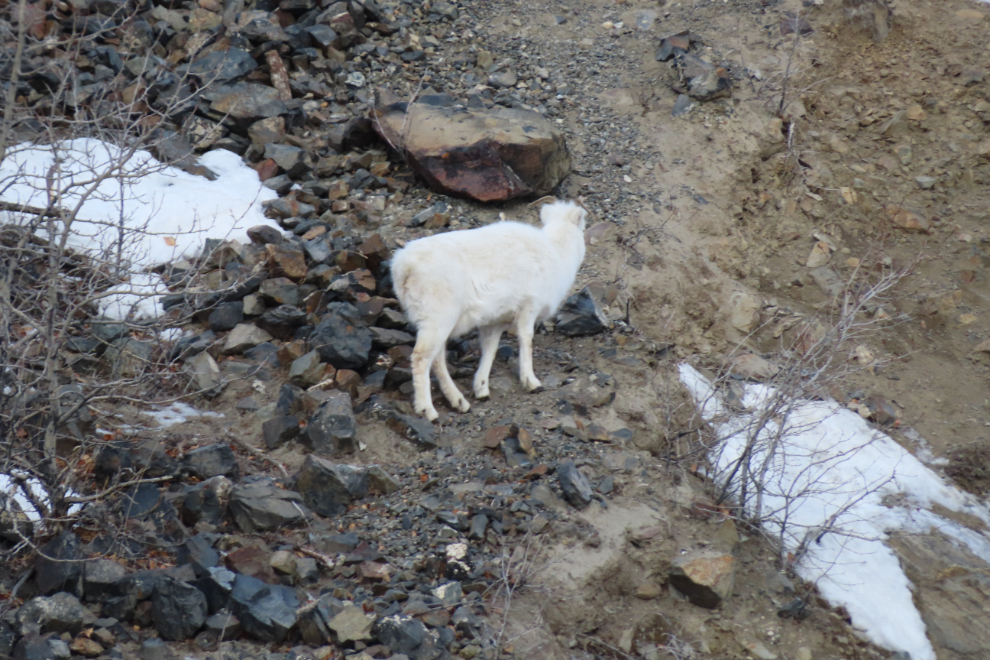
There’s one sheep on the highway just ahead, and another about to step onto it.
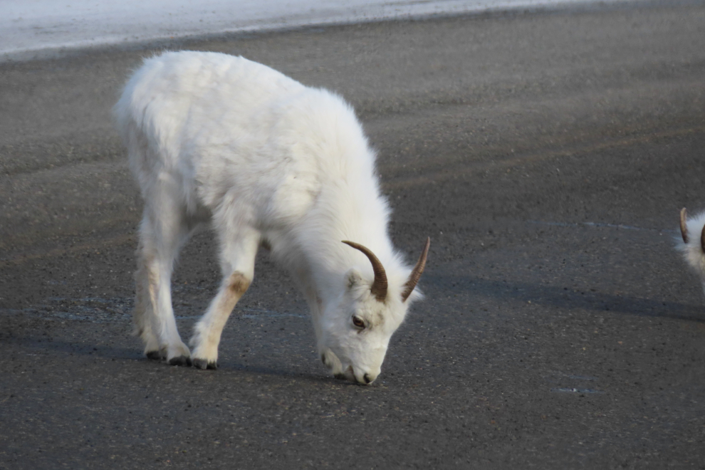
There was no traffic at all, and I spent quite a while with these two, inching closer and closer, and getting out of the Jeep to talk to them as I got close enough.
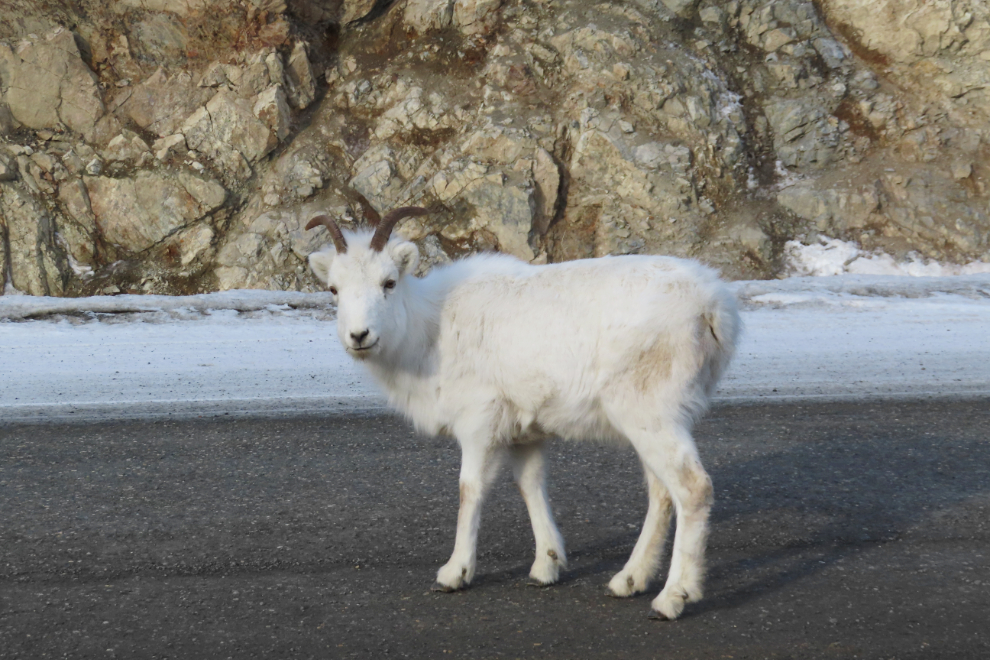
When it was time to continue on, I drove slowly ahead as this guy walked towards me. When he was right beside me, we both stopped, and I talked to him for a couple of minutes. You can see that he was totally okay with that interaction, perhaps even intrigued by it. This sort of event can really make my day special. It certainly makes me thankful to live here 🙂
About 5 km further along, I was totally unprepared to have the road ahead filled with Mule deer as I came around a corner! There were about 15 of them, and as I came to a stop, they scattered. I could have gotten some photos of some of them peeking out from the bushes, but I fully expected them to come back onto the road, so didn’t. They didn’t return.
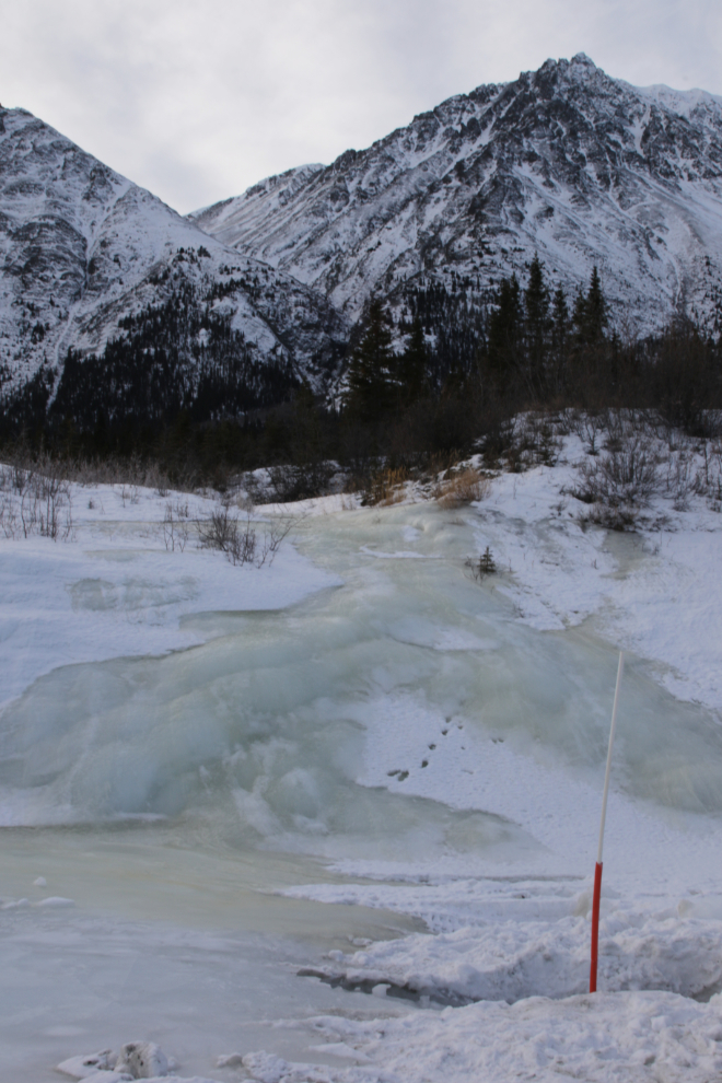
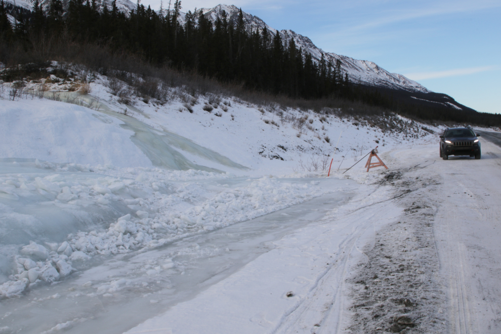
A friend had told me about some great ice along the lake, and sometimes a spectacular pressure ridge forms a few miles north of Sheep Mountain, but I found nothing this day.
I drove up and down the highway 3 times looking unsuccessfully for ice and deer, but finally turned around at Williscroft Creek and on the way back stopped at a “glacier” at Km 1655. These ice buildups are a pain for the highway maintenance folks, and they’re both trenching and using steam hoses to deal with this one.
Back at Sheep Mountain, a vehicle I had seen going back and forth on the highway as I was, was stopped and some big lenses were pointed up the mountain. The two sheep I had spent time with were now climbing back up the slope.
Starting to climb up from the lake, headed home, I drove past the access road to the ghost town of Kluane (Silver City), then stopped, backed up, and made that detour. I was there last June, but love the vibe there.
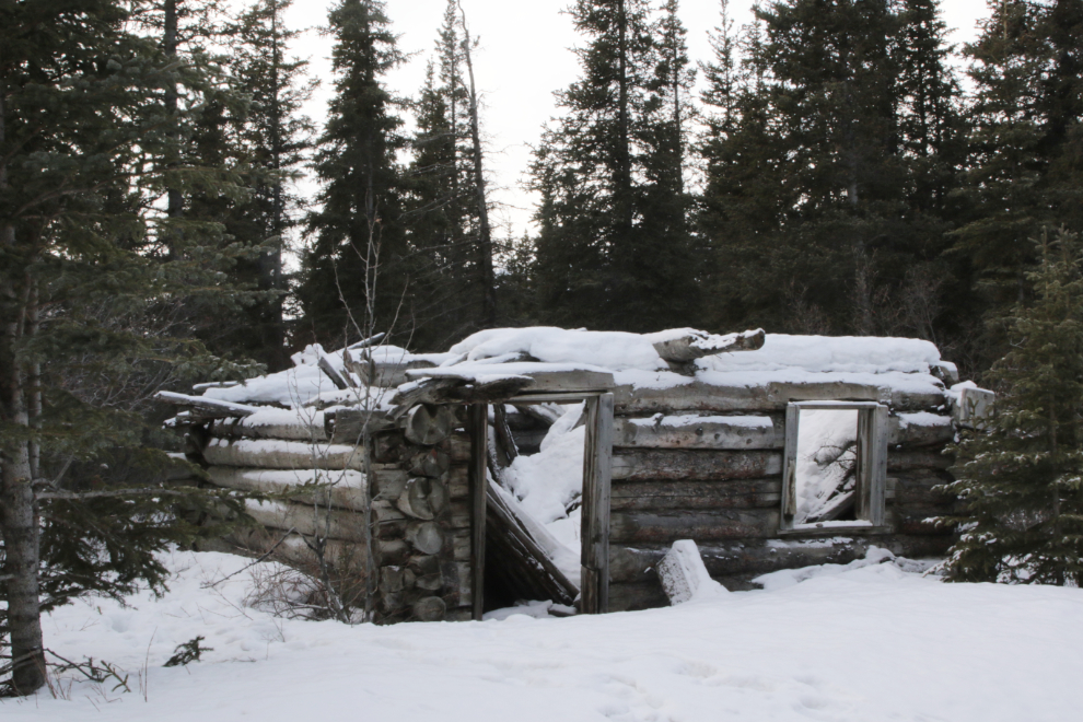
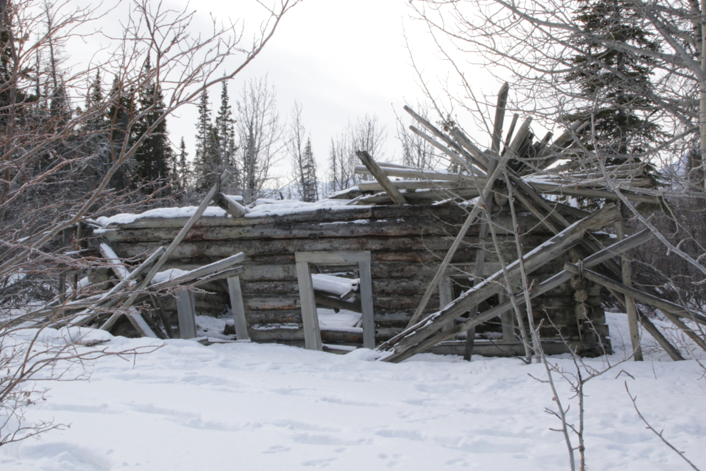
Kluane was established as a North-West Mounted Police post in 1904, as the Kluane Gold Rush was exploding – see “An Explorer’s Guide to Silver City (Kluane)“. The building in the next two photos seems to have been the largest – a roadhouse and store originally, I expect.
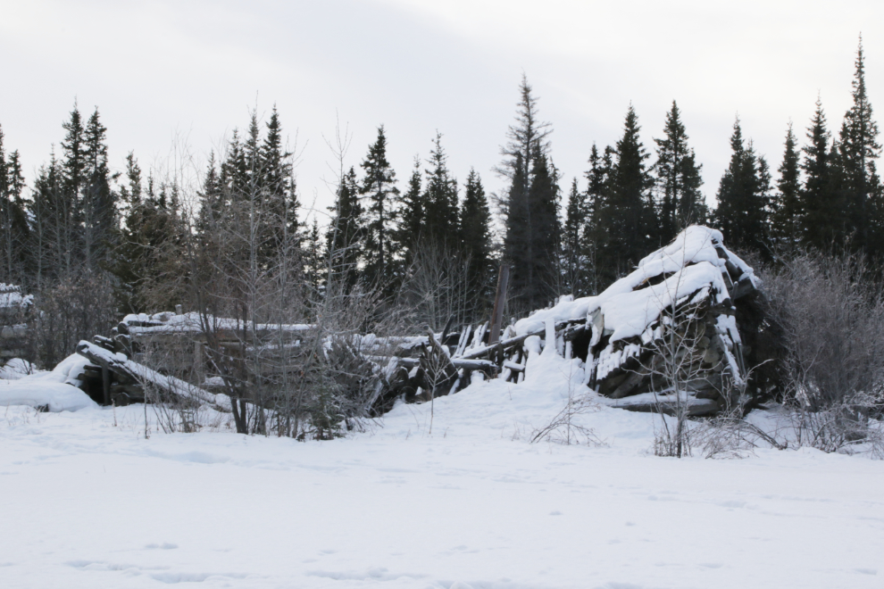
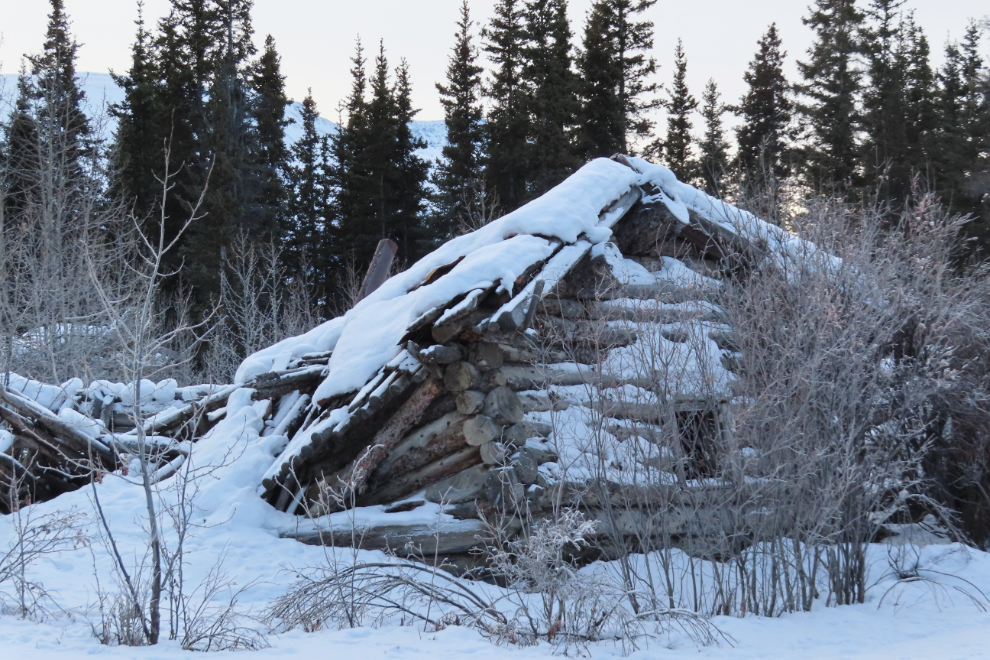
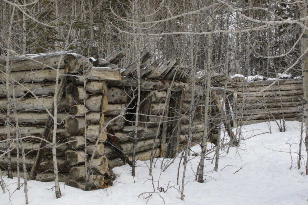
The site was owned many years ago by a fellow in Fairbanks who planned to turn it into a theme park, and I think his family still owns it. There are buildings scattered all through the forest, all now far beyond restoration. The next three photos show more of what’s visible without trudging through the snow.
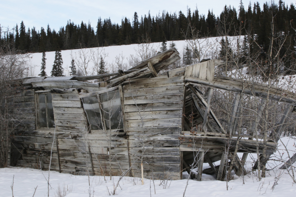
The next photo shows the ruins of a substantial building erected by the U.S. Army during construction of the Alaska Highway in 1942. This is the last one standing. Well, sorta standing 🙂
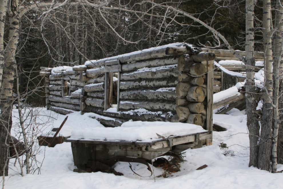
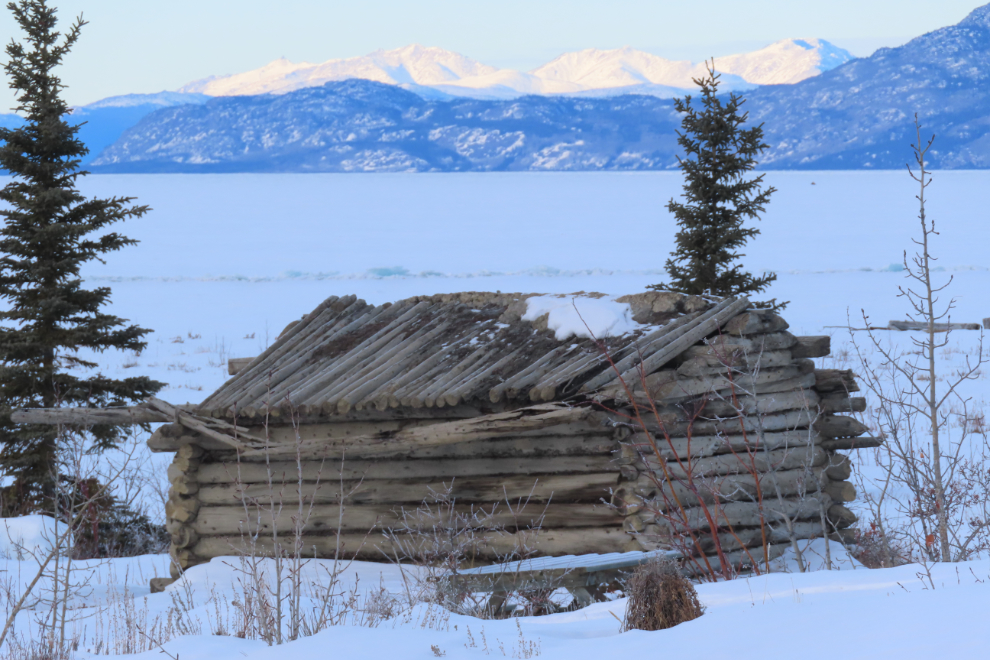
The final cabin is on the beach of Kluane Lake, and is perhaps in the best condition of any of them, though it appears to be of the same vintage.
Almost back to the highway, I stopped to get a photo of an old bus that it’s a wrecking yard of vehicles and “stuff” collected starting in the late 1990s by tow truck driver Joel Prestone, who died in 2014 – it appears to be abandoned now. What a wonderful little motorhome that would make! 🙂
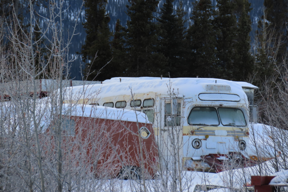
While stopped to get that bus photo, the car of photographers I’d been meeting went by on the way in to Silver City.
By the time I reached Sulphur Creek and Sulphur Lake at Km 1614.7 of the highway, it was a few minutes after 4 o’clock – I was running out of day.
Climbing up to Bear Creek Summit, at Km 1602.9. There was a temperature inversion happening – when there’s no wind, cold air sinks and warm air rises so it gets warmer as you climb. It was -8 at the lake, -1 at the summit, then dropped back down to -5 at Haines Junction. Little things that intrigue me 🙂
Dropping down from the summit at Km 1591.2. A sanding truck had been sent out, and it was very welcome, because that slope was extremely icy!
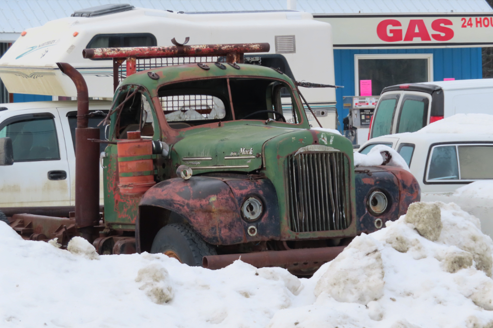
As 5:00 neared I was ready for dinner. Okay, maybe one more photo – and I had to back up quite a way get this one after spotting it through a break in the trees as I went by.
Okay, I said no more photos, but this B-61 Mack truck looked so great in the snow!
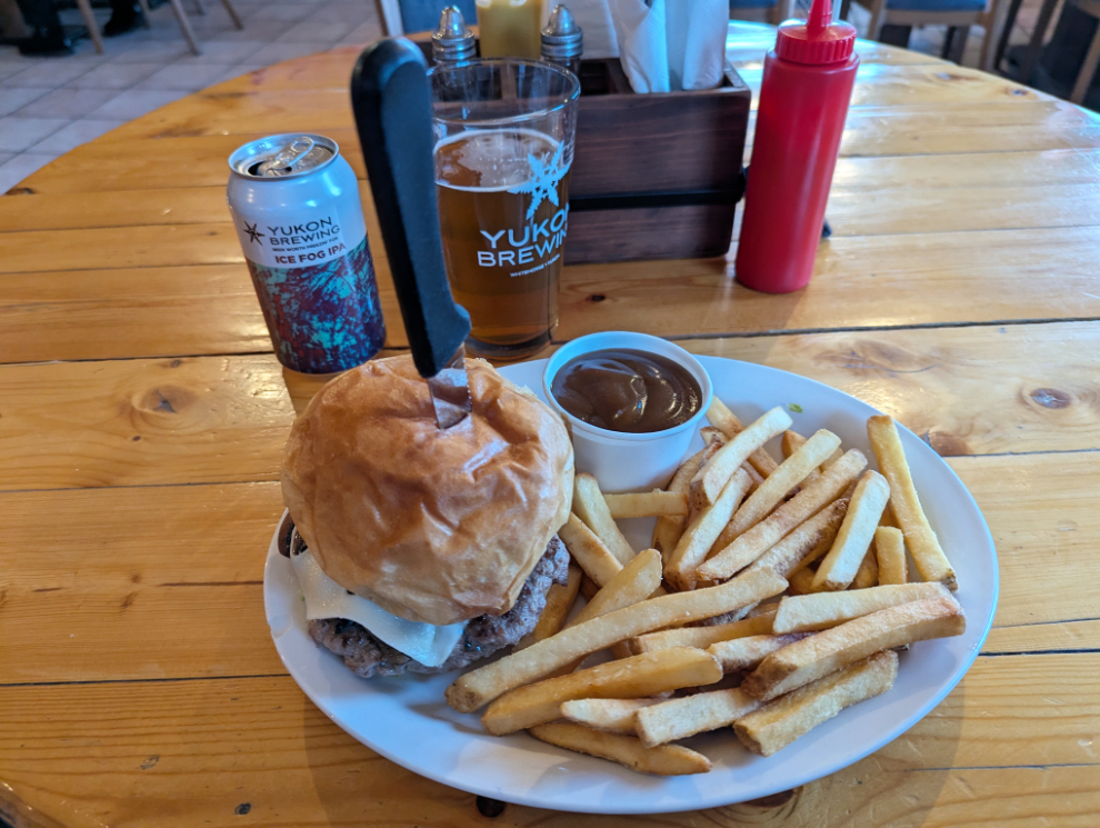
With no more distractions, I made it to the Mile 1016 Pub, and the final photo of the day is of my Mushroom Swiss burger and Ice Fog beer – ahhhhh, I deserved that! 🙂
By the time I left 1016, I had lost the light so just aimed for home, though I had to stop for a half-hour nap at a rest area half way. It had turned out to be an excellent day, exactly what I needed 🙂