A detailed look at the Waterfront Trail in Whitehorse
My project yesterday (February 27th) was to document the entire Waterfront Trail, to show people what it looks like as a reply to some online complaints about how the new buildings in Whitehorse have ruined the views of the river we used to have.
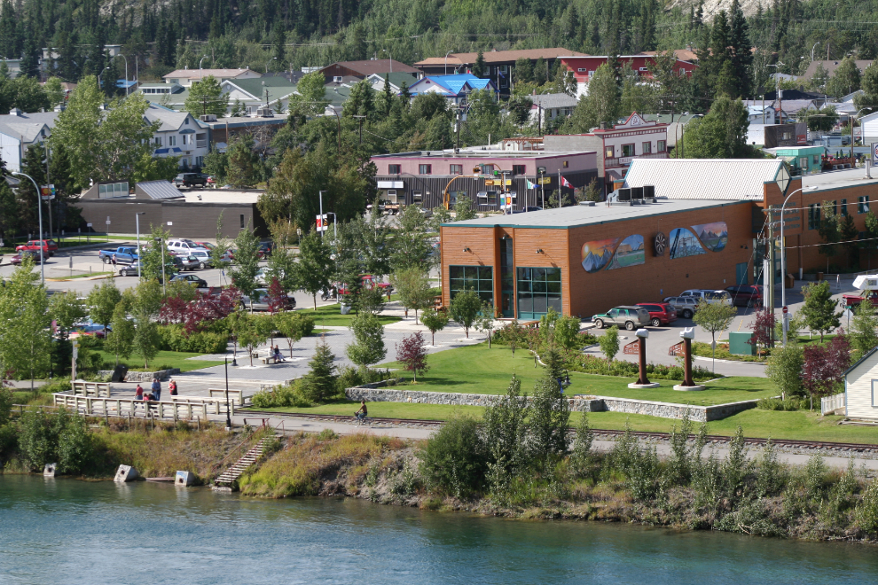
In actual fact, we now for the first time in the 125-year history of the community have the entire length of the river accessible to everyone, and the entire 3 kilometers of paved trail is family-friendly.
I’ll start with a map – this is my track with Strava yesterday. You can follow along with an interactive Google map. My walk covered 6.2 kilometers in an hour and 24 minutes, and I shot 93 photos.

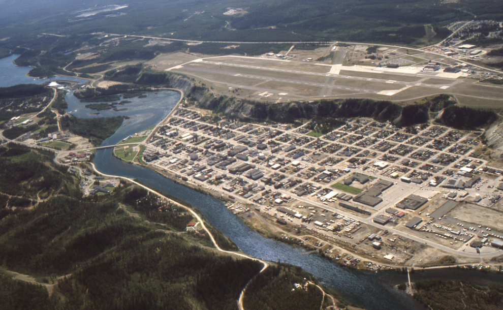
The next photo was shot from my Cessna on June 19, 1985 – my first look at Whitehorse. It shows clearly how little of the river was accessible then. You can see a greatly-enlarged version of that photo here.
The vision of lengthy paved trails along the Yukon River goes back to 1999 – the first public meeting was held that November. While some people wanted things to be left as they were, the City saw enough support to continue. Even in 2002, however, the plans were very different than what actually happened – the northern section of that planned trail has yet to be built, though a casual trail exists, which I’ll show you towards the end of this post.
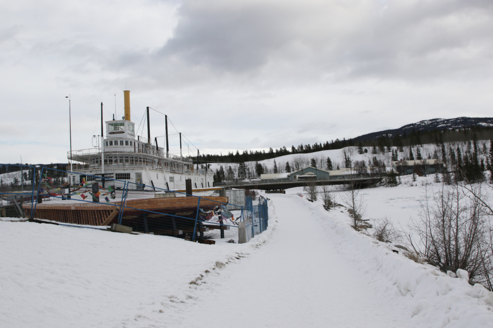
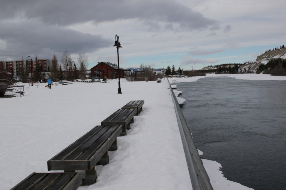
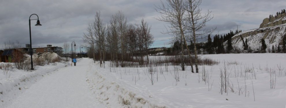
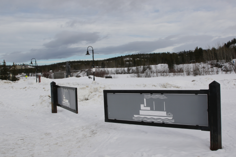
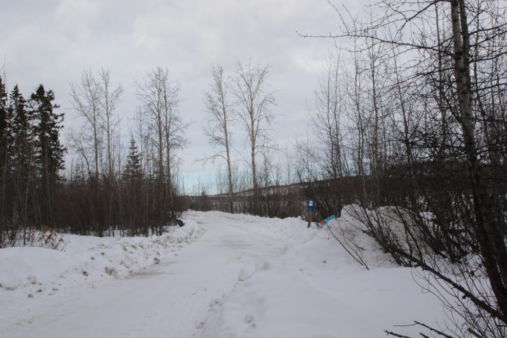
I started my walk at the SS Klondike, where there is abundant parking.
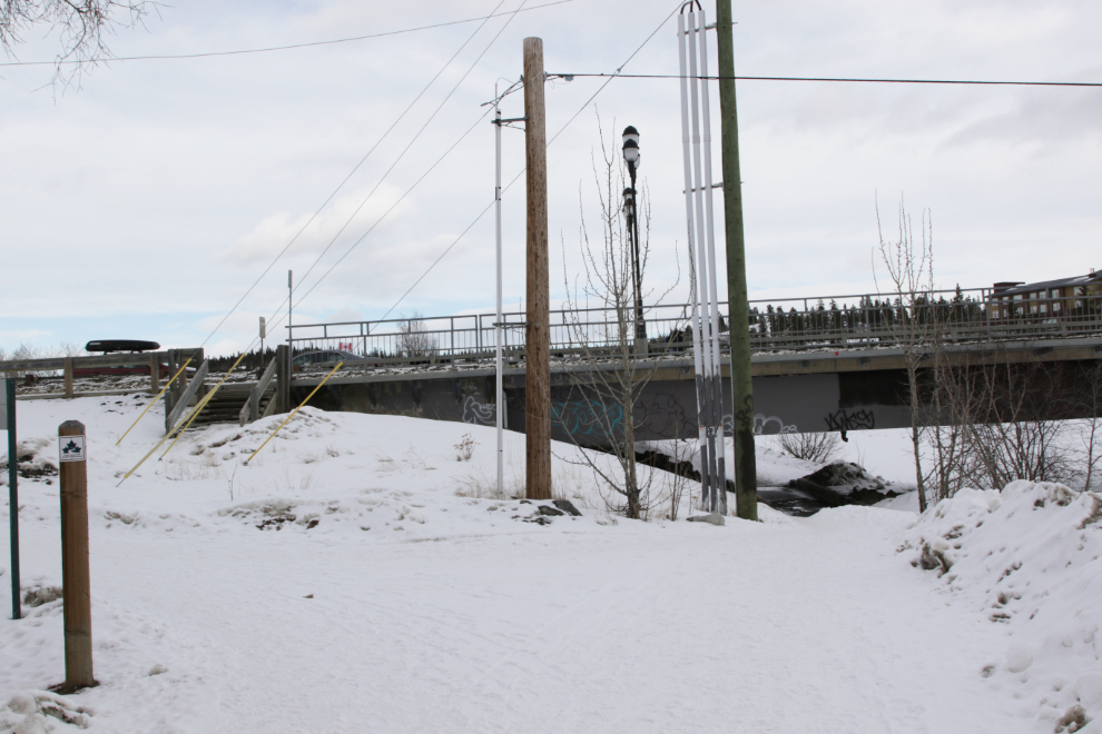
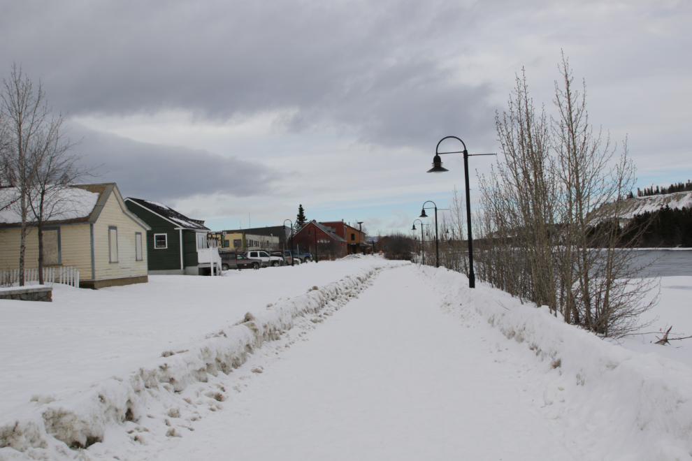
In just under 200 meters I was approaching the Robert Campbell Bridge across the Yukon River. The stairs to the left are for the Millennium Trail (which I’ve written about a few times, most recently two weeks ago), while the Waterfront Trail begins by walking under the bridge straight ahead. These trails are well maintained year-round.
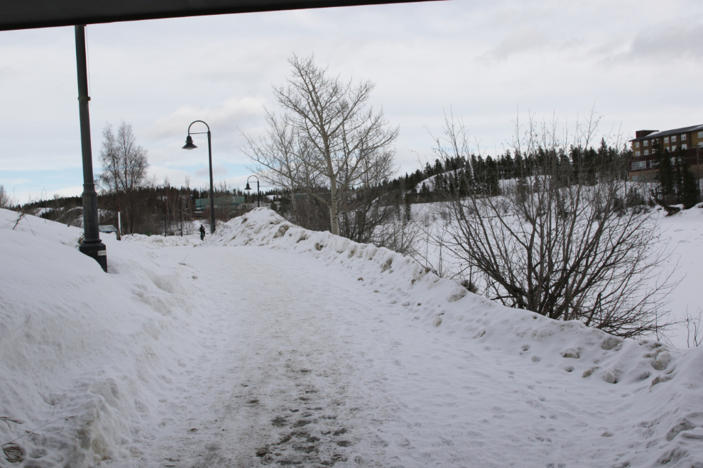
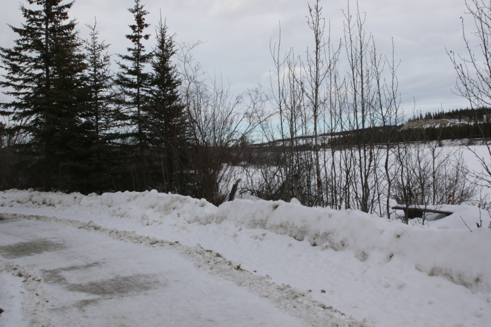
This is the southern end of the Waterfront Trail. Across the river is a residence for temporary nurses and doctors.
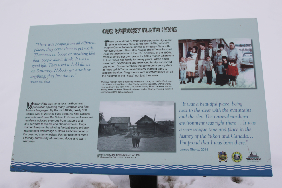
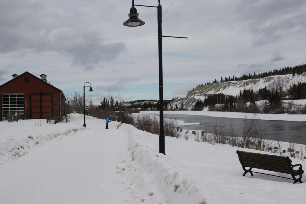
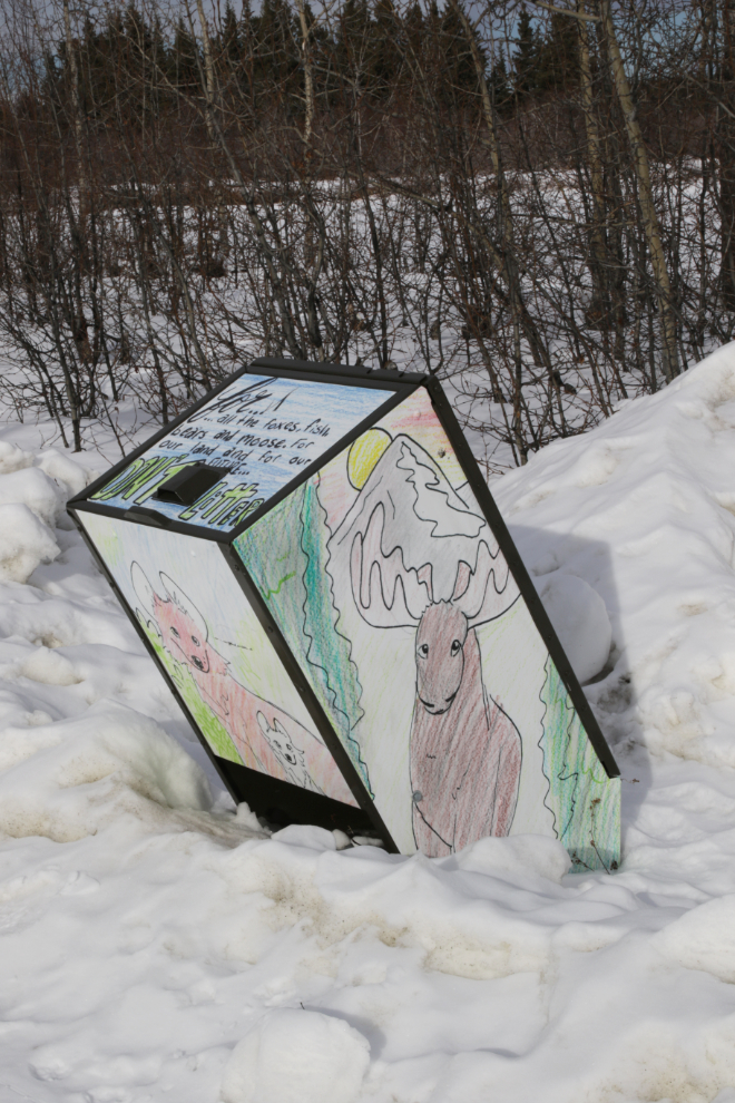
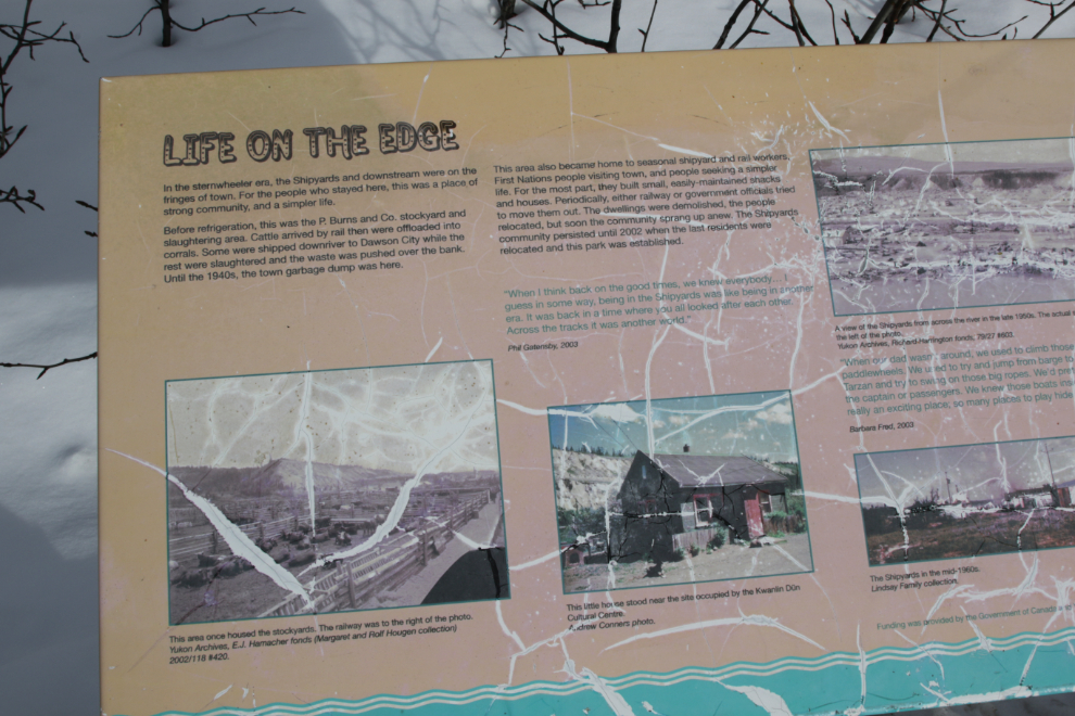
For the next 300 meters, the trail runs between Rotary Park and the river. The Rotary Club built this park in 1969 – when they started, there were still a few homes there in a squatters’ community called Whiskey Flats. There are many interpretive signs along the entire length of the trail, with information about history and nature.
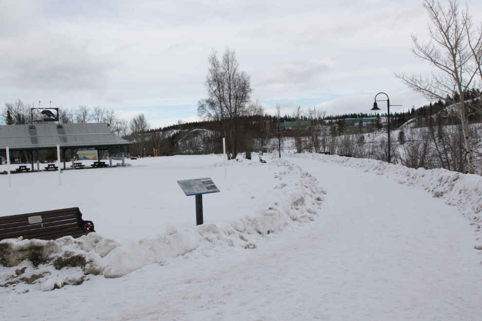
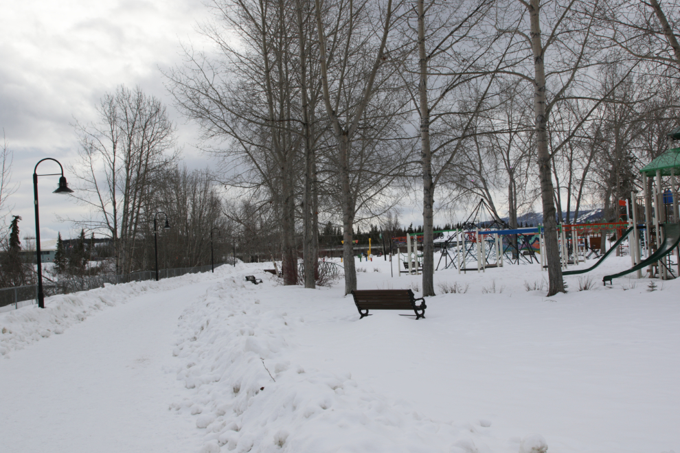
A look back at the amazing children’s playground, which includes a water park. This is the only section of the Waterfront Trail where there’s a chain-link fence between the trail and the river – it’s there to keep the kids safe.
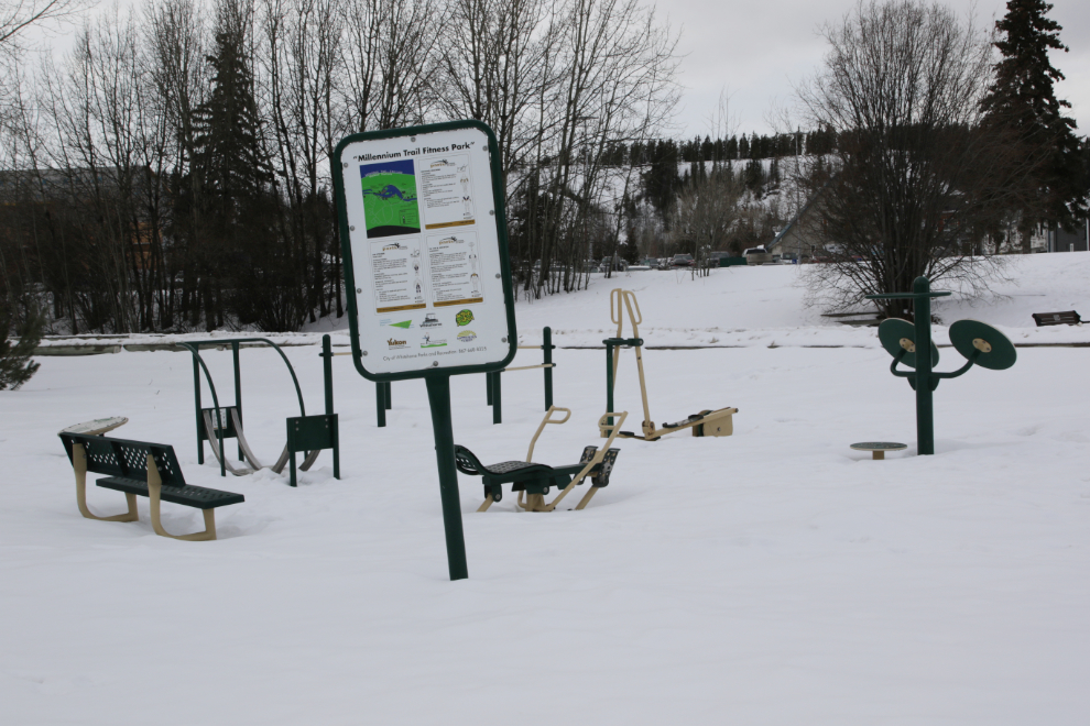
The point of the huge network of trails in Whitehorse – now totalling over 200 km – is to encourage people of all ages to get and stay fit. Beside the children’s playground is this fitness park, with instructions on how to use each piece of equipment.
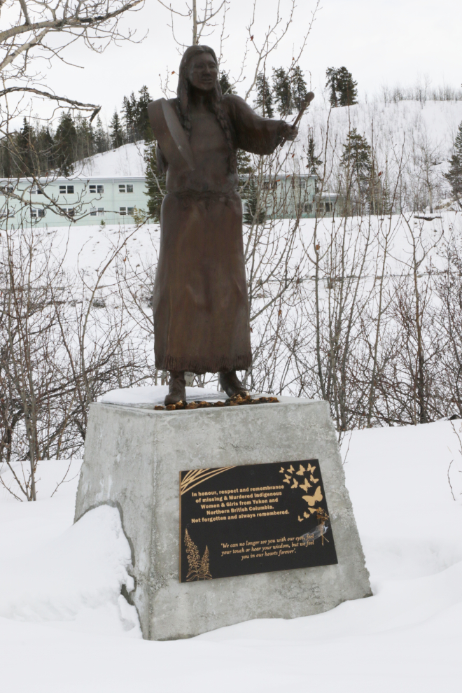
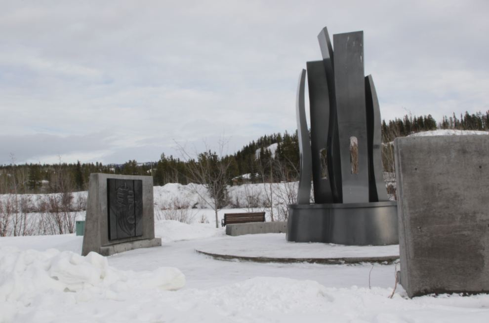
The first of several large pieces of art along the trail is this memorial sculpture, “Finding Peace,” by Dawson artist Halin de Repentigny. It was unveiled in September 2021, “in honour, respect and remembrance of Missing and Murdered Indigenous Women and Girls from Yukon and Northern British Columbia.”
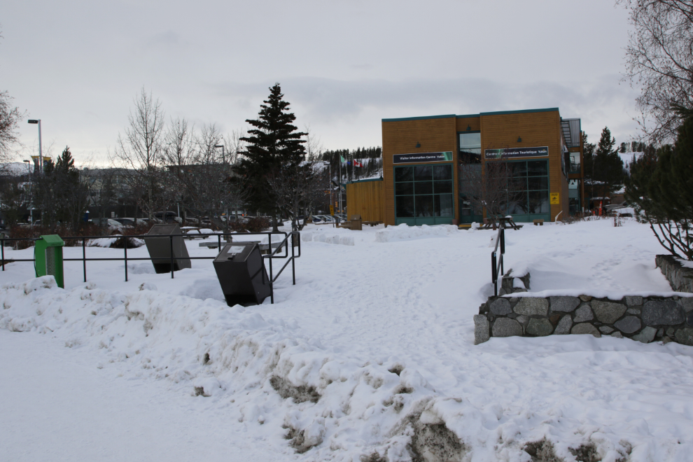
For the next 200 meters or so, the trail runs between two government buildings and the river. They are the Yukon Legislative Building and Yukon Visitor Information Centre, both with large welcoming lawns in the summer.
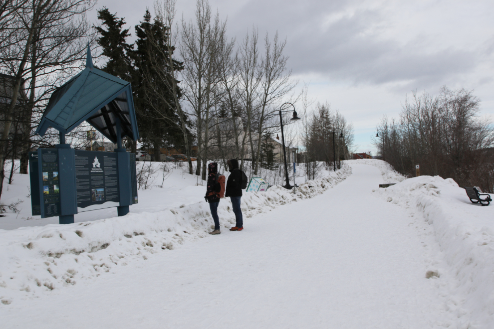
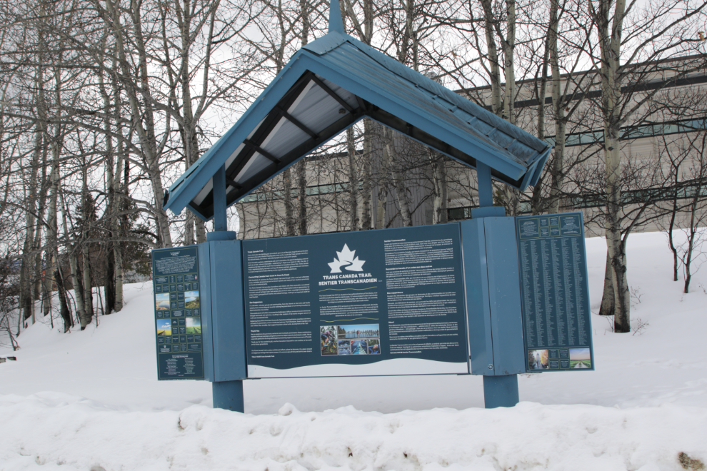
The Waterfront Trail is part of the Trans Canada Trail. The people were reading the interpretive panels which begin with “From where you are standing, you can embark upon one of the most magnificent and diverse journeys in the world. Whether heading east, west, north or south, the Trans Canada Trail offers the natural beauty, rich history and enduring spirit of our land and its people.” and ends with “The Trans Canada Trail is a place to think and reflect, a place for discovery. It’s a place steeped in Indigenous heritage that inspires respect. It’s common ground that gives birth to new dreams.” I think the Waterfront Trail fits beautifully into those statements.
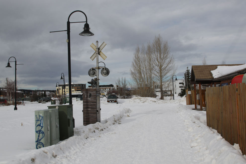
A look back at a railway crossing. For many years a little trolley ran the entire length of the Waterfront Trail during the summer. It was closed a few years ago but sometimes still runs on the southern third of the line.

The public space behind the Visitor Centre is lovely in the summer, with both paved and lawn areas, sculptures, and benches. To the left is a Green Spoke bike repair station. There are many garbage bins and doggy bag dispensers along the trail.
Here’s what that space looks like in mid August.
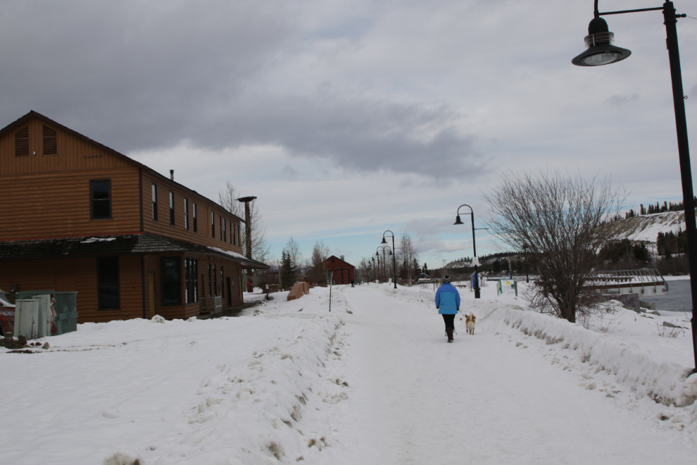
Next, the trail runs behind two of Whitehorse’s designated heritage buildings, Train Crew House #1 and #2. These were used by crews of the White Pass & Yukon Route during the 80 years it ran from Skagway to Whitehorse – now it stops at Carcross, and most of the rail line is no longer even walkable.
I shot the next photo from behind another designated heritage building, the Old Firehall. On the left is the White Pass & Yukon Route station, also designated.
A Little Free Library is a wonderful addition to the trail.
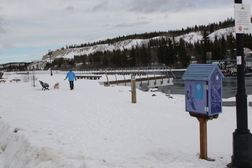
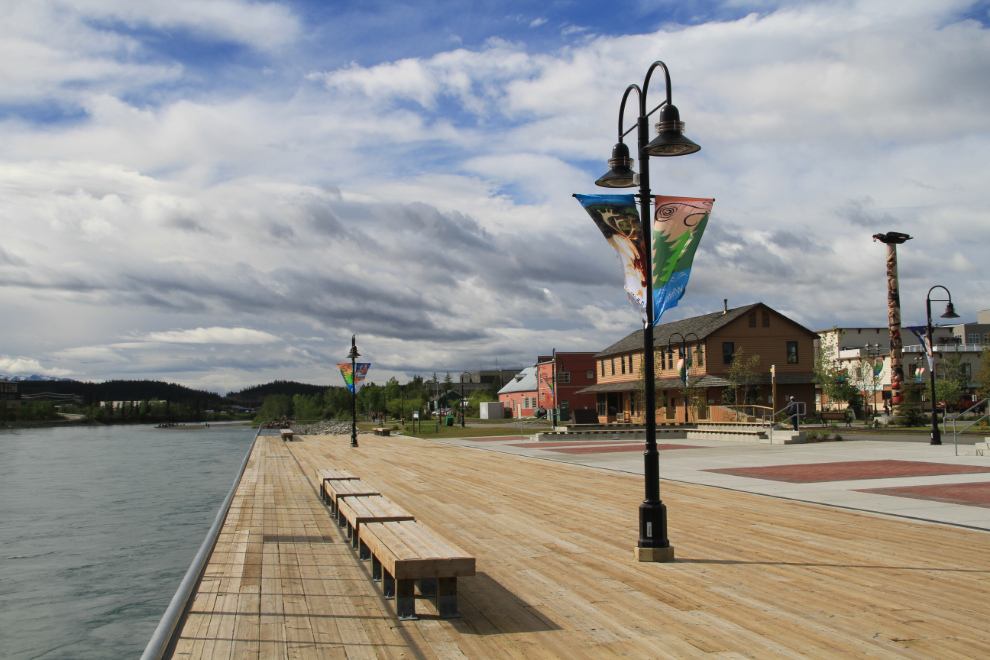
The Wharf, built in 2011, and the small adjacent park, have become one of the most popular public spaces in Whitehorse. Being close to the action, half a block from Main Street and another half a block from the MacBride Museum, no doubt helps with that.
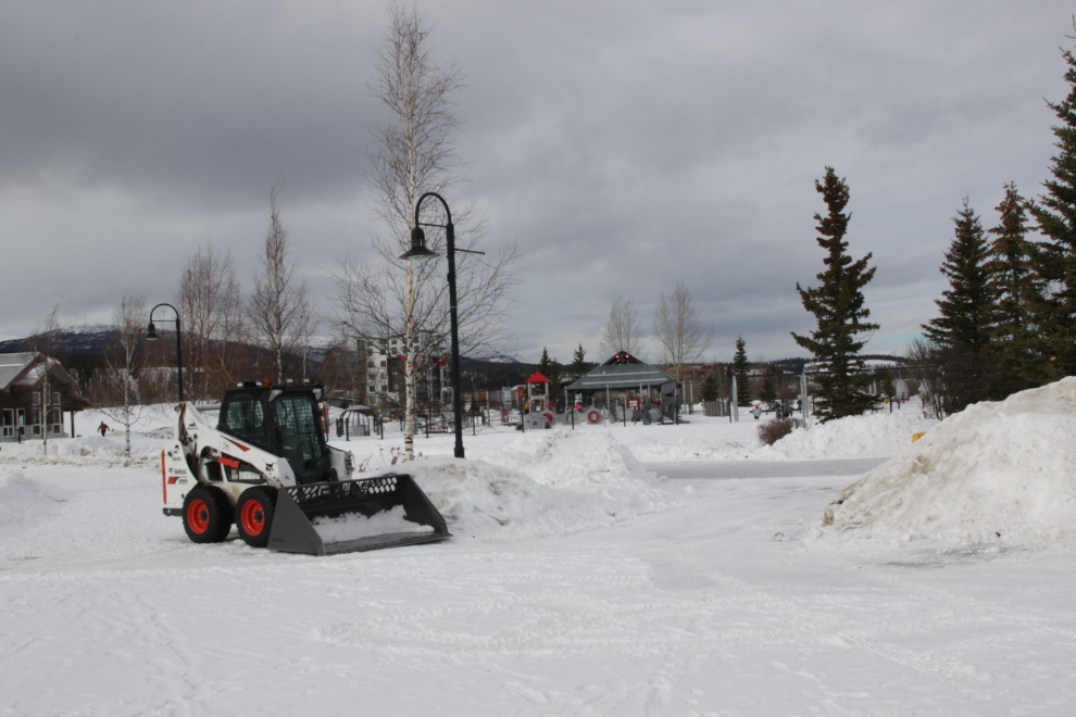
Getting that last photo shot from the The Wharf, though, did result in my only complaint from this walk. Breaks need to be plowed through the snow berms along the trail – it would only take a couple of minutes as the Bobcat is clearing the trail.
Here’s what The Wharf and the park look like in mid July.
Next we come to the historic White Pass & Yukon Route “roundhouse” (which is rectangular) – it houses the trolley and a steam locomotive.
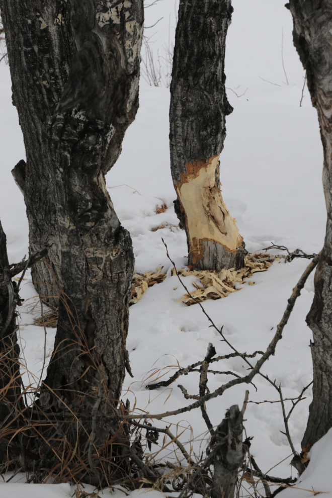
In many places there are still plenty of trees and willows between the trail and the river.

There are enough trees to even keep beavers happy 🙂 – yes, Whitehorse is “The Wilderness City.” Where beaver activity could cause a hazard, wire mesh is put around the trees to prevent their logging.
The only privately-owned building right on the river now is Kanoe People, who have been there since the late 1980s.
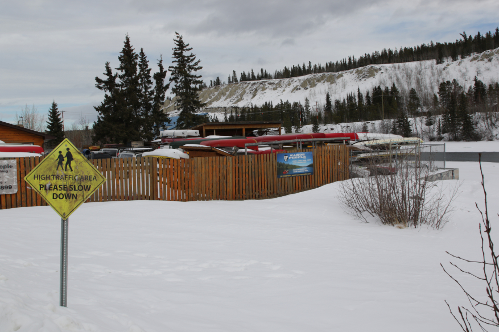
Right in front of Kanoe People is one of the few remaining railway-crossing signal lights.
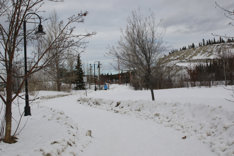
Wandering among the trees adds some character to the trail.
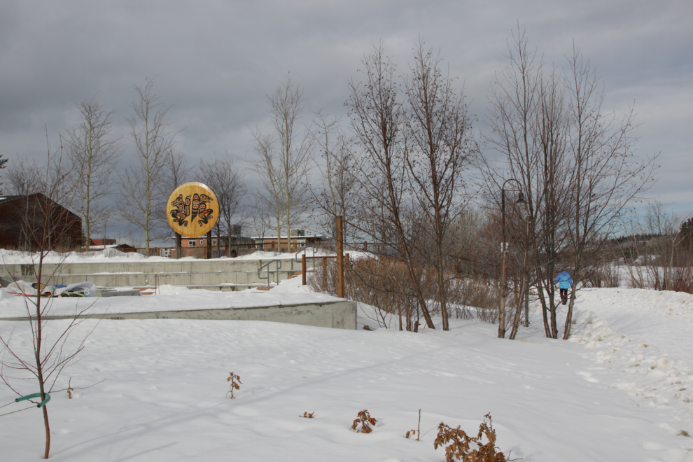
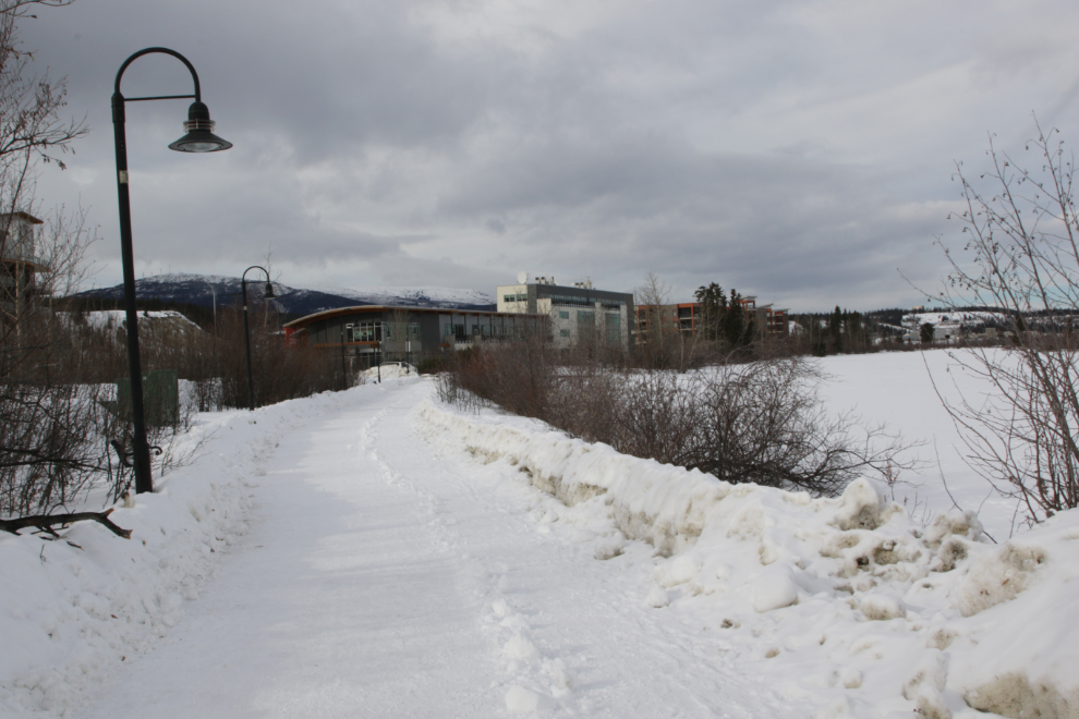
Behind the large Kwanlin Dun Cultural Centre (also home to the Whitehorse Library) is a space where many events are held.
In some places it takes a panoramic photo to properly show the space.
I reached the first of the riverfront condos 28 minutes after leaving the car. The kids are playing on undeveloped property that will certainly be built on some day – this privately-owned open riverfront property is now the closest one to Main Street.
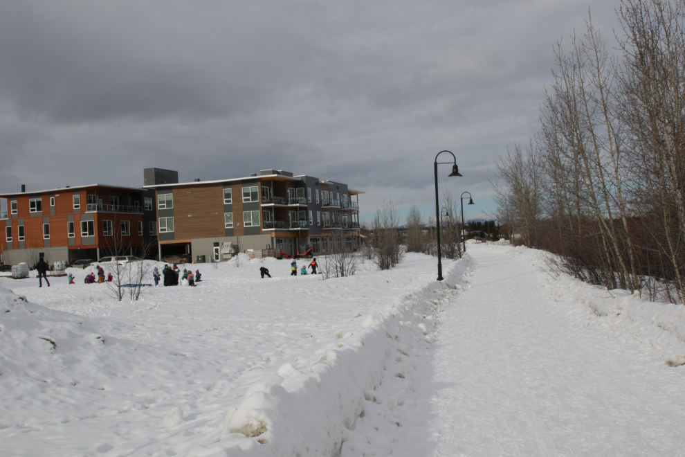
The view from those condos shown above. Lots of room for everyone.
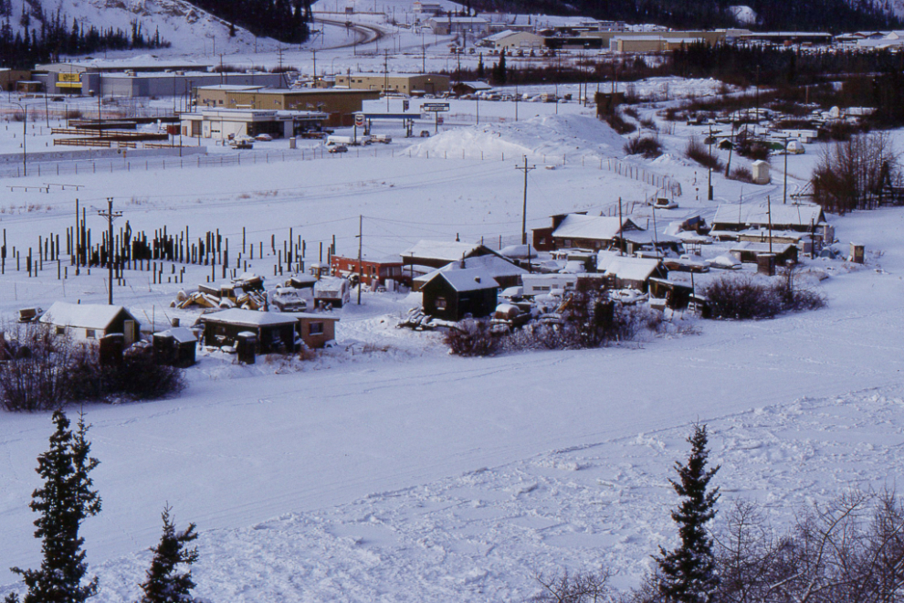
The next 400 meters of the Waterfront Trail goes along Shipyards Park, originally the shipyards of the British Yukon Navigation Company and other smaller riverboat operators, then for decades the site of a couple of squatters villages. The next photo shows the remains of those communities as I saw them on January 1, 1993. The pilings were for the Taga Ku facility, a 153-room Holiday Inn hotel, 700-seat conference centre, and twin office towers that never got built.
This is the main entrance to the Waterfront Trail from Shipyards Park.
A paved path around a bit of the park is flooded as a skating path during the winter.
The next photo shows the Yukon Workers Memorial, created by sculptor Béla Simó to honor Yukon workers who have been killed and injured on the job. It was installed in 2016.
There are 3 historic buildings in Shipyards Park. In 2001 the City’s Heritage Advisory Board recommended that a core of squatters’ homes be kept, but that was rejected by Council. That was among the reasons most members of the Board resigned in 2002, and the group died. The most significant of the remaining buildings, a designated heritage building, is the Pioneer Hotel #2, more commonly known as the home of photographer John Hatch, who died in 2000.
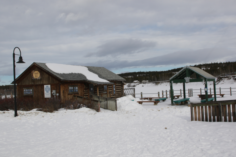
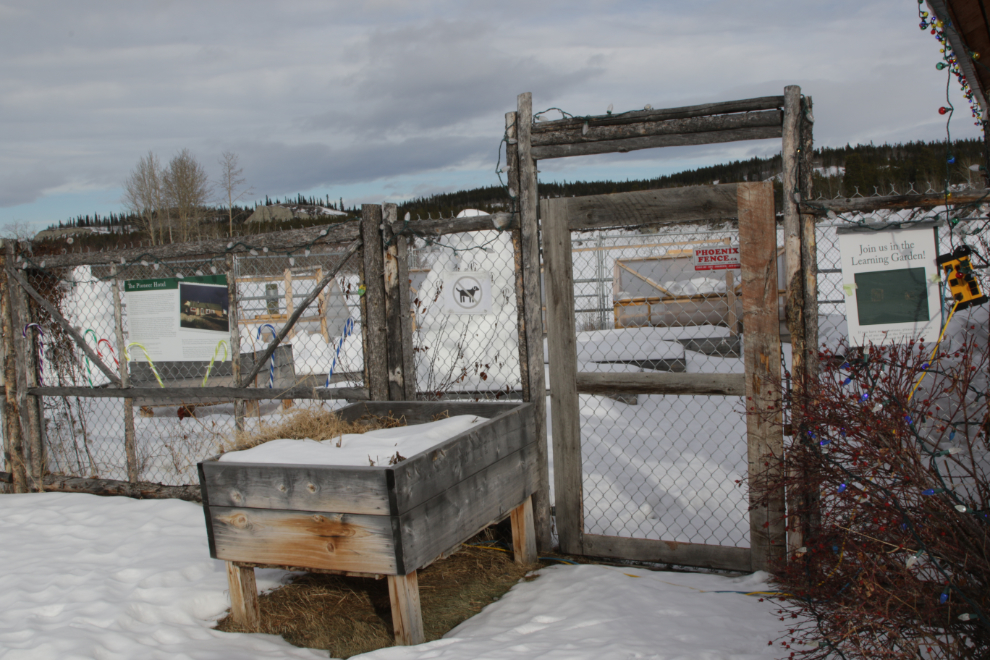
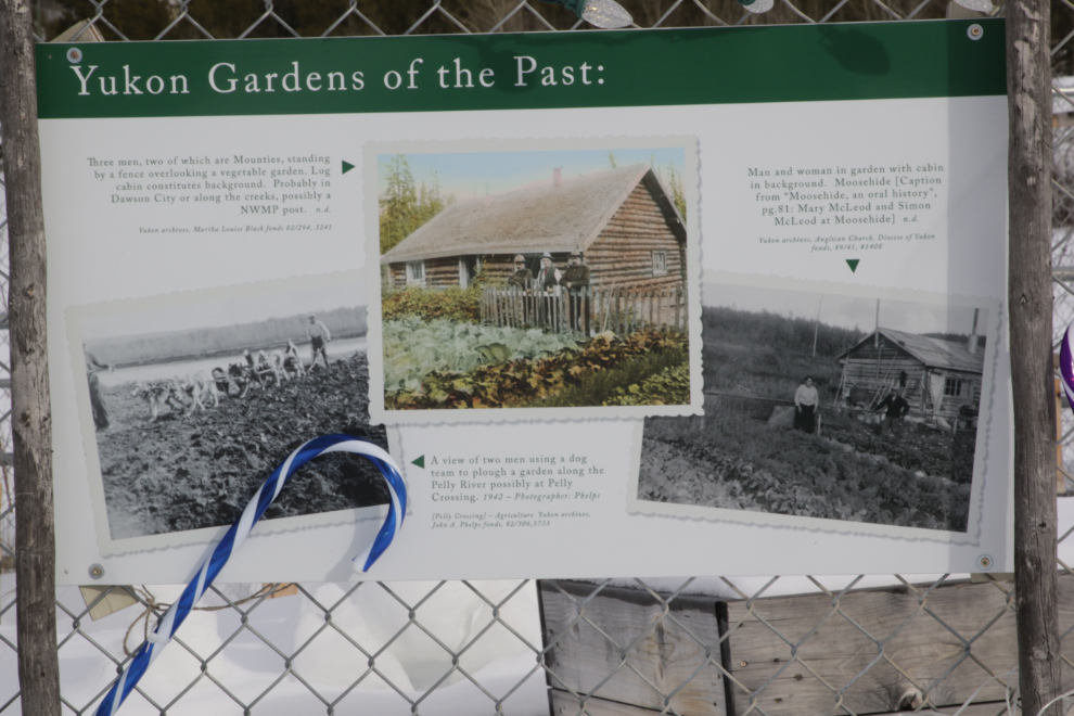
Beside the Pioneer Hotel, which is now the home of the Yukon Literacy Coalition, is The Learning Garden, a colourful and interesting place as the growing season progresses.
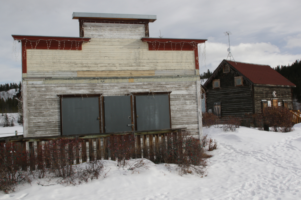
Jenni House, named after former owner Ed Jenni, was built in 1899 on the opposite side of the Yukon River, but was moved as Whitehorse started to develop on this side. To the right is the Chambers House, named after Harold “Shorty” Chambers. Not originally located at Shipyards, it was moved here in 2005 and is now the home of CJUC Radio.
Even many of the garbage bins brighten the trail up – colour is always welcome this time of year.
Some of the interpretive signs are about at the end of their useful lives. This one explains that in the days before refrigeration, P. Burns & Co. had their stockyard and slaughtering area here. It was the town garbage dump for a while, then became a community of shacks and small homes for seasonal railway and boat crews, then finally a squatters’ village.
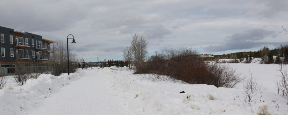
Forty minutes from the car I was approaching the main area of large buildings. The first is commercial and offices, the rest are condos. Since the 1940s this was a light industrial area, primarily used as a railway-trucking transshipment area, so no homes were demolished or had their views blocked. Hundreds of people are now living what they consider to be very good lives here. I know a few and visit often – the next visit will be this evening.
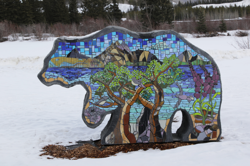
The newest and most colourful piece of art in the park along the Waterfront Trail, right at the north end of the park, is “The Bears,” by Jeanine Baker and Donald Watt – it was installed in 2023. The condo, called The Loft, is the newest one in town. It is still being finished, and at least one of the two-story penthouse units is still for sale, for $1,150,000.

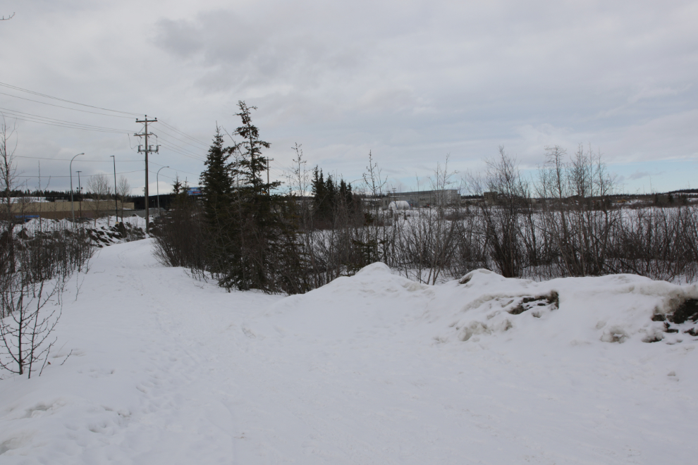
The rest of the trail – another 550 meters or so – goes through a fairly thick mixed boreal forest, very different than what you’ve seen to this point. The next photo is a panorama shot near the north end of the commercial/office building.

From that point all views of the river are heavily screened by trees.
Some casual places have been created off to the side of the trail for people to meet – sometimes to drink, though that’s much less common than it used to be.
I don’t know if this little creature was set up on the berm along the trail on purpose, but it made me smile anyway 🙂

You may have noticed that there are few people in my photos – this cyclist was perhaps the tenth person I had seen in almost an hour.

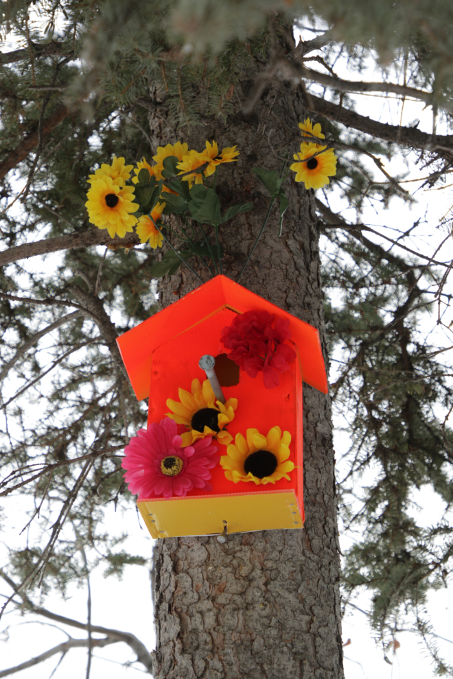
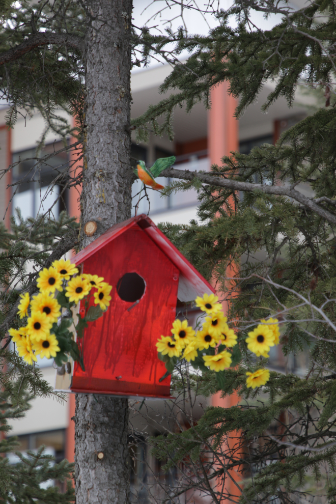
In recent weeks, about 20 very colourful birdhouses and artificial flowers have been installed, apparently built by a seniors’ group. They’re a wonderful addition, and I hope will get well used.
This little viewing deck along a quiet side channel of the river provides a good place to watch waterfowl and gulls in the spring.
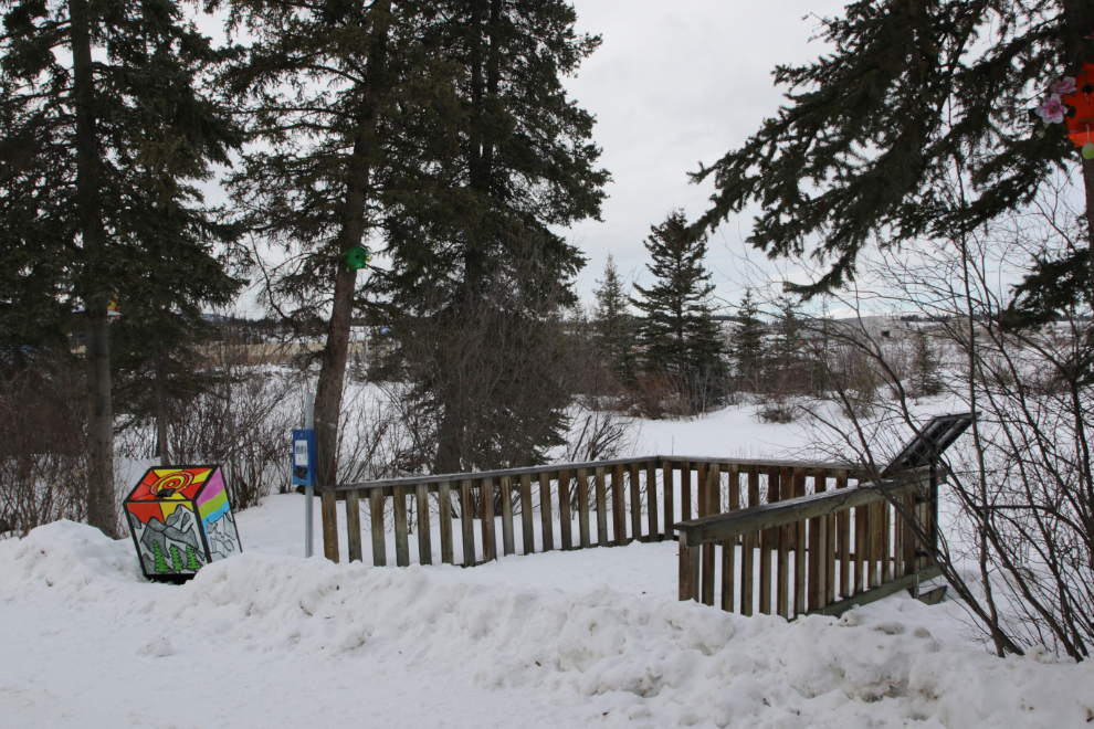
I reached the north end of the Waterfront Trail 53 minutes after leaving my car. The towering structure on the left is a bat house. The Little Brown Myotis (Bat) (Myotis lucifugus) is commonly seen in the Yukon, and homes like this have been built at most government campgrounds.
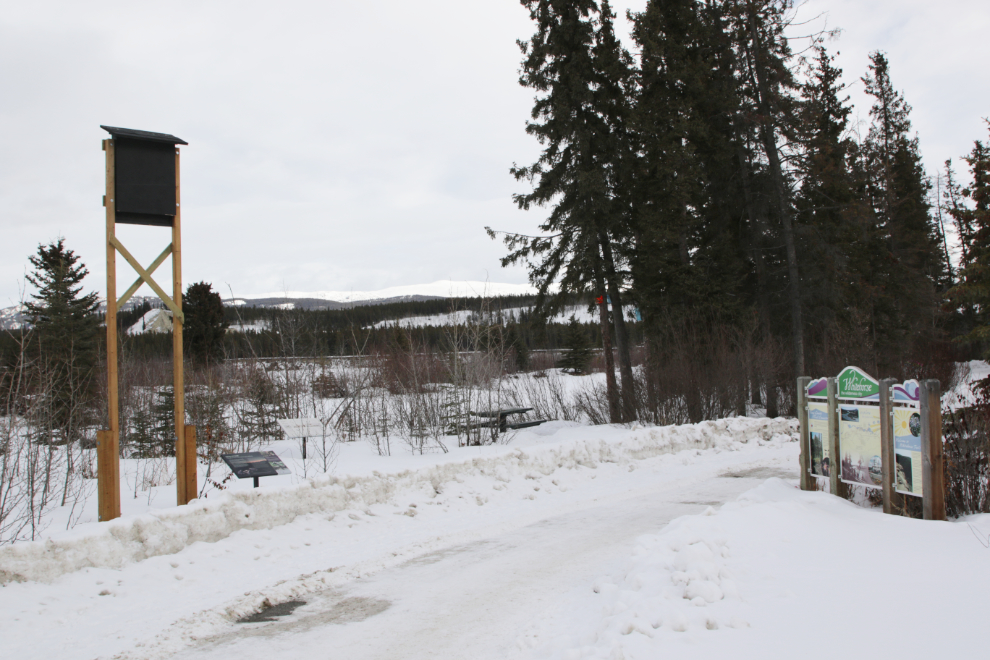
From there a trail crosses over Spook Creek and continues along the river for another kilometer or so. While it gets a fair bit of use by birdwatchers in the spring, it’s little used in the winter, so from here I retraced my steps back to the SS Klondike.
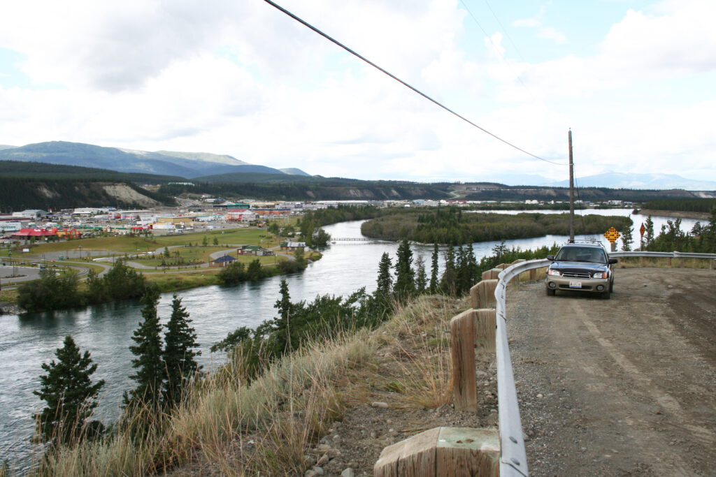
Over the past 35 years I’ve shot hundreds of photos from this location overlooking what is now Shipyards Park. It and the airport trails have provided me with superb locations to record the growth of Whitehorse. This photo was shot in August 2006.
While yesterday’s walk was done on one of the worst possible days to show you how nice the trail can be, I hope that it shows enough to encourage you to get out for a look, and perhaps clears up some misconceptions about the city’s growth.
I wonder what happened to that footbridge at the northern end of Shipyards Park (in the photo from 2006)? Wish it was still there! I can also see it in your aerial photo of the city. from 1985
The bridge to Kishwoot Island was demolished in 2010 after having been condemned for several years. The removal was also part of a land claims agreement.
I love reading the history of places and sights I hope to see. But I see them through your eyes. Thank you Murray!
It’s always nice to have you along, Patsy. I hope you’re doing well with all that’s happening there.
The mighty Yukon River trail is amazing, alittle of everything for everyone, I left in 1998 and the city has seen progress big time, remember there was two men of sourdough types public drinking watching the city erect the first traffic light, the one said to the other, there goes the territory!!! but perhaps they would have changed their minds after walking the riverfront trail, thanks Murrster 🍺👍
Wow, it’s hard to believe you’ve been gone for 27 years now. Yes, it’s a very different place now in many ways. The loss of character that happens with gentrification is sad, but making the city more friendly to most people – families especially – isn’t.
Thanks so much for this Murray. My last winter in Whitehorse was around 1982 and I decided to go out for a walk. From Alexander, over to 2nd Ave, down to Riverside Grocery, then up to 4th Ave and back home. I thought “wow, what a boring walk, I’ve done the same thing for over 20 years of my life!” I loved living in cities like Victoria, Vancouver, Toronto where you could walk down a block of houses that you’d never seen before. And now with the Millenium Trail and the walk you document here, residents have so many options even in the winter. Everything has opened up to the river and people are out enjoying the sights. The trail system has been so amazing in its development.