Tombstone Rocks! – Geology Weekend in Tombstone Park
From Thursday, August 3rd, until Saturday the 5th, we camped at Tombstone Mountain Campground, and attended a few of the events during “Tombstone Rocks”, a Tombstone Park Geology Weekend. There was some awesome hiking and I’ll be back for more next year, but next time, I’ll try to keep notes!
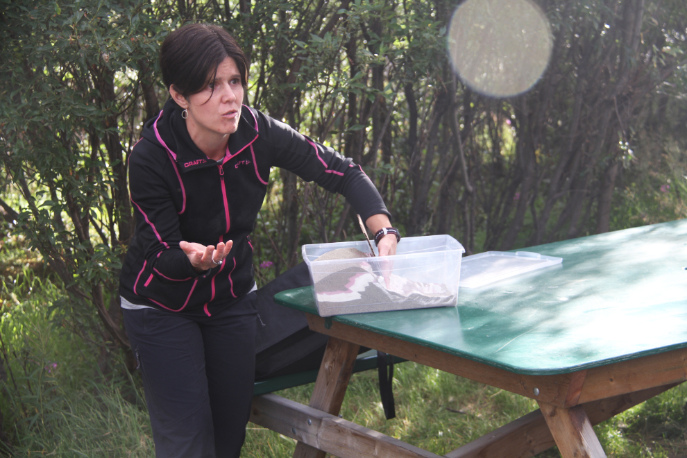
The first event that we attended was on Friday night, and it began with Leyla Weston, Outreach Geologist at the Yukon Geological Survey (YGS), showing us the basics of tectonic plate movement, using a box filled with layers of flour, jello, and I don’t know what else. The folds appeared in those materials pretty much as they have in the rocks around us, which I thought was really cool.
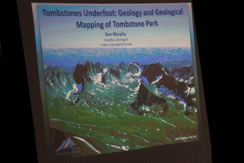
We then moved inside a picnic shelter with black-out curtains, for a Powerpoint presentation by Don Murphy, Geology Emeritus at YGS. It was great to see the room full.
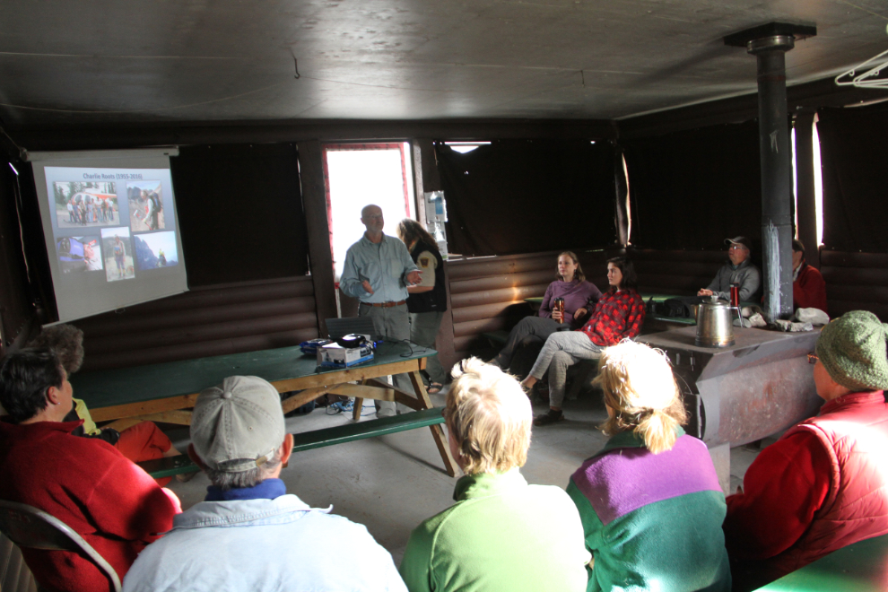
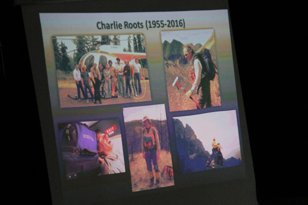
The presentation started off on a sad note for me, and for some others including Don. I hadn’t heard that geologist Charlie Roots had died of ALS last year. He was a great help to me while I was researching and writing my book about mining on Montana Mountain, ensuring that my explanations of the complex geology were correctly simplified from his and other geologists’ work in the area. It was also Charlie who started this Tombstone Geology Weekend program.
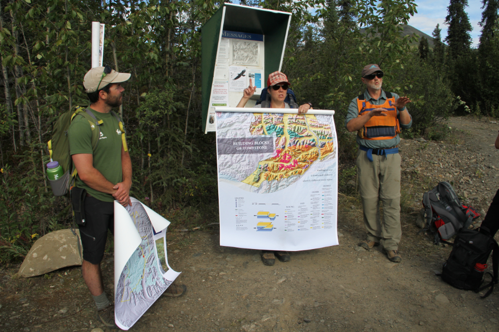
On with the program. Don and Leyla explained the basics of the formation of the mountains in the Tombstone area, and also described the physically demanding process of creating geology maps. A large
geology map of the Tombstone area is online – it’s a 124MB download. I went to bed that night with my head loaded with new information! 🙂
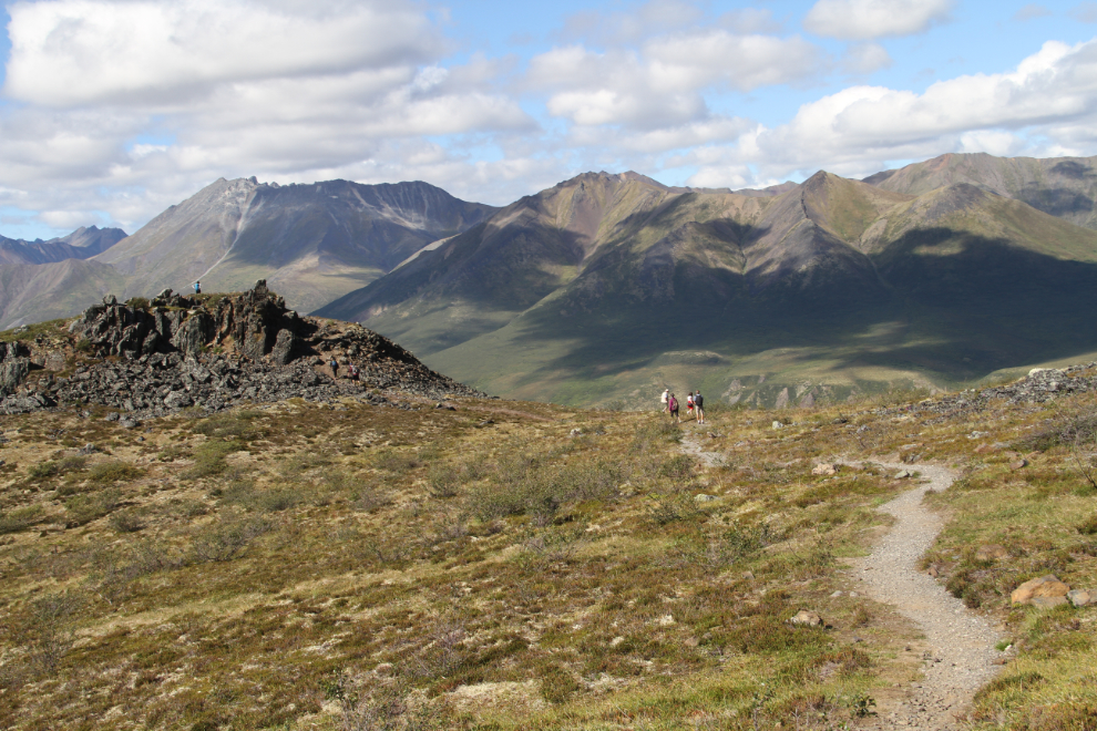
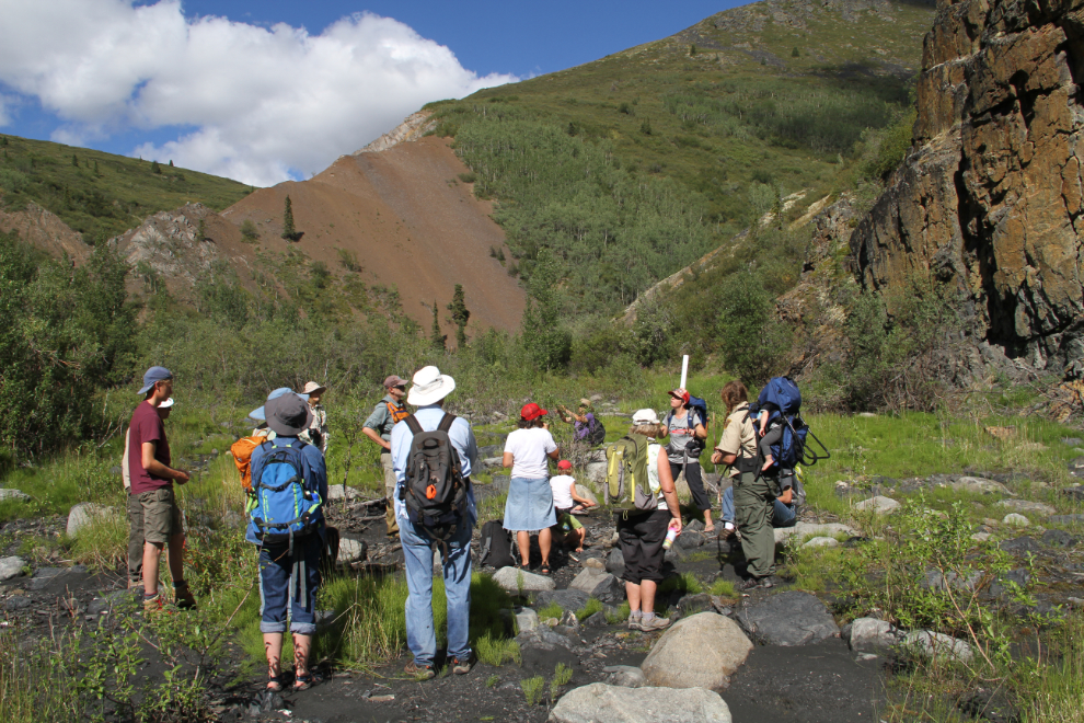
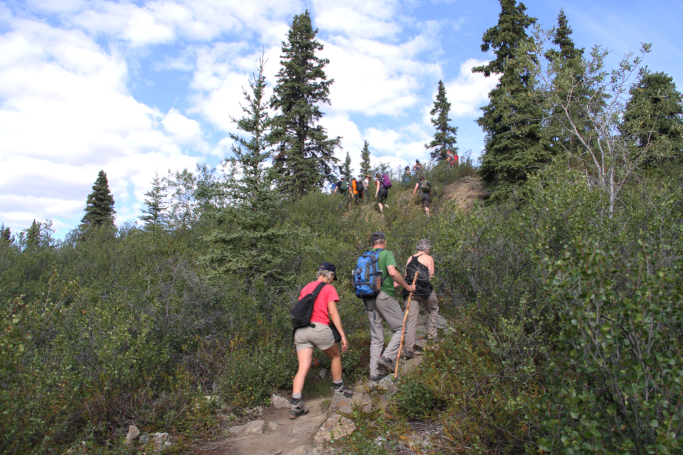
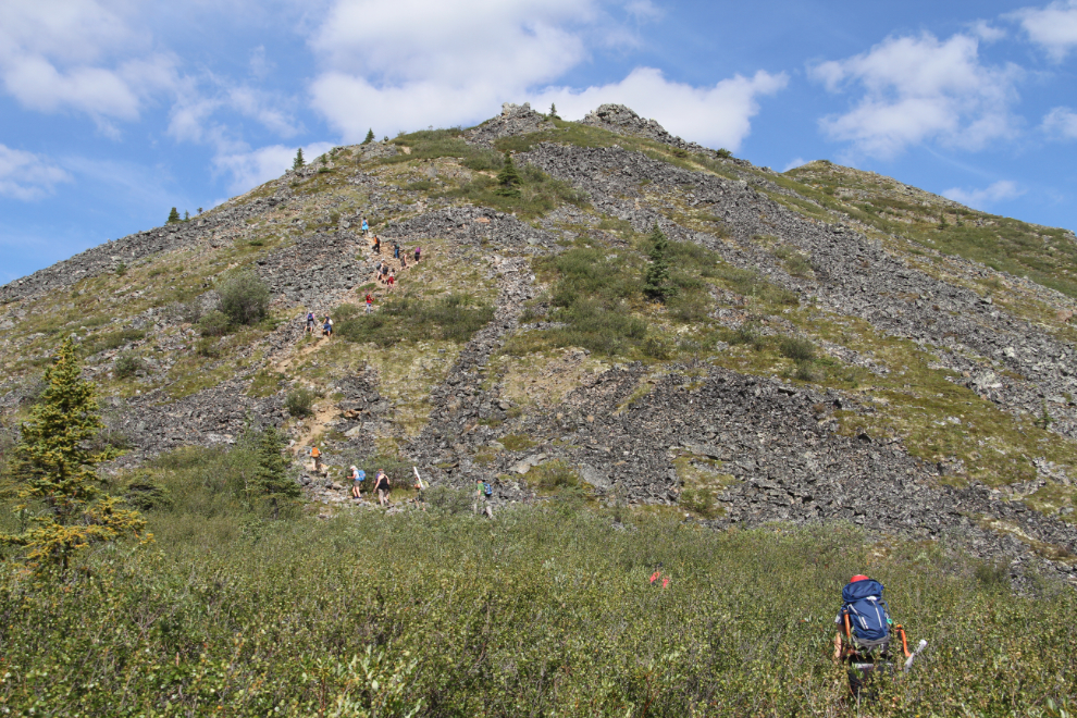
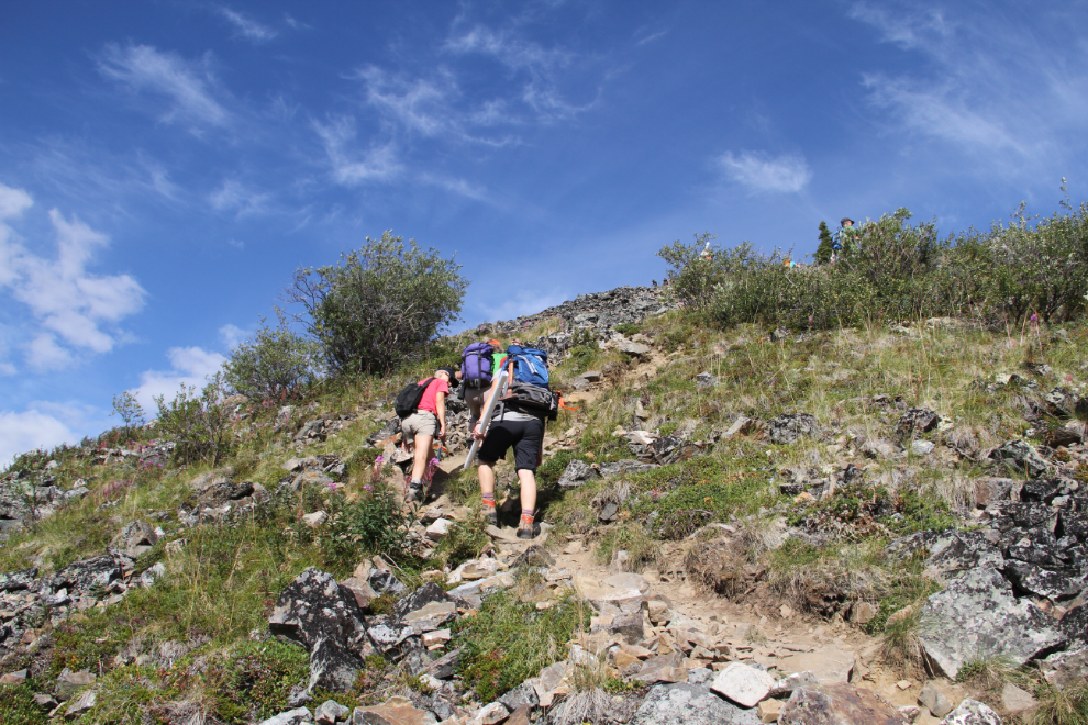
On Saturday morning, about 15 people met at the picnic shelter and we car-pooled up to the Goldensides trailhead again. It was much nicer in the sunshine!!
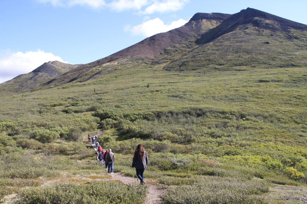
The light was perfect for showing many of the features that Don and Leyla were talking about.
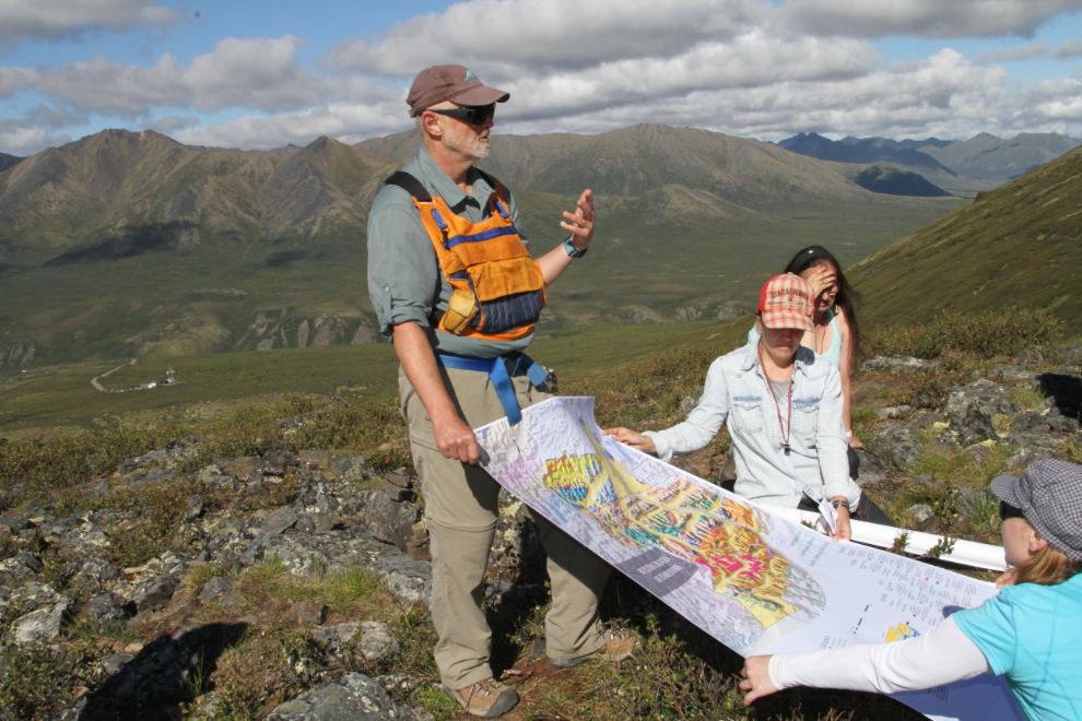
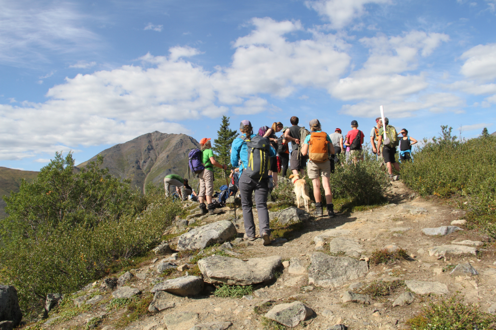
Way up on an outcropping of bedrock chert, the geological map came out and the explanations of what we were seeing got into much more detail. While I remember the basics, I want much more now.
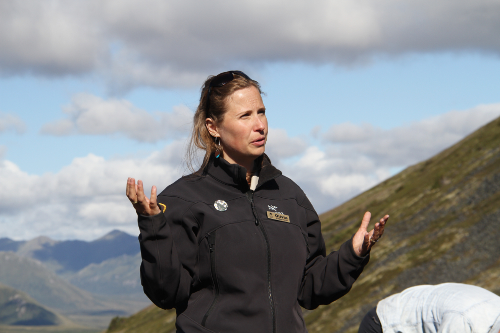
Yukon Parks interpreter Olivia was on hand to explain some of the natural stuff beyond the rocks – including plants, animals, and glaciers. I hope that there’s a glacier section on this weekend next year.
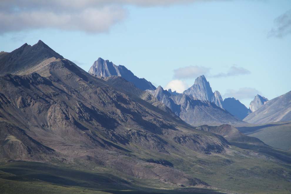
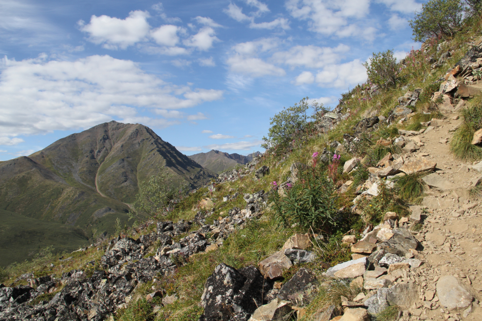
The view to the northeast, with the sun reflecting off chert and slate slopes.
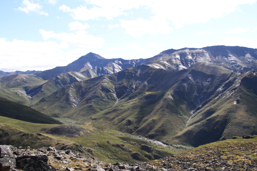
The variety in the terrain is quite incredible. In this photo, you can see both folding of sedimentary layers in the foreground, and igneous intrusions of syenite which date to 92 million years ago.
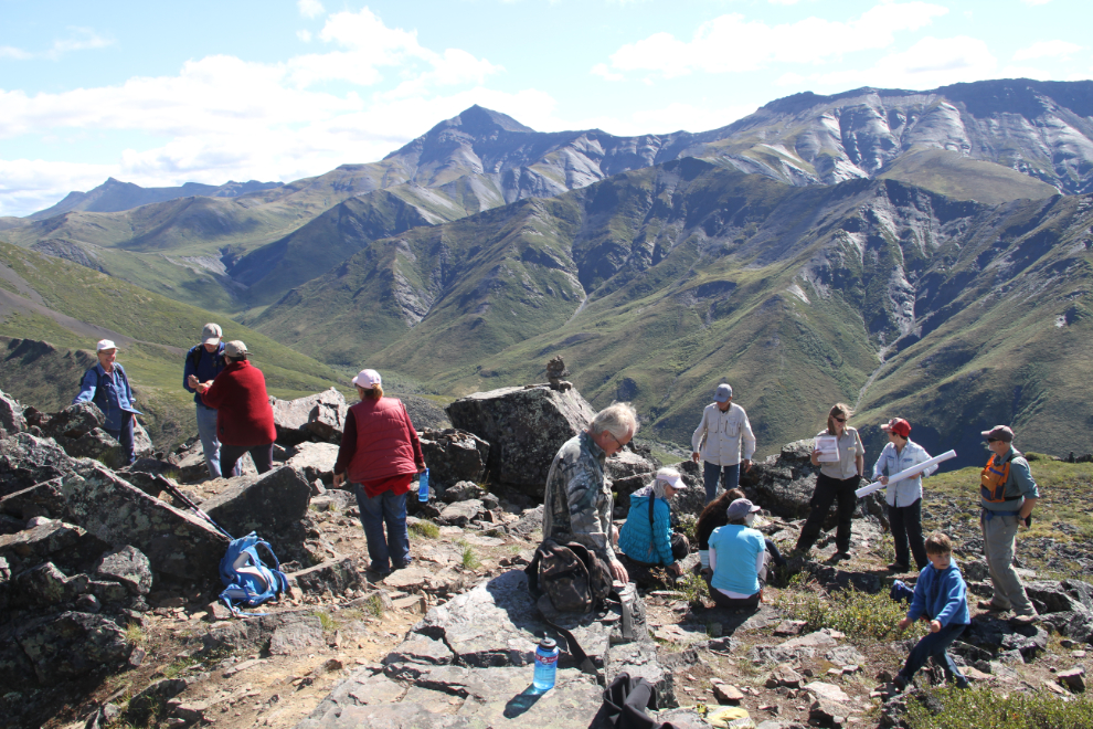
A lunch break at the top, with lots of talking.
I headed back down the trail at 12:45.
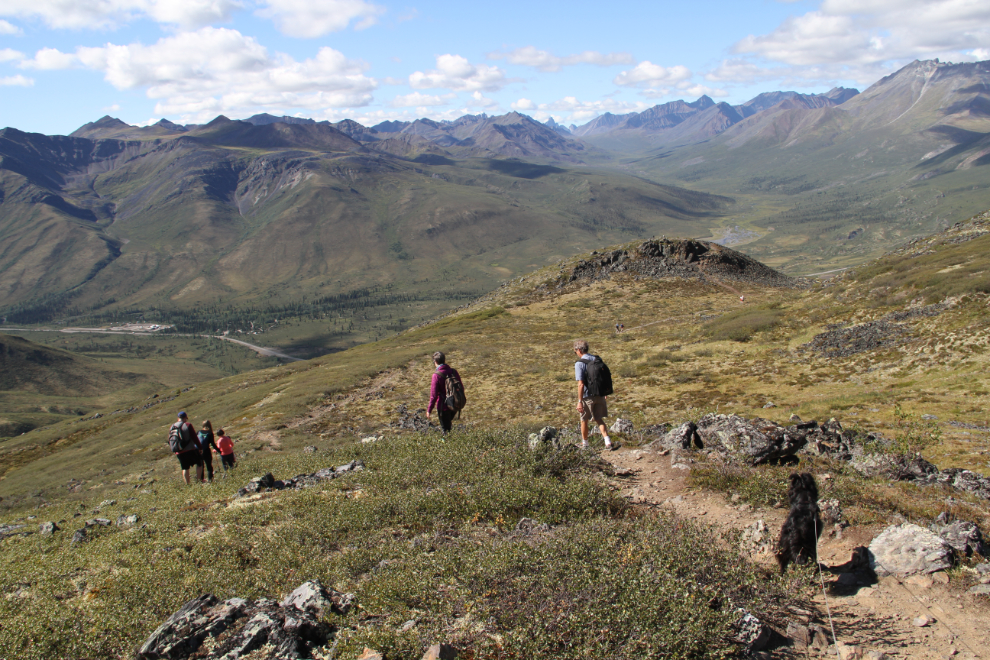
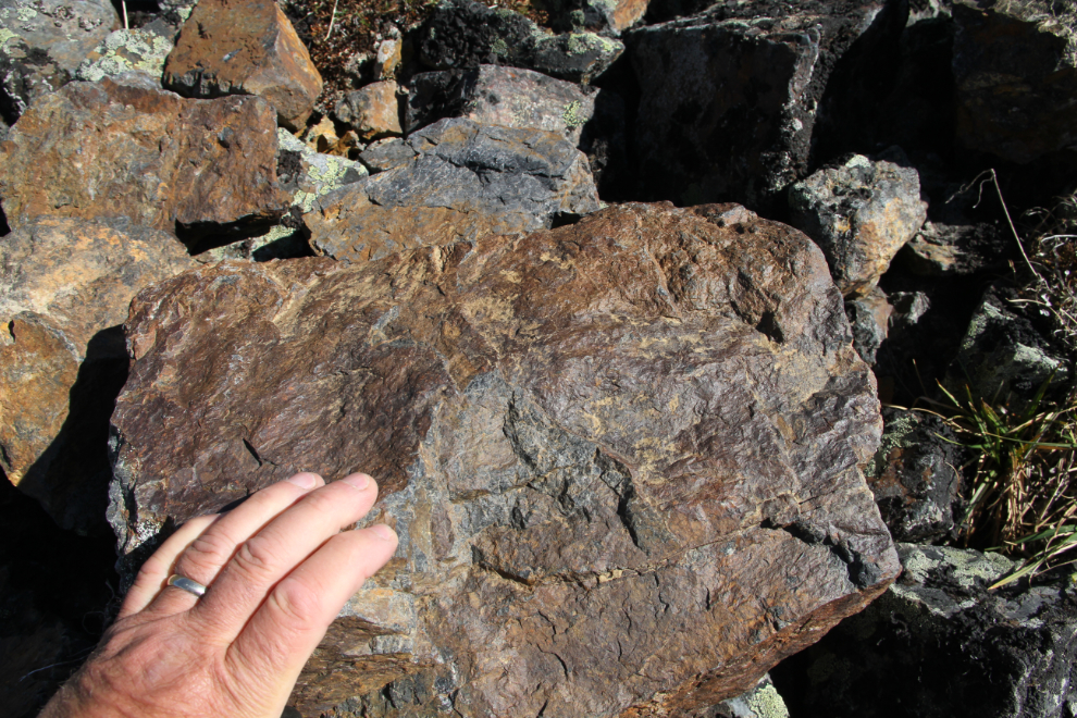
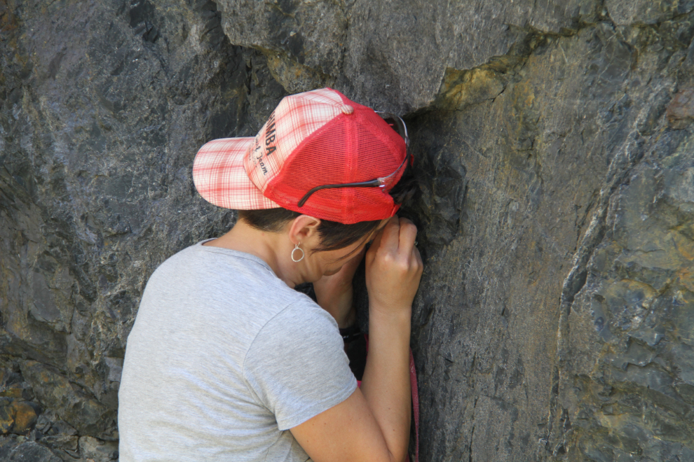
Assessing a block of chert alongside the trail. As I walked, I was watching for a similar block that had a layer that Don said was caused by an underwater avalanche, but couldn’t find it again.
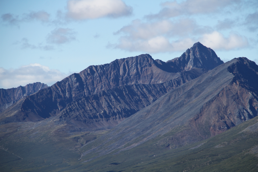
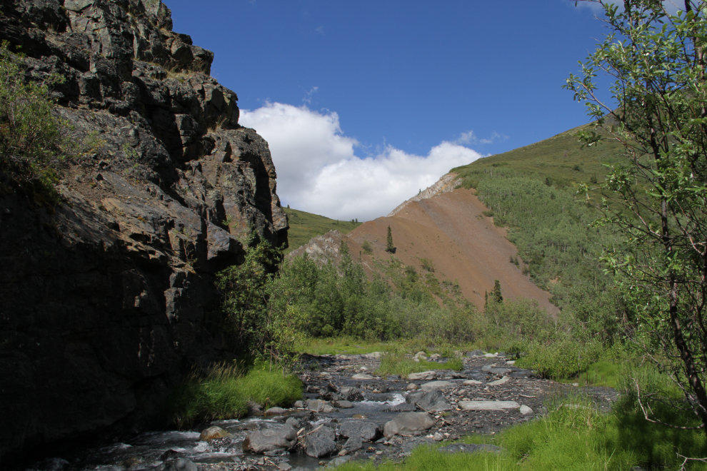
To the left is the outcropping of chert where we had our first major talk.
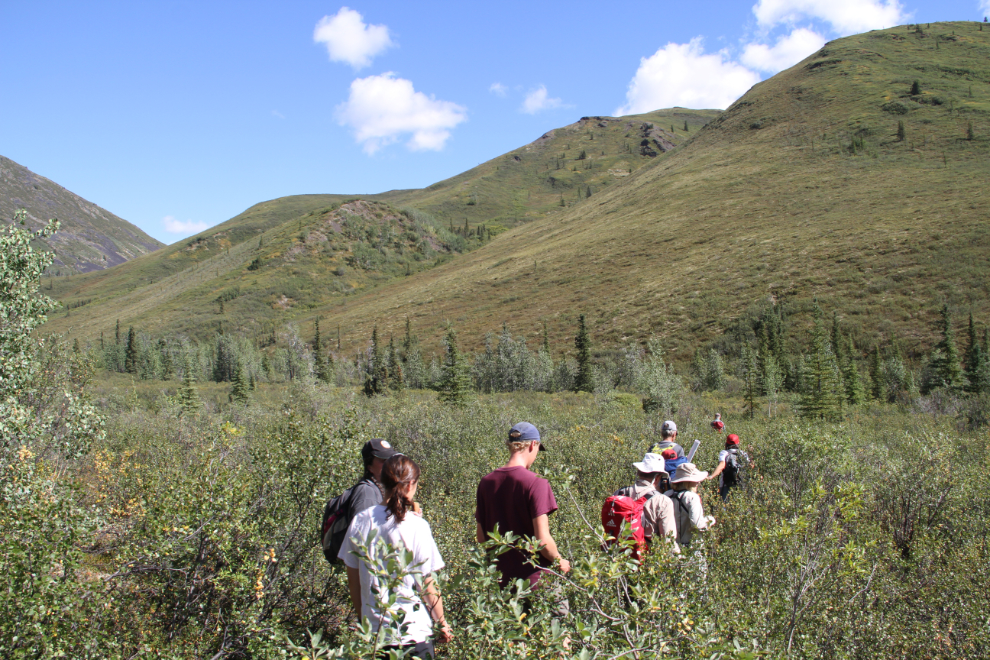
The next hike was supposed to start at 2:00 pm, but we had run late on the Goldensides ones, so it was a bit late. This one was to Charlie’s Canyon, one of Charlie Roots’ favourites because it gives people a glimpse at what a geologist does while mapping, crashing through brush and hoping for a moose trail to ease the route.
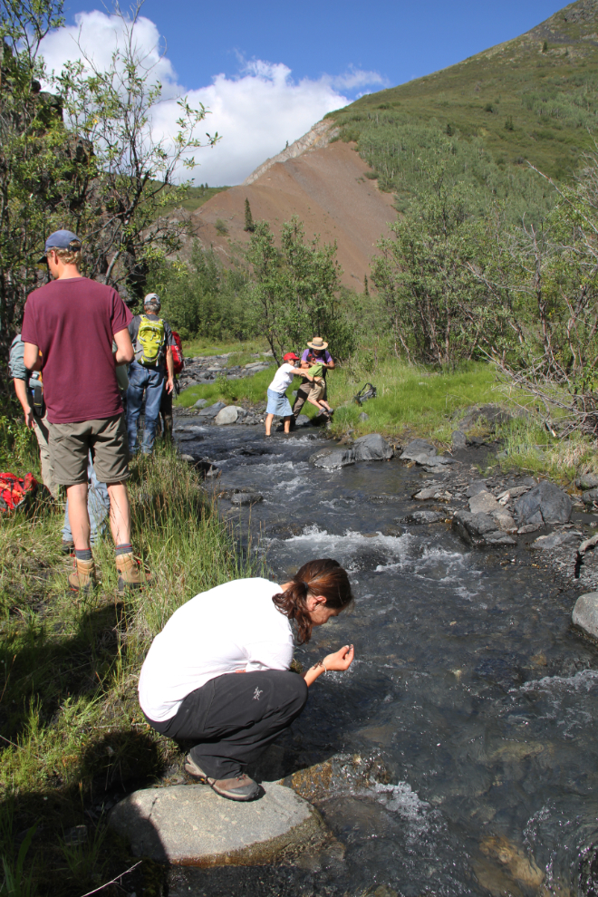
The crossing of Charcoal Creek saw all sorts of answers to the problem, from barefoot crossing while carrying boots, to waterproofed boots, and attempts to jump it. Two of us were wearing sports sandals and just walked across 🙂
Charlie’s Canyon is a surprisingly complex location, in a geologic way. Complex enough that I can’t even attempt to pass any useful information on to you yet.
Most of the hikers had done the Goldensides trail, and everyone’s enthusiasm was still high. Don or Leyla never tired of explaining how a certain rock people found was formed.
Don somehow found the microscopic remains of some of the radiolarians that help create chert, on the 60-foot-high canyon walls. Most of us had a look at them with hand lenses – even Leyla had never seen them “in the wild” like this.
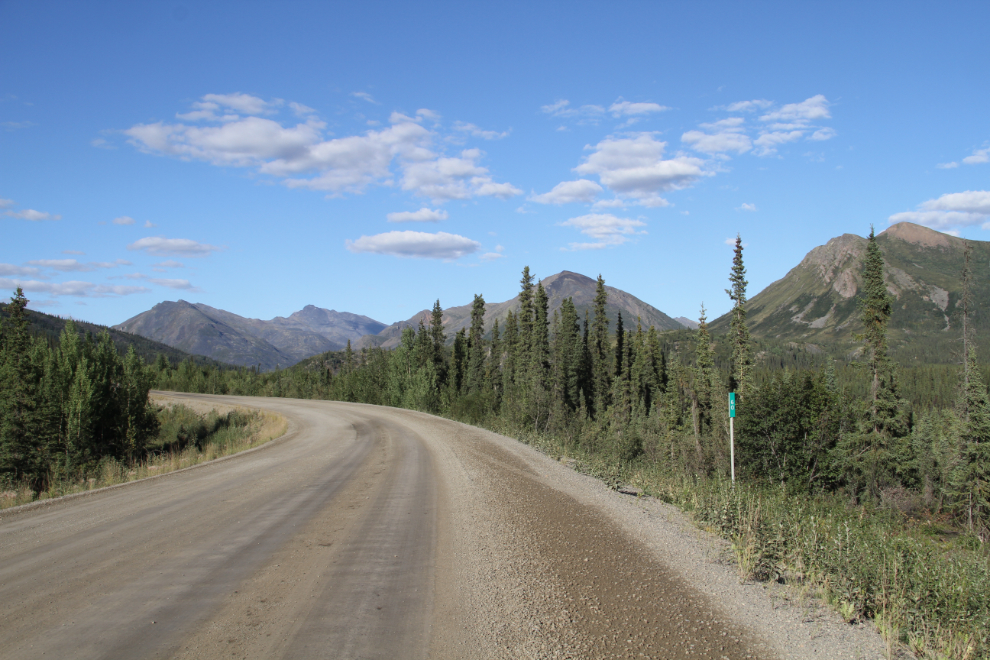
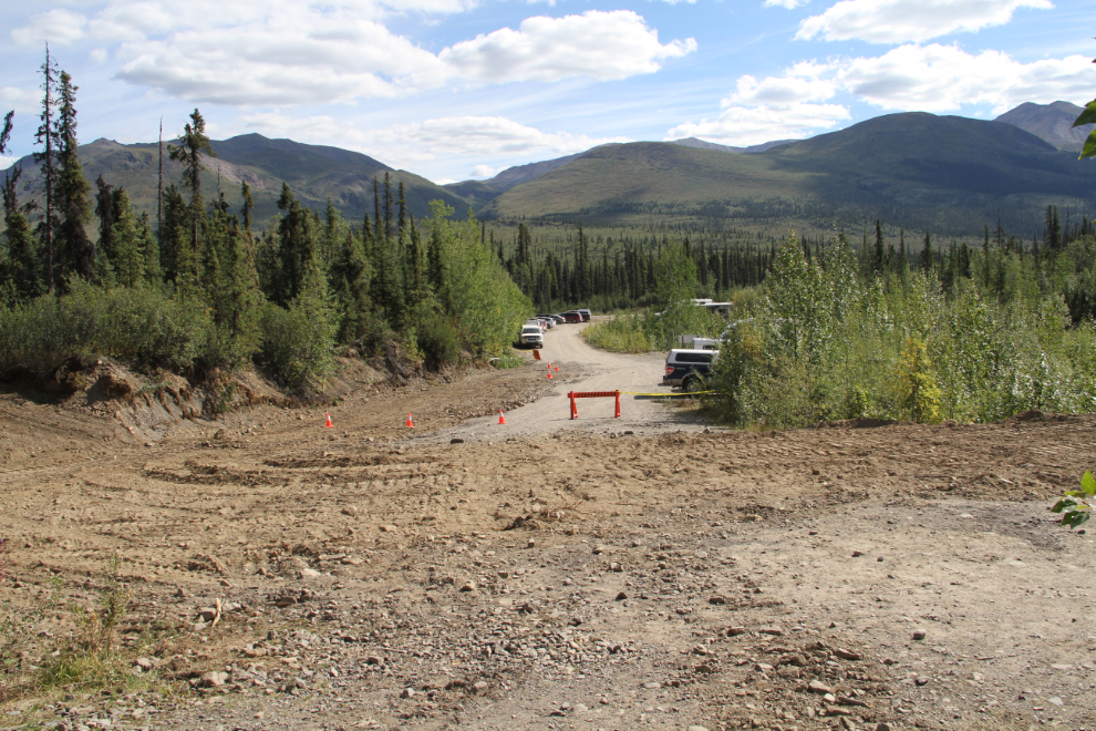
That evening, Cathy and I drove down to the Grizzly Creek trailhead, to be sure that the motorhome would fit for the hike on Sunday morning. Cathy was flying home that afternoon and I didn’t want to take time away from the trail to drive back to the campground to get the motorhome. Due to new parking lot improvements with a large RV area, it would fit. The next photo was shot right at the Km 60 post as I drove back to the campground.
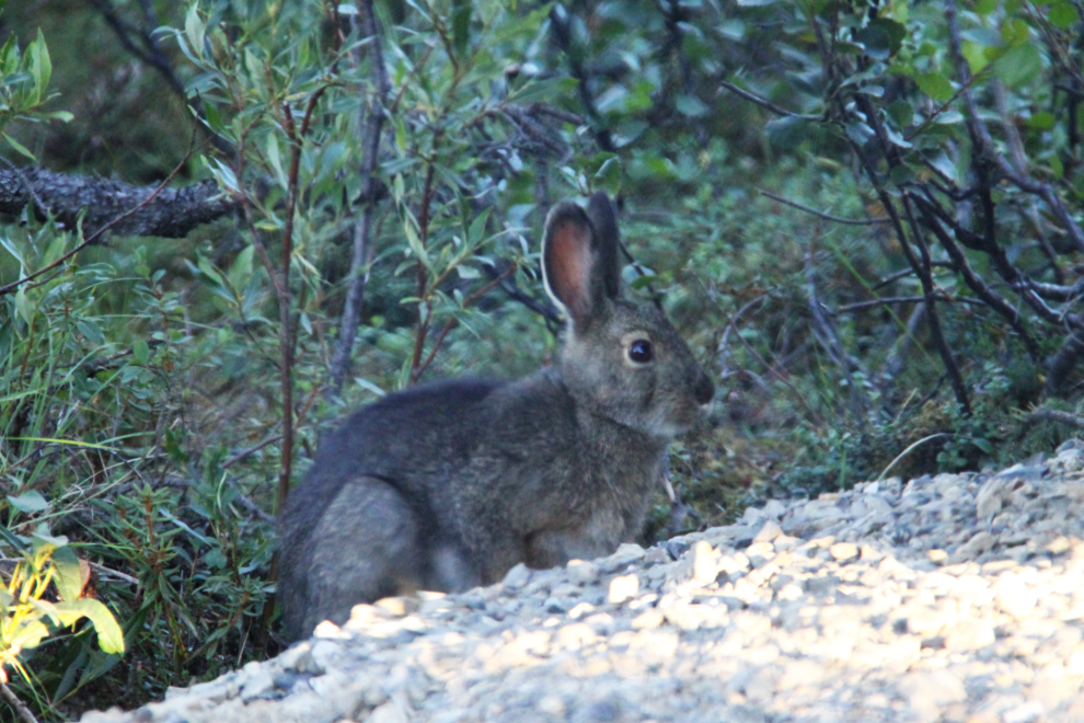
Back at our campsite, a very confident snowshoe hare (Lepus americanus) came to visit us for the second evening. I was amazed at how close he came, even with 2 dogs (I was very pleased with both Bella’s and Tucker’s calm reaction to the hare, too).
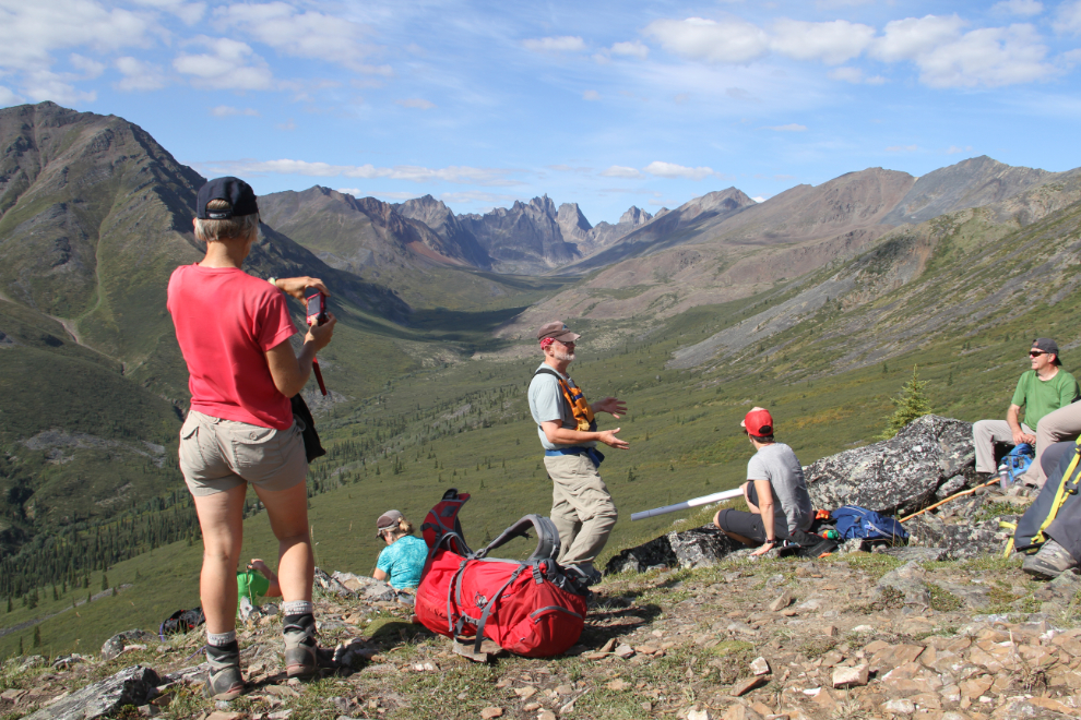
At 10:00 on Sunday morning, another group of about 15 people had gathered at the Grizzly Creek trailhead. All but 3 of the group were new to the Geology Weekend events, so the 40-minute introduction to the area started with the basics.
At Km 1.5 of the trail, we took a break and Don and Leyla explained more about the area’s geology. This spot on Cairnes Creek is the last spot where water bottles can be filled – the trail starts to climb fairly steeply soon after.

While YukonHiking.ca rates the trail as Easy, they’re the only ones who do. Yukon Parks says: “Many people are not prepared for the level of difficulty they encounter on this trail. …From [Km 1.5] it’s a steady and relentless climb through willow and dwarf birch and then finally through rocky terrain to the Mount Monolith Lookout [at Km 3]”. Some of our group turned back at around the time the next photo was shot, at 11:25.
There was a rest stop at “the first lookout”, and Don was noticeably pleased when everybody said that they were going to continue another 20 minutes to the main lookout where he wanted to do his talk.
The start of the final climb.
Yes, it is that steep. And it was very warm, 24C/75F perhaps.
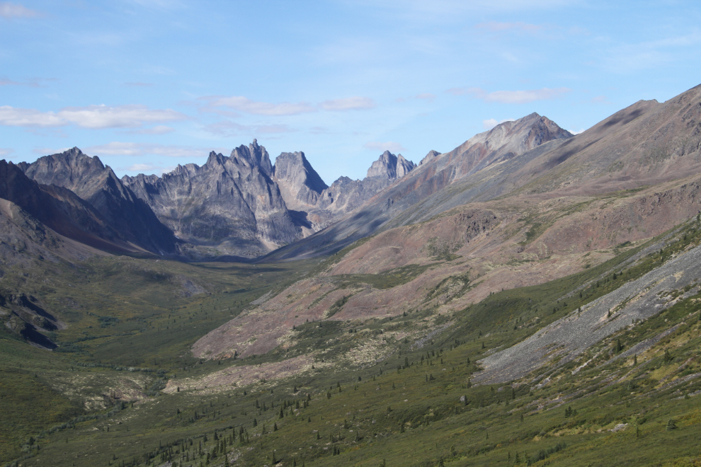
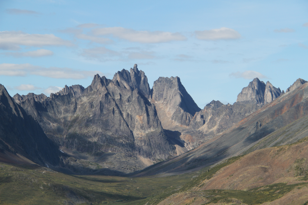
This, however, is the reward. I’m calling this one of the finest views I’ve ever seen anywhere in the world, for a variety of scenic and emotional reasons. Mount Monolith is the one with “the finger” 🙂
I very seldom hike with other people – my passion is for solo wilderness travel. Being in a location like this, on a day like this, with a group of like-minded people, though, made this a very special experience.
Don Murphy was clearly in his element. He may be retired, but he still lives and breathes rocks.
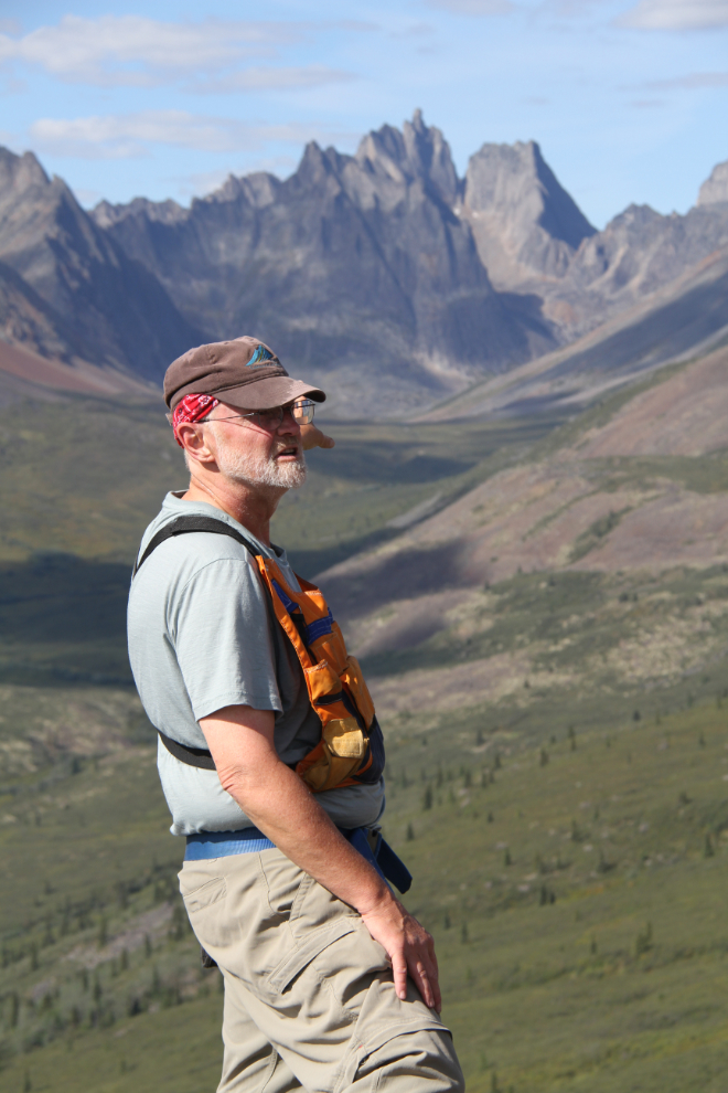
Looking to the north-east from the lookout, to Fold Mountain. From this vantage point, those ridges of Keno Hill quartzite can be followed quite clearly from Fold Mountain, across two valleys and far up towards Mount Monolith.
I had to head down at 12:45 to get Cathy to the airport. When I went to thank Don and Leyla for an awesome weekend, they asked if I’d be interested in working with them on a Geology & History Weekend on Montana Mountain next year. Wow – would I ever!
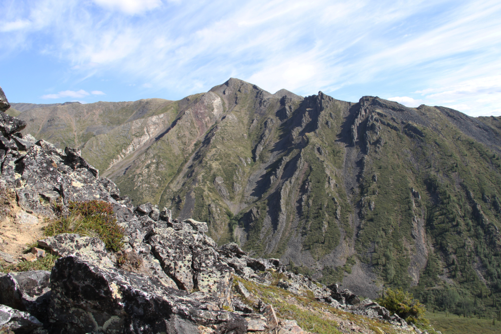
Hiking back to the car alone, I could take many more photos than I did on the way up. The trail requires you to watch your footing quite closely.
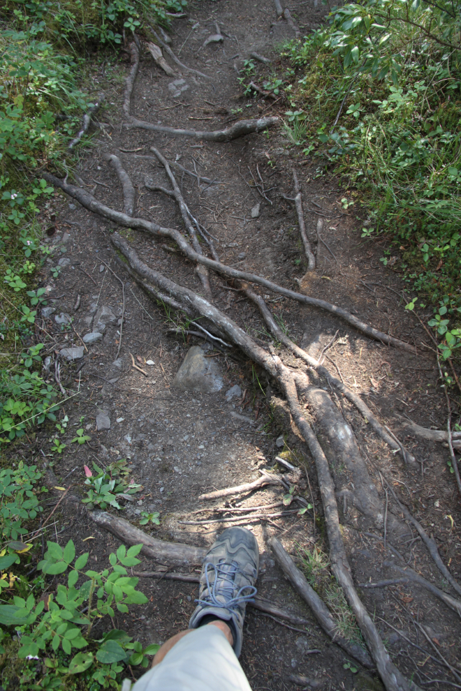
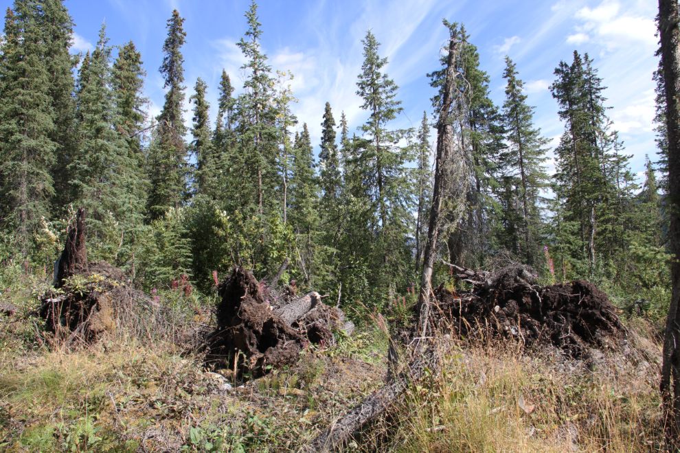
On the way up, I hadn’t noticed that the trail climbs up a glacial esker and runs along the top of it for a few hundred yards/meters. Eskers are one of my favourite glacial landforms – each is unique, and I love the way they wander across the land. There are also 2 blow-down areas, where every tree has been knocked down by micro-burst wind events, over areas of about 1 and 3 acres.
Back at the trailhead, 25 minutes early. It was exactly 3 hours round trip.
From there, the Dawson airport was the next stop, and then, to an RV park in Dawson for the night. This was Day 10 on the road without services, and I had various tanks on the RV to empty or fill before continuing on for another few days.