The end of Summer – a 60-km ride on the e-bike
I’m a week late with this post – it’s now full-on Fall, and night-time lows have hit -5°C/23°F at least 3 times in recent days. A bit of snow is forecast by the end of this week. But on September 12th, our amazingly warm and sunny Indian Summer was still going strong. The weather forecast showed the 13th and 14th to be the end of it, so I decided to make the best use of it, with long rides on both the e-bike and motorcycle.
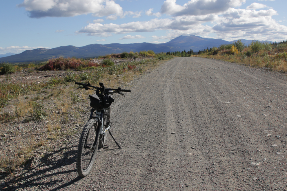
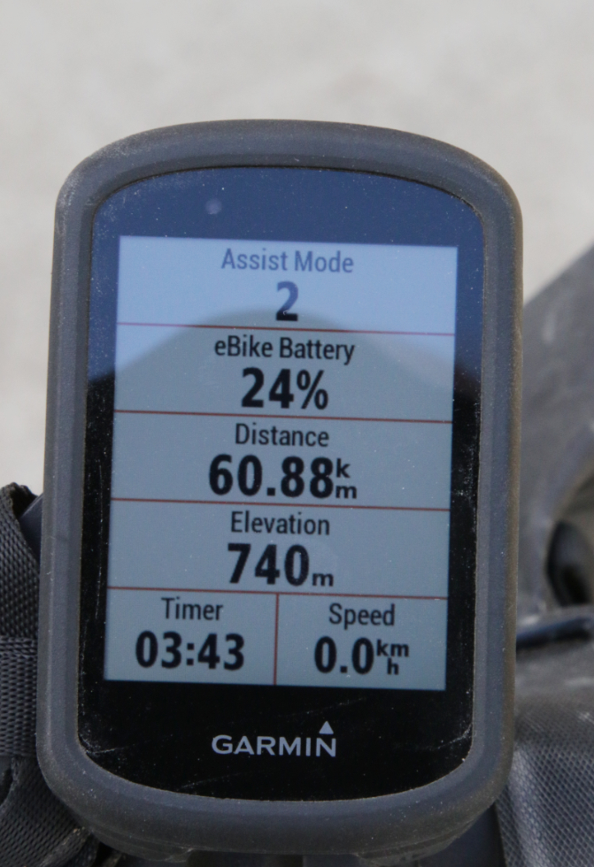
When I left the house with the e-bike on September 13th I told Cathy my goal was 55 km, and I ended the day with 60.88 km on the bike’s Garmin computer. You can see the route with an interactive map on my Strava page.
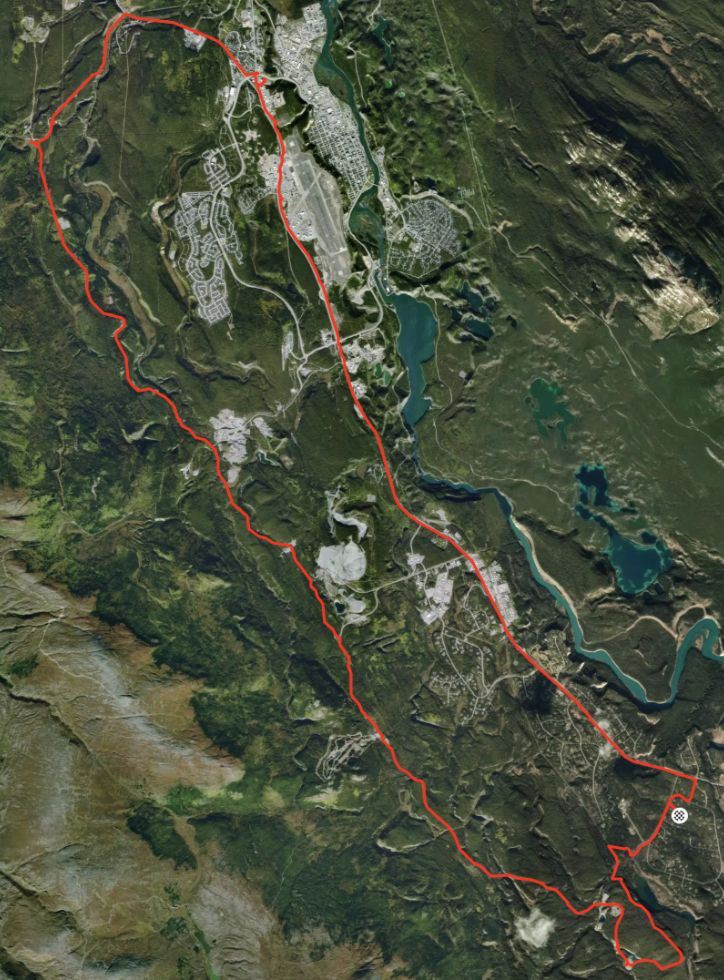
The most interesting route to put a bunch of miles on is to go north through the old copper mining area (the Whitehorse Copper Belt) on good gravel roads, then back home along the Alaska Highway. There are a few ways to get started – I opted to make a wide loop via some trails and the World War II Canol pipeline road.
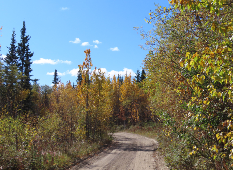
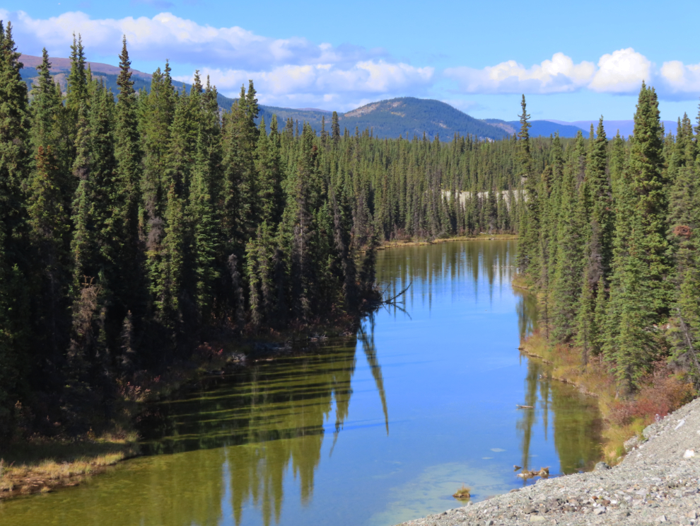
This view back tom the north along the Canol road always stops me for a photo or two. The long-abandoned White Pass & Yukon Route railway runs along the marshy valley below.
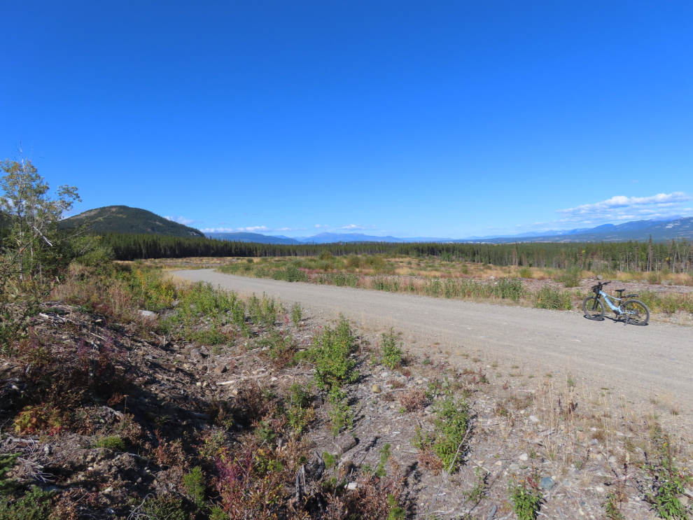
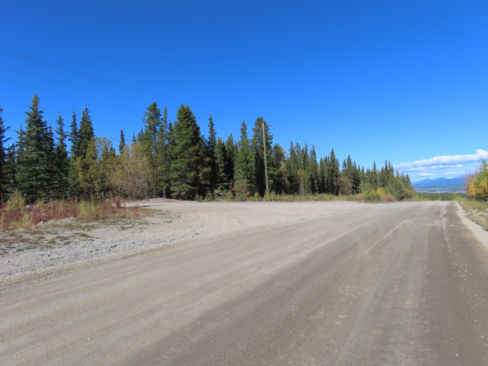
Much of the Copper Belt ride is much more open than it used to be, due to a massive firebreak that has been cut over the past five years or so.
I really like the views around the Black Cub South mining pit, so many of my rides come by here. On a hot day it’s a great place to have a swim, though the water never gets warm.
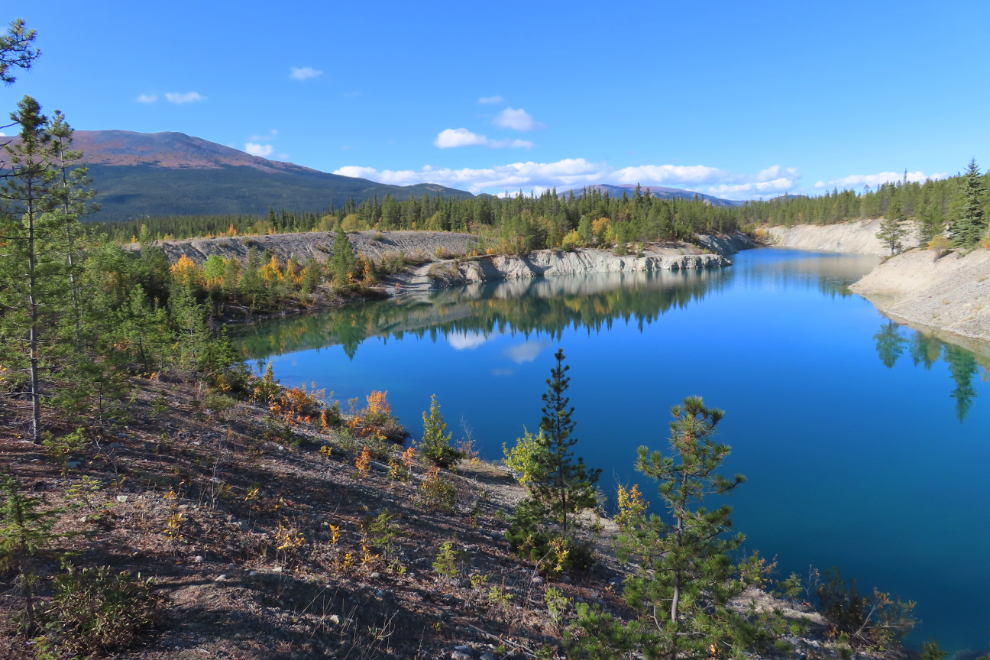
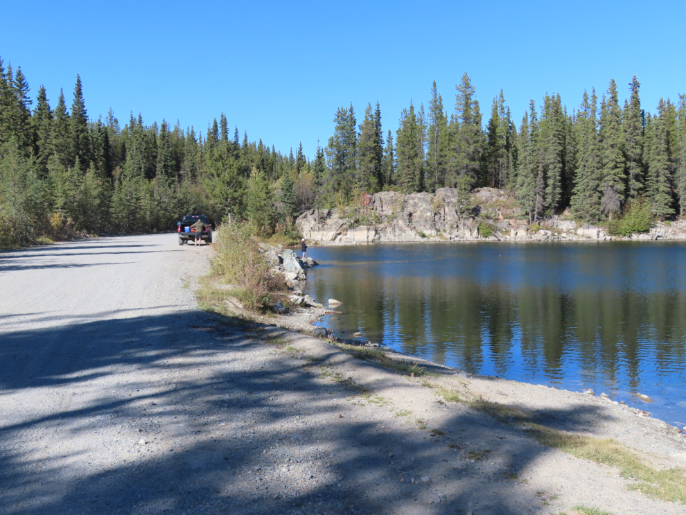
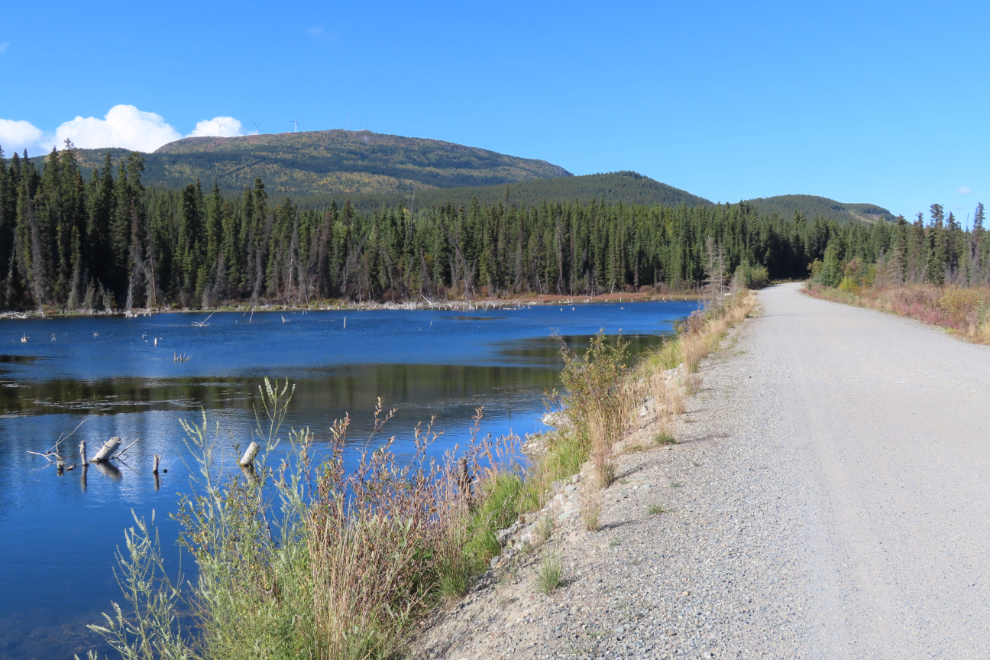
This narrow lake isn’t visible from the road – you have to know where to make a short detour. There’s no easy access down to it.
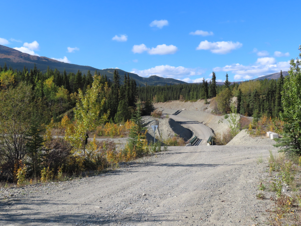
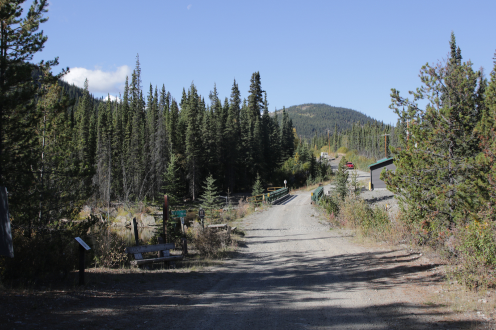
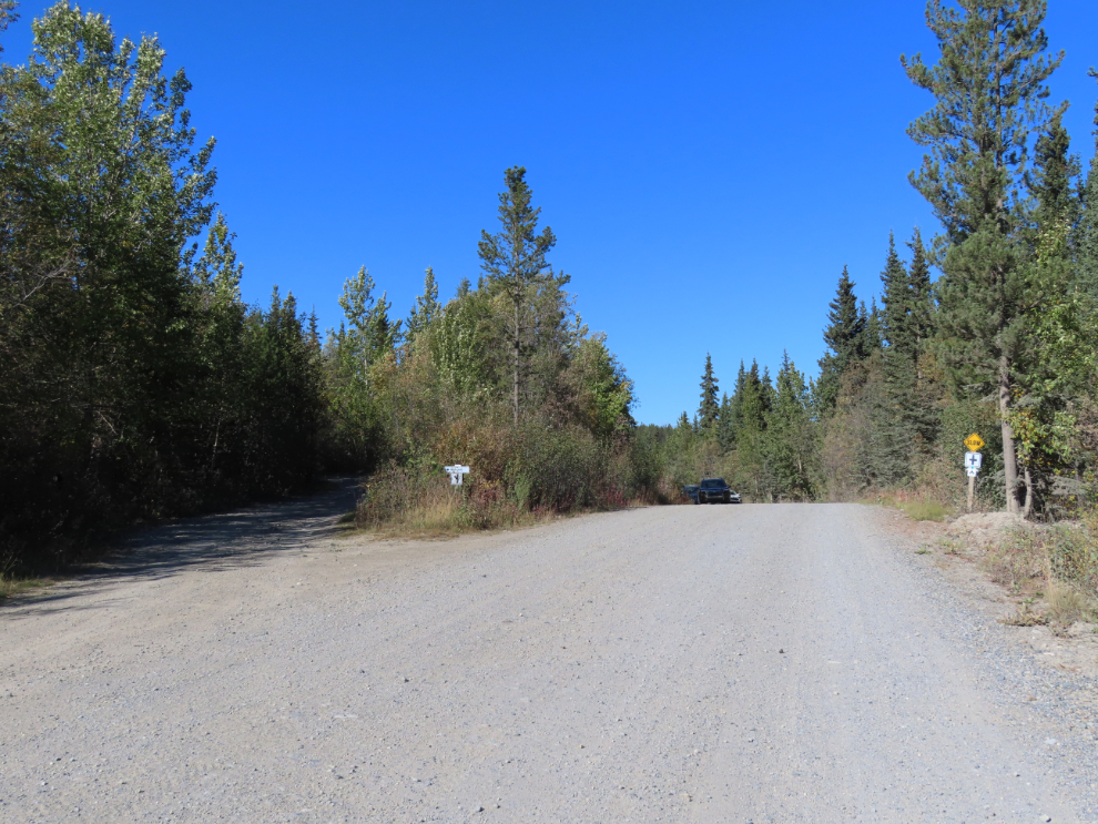
The road through the Copper Belt goes straight ahead, with a bridge crossing Wolf Creek. To the right is a shortcut back home, to the left is a small lake in another mining pit, the Keewenaw. It had now been 45 minutes since I left home.
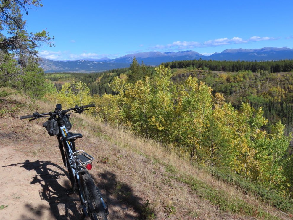
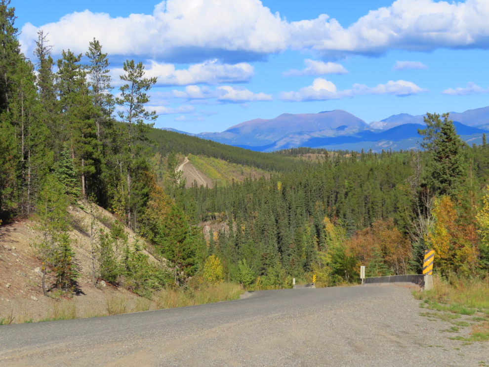
Past Wolf Creek, both the road and the firebreak cut get wider, and there are some nice views across the Yukon River valley. The road has some notable hills up to about 11% grade, both up and down, and it’s nice to have the “e” on the bike. The next photo was shot at the high point of the ride, 882 meters, which was 133 meters (436 feet) above my starting point.
Looking back to the south.
Another Bailey bridge to cross just before the Coal Lake Road, an extremely rough and steep road I’ve only followed a bit beyond treeline, a fraction of its length. It’s best considered to be an ATV trail.
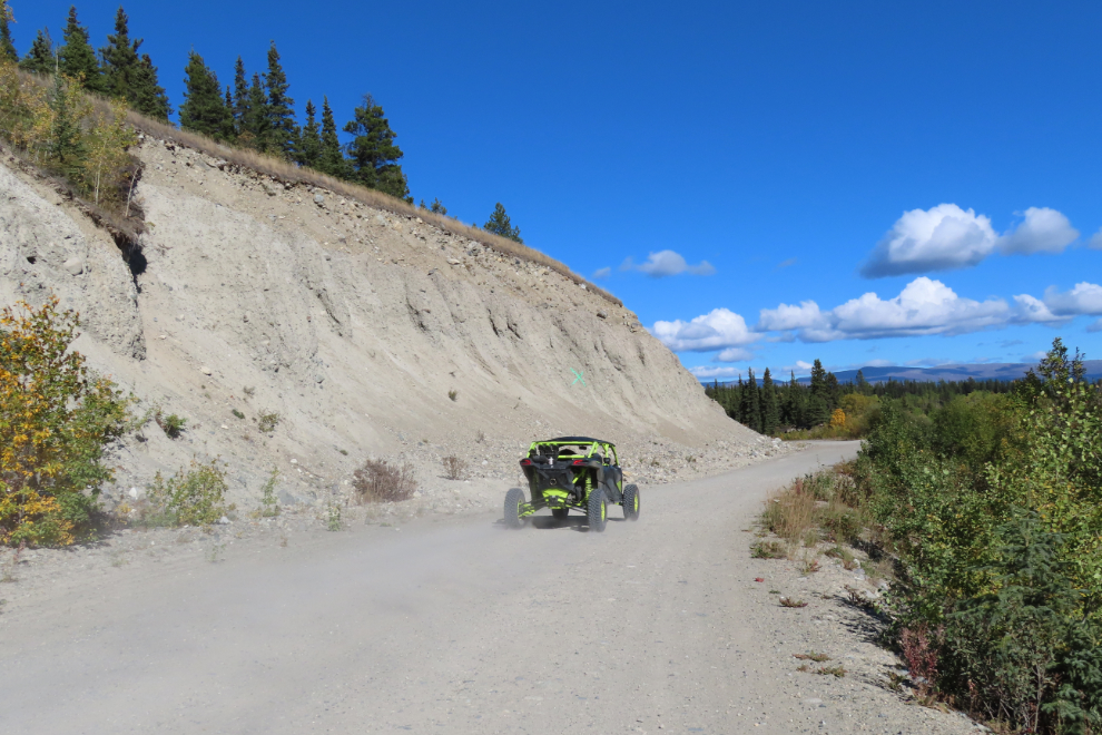
At the Mount Sima ski hill the mining road becomes a regular public road, but you only need to ride along it for 2.4 km, then you take a left to get back onto the mining road. During the 15.3 km to the ski hill, I hadn’t seen another person, but then there were a few vehicles on the regular road.
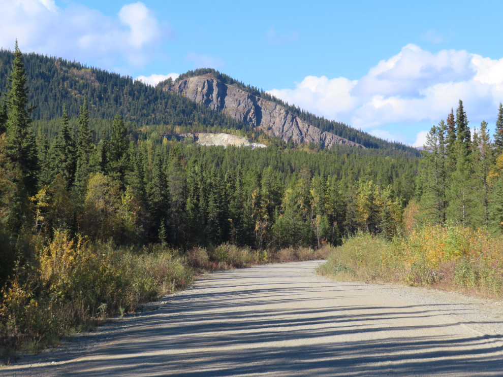
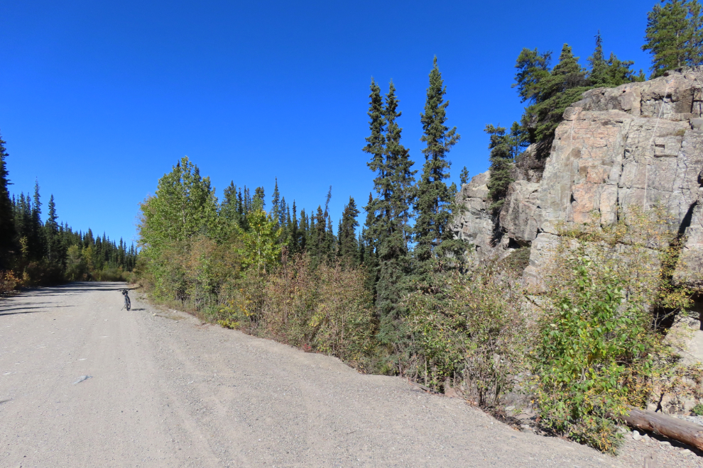
As many times as I’ve seen it, the view in the next photo always surprises me – those cliffs are so out of character from anything else in the area.
Carr-Glynn Lake, named for a station on the Copper Mines Branch of the White Pass & Yukon Route railroad, is sometimes a nice place to take a break.
The road to the left in the next photo climbs Mount McIntyre (“Mount Mac”). It’s recommended as a 4-wheel-drive road, and at about treeline that’s no longer optional. I’ve spent many days up there driving, hiking, and biking. I was now an hour and 35 minutes (and 22.7 km) from home.
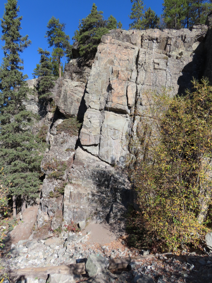
Five minutes later I reached a small but apparently popular rock-climbing area.
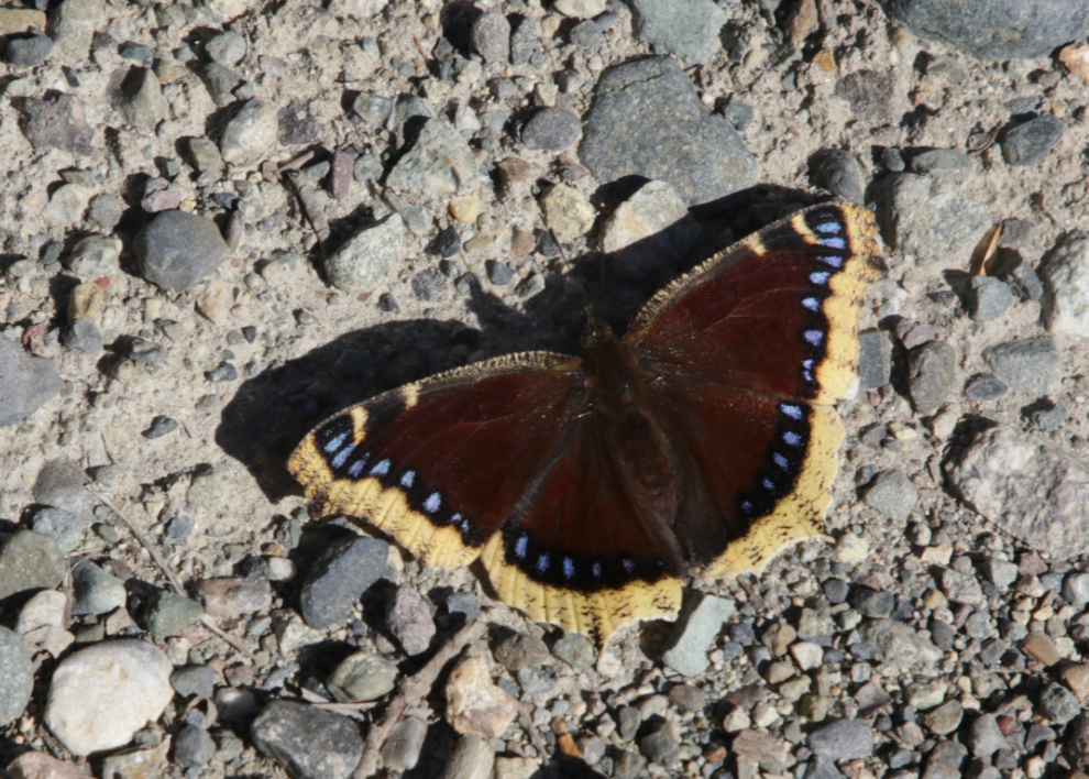
There are a lot of the striking Mourning cloak butterflies (Nymphalis antiopa) around right now, and I found a particularly cooperative one at the rock climbing stop.
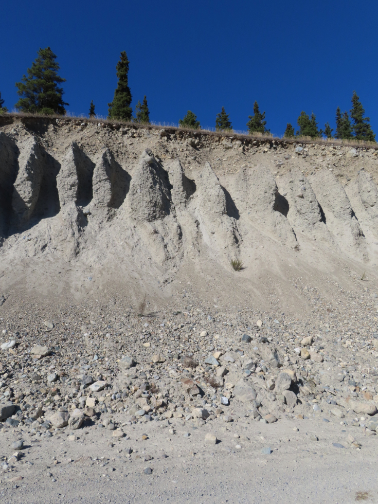
An impressive cutbank hints at the distant past, when a substantial river flowed here as the glaciers melted and drained away.
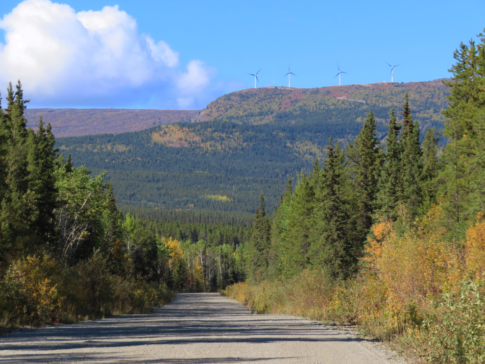
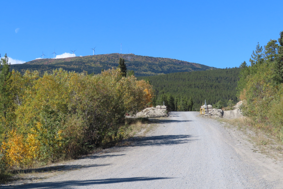
Exactly two hours from home, the four new wind turbines on Haeckel Hill could be plainly seen. This $29.8 million project, completed in 2023, will power up to 650 Yukon homes.
Nearing the northern end of the mining road, the road runs along a shallow lake that seems to have been created by the road.
Three minutes later, the northern end of the road.
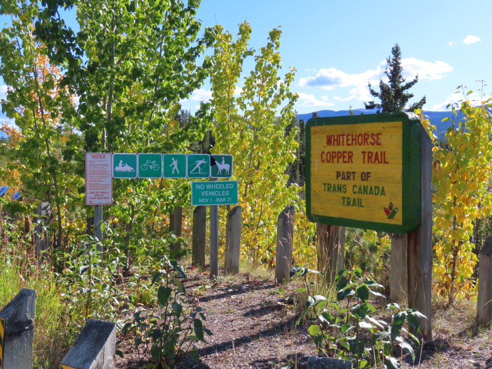
There are no signs marking the start of this road/trail at the southern end, but there are a lot of signs at this end!
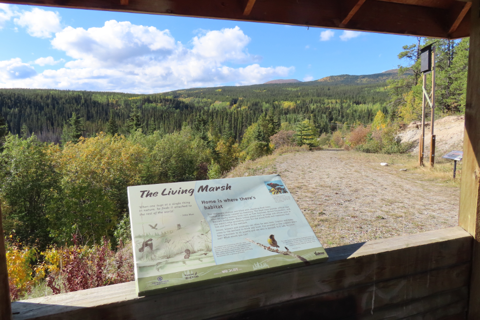
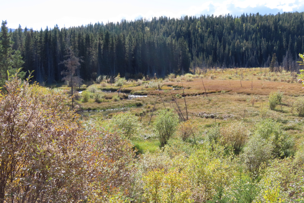
At this end, there is also a gazebo with some interpretive signs about various aspects of McIntyre Marsh below, and I spent a few minutes there. In the first photo below, you can see a large bat house to the right, to help our Little brown bats (Myotis lucifugus), whose population is considered to be Vulnerable.
From there I’d be on pavement all the way home, first on Fish Lake Road, which at the spot seen in the next photo, drops steeply down into the valley of McIntyre Creek, where it meets the Alaska Highway.
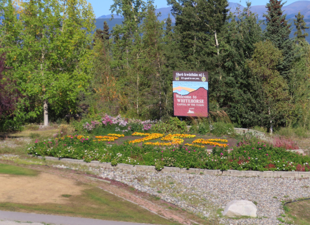
I made a little detour on the way home to get a photo of the 75th Anniversary garden at the Welcome to Whitehorse sign. It has struck many of us as odd that the city has made a big deal of this anniversary, when it’s actually the community’s 125th anniversary. It became a real town in 1900 when the railway reached it, but was incorporated as a city in 1950.
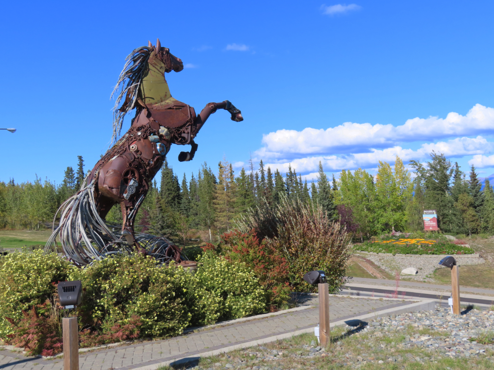
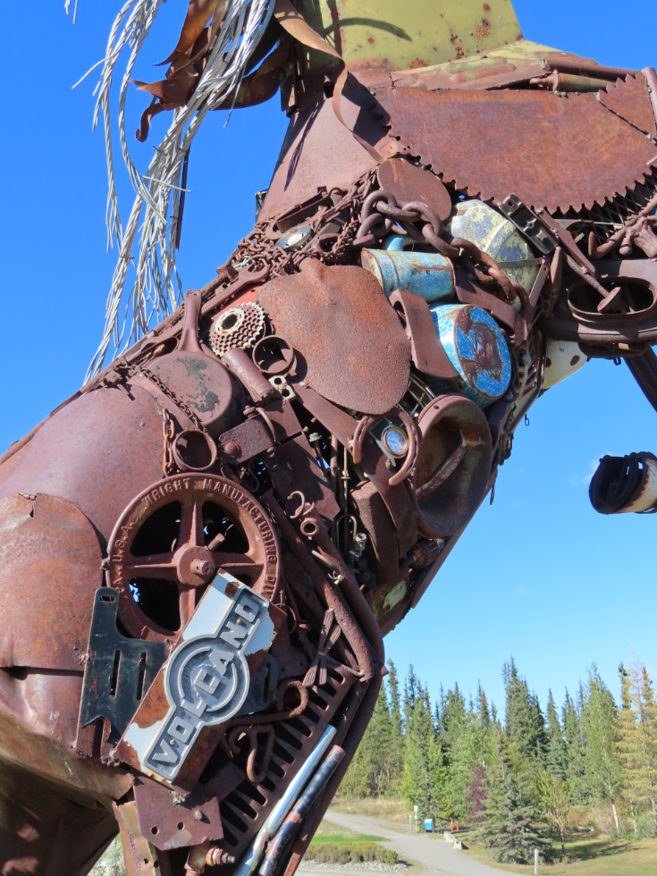
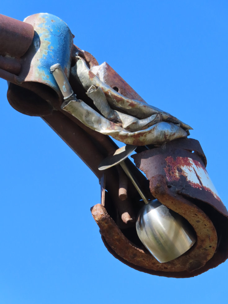
I shot the photo above from The Horse. In 2009-2011, Artist Daphne Mennell and welder Roger Poole turned a pile of assorted scrap metal into one of the most-loved pieces of public art in Whitehorse. Many of those pieces have people’s memories and stories invisibly attached.
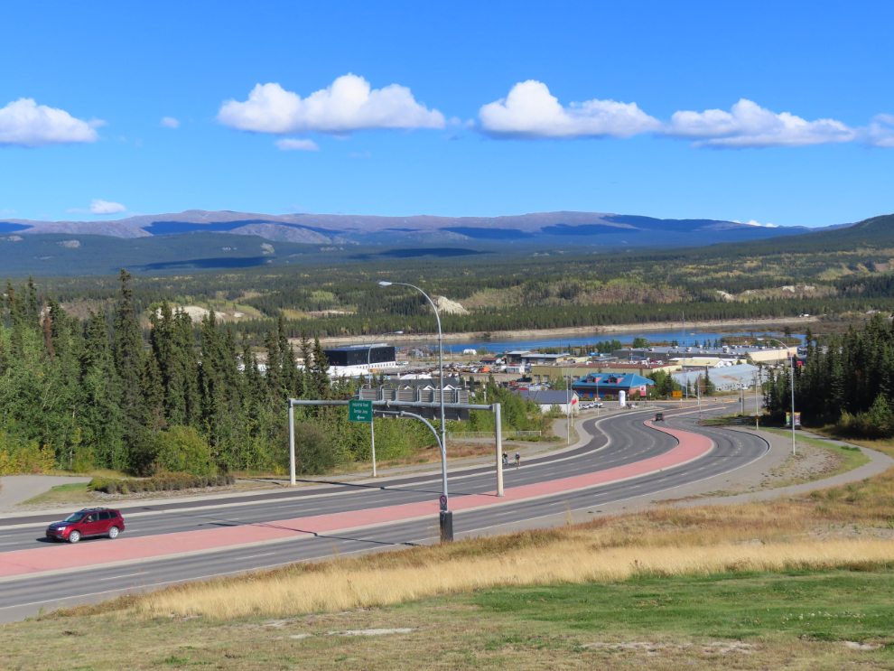
From The Horse there’s a great view down Two Mile Hill, which is the northern access to downtown Whitehorse from the Alaska Highway.
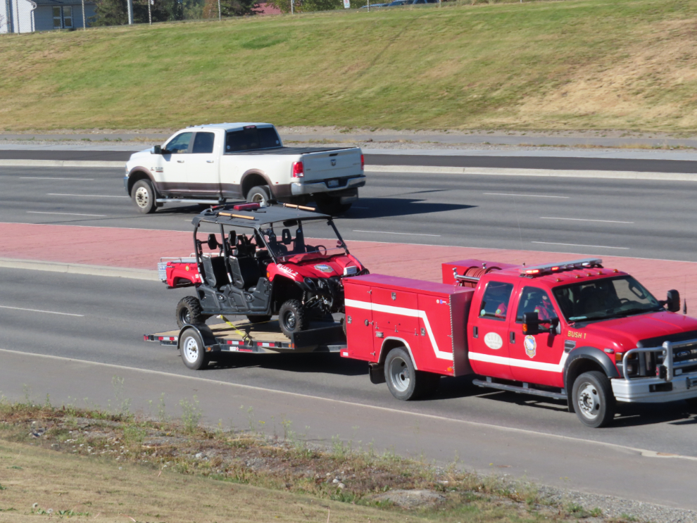
While I was there a little “fire truck” that I don’t think I knew existed went by in a hurry with the lights and siren on the tow vehicle activated, apparently to fight a little bush fire.
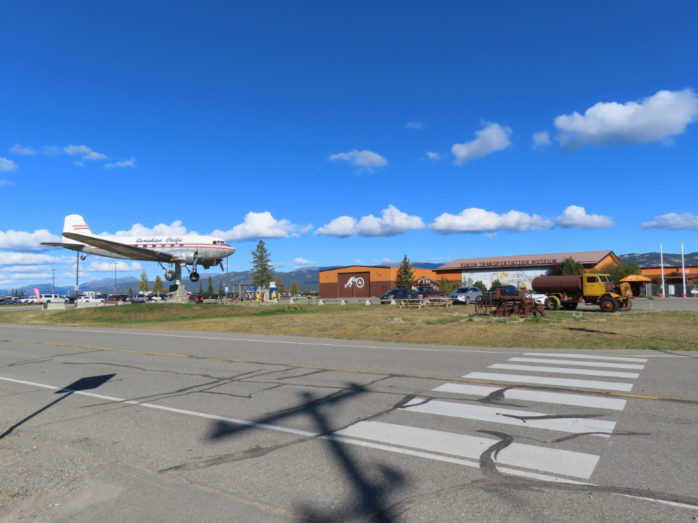
The Yukon Transportation Museum. I’m long overdue for a visit, and need to renew my membership…
The ride back home along the highway kinda sucked, as there was a strong south wind in my face, forcing me to add a notch of power to make any speed. But when I got home, with 60.88 km on the clock, there was still 24% battery left, which I was very pleased about.
All in all it was an excellent ride, and I was looking forward to a much longer ride the next day on “the noisy bike” 🙂