Canoeing the Yukon River, Part 6: Ballarat Creek to Dawson City, and home
This post covers our last two full days on the river – Tuesday, August 19th and Wednesday, August 20th – with a bit about the drive home on the 21st.
To start this day, the lovely little valley of Sparkling Creek, at about 11:00.
We met two guys in tiny packrafts, unusual vessels for a trip like this. One was from the Czech Republic. They were obviously not in a hurry 🙂
Sunshine arrived in the early afternoon – it was sure welcome! The photo, though, was actually shot to show a landmark in Mike Rourke’s river guide – “Old channels blocked by log jams.”
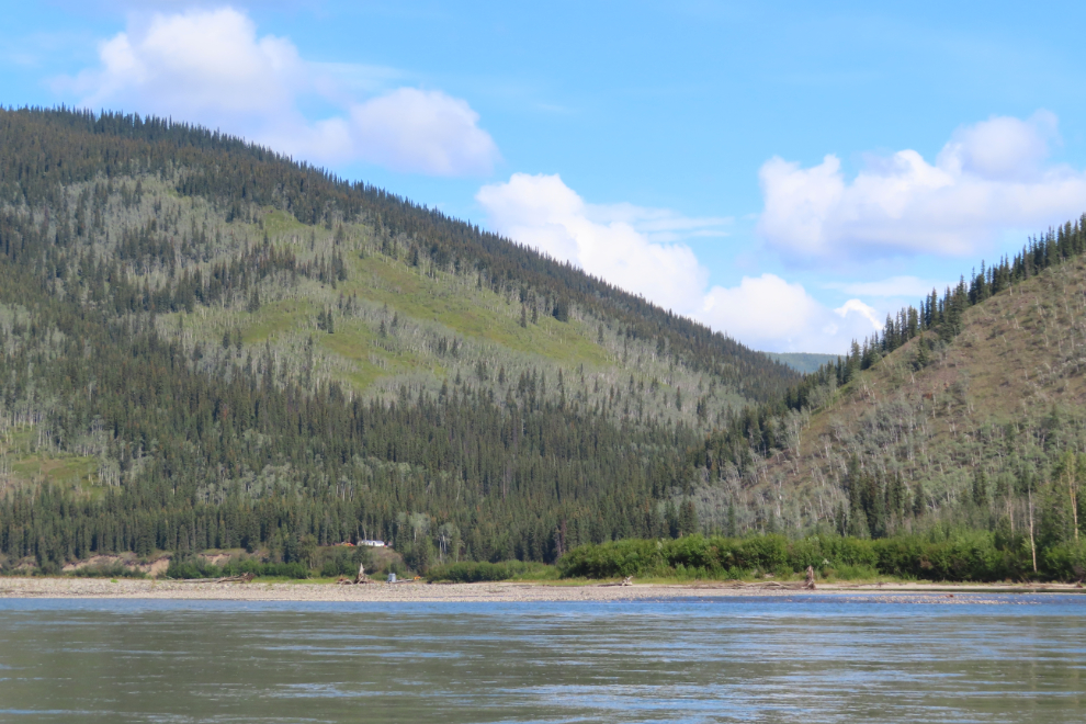
A wall tent camp and a large water pump at the river, so probably a placer gold mine not too far back into that valley.
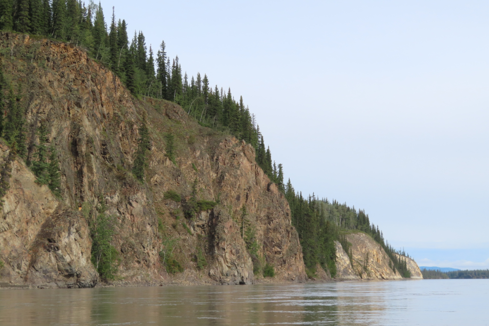
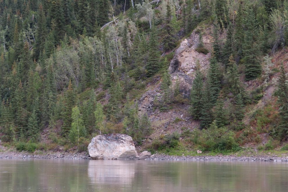
By 2:00 we were back under some impressive rocks.
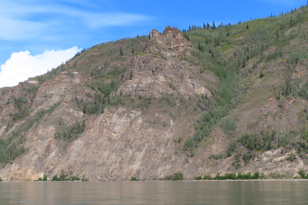
2:50.
We took one of our breaks at about 3:30. We generally got out for a stretch about every 2½-3 hours.
4:10.
By 6:00 we were camped on an island below the Stewart River, having paddled 50 miles this day. We had a good look at the former site of the community of Stewart Island as we drifted past, but it’s all gone now, washed into the river 🙁 In 1997, the Hudson’s Bay post had just fallen in but there were a few buildings remaining.
We both really liked this camp for a small side channel that made lots of noise as it tumbled off the main river.
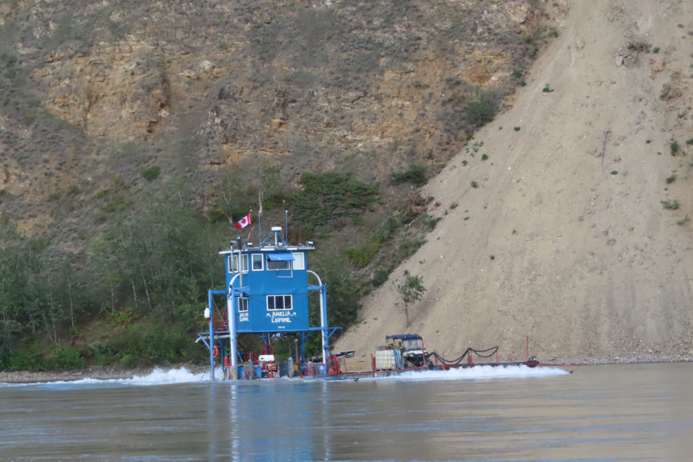
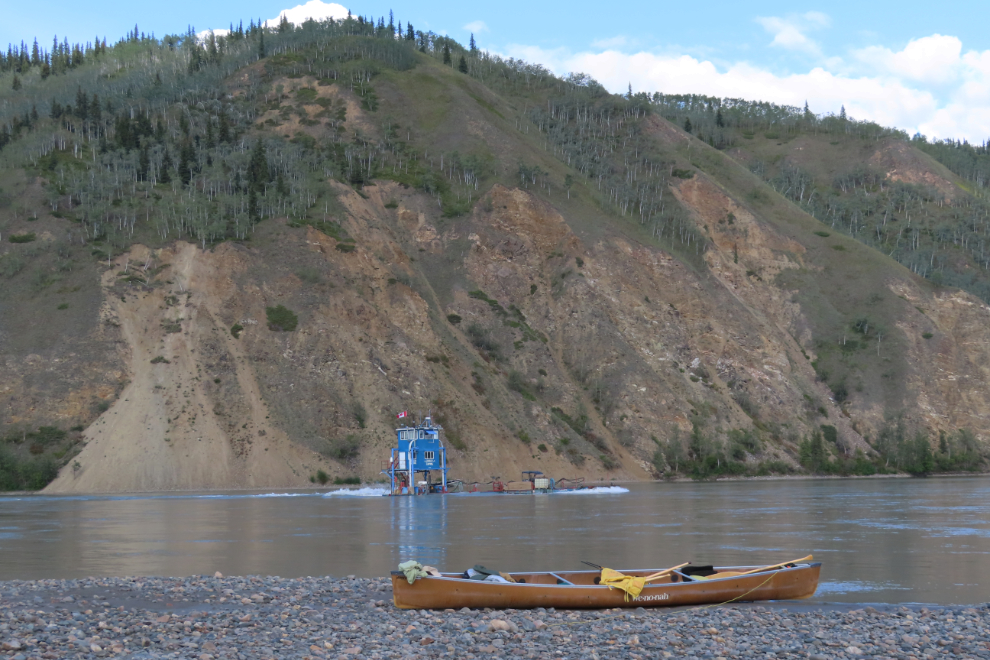
I had laid down for a nap as I often did, but Steve woke me up by calling “you’re going to want to see this – I don’t know what it is but it’s 2 stories high!” And indeed I did want to see it – I have many photos of the Dawson-based freight boat Amelia Lupine shot over the past 25 years or so, but none of her working her way up the river with a load.
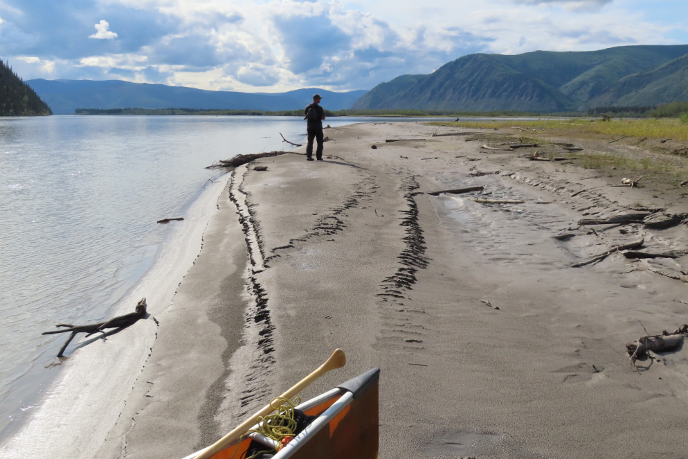
Starting to break camp at about 09:00.
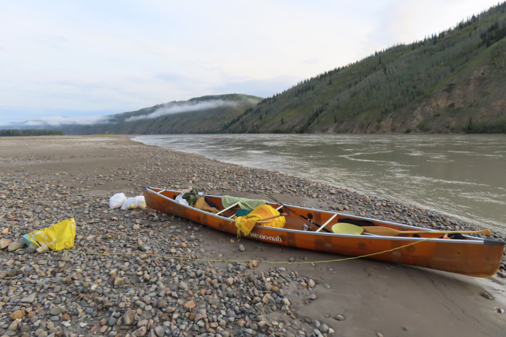
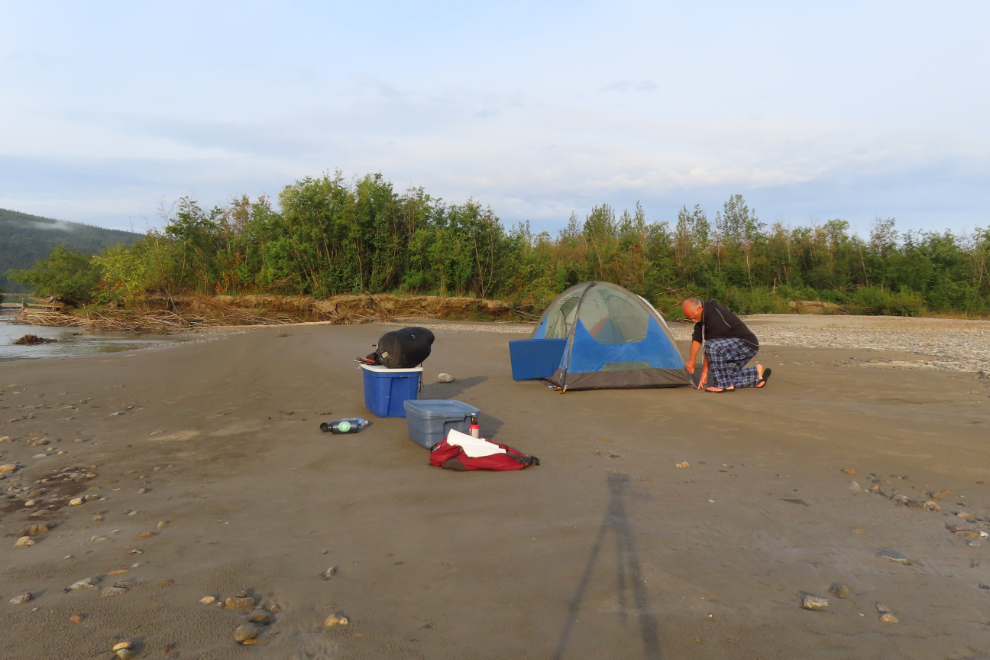
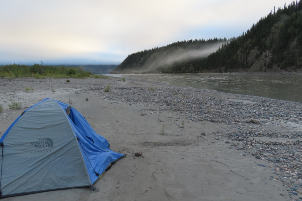
August 19/20: Camp #9 – Lat: 63.378796, Long: -139.533705. Elevation: 1,138 ft.
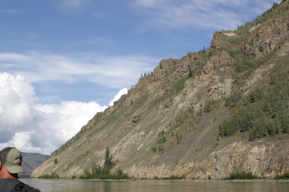
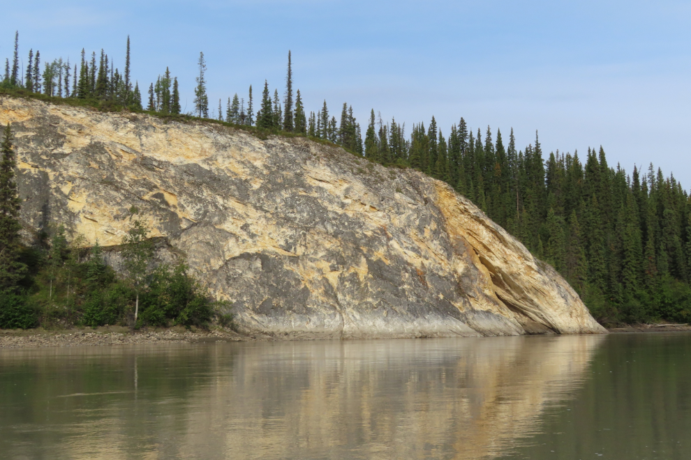
10:10 – by now, “rock outcrops” and “pinnacles” were common terms in the river guide landmarks.
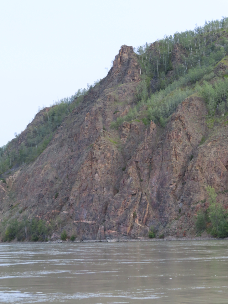
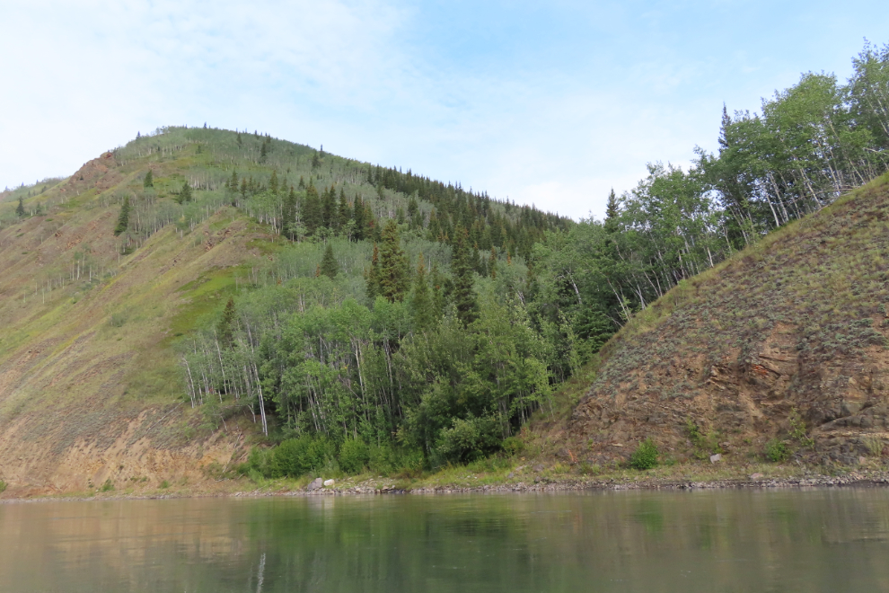
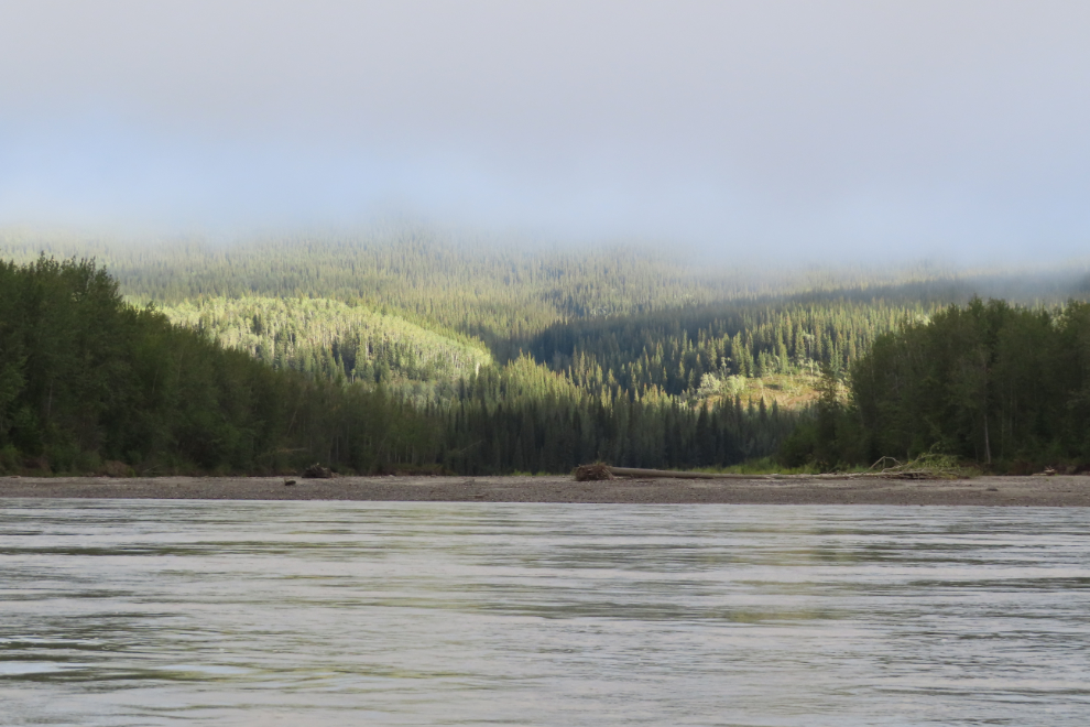
Tight little valleys with creeks like this were getting to be quite common. This country is very different than the upper river.
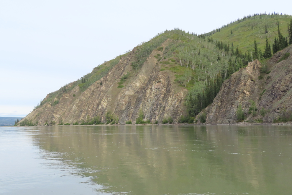
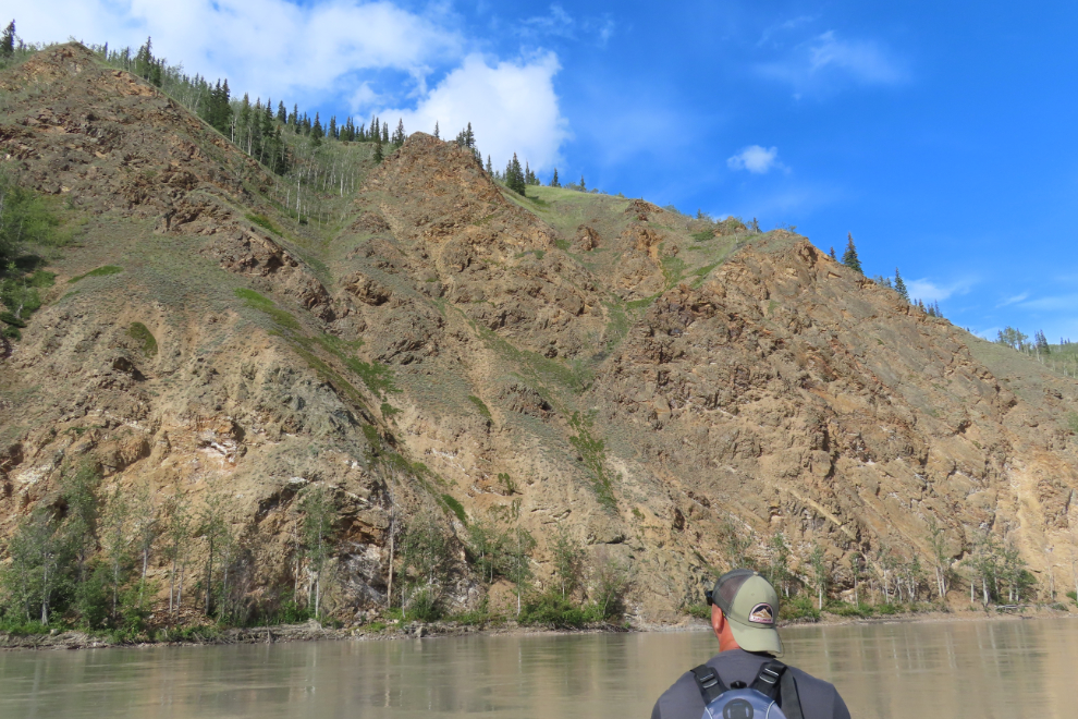
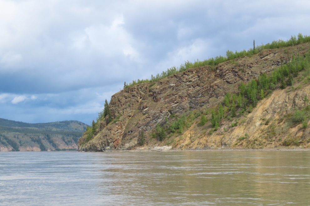
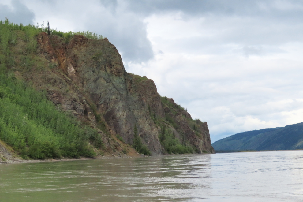
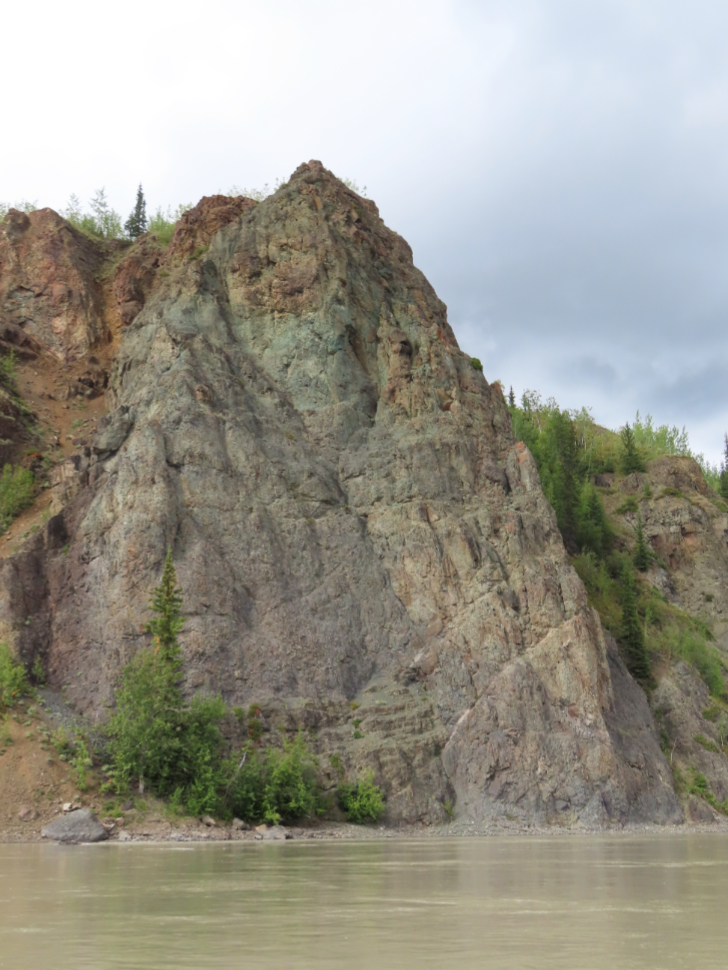
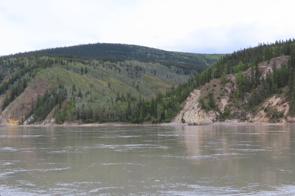
The next four photos were shot in less than 15 minutes starting at about 11:00. We didn’t even paddle for much of that period, the rocks were so incredible.
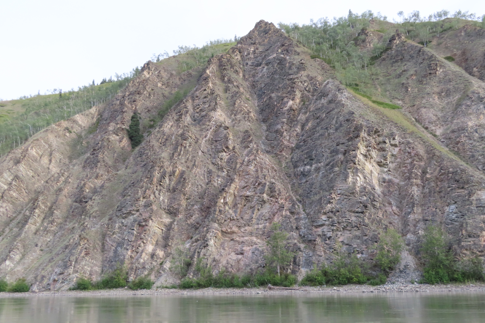
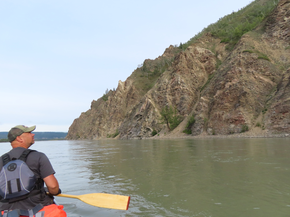
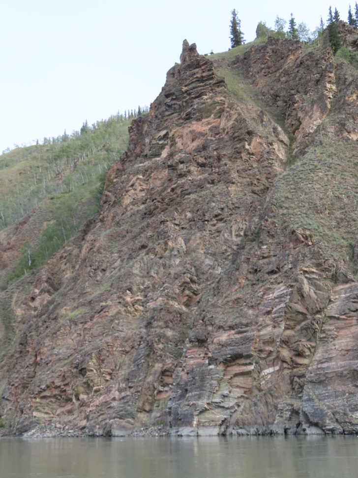
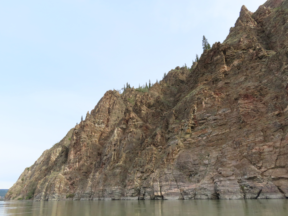
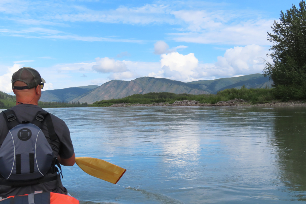
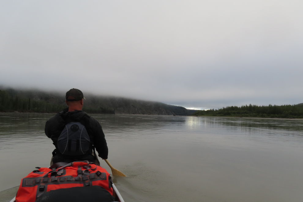
With all the large rivers that had joined the Yukon – the White and Stewart most recently – the river was now vast, and staying close to shore was far more interesting and we didn’t feel like we were on a lake, not moving. The strongest current also seemed to be near the cliff walls, so if that wasn’t just an optical illusion it was another benefit.
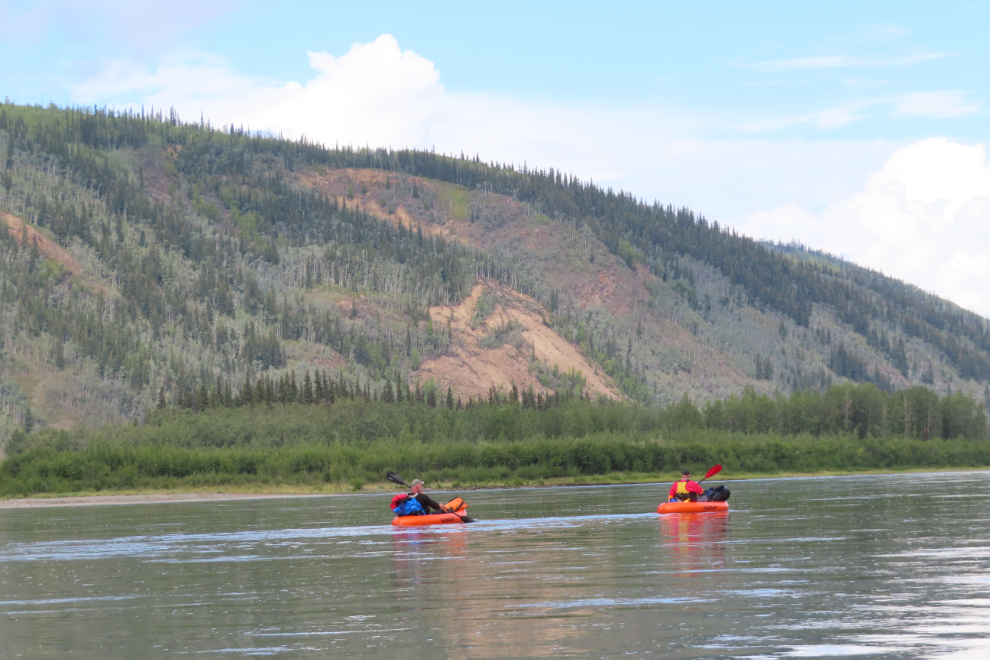
Really definite landmarks were few and far between in the river guide, but “Yellow rock outcrops” across from the mouth of Rosebute Creek was excellent 🙂 We were now only 48 miles from Dawson City, at 11:20.
The view ahead at 1:15 had plenty of variety.
At about 2:00, we got hit by a violent thunderstorm, with high winds and torrential rain. It had come out of nowhere, and I had to scramble to protect my book, cameras, and inReach. We got soaked! Once the worst was over, I spun the canoe around to get this photo of the beast moving upriver.
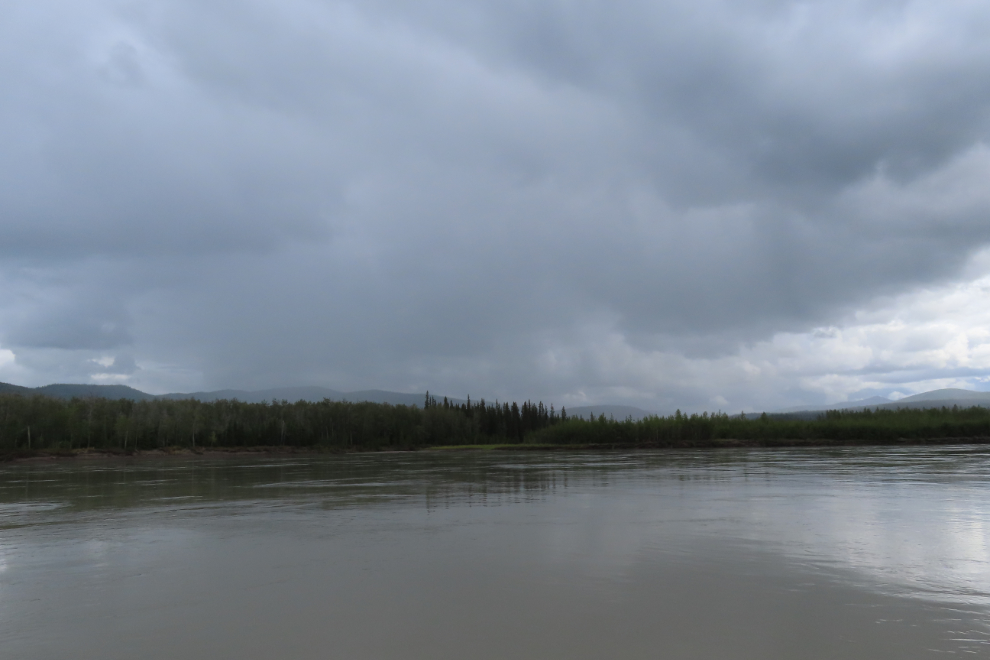
It looked like there might be more storms like the one that had hit us, so we decided to beach as soon as possible and get our rain gear ready. We had some cliffs to get by first…
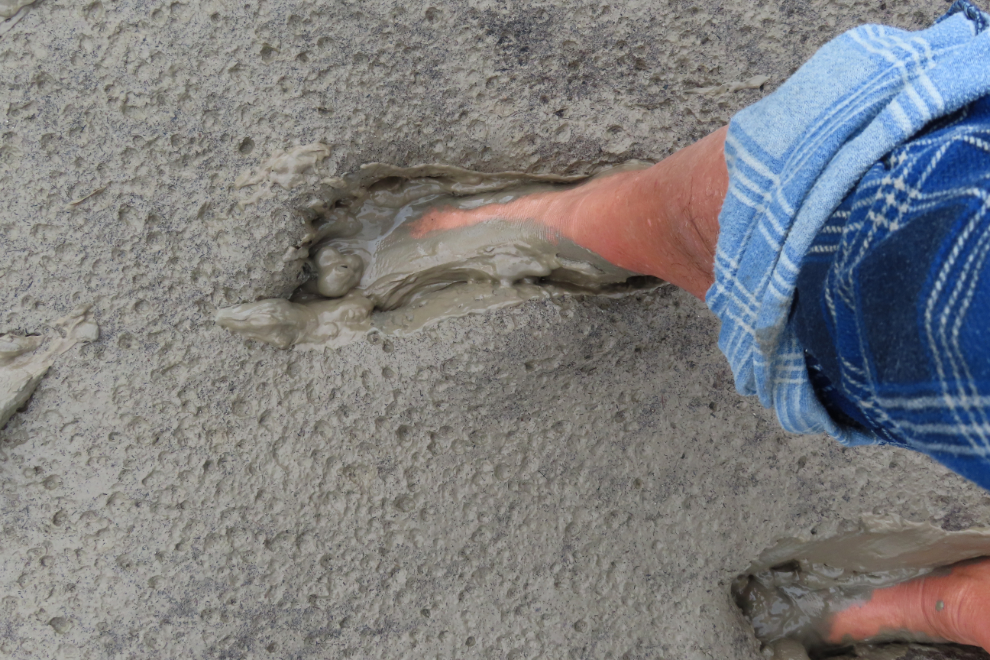
Our choice of beach turned out to be poor – at least that’s what we thought initially. It was mud, not sand. But Steve took a walk and yelled back that it was awesome mud and I should come for a walk in it, too!
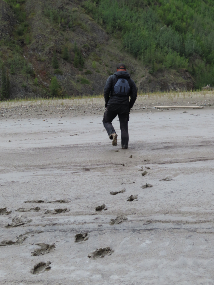
Oh yeah, this was awesome mud! People pay to get slathered with talcum-soft mud like this 😀
After the goofing around, we did get our rain gear ready for another storm, but didn’t need it (of course). At 3:40 we were at another notable landmark, “Big white rock,” close to a location known as 14 Mile, being 14 miles from Dawson. My plan was to make our final camp somewhere about an hour from Dawson, to meet Cathy about 10:00 the next morning, making the 7-hour drive home easy.
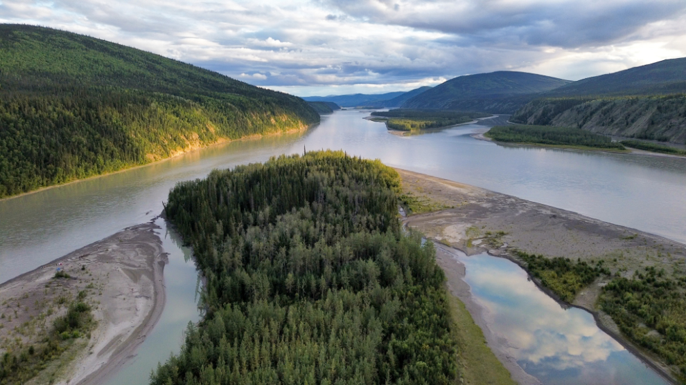
Caribou (Little Jim) Creek, at 10 Mile.
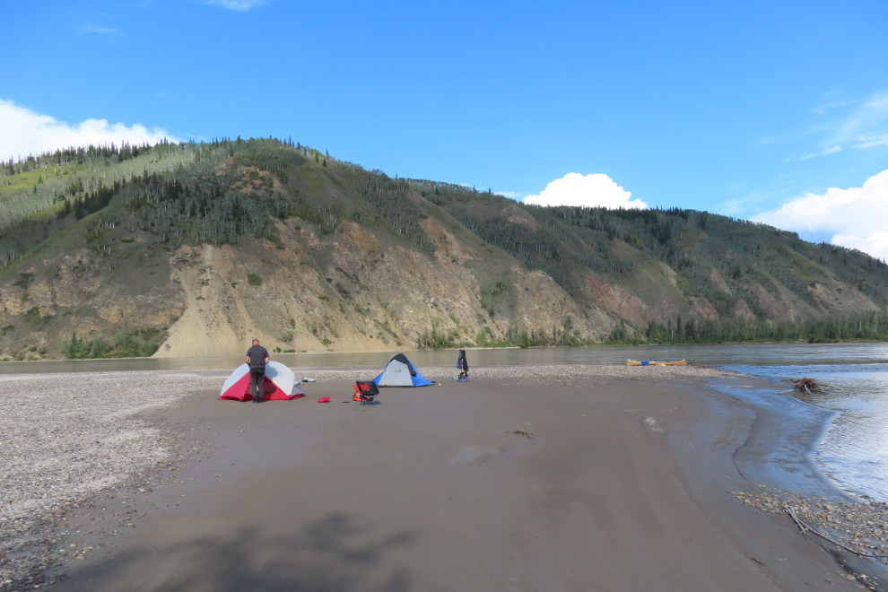
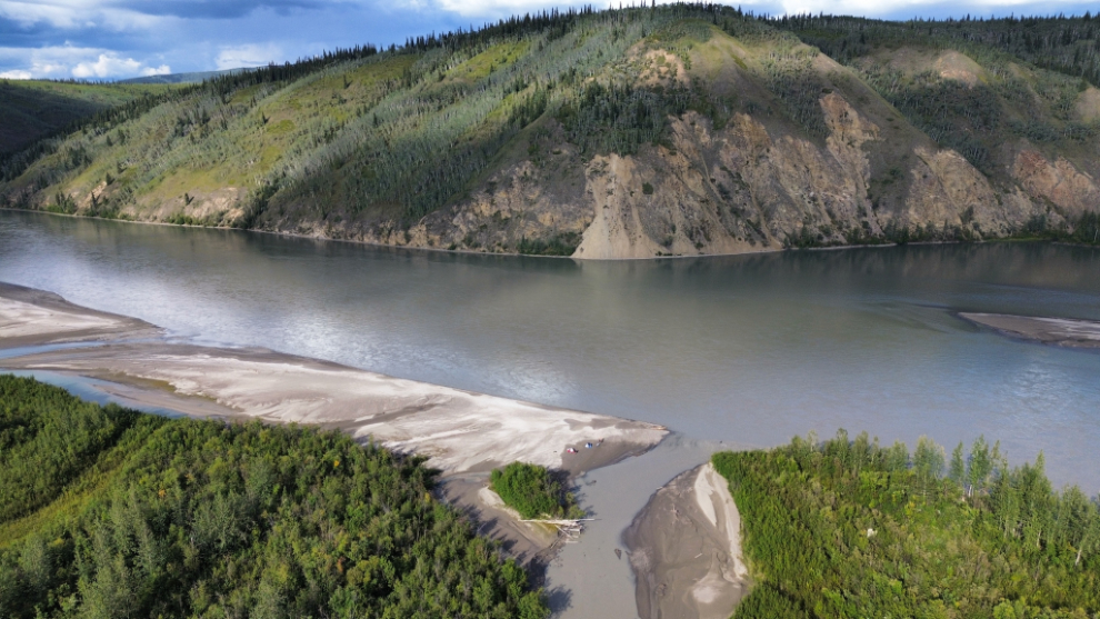
Just after passing Caribou Creek, we moved out of the main channel into what I called the camping channel, and within a couple of minutes had found a pretty decent camping island, near the head of the sandy islands to the left in the drone shot.
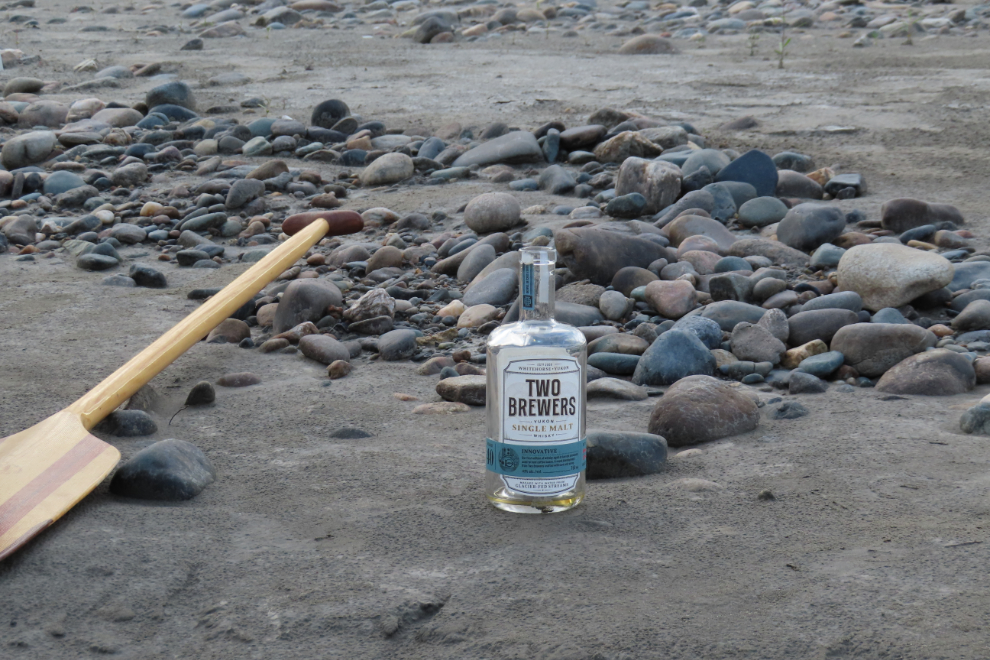
Steve and I had the final shots of good Yukon whisky that evening (there was less than half a bottle when we started at Whitehorse). I commented that my Dad would have loved to be there with us – it reminded me so much of his placer gold claim on the Fraser River at Spuzzum, where he and I did exactly that a few times. The only big difference in our scene and the one at Spuzzum was that the river was running in the opposite direction.
The final morning – Thursday, August 21st, Day 11 of the trip – was very cold, probably about 3°C but feeling colder because of the fog rolling through.
August 20/21: Camp #10 – Lat: 63.995533, Long: -139.635158. Elevation: 1,070 ft.
This was miserable, perhaps made worse because we could see warm sun ahead and just a few hundred yards to the west.
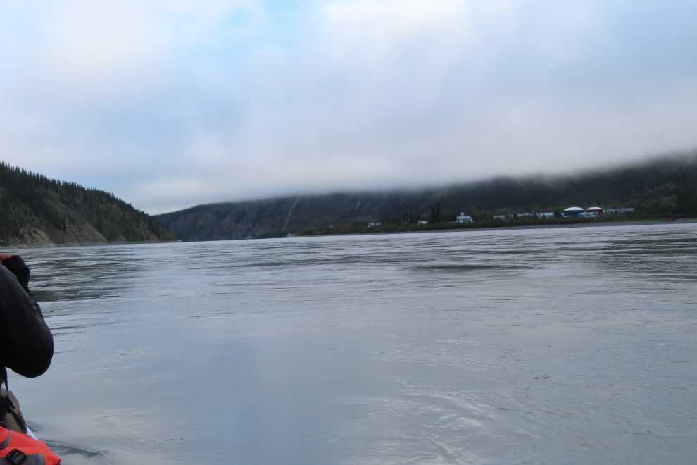
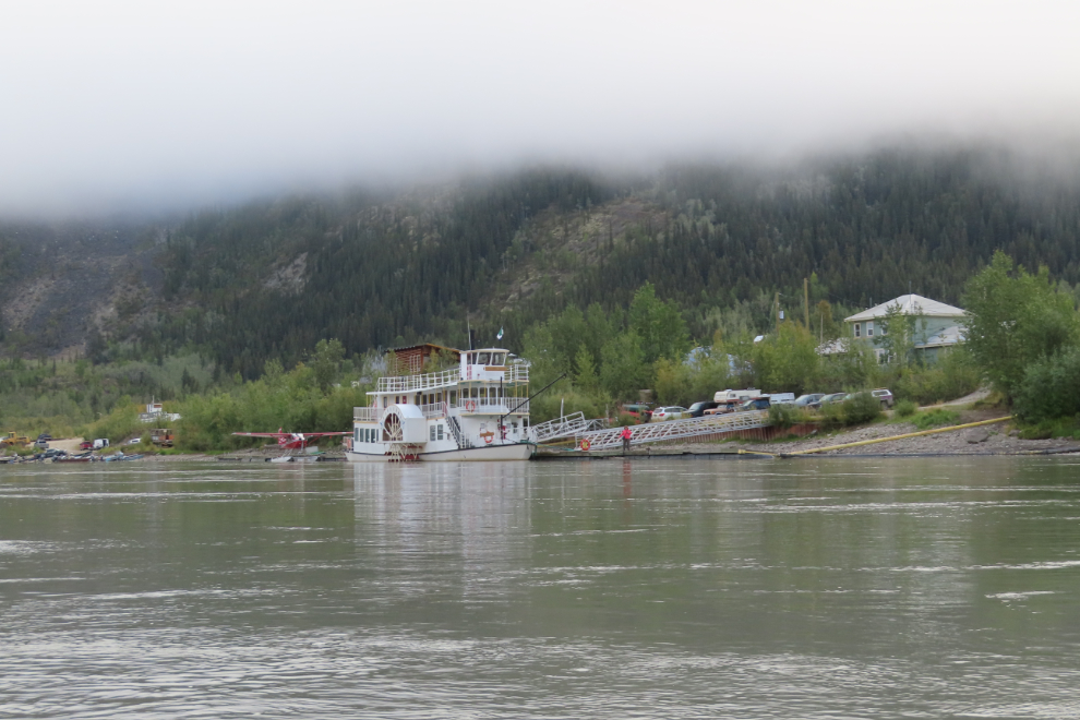
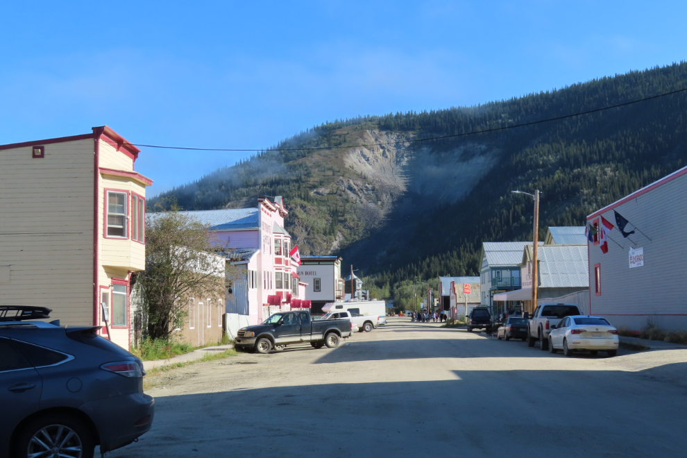
All of a sudden, at 09:30, there was Dawson ahead of us! With the very distinctive Moosehide Slide hidden in the fog/clouds, there had been nothing to indicate that we were getting close.
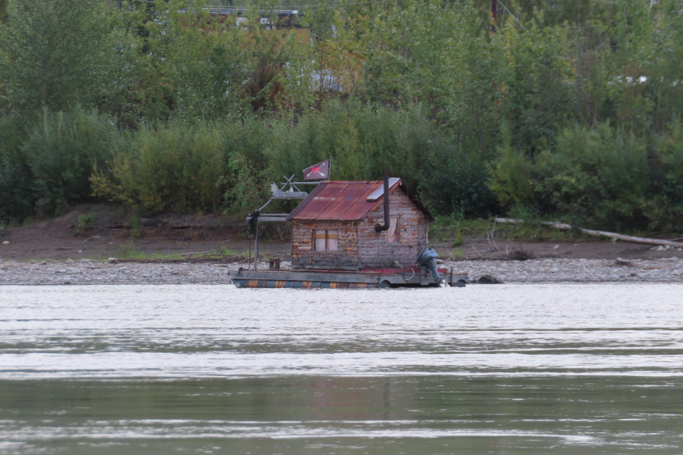
A wonderful tiny floating cabin at the upstream end of town 🙂
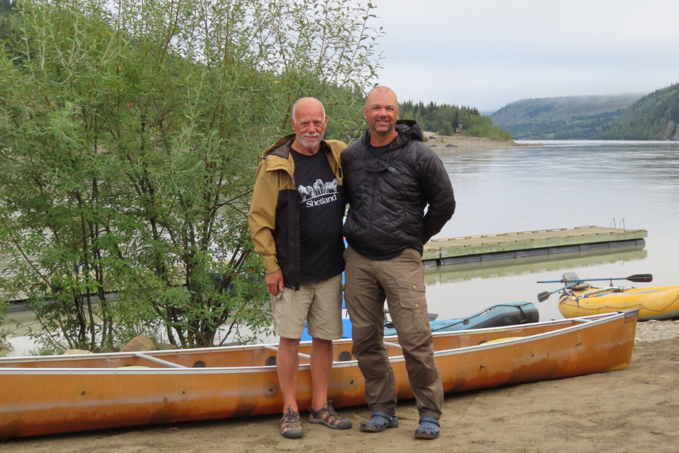
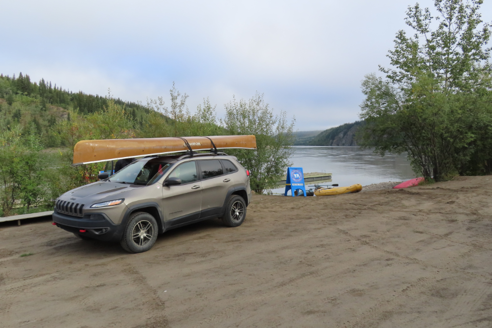
What a deep pleasure to see Cathy waiting for us on the dock. I had tried to discuss other options for getting home, but she was adamant that this was what needed to happen. Yeah, she was right 🙂
We did it!
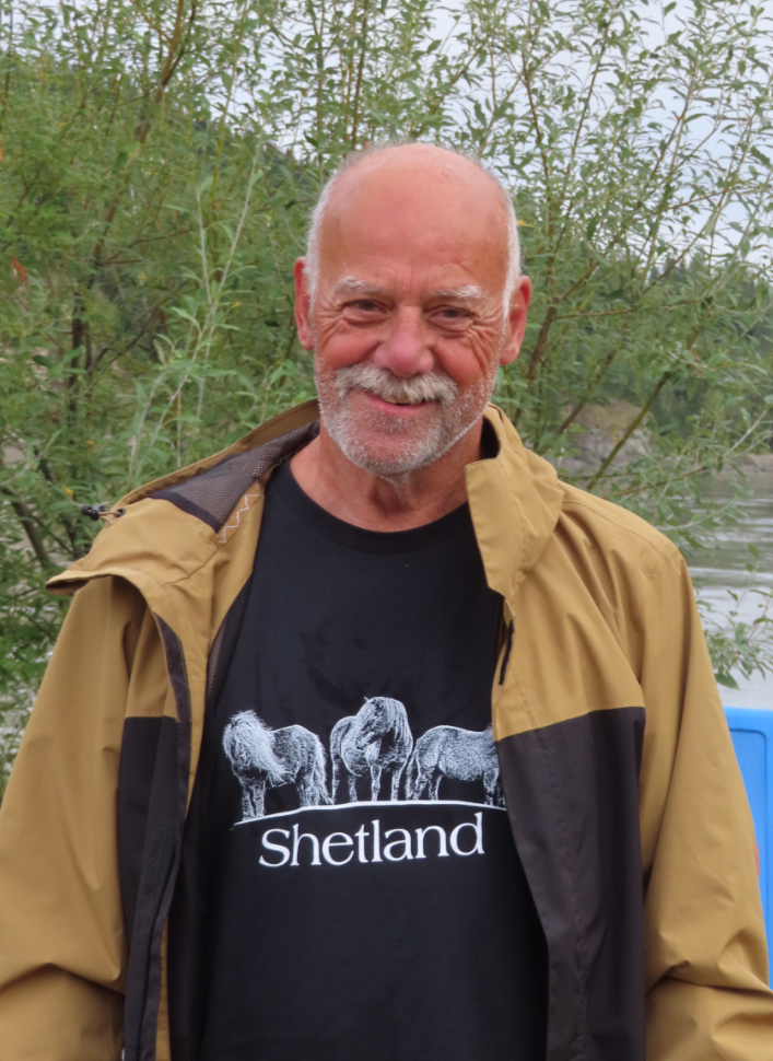
The last time I did something notable for a milestone birthday was when I bought the nicest motorcycle I had ever owned just before my 60th birthday. Now I had celebrated my 75th birthday, coming up in a few weeks, in pretty much the most “Yukon” way possible 🙂
Ready to head home. But perhaps a good breakfast would be a nice start? Absolutely! So off to “the Eldo” (the Eldorado Hotel) we went. In 35 years of breakfasting there, I’ve never been disappointed, and it was great this time, too.
By the time we came out from breakfast, the day was glorious, perfect for the drive.
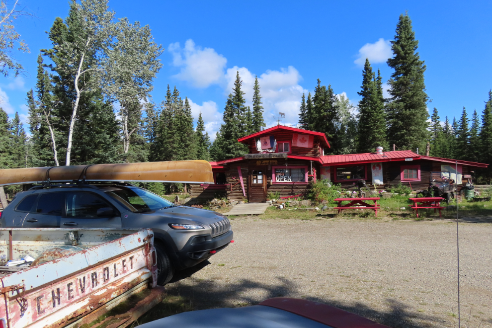
I drove for the first leg, to Moose Creek Lodge, where I wanted to see my friend Maja and get some coffee and pastries. Then Steve took the wheel and I put on my noise-cancelling headphones to get rid of the road noise that bothers me now.
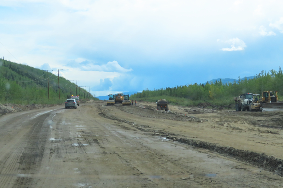
Cathy had heard that the highway was in terrible shape, but said as long as you picked a speed where you could see the potholes it was no big deal. I agreed – I’ve seen it much worse. There were two lengthy sections of construction, though, which slowed us down quite a bit. But just before 5:30, we pulled into our driveway.
And there we go – 10 full days plus an hour to paddle 439 miles, 28 years almost to the day after saying I’d never be able to make that amazing trip with my son happen again.
I’m so happy for you and Steve! What a beautiful adventure!!
Ellen
Thanks, Ellen – it was truly a world-class Adventure, in my back yard.
Following you and Steve on your 10 days (and an hour) of Yukon River paddling and camping has been a joy.
Thank you, Ryan – it was really nice having you along. I hope some day you can join me on another wilderness hike in the real world.