Canoeing the Yukon River, Part 2: the Thirty Mile River and Hootalinqua
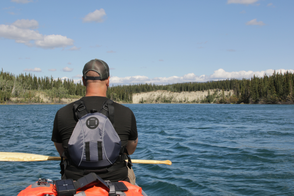
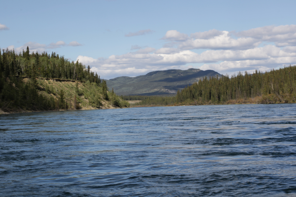
This post begins on the afternoon of Day 3 – Wednesday, August 13th – as we started paddling down the Thirty Mile section of the Yukon River, from the foot of Lake Laberge north.
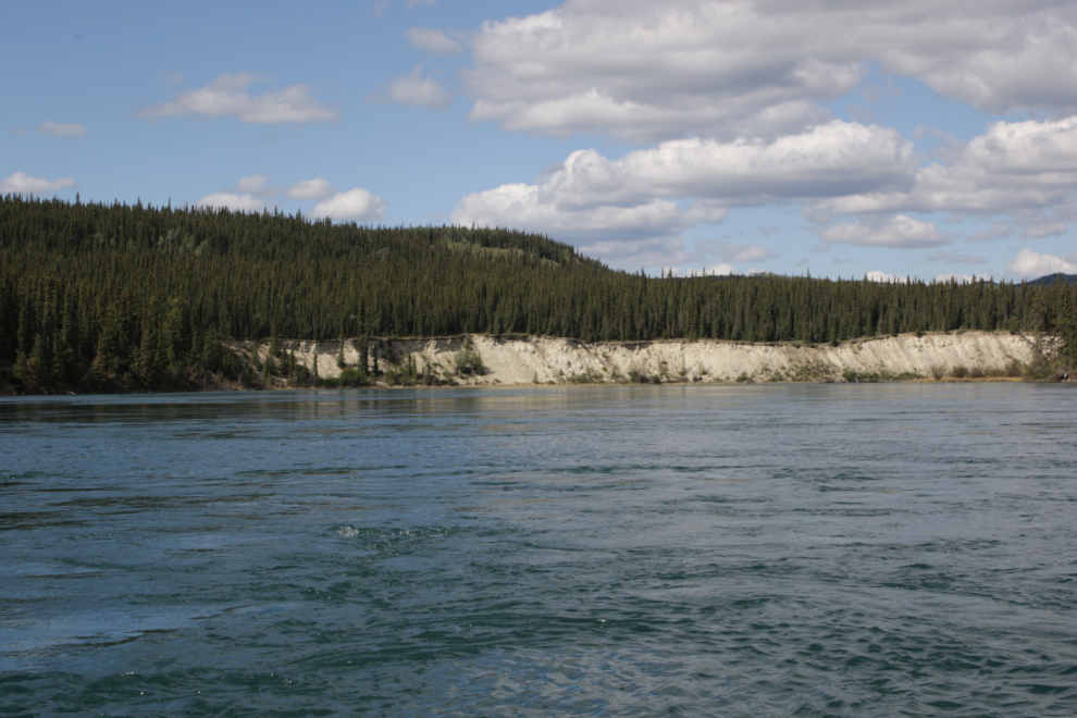
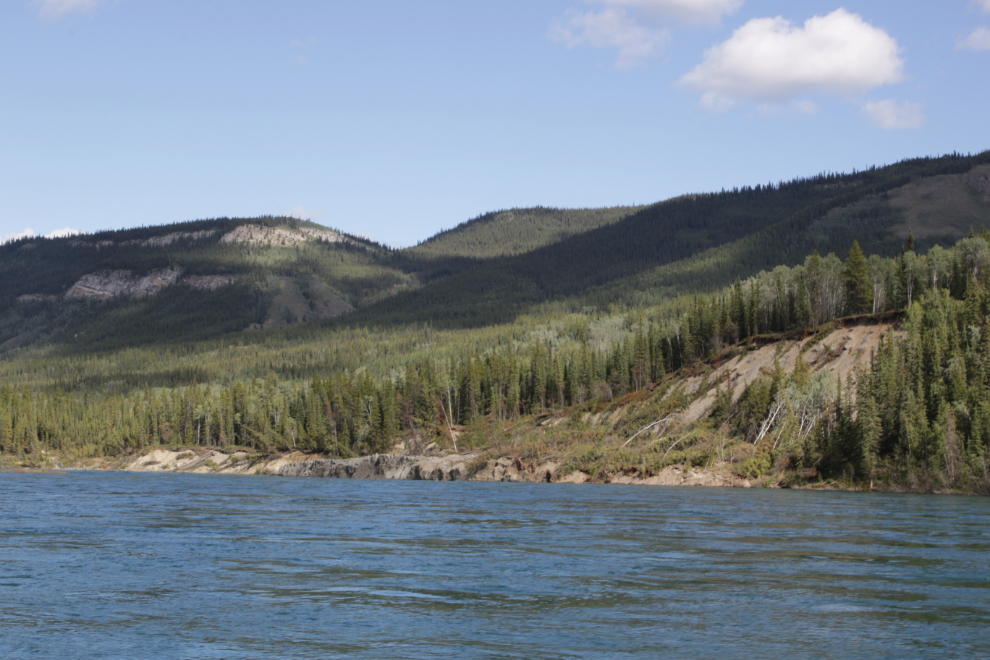
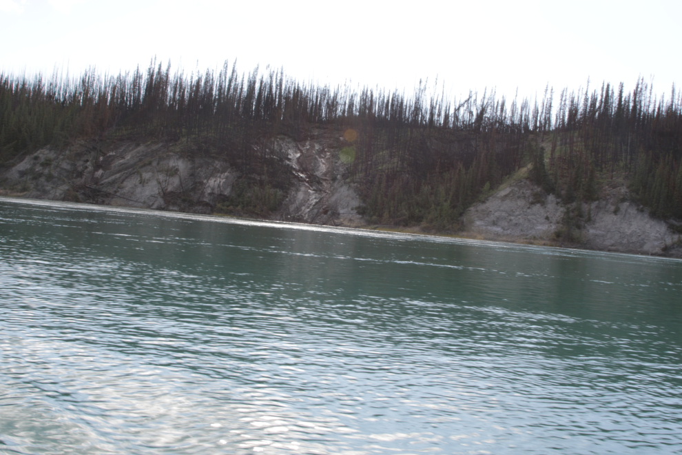
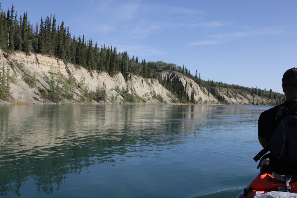
The Thirty Mile was designated a Canadian Heritage River in 1991 for its outstanding natural, historical and recreational features. The CHRS website says in part: “With its crystal clear waters, deeply incised tributary channels, slumping and undercut river banks and almost perpendicular sand and gravel bluffs nearly 100 metres high, this is perhaps the most scenic segment of the Yukon River. The nomination of the Thirty Mile to the CHRS was based largely on its close connection with the famous Klondike gold rush and paddle-wheeler eras on the Yukon River. At its peak in 1898, the Klondike gold rush saw nearly 30,000 gold seekers in 7,000 boats travel the Thirty Mile en route from Bennett, B.C. to the goldfields near Dawson City. The Thirty Mile was the most difficult part for the run between Whitehorse and Dawson City. Its strong current, shifting shoals and treacherous rocks claimed more ships than any other stretch of the Yukon River. Simply marked gravesites are found along the Thirty Mile, and some locations are named after the boats that were wrecked there, such as Domville Creek, Casca Reef, La France Creek, and Tanana Reef.”
The first photo was shot at 3:15, while the wind and waves from the lake were still affecting paddling, though that ended once we passed the bend just ahead.
At the bend mentioned above, we got caught in a surprisingly huge and powerful eddy that sent us back towards Whitehorse for a minute or two!
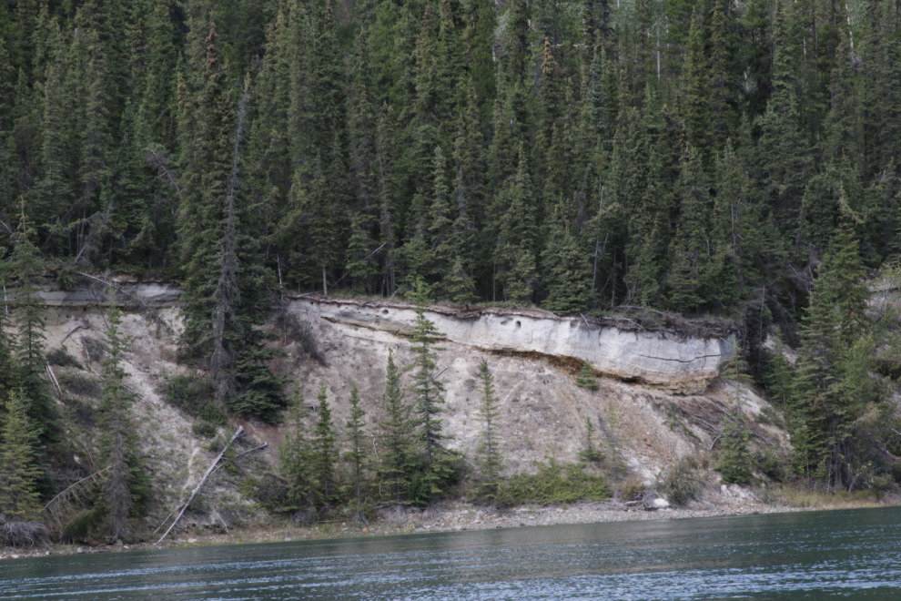
A layer of volcanic ash is found throughout much of the southern Yukon. Known as White River ash, it came from the eruption about 1,250 years of a vent on the shoulder of Mount Churchill, at the head of the White River, near the Yukon-Alaska border. That vent is now under the Klutlan Glacier. Usually only a few inches thick, this layer is particularly thick.
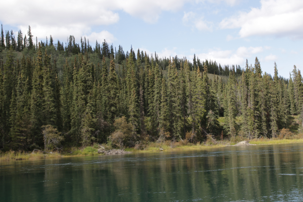
In the next photo there are two beaver lodges built into the bank of the river. Though we would see many of them, we never saw a beaver.
The scenic value of the Thirty Mile is undeniable. This is country for solo or two-person travel – experiencing wilderness like this well requires silence and as few distractions as possible.
At 4:30 we came to a large landslide that appeared to be very recent.
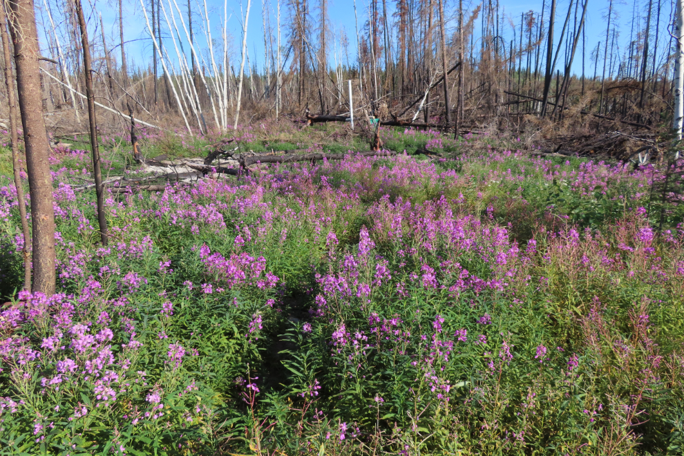
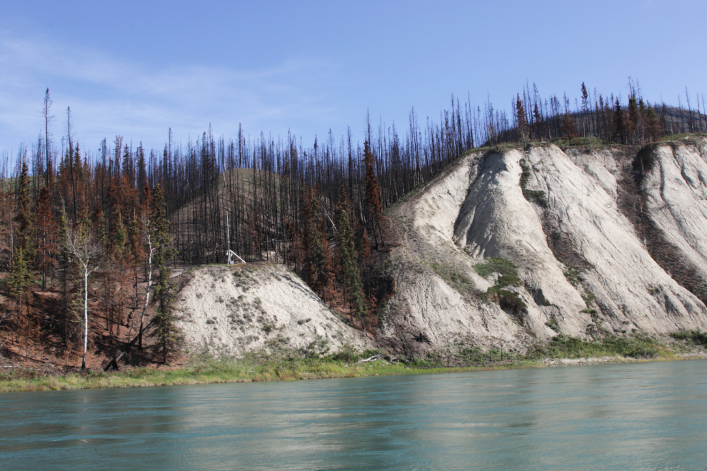
At 5:00 we reached Maunoir Butte and the start of a huge, recent wildfire.
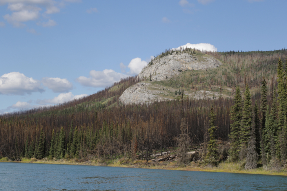
As the desired end of our paddling day approached, the wildfire damage was not looking good for campsites surviving.
The loss of ground cover from the fire appeared to be triggering frequent landslides.
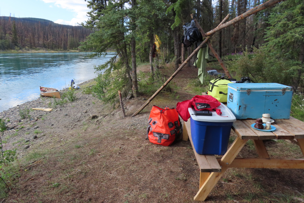
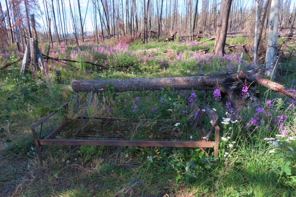
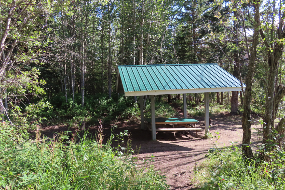
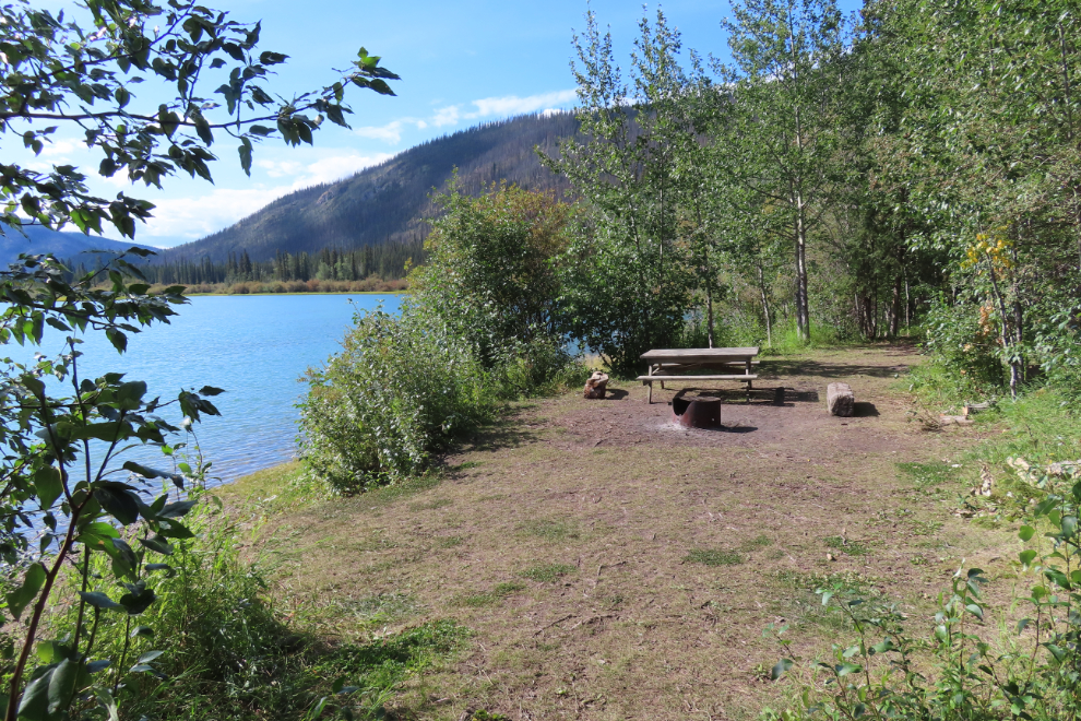
Rather incredibly, we found a lovely Laberge Renewable Resources Council (LRRC) campsite just below Mermus Point, 14 miles from the start of the Thirty Mile. Although the toilet was destroyed by the fire, it had been replaced, and the main camping area is in a tiny piece of forest that had somehow been saved.
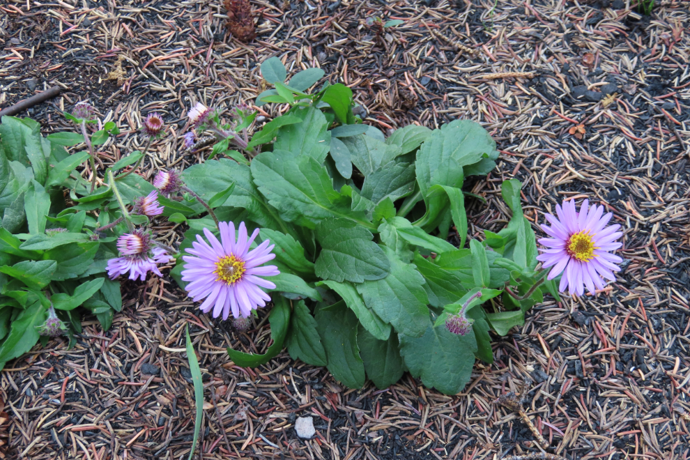
Some beautiful Alpine aster (Aster alpinus) along the trail to the toilet.
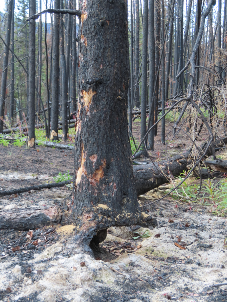
Close to the toilet, this tree was so undercut by the fire it looked like a person could push it over.
I heated up burgers for dinner (with patties I made over the barbecue at home), with potato salad.
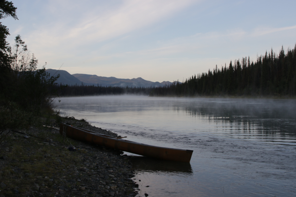
The next morning – Thursday, August 14th – was chilly but beautiful, with a bit of fog rising off the river. At 07:00 when I shot this, it was probably about 4°C.
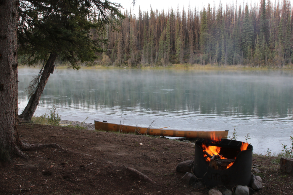
Fifteen minutes late I had a fire going for when Steve got up.
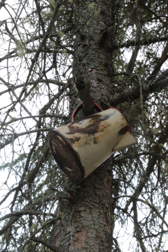
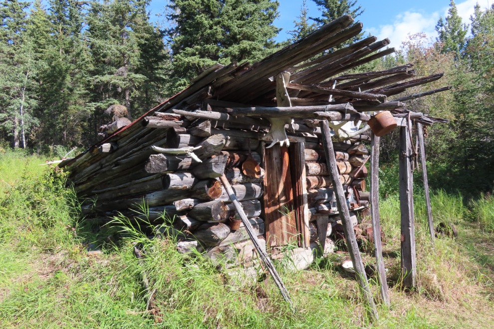
There were a few artifacts from the old days placed around the site, including this coffee pot in a tree.
Before departing, Steve launched his drone, but four crows were very unhappy about it so he just got this one photo of our camp then landed.
August 13/14: Camp #3 – Lat: 61.525401, Long: -135.140311. Elevation: 2,043 ft.
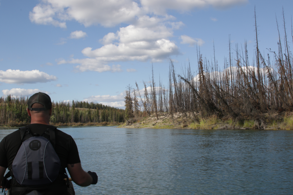
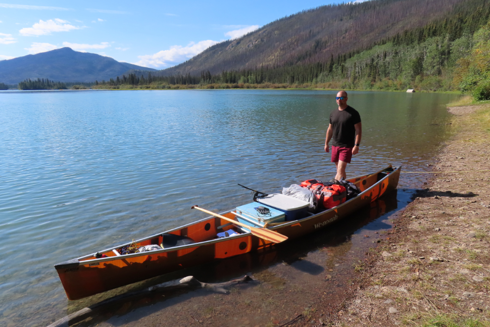
We were back on the water just before 09:30, and it looked like we had a spectacular day ahead.
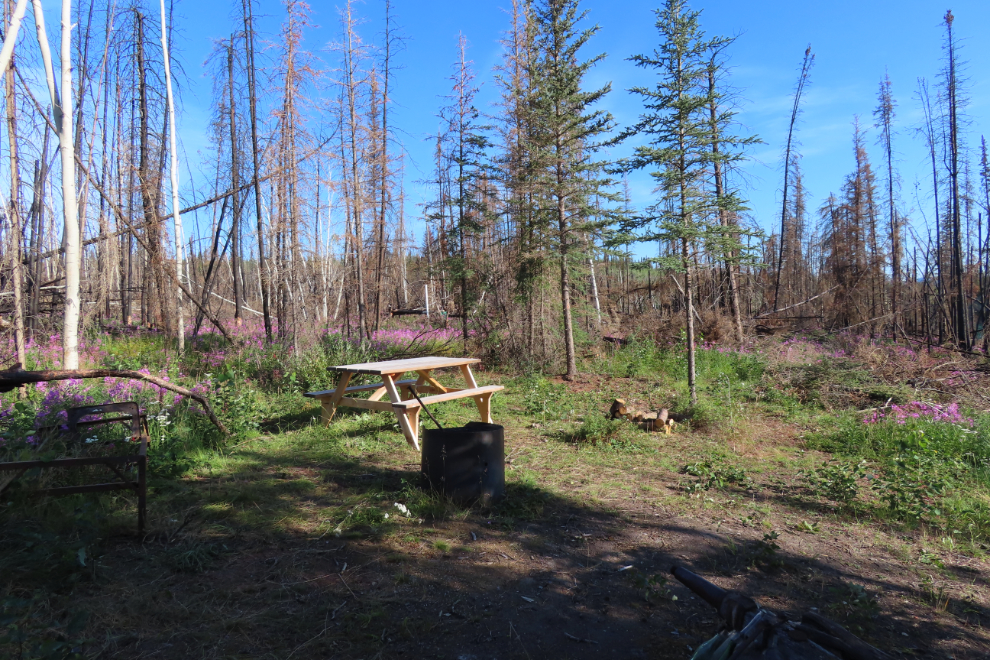
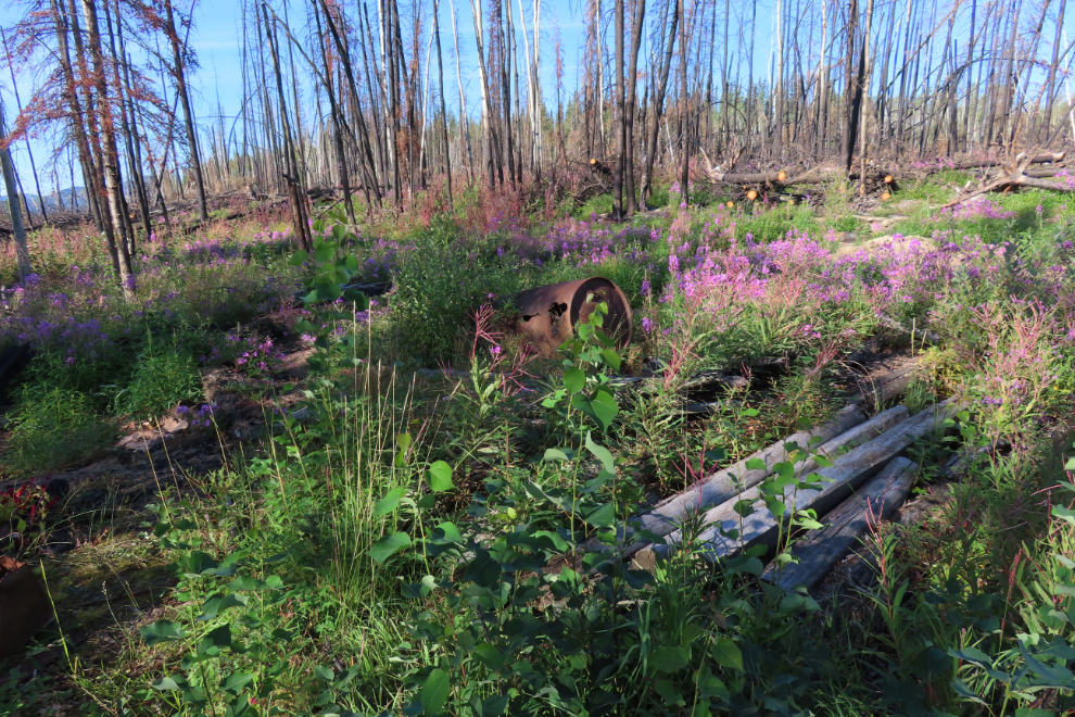
One of the historic sites I most wanted to re-visit was the 17 Mile Wood Camp, one of perhaps 150 wood camps along the Yukon’s rivers where fuel for the sternwheelers was cut. As we approached, though, I knew what we were going to find.
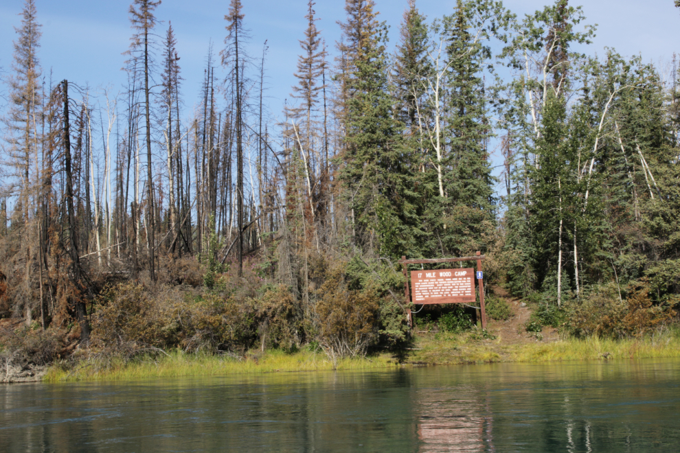
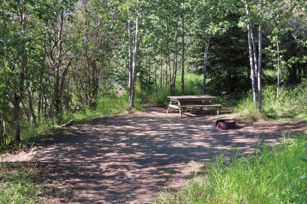
Only the heritage sign had survived the fire, though the picnic table and toilet had been replaced. The next four photos show the site as it exists now.
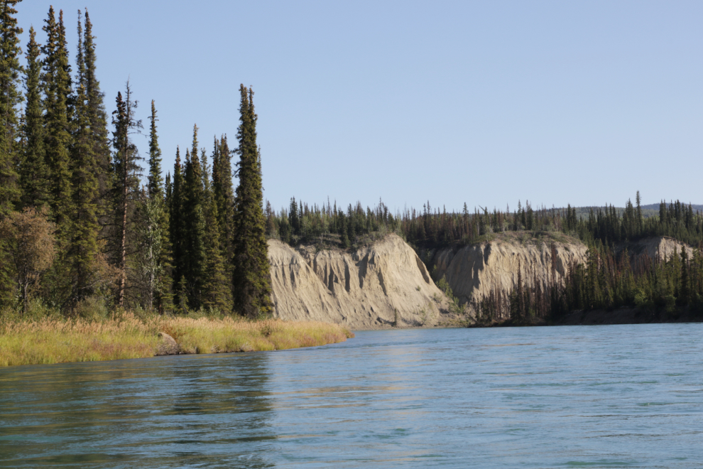
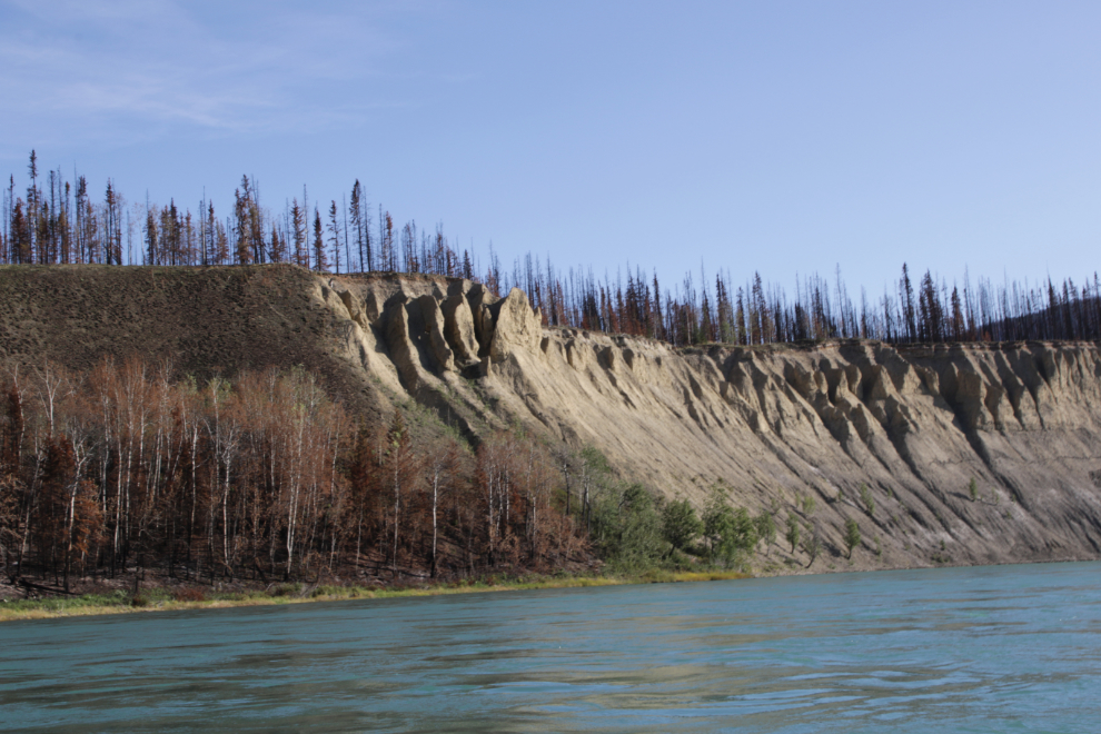
A few minutes after leaving 17 Mile, baby hoodoos, at 10:00.
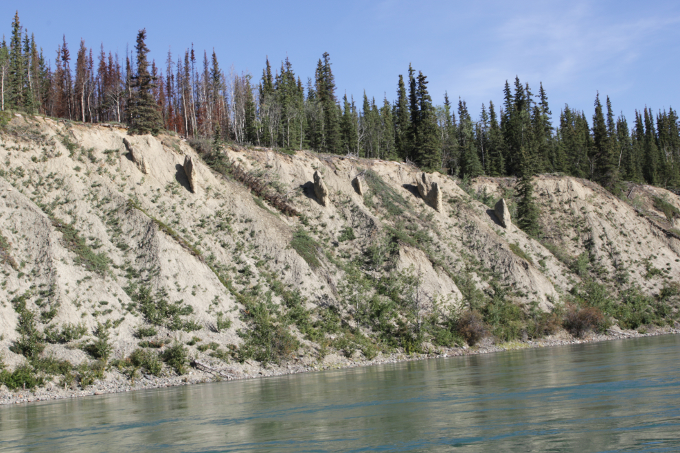
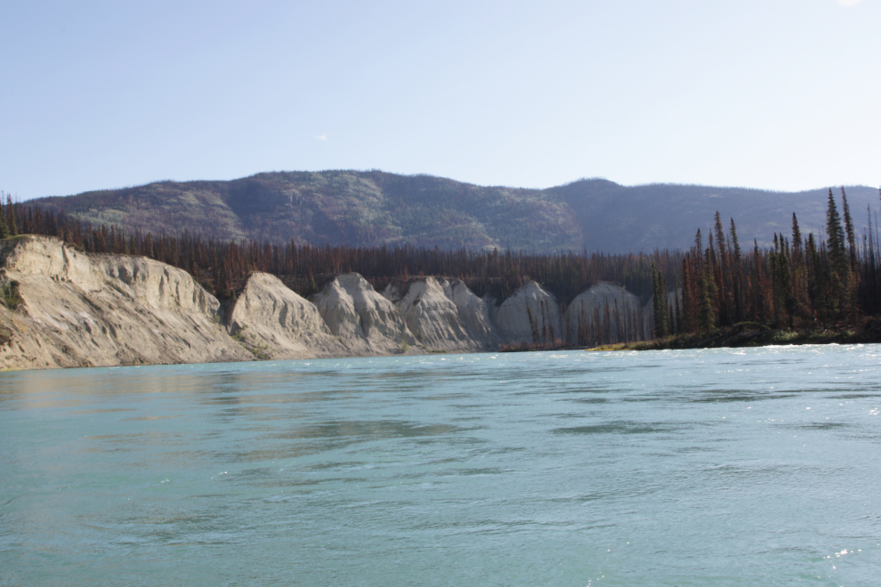
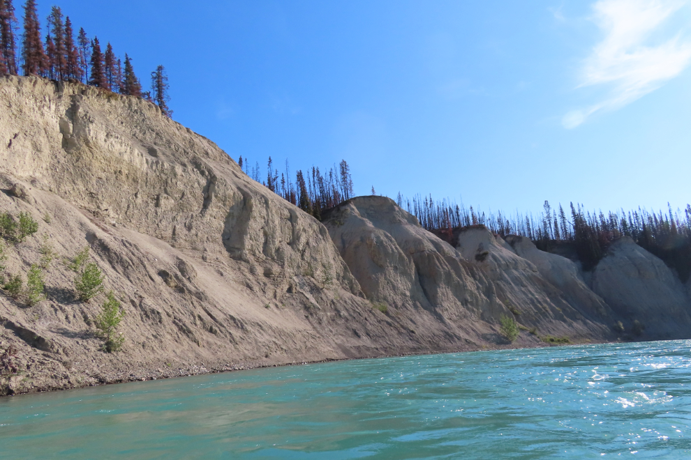
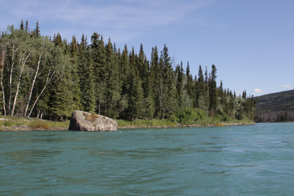
The cutbanks in their infinite variety are the main landmarks along the Thirty Mile.
Having Mike Rourke’s guide to the river open in front of me all the time was invaluable in avoiding problems such as the “riffles” just above Cape Horn at 10:33 (seen to the right side of the river). No doubt some people enjoy running them but we chose not to.
A wildfire from earlier this year got very hot in a few places.
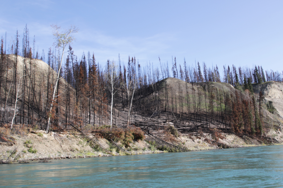
Hot spots were still smouldering at many places.
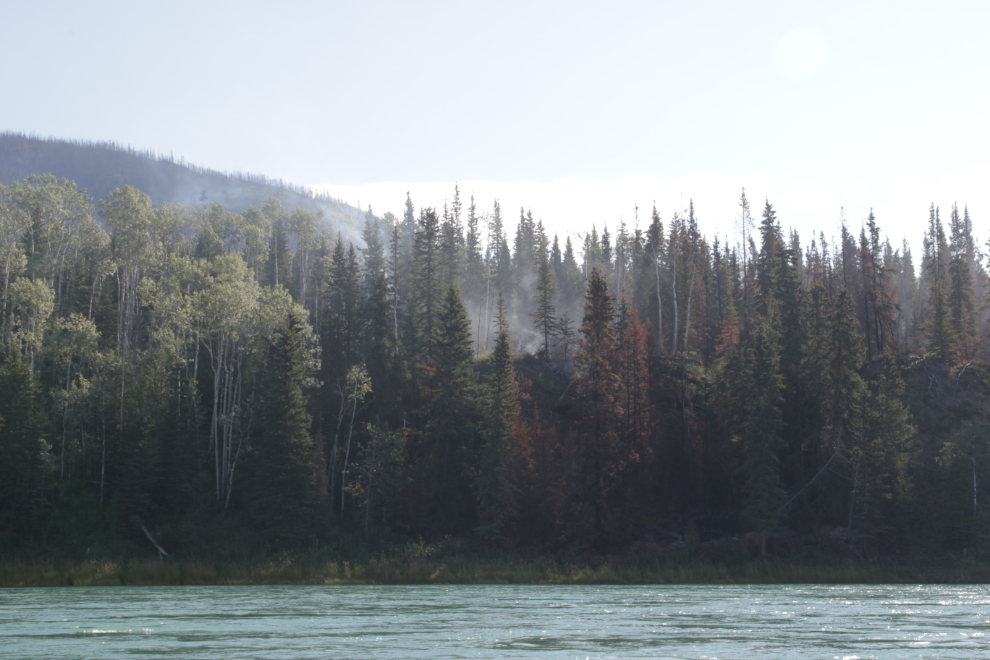
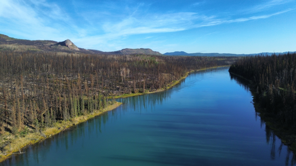
The contrasting colours were sometimes quite dramatic.
Mike notes “Big Rock” near the lower end of the Thirty Mile to confirm our exact location.
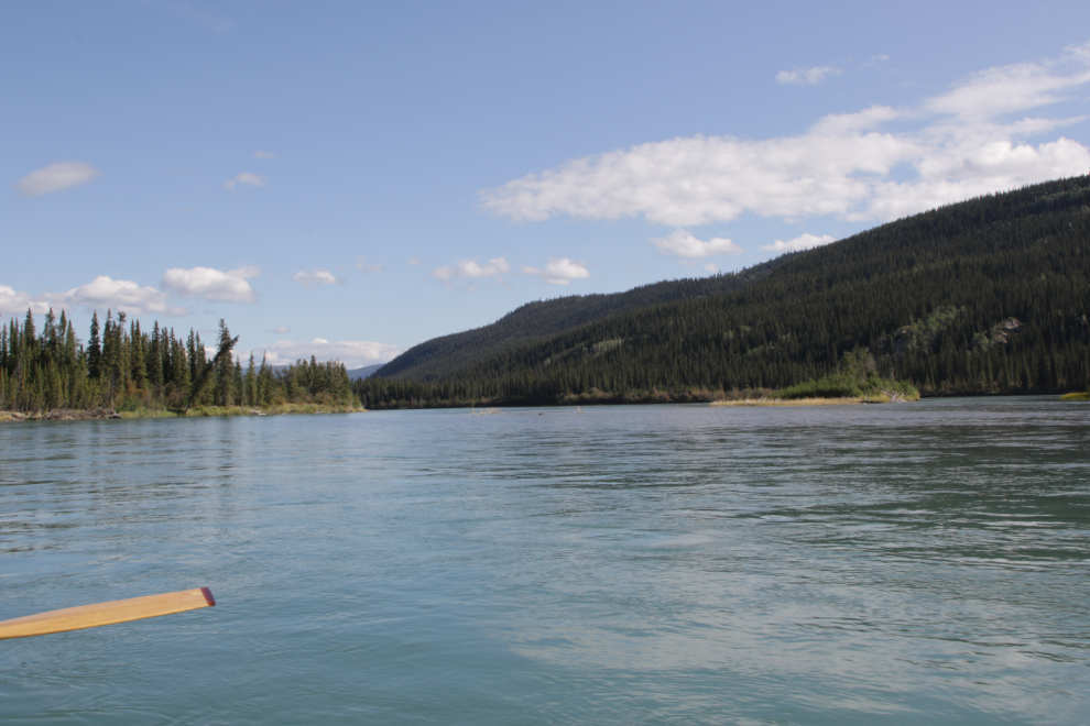
Nearing the junction with the Teslin River, where the size of the river we were paddling on doubled in size. The Thirty Mile River section ends at the Teslin.
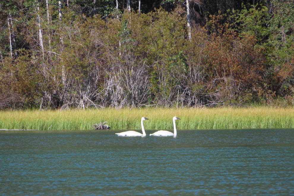
It was wonderful to see a pair of Trumpeter swans quite close and get no sign of alarm from them as we drifted silently past.
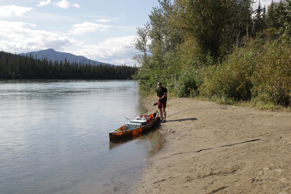
At about 11:30 we landed at Hootalinqua, a now-deserted community that served river traffic starting in the early years of the Klondike Gold Rush.
There are nice campsites at at least three locations around the historic buildings, but although many people obviously camp there, that wasn’t our interest.
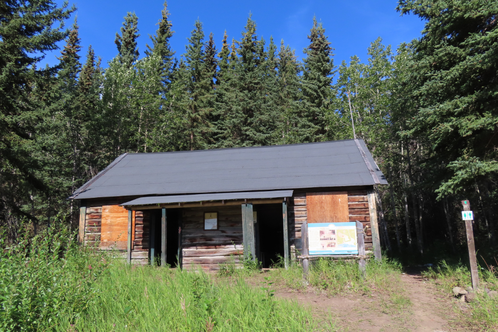
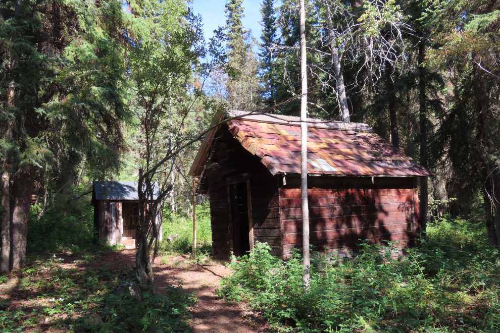
The main building at Hootalinqua now is the telegraph station that dates to 1900. It was stabilized and re-roofed in 1982, but it could use some more love now.
Behind the telegraph station is a shed with the roof covered with tin from flattened gas cans, and a double-seater outhouse.
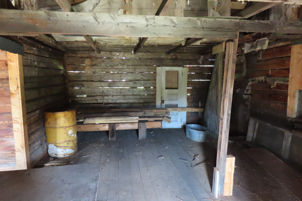
I expect that the most-loved building at Hootalinqua is this wonderful cabin or tool shed. In 1997 when we visited, it was in good condition and you could walk inside safely, but that’s no longer the case.
Two more camping areas, on opposite sides of “downtown” Hootalinqua.
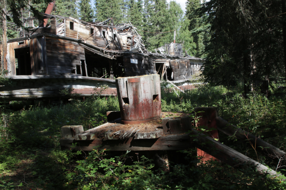
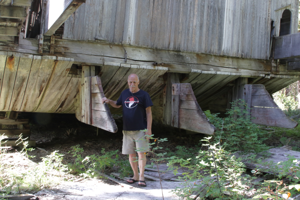
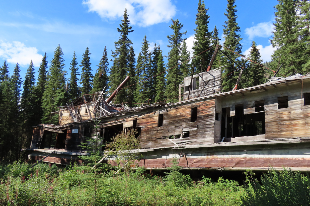
It was 12:15 when we landed at the Hootalinqua Island shipyard, or just Shipyard Island, just downriver from the community.
The initial view of the shipyard screamed “neglect” – the government has clearly lost interest in the river’s historic resources, and that’s perhaps clearest here.
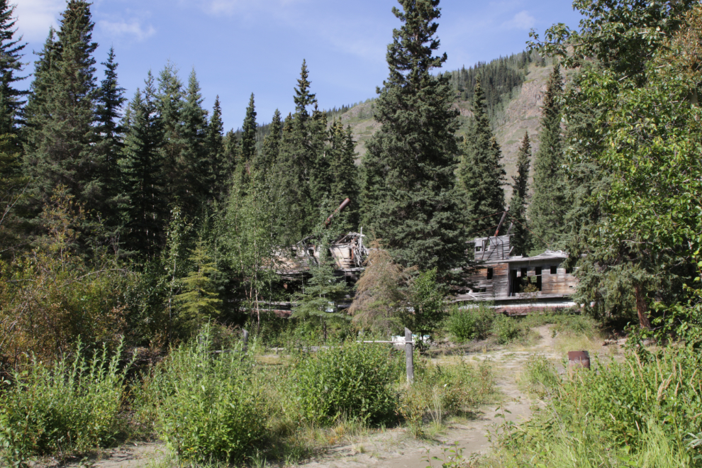
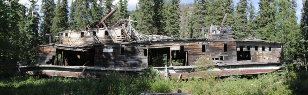
This interpretive sign gives a brief history of the 130-foot-long sternwheeler that remains there, originally called the Evelyn and later the Norcom.
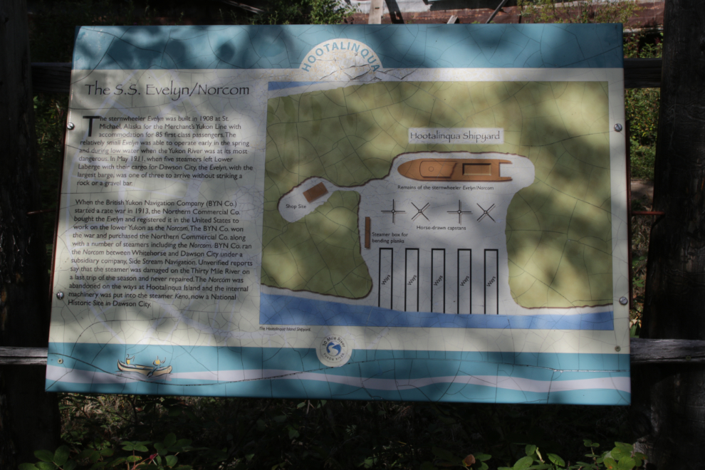
A member of my Yukon History & Abandoned Places group at Facebook, though, reported a few months ago that the sign also shows an impossible situation. It shows the boat on the wrong side of the ways and capstans – it had to have been hauled up from the other side of the island! The ways and capstans would have been used for other boats on this side.
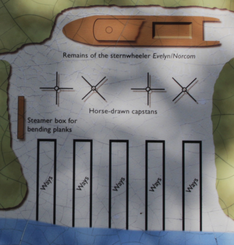
One of the capstans with the boat.
A 3-photo stitched panorama of the entire boat.
Me at the bow – both the boat’s names, Evelyn and Norcom, are still visible.
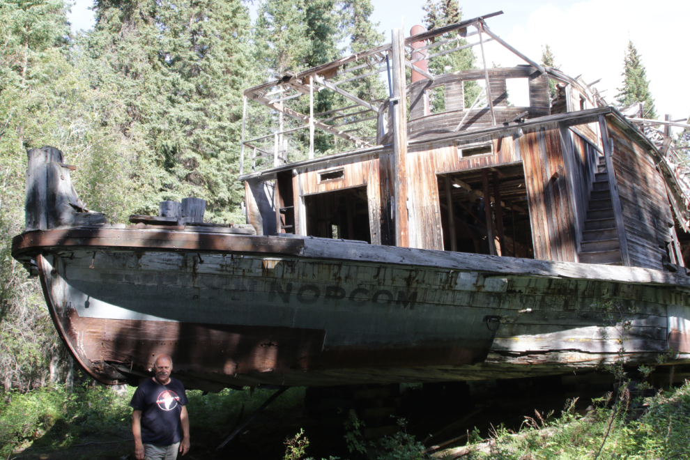
Me at the stern – the rudders still turn.
A final photo as we walked back to the canoe.
From Shipyard Island it would take 2 days to reach Carmacks – that part of the story is next.
Living history! I love it!!
Ellen