Exploring Shetland, from Lerwick south
This is blog post #27 from our tour of northern Europe. On Thursday, July 24th, we anchored off Lerwick, the main town on the Shetland archipelago, and tendered into town. We began by looking around the town, then went on an excellent bus tour from there to the southernmost point on the island, Sumburgh Head Lighthouse.
Picking photos for the blog is tough. There are 299 photos in the Shetland album, and there is SO much I wanted to show you! But I kept editing and editing until I got it down to a reasonable number to post. Barely reasonable perhaps – there are 79 photos 🙂
Lerwick has a population of about 7,500 but about half of the islands’ 22,000 people live within 10 miles of the town, so there is a lot of open country to explore – without trees to block the views. 🙂
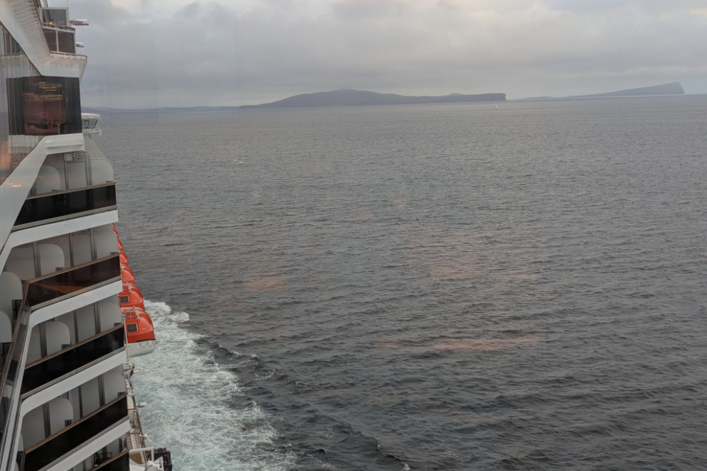
Shetland first came into view from my work station on Deck 9 of the cruise ship Nieuw Statendam at about 05:00. I commented on Facebook: “The odds of ever seeing the Faroe Islands or Shetland were so remote, they never even made it onto The List, but here we are. Amazing.”
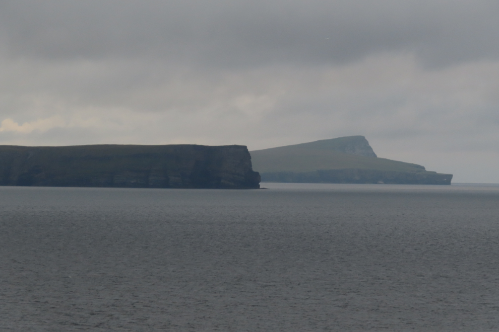
A closer look at the dramatic headlands on the island of Bressay.
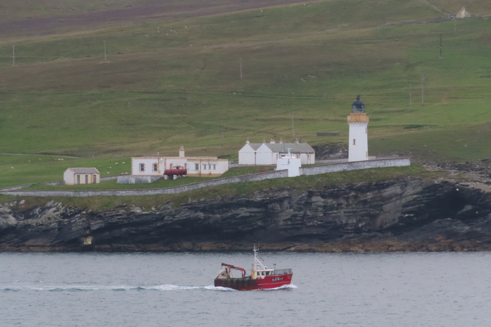
Just before 06:00 I shot this photo of the Bressay Lighthouse (one of many I got of it from various locations)…
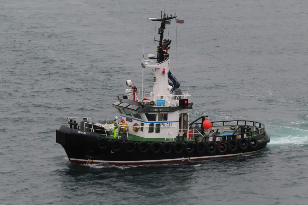
…and a couple of minutes later our pilot arrived on the tug Knab.
Fifteen minutes later we were anchored at Lerwick, and our tenders were soon launched.
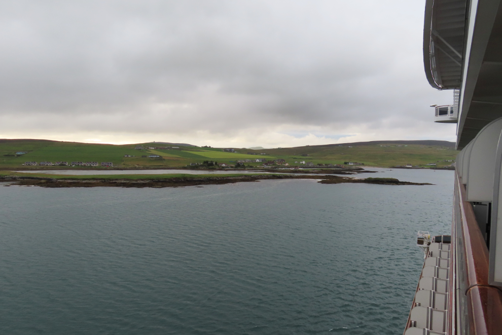
As soon as Cathy and I stepped ashore we knew that Lerwick would be one of our favourite ports, and at the end of the day that proved to be true.
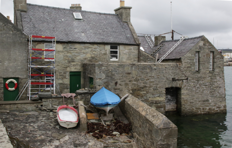
When I posted this photo on Facebook, a friend asked “Is that Jimmy Perez’s house?” I replied “Probably not – I had never even heard of the show until yesterday.” Actually it is Jimmy Perez’s house and I had heard of the show just had never seen it. And that’s Bain’s Beach, which is seen often in the show apparently.
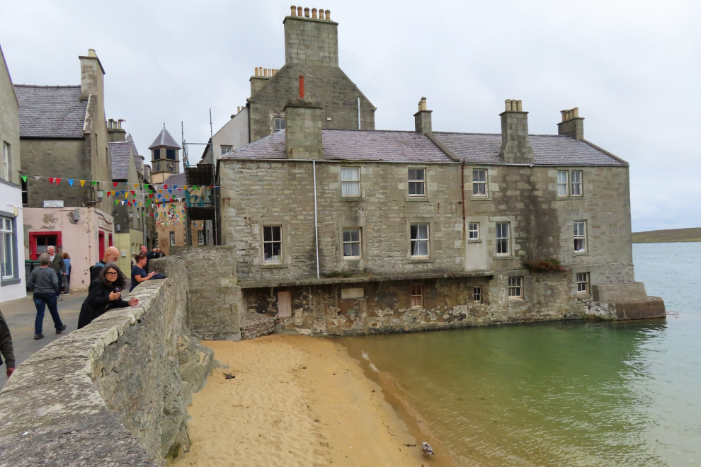
The lifering to the left says that this is “The Lodberrie” (which was the fictional Jimmy Perez’s house). The Shetland Amenity Trust describes a lodberrie as “a house, store and courtyard built into the sea, with a door in the sturdy sea wall through which goods could be moved. In 1814 there were 21 along the shorefront, most reflecting the owner’s name, and many became associated with smuggling.”
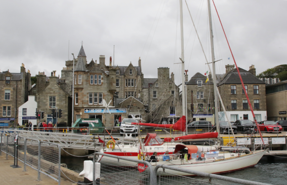
Lerwick is enough to make a photographer’s head explode – you need to have your head on a swivel to capture a few of the opportunities.
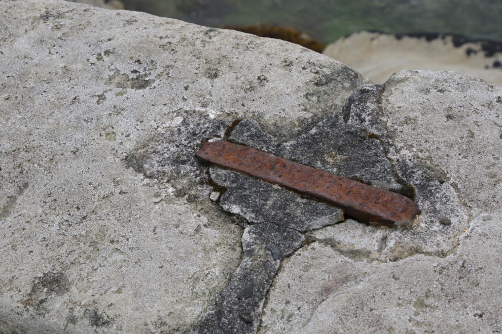
Heavy iron pins hold a seaside stone wall together.
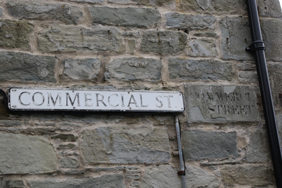
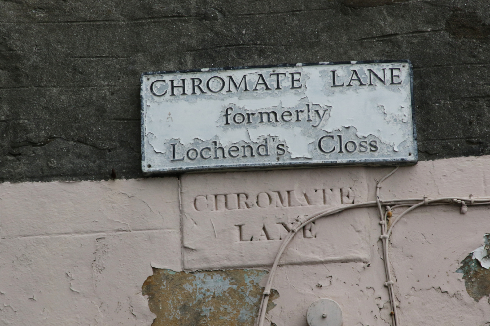
Even the street signs are interesting – adding a “modern” metal sign to the original concrete one, and changing the name of many streets.
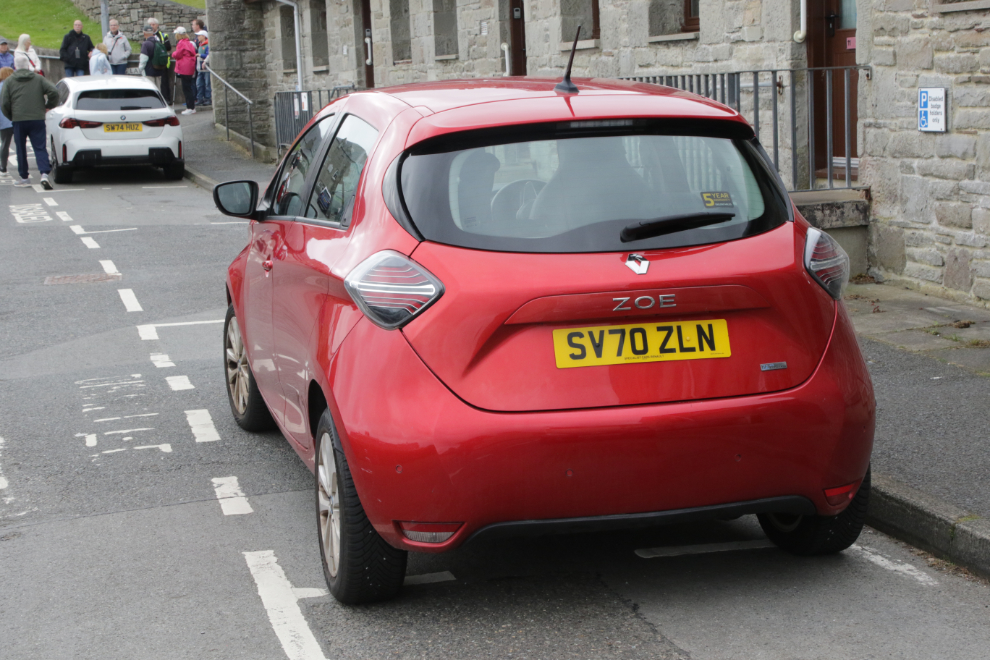
Shetland licence plates are as basic as they come 🙂
The buildings in the background were “Homes for Widows.” They were built by Arthur Anderson, a native and Lerwick, Member of Parliament from 1847-52, and chairman of the Peninsular and Oriental Steam Navigation Company, “In Memory of His Wife.
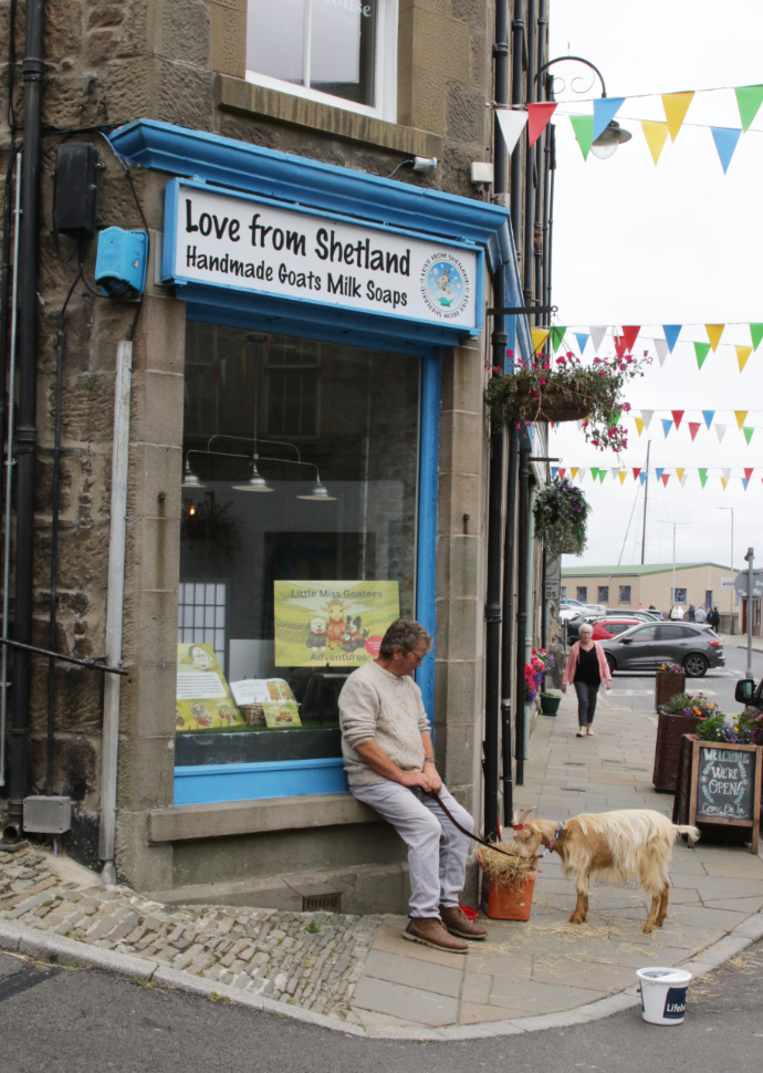
What better advertising for a shop selling Handmade Goats Milk Soaps than a goat?! 😀
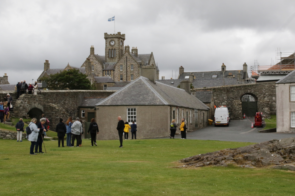
At the edge of downtown, we came to the walls of Fort Charlotte, which “has stood guard over Bressay Sound for 35 years.”
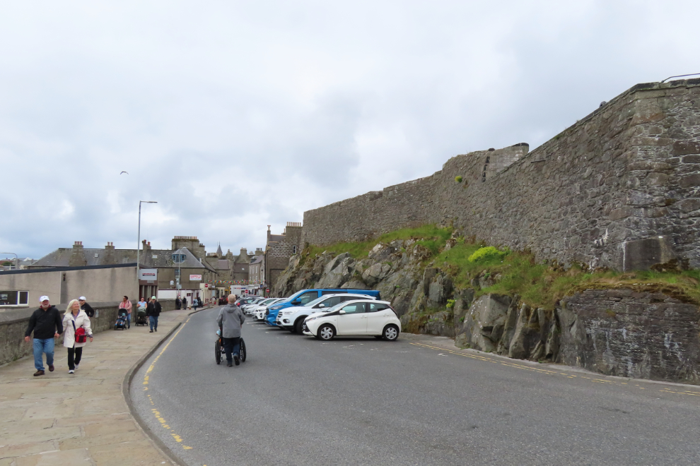
I could have spent at least an hour at the fort, but we were running out of time before we had to get back to the dock to catch our tour bus. Fort Charlotte’s story is lengthy, extremely interesting, and fairly well interpreted with signs.
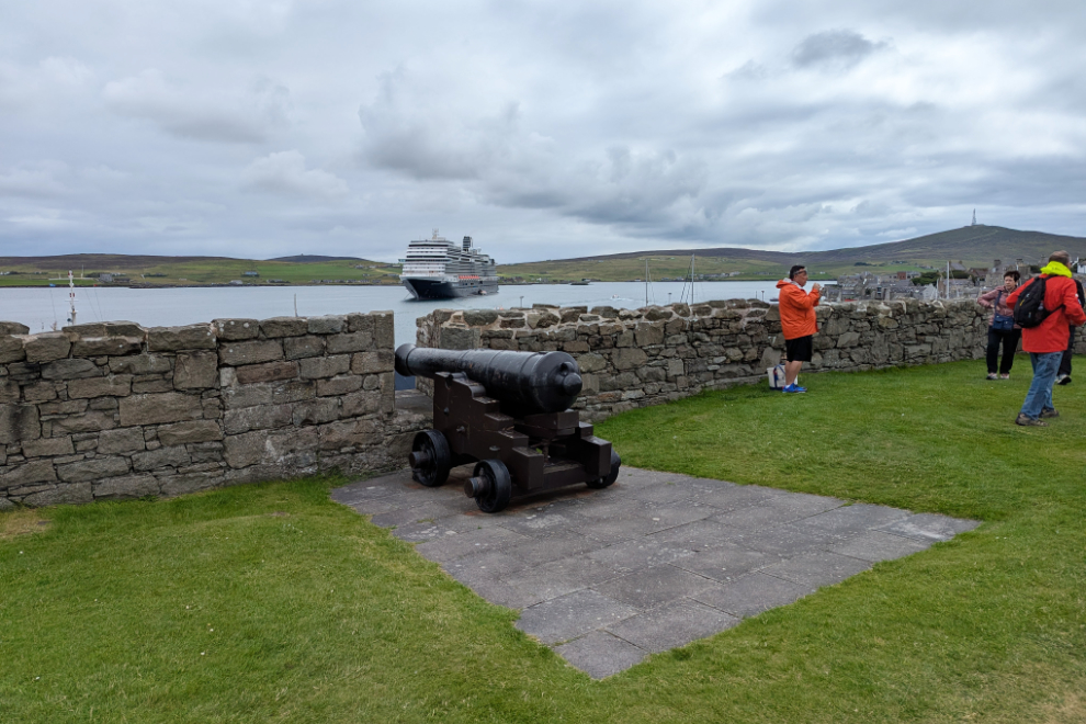
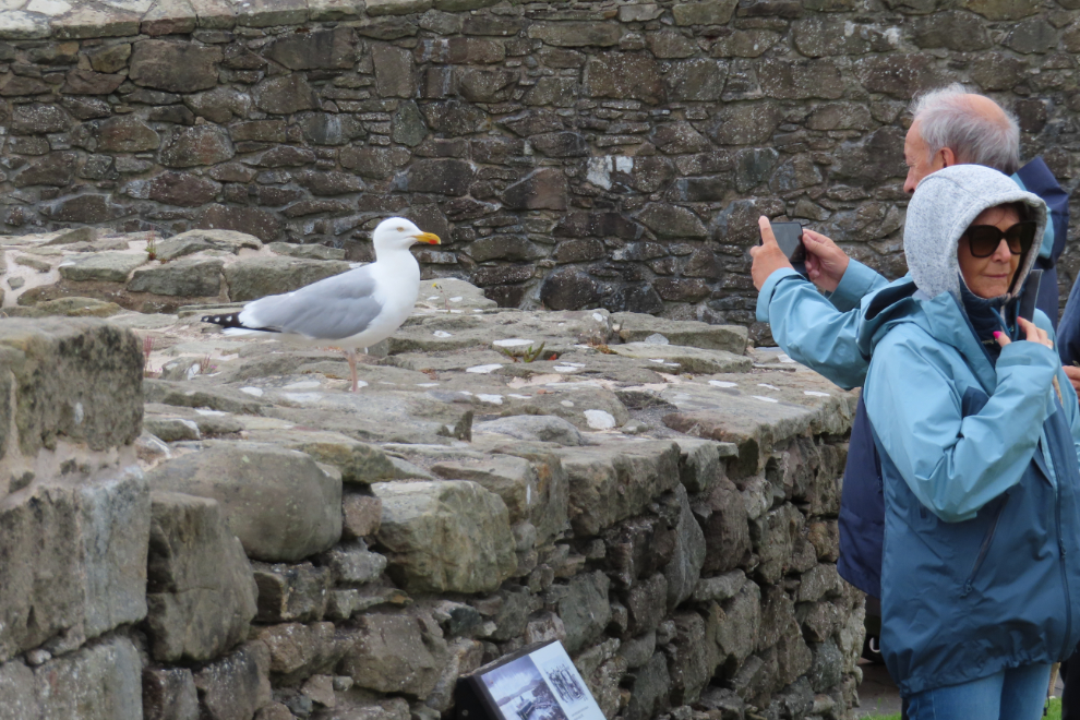
Even the birdwatching is quite good at the fort 🙂
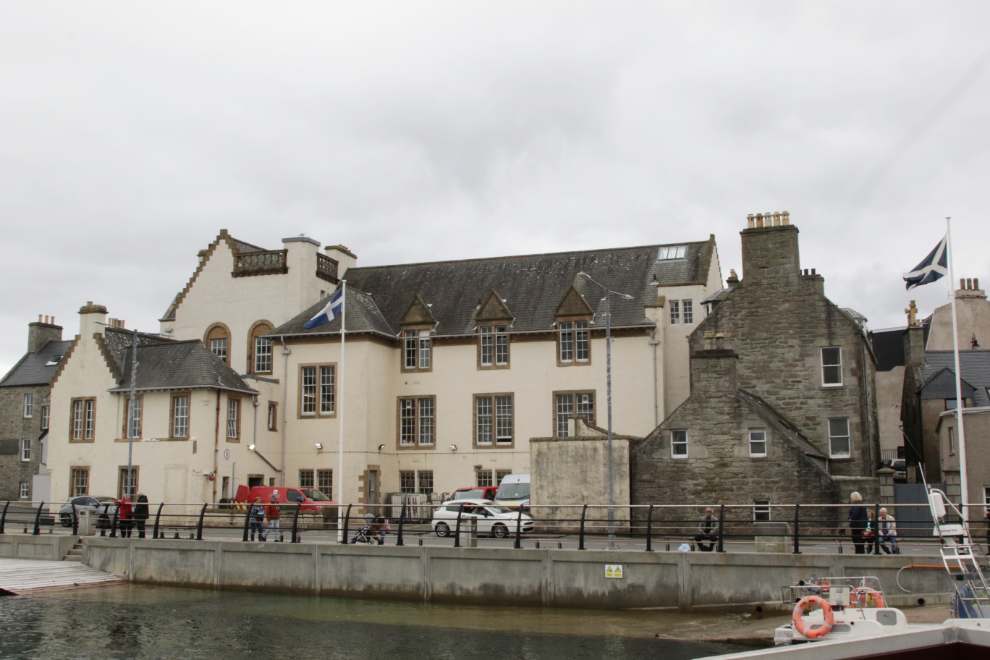
Out on the dock was a very good place to get photos of the post office and a few other buildings.
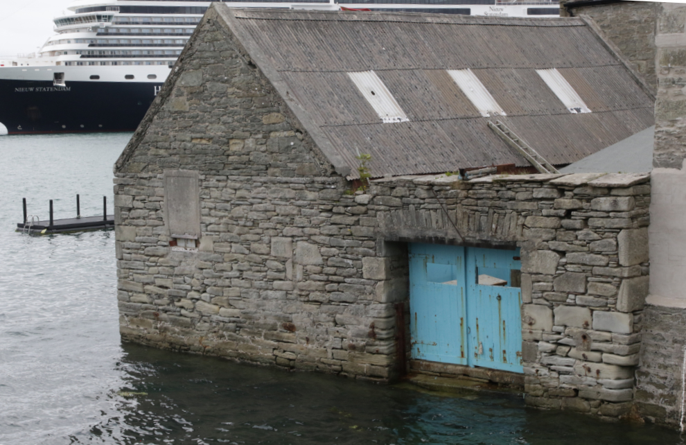
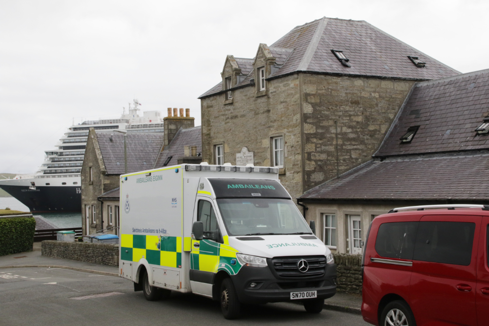
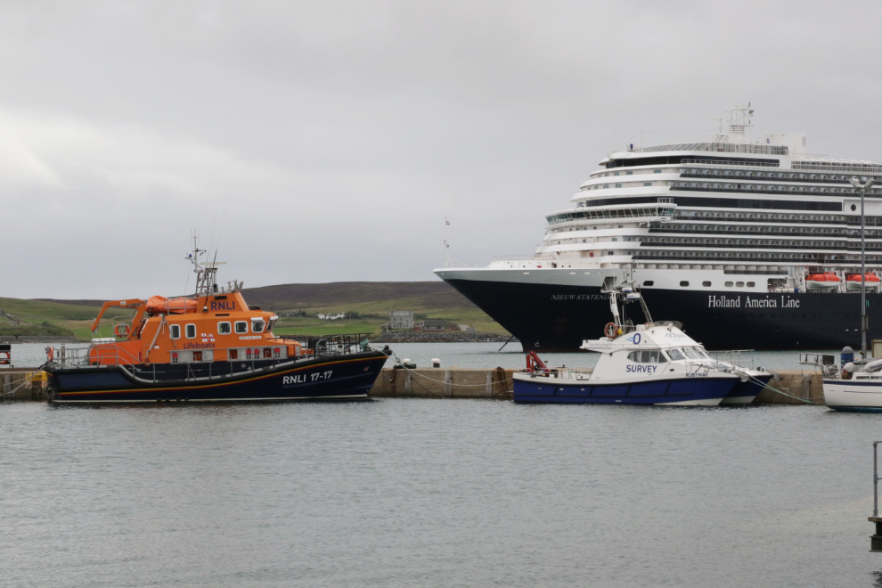
As with most of the communities we visited, the sea, while it allows people to live in these places, also takes many lives. The rescue services, in particular lifeboats, are a crucial component of life.
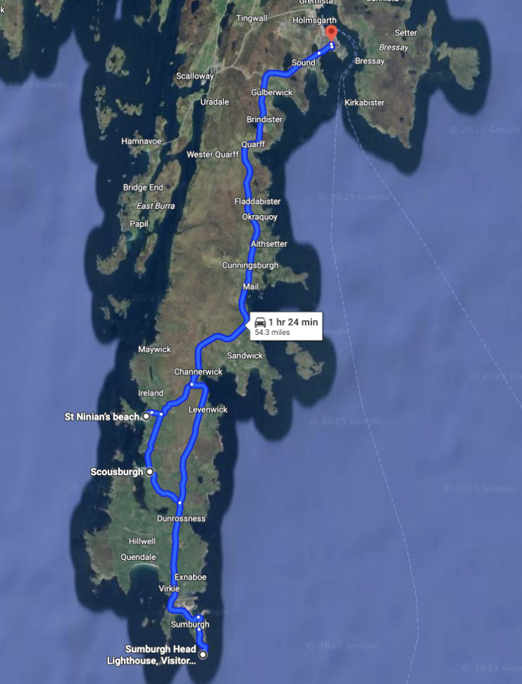
Okay, let’s get on the road. Here’s a map of our basic route. See an interactive map here.
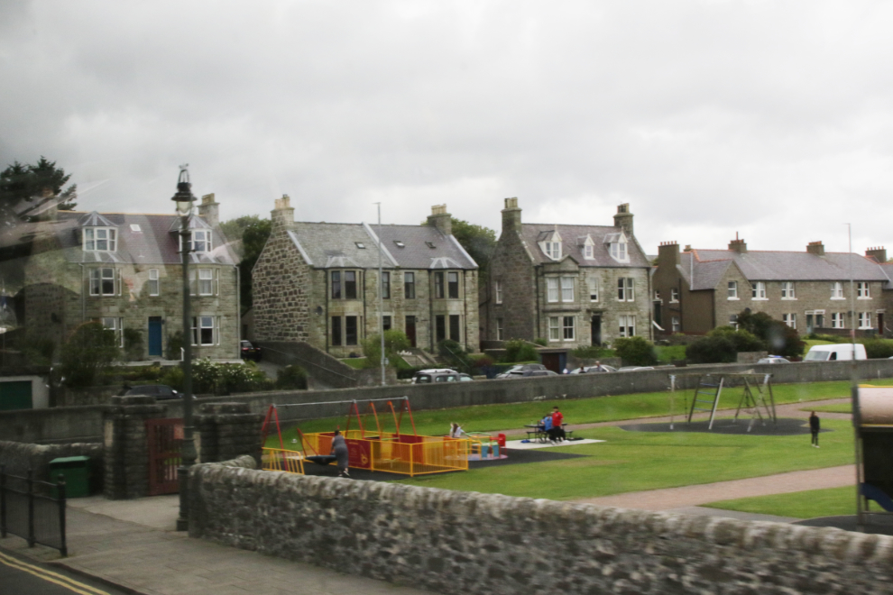
A few minutes before our scheduled 12:45 start time, we were off, beginning with a loop around town. The only photo worth sharing from that is this particularly fine residential area.
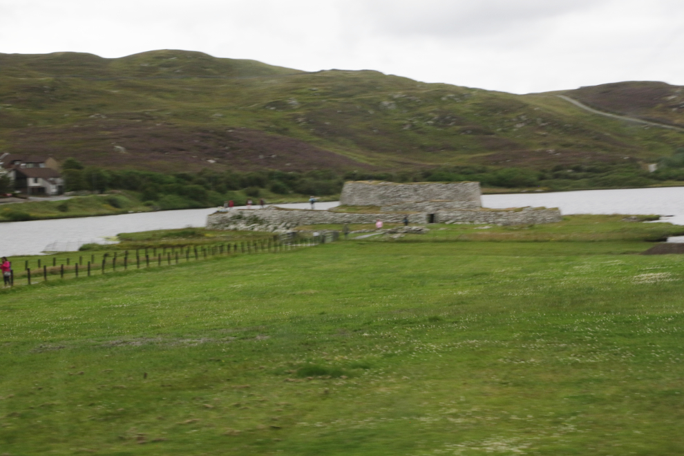
We passed by the Broch of Clickimin site on the shore of Clickimin Loch. It consists of the excavated remains of a circular Iron Age fortification (the broch) and an earlier Bronze Age farmstead. The Iron Age is from 1200 BC to 550 BC, the Bronze Age from 3300 BC to 1200 BC.
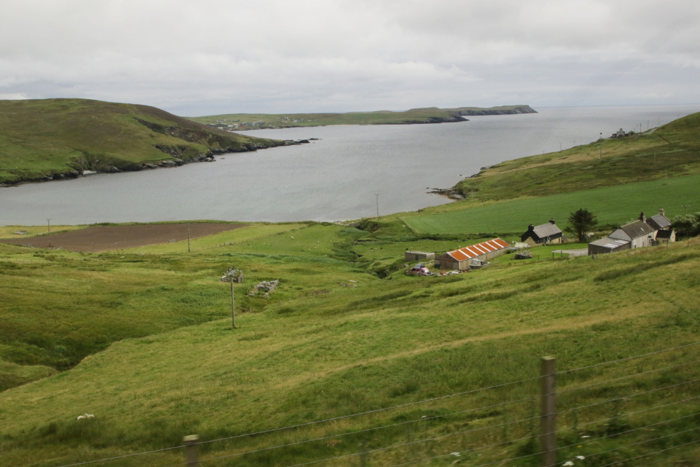
Within minutes we were away from the town and out in the country that I quickly fell in love with. There were lots of farms and crofts and grazing fields for sheep and cattle, much of the land is undeveloped.
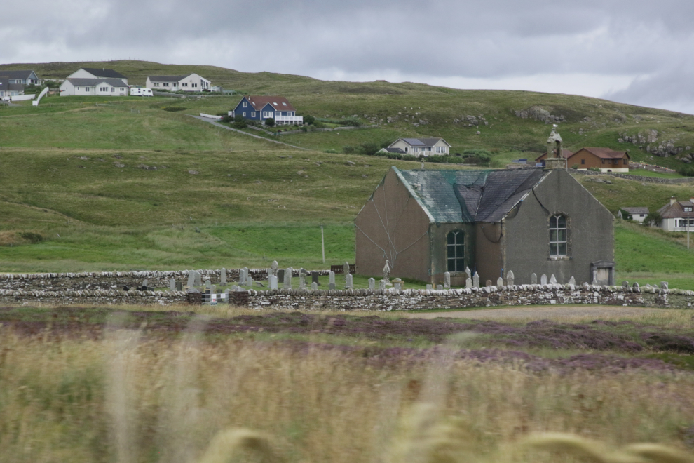
The Quarff Parish Kirk, designed by John Davidson and Thomas MacFarlane, was built in 1828-1829. Although the church was abandoned over 30 years ago and is on the national Buildings at Risk Register because of its deteriorating condition, the listing notes that the graveyard is in use and well-cared for.
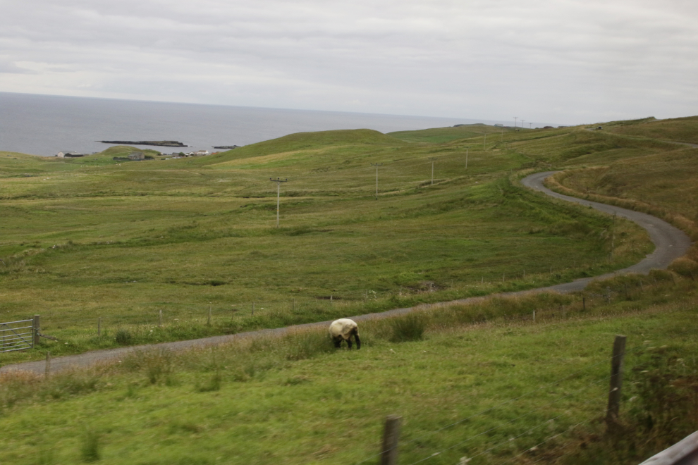
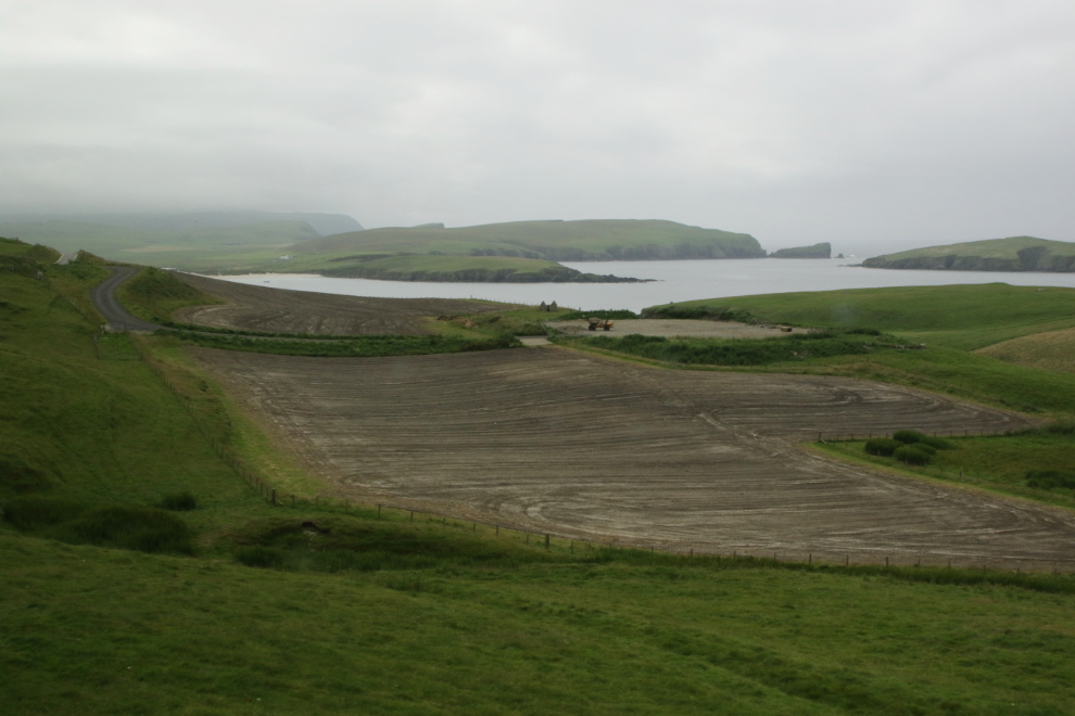
Every turn in the road brought a new vista, almost always with something worth photographing.
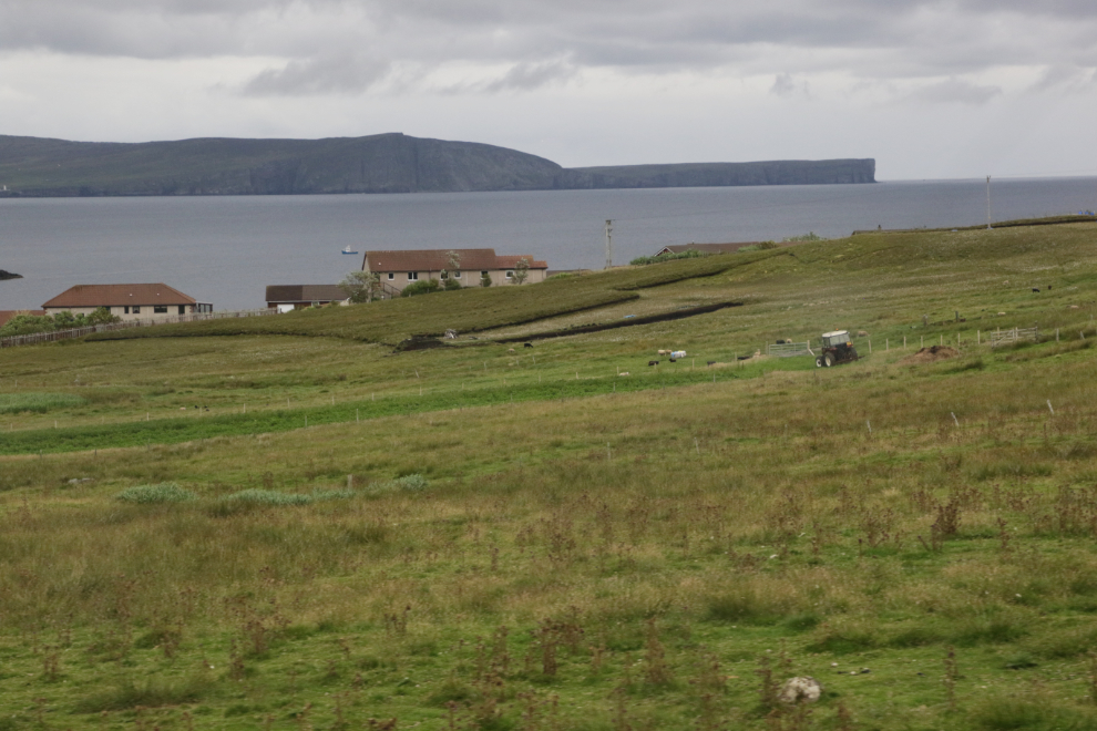
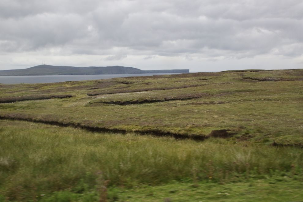
We were soon into what I took to be peat lands. That turned out to be correct, and during the coming hours we would learn a lot about the harvesting on peat for home heating fuel. About 50% of Shetland is peat land. Peat, composed mostly of compacted Sphagnum moss, regenerates at a rate of about 1mm a year, so these peatlands have taken thousands of years to form.
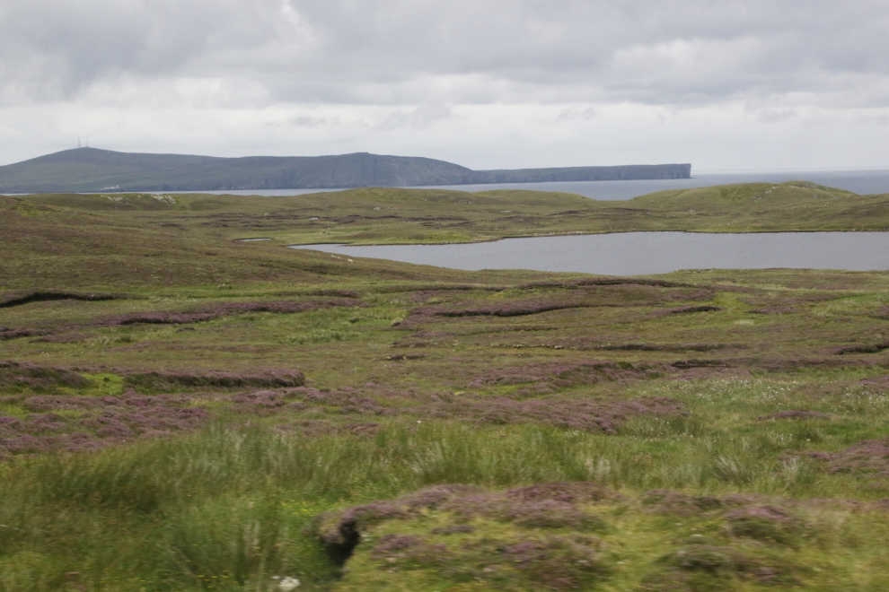
In some areas the heather growing over the peat was blooming and the slopes were turning purple.
Would I ever have loved to be down there on my e-bike!
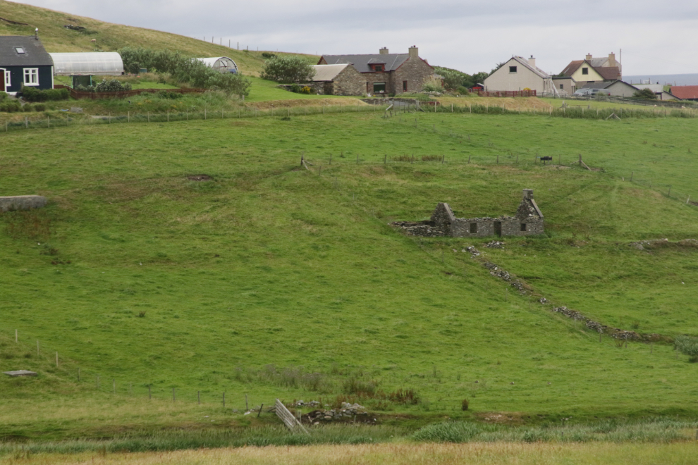
There are ruins of stone buildings everywhere. While in North America we generally think of stone as building material for rich people, on Shetland there are few trees but plenty of rock, so it’s the usual material used.
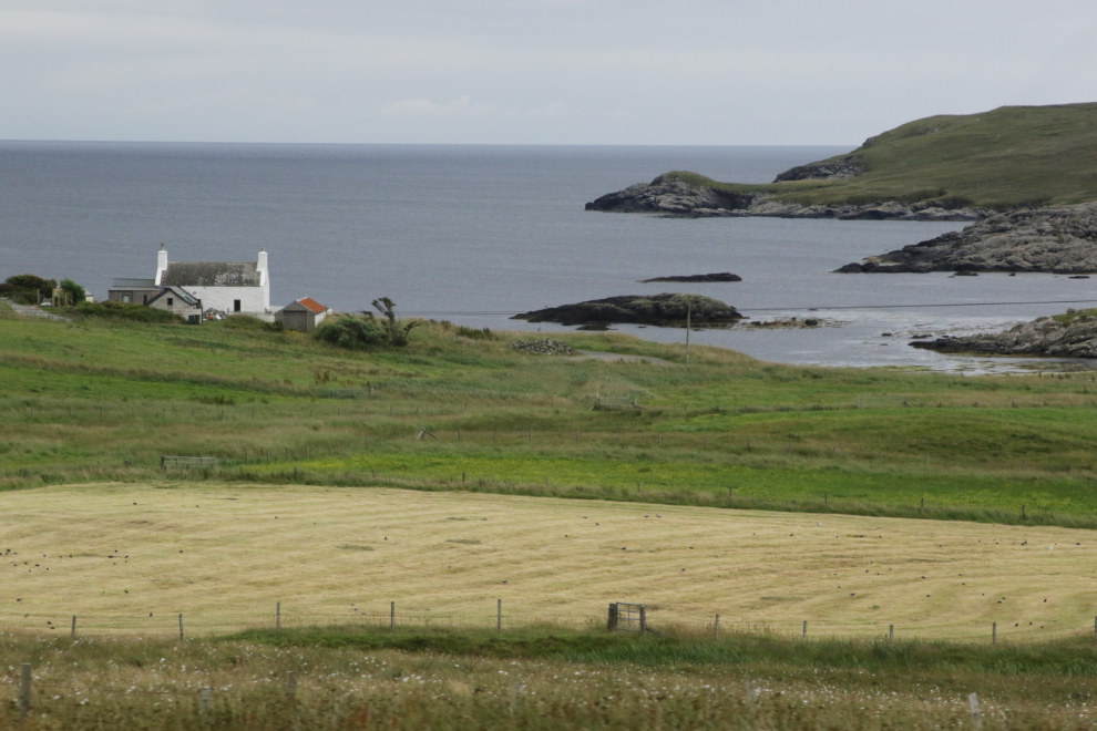
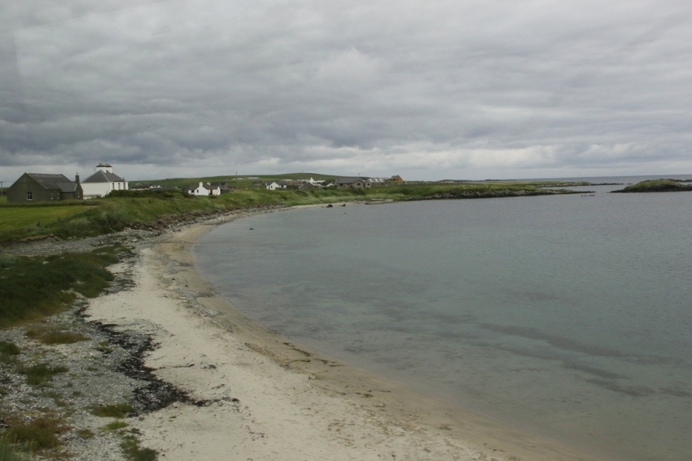
The road dips down to the shore at Cunningsburgh Beach. We were now only 11 miles from the dock!
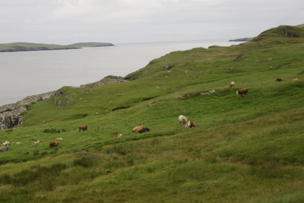
We had seen mostly sheep in the fields – this was the first where the were more than a couple of cows.
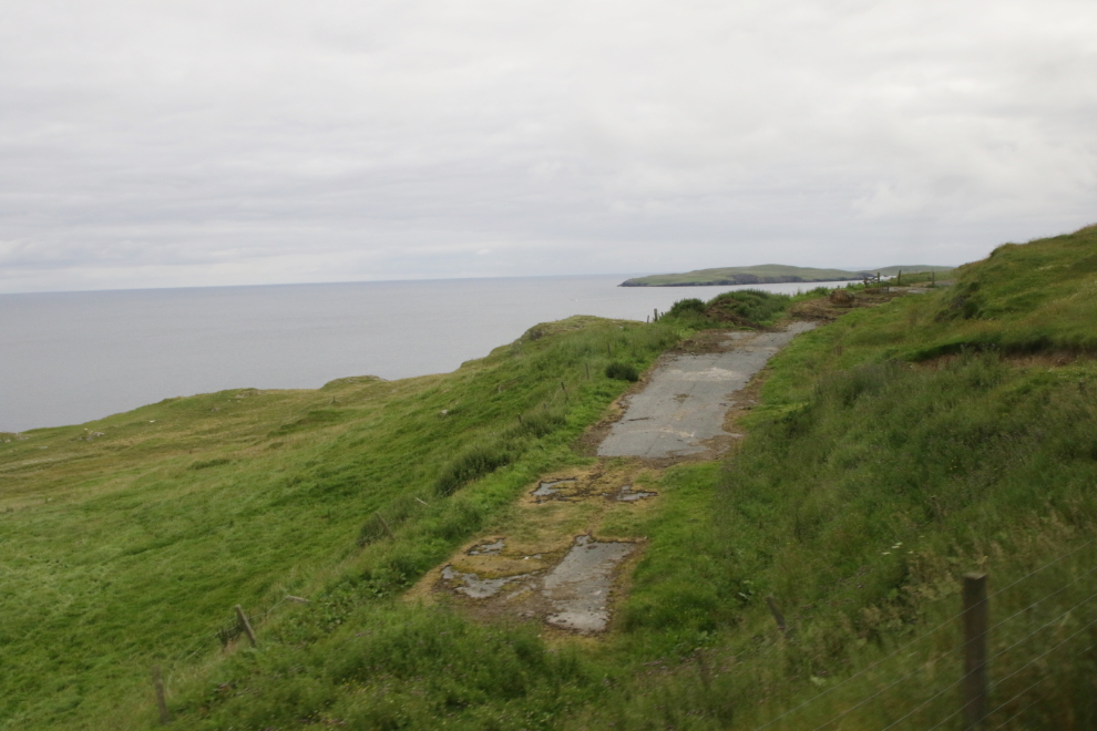
Old sections of road were occasionally seen.
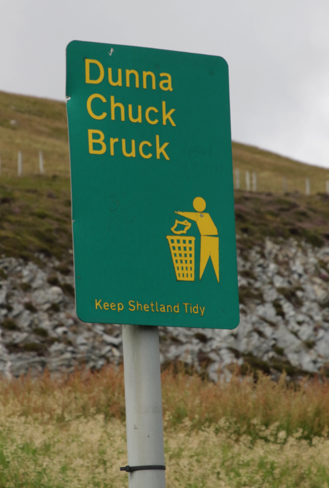
We stopped at one of the rare viewpoints, and this sign caught my eye. People in Shetland speak English. Sort of 🙂 The language is a regional dialect of English, with roots firmly bedded in Shetland’s Scandinavian past.
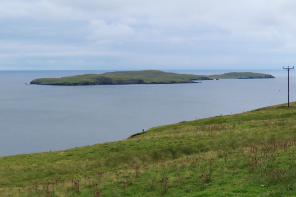
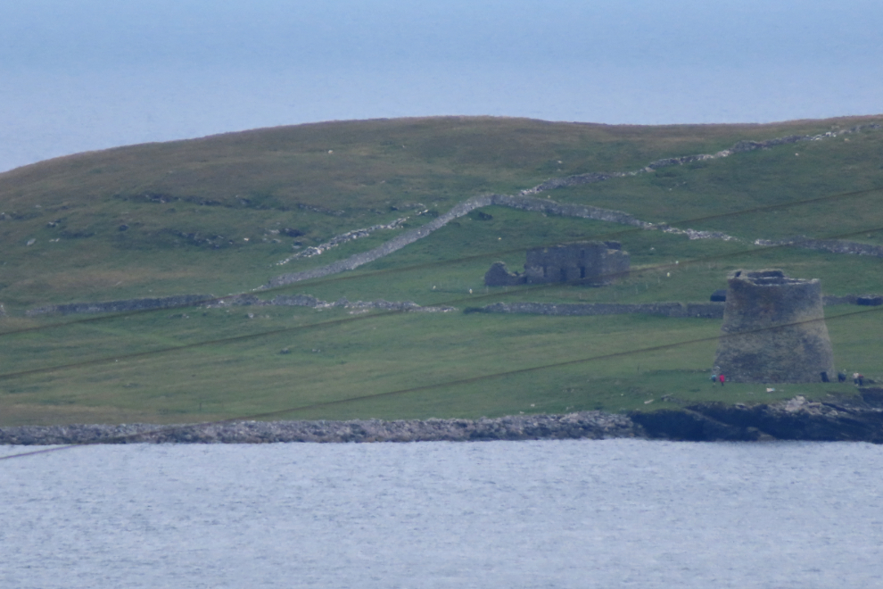
We had stopped to get a distant view of the Broch of Mousa, built in about 300 BC on the island of Mousa. At 13.3 meters (44 feet), it is the tallest broch still standing and amongst the best-preserved prehistoric buildings in Europe. The close view was shot at my little Powershot’s full 960mm range – both were shot from the viewpoint.
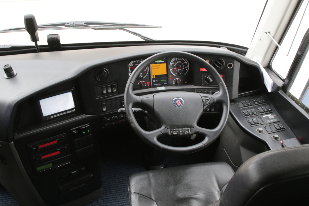
The stop gave me a chance to look at the driver’s position of our fairly new Scania coach – very nice 🙂
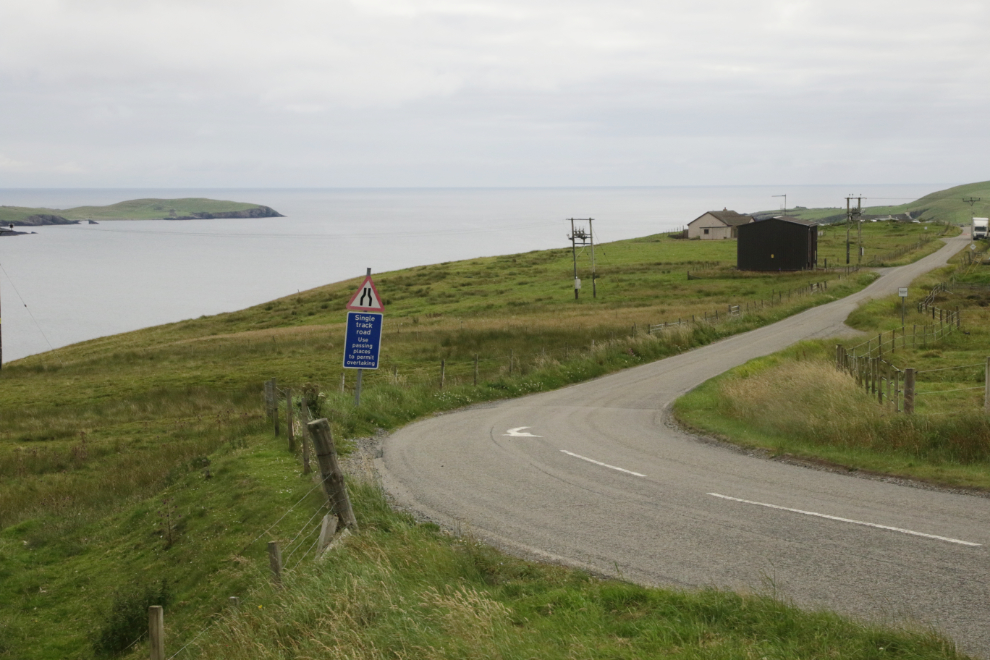
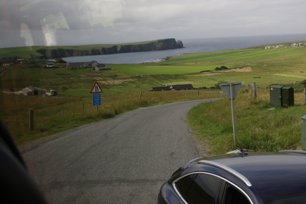
Continuing on, we went by a sign warning that the road ahead was single track (one lane). While one-lane roads are common, warning signs are not.
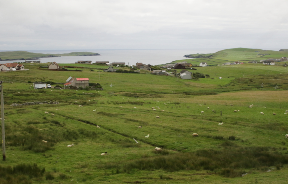
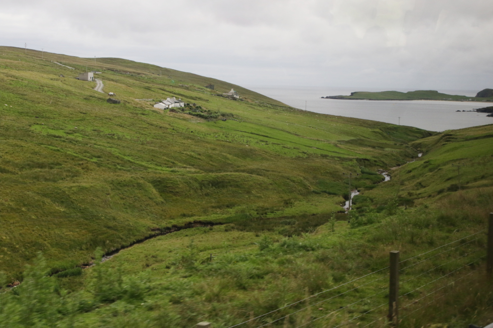
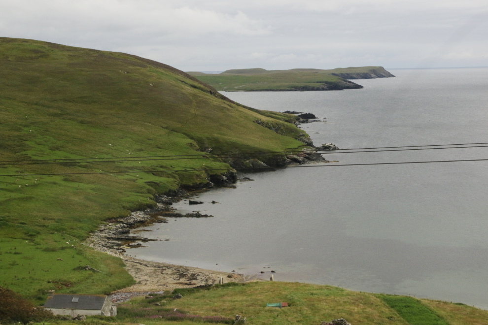
To show you how rapidly the views change, the next 4 photos were shot in a 5-minute period.
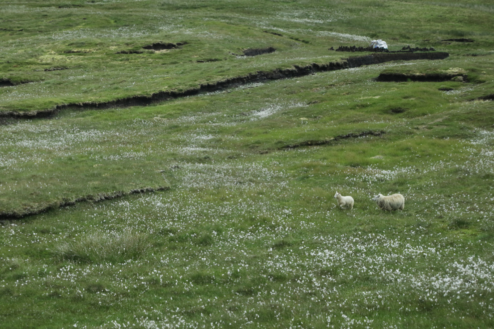
Peatland dotted with Arctic cotton grass, with a lamb and his mom.
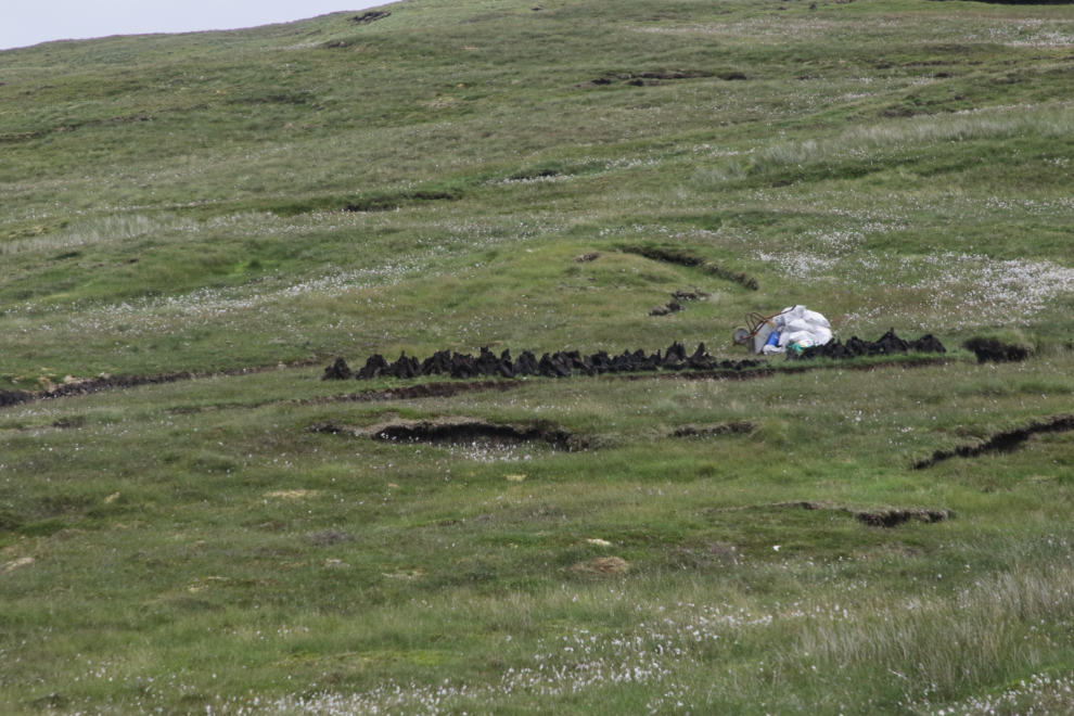
At the upper right of the photo above you can see a peat bank being cut and the peat bagged – here’s a closer look at it. Shetland with Laurie has an excellent page about peat in the life of a Shetland family.
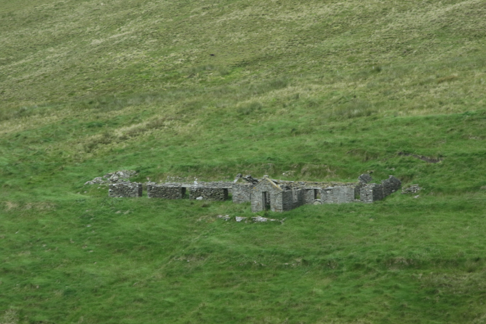
The ruins of a sizeable stone home.
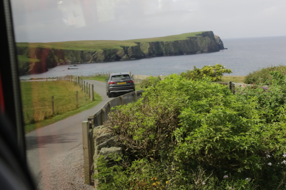
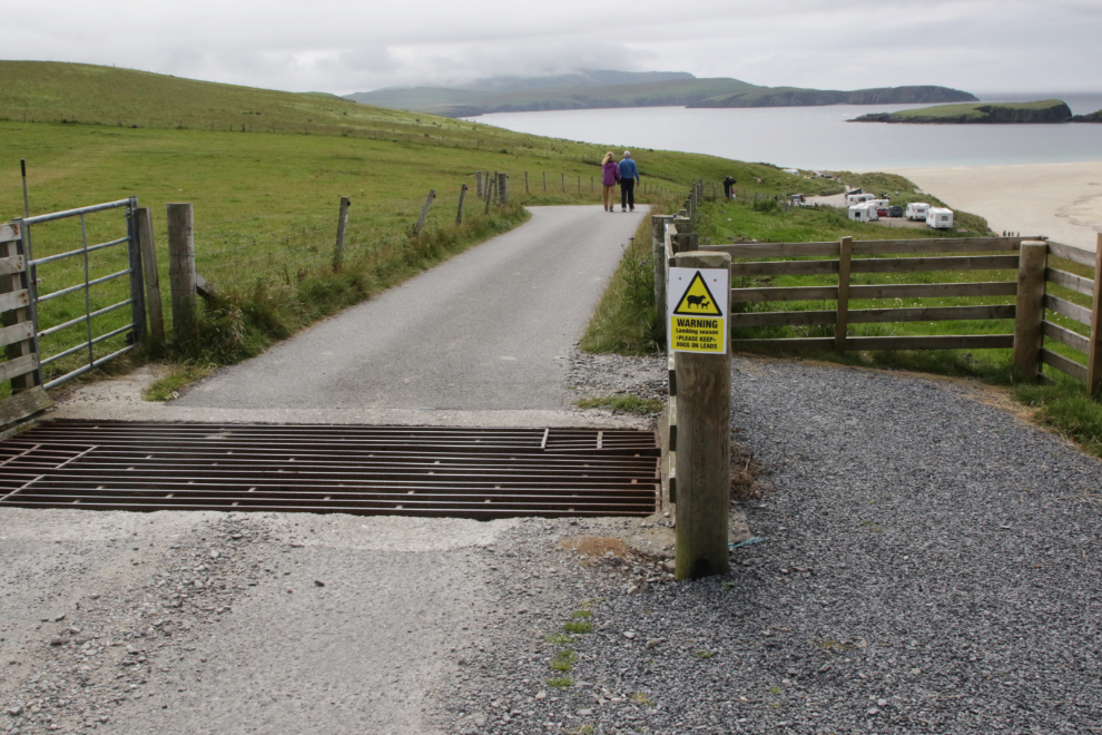
Turning towards St. Ninian Isle on a one-lane road.
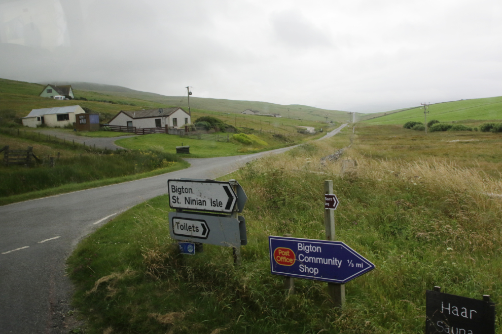
The road got smaller and smaller. At the end of this one was a turn-around area for a bus. It would sure get interesting if 2 busses came here.
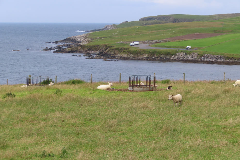
This was the prize at the end – St. Ninian Isle and the sandy spit that joins it to “the mainland” (the larger island). Anywhere in North America, that grassy slope would be home to an RV park and cabins where you could enjoy that view at prices from $65-350 per night. There, 7 RVs were parked for free.
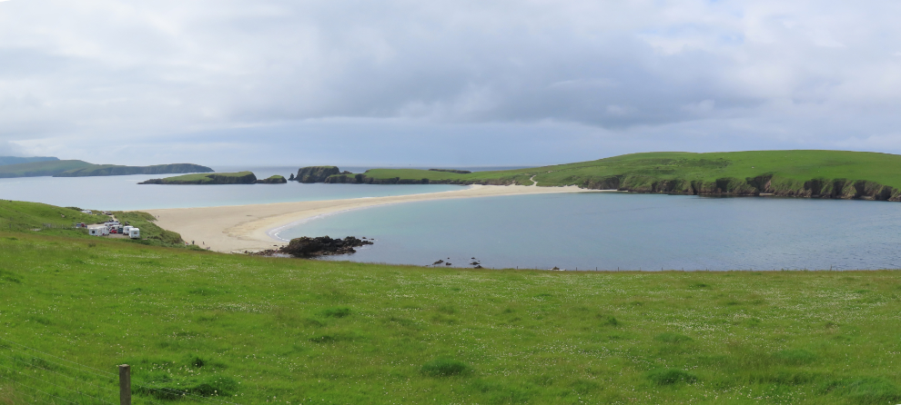
A few folks started walking down towards the beach but I don’t think any of us reached it – I was happy to enjoy it from above and didn’t go very far. I would sure like to spend a few days here with a campervan, though.
This is the view in the other direction (to the north) from the bus turn-around.
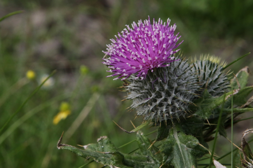
I took a few photos of wildflowers there, including this particularly fine Scotch thistle (Onopordum acanthium).
Headed south again, on a one-lane road with wide spots used for passing – that we used a few times.
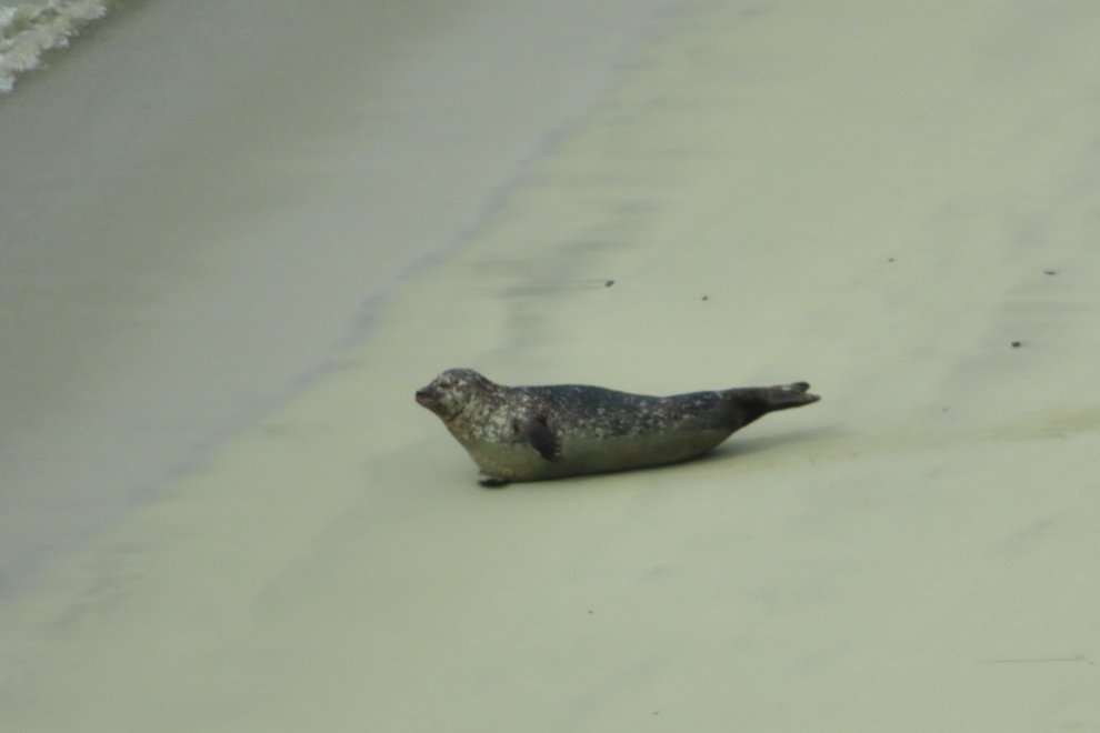
While the sandy beach and crystal water was what I initially saw at Rerwick Beach, I then spotted a harbour seal that I caught with the full zoom on the little camera.
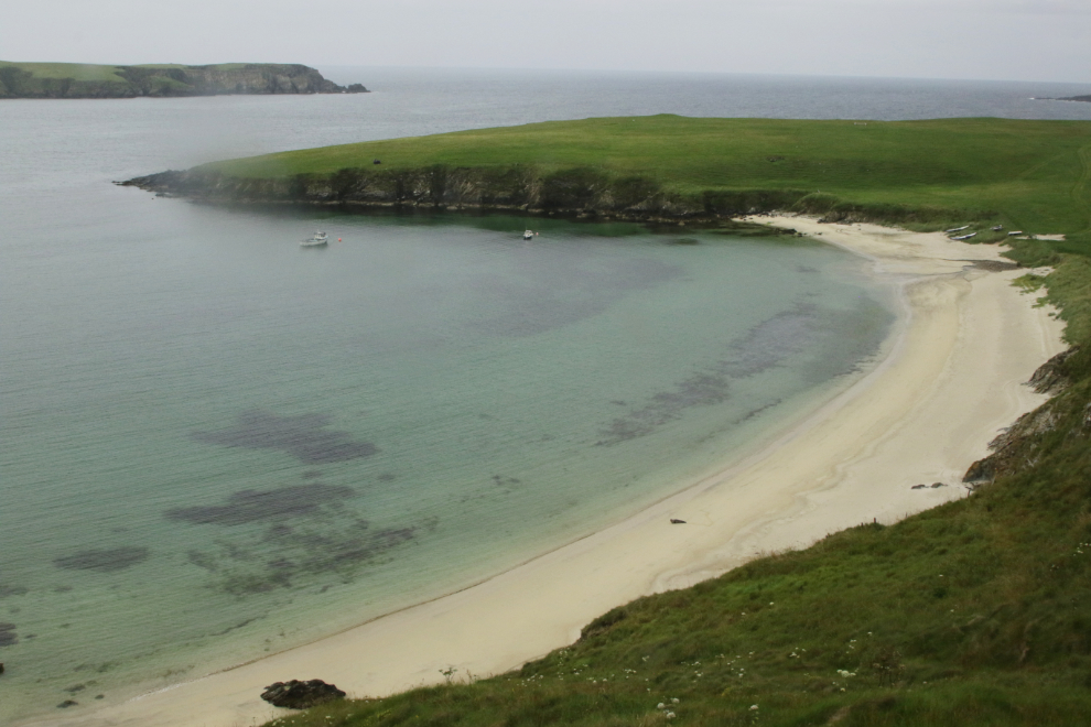
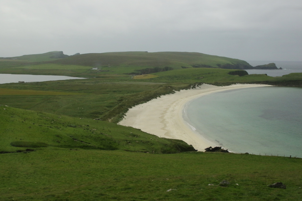
On the other side of that small bay is an even larger beach, Scousburgh Sands. Rerwick Beach is not accessible by road, but Scousburgh Sands is, and there’s parking for about 10 vehicles.
Many Shetlanders have a strong sense of local identity – they are Shetlanders, not Scots. Our guide, Kathryn, was one, and she was the best guide we had on the entire trip. However, by about this point I could feel my brain being challenged by trying to understand her accent. My brain injury had only caused one crash so far, when I really wanted to spend time at one of the live music lounges on the ship – Cathy had to help me get back to the cabin 🙁
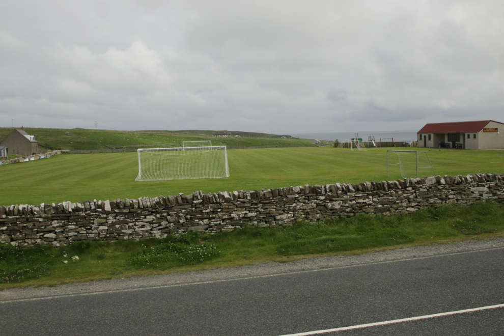
We made a rest stop at Boddam, at the Dunrossness Central Public Hall. This playing field with a fine stone wall was across the road.
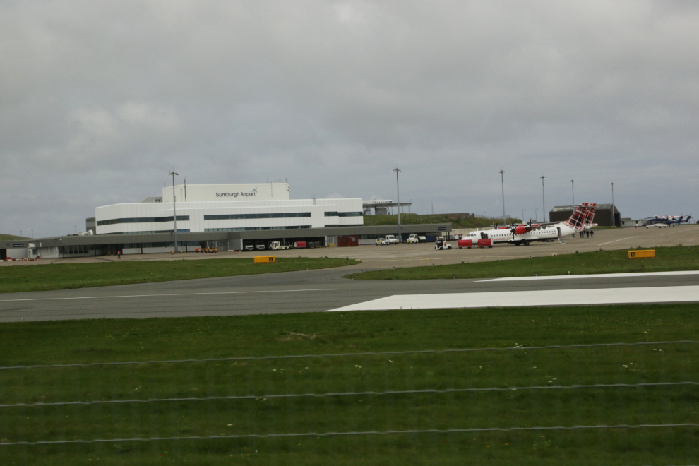
A nice view of part of Sumburgh Airport.
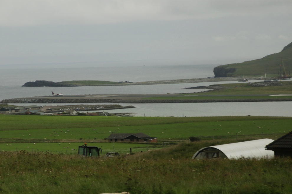
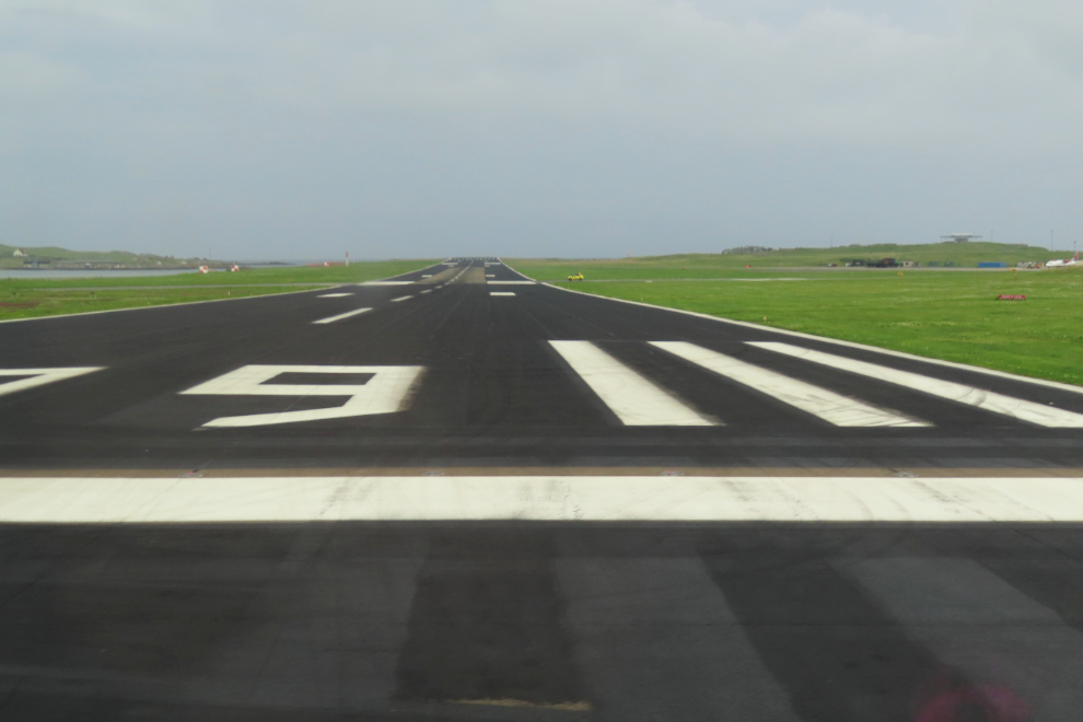
The road crosses one of the two main runways at the very active Sumburgh Airport, and gates are manually closed and opened when aircraft are using 09/27. It was closed when we arrived, to let a Ryanair flight take off. That only took a couple of minutes and we were on our way again.
There is never enough time – this is the Old Scatness Broch & Iron Age Village that we passed by.
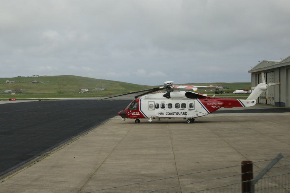
We then looped around the main of the airport. His Majesty’s Coastguard operates G-MCGL, a Sikorsky S-92A Helibus.
Although it’s quite a drive from the main population centre (Lerwick), Sumburgh is Shetland’s primary airport, and Ryanair seems to serve it well.
Immediately to the southeast of the airport, a new dock is being built for the ferries to Fair Isle, which is about 40 km south.
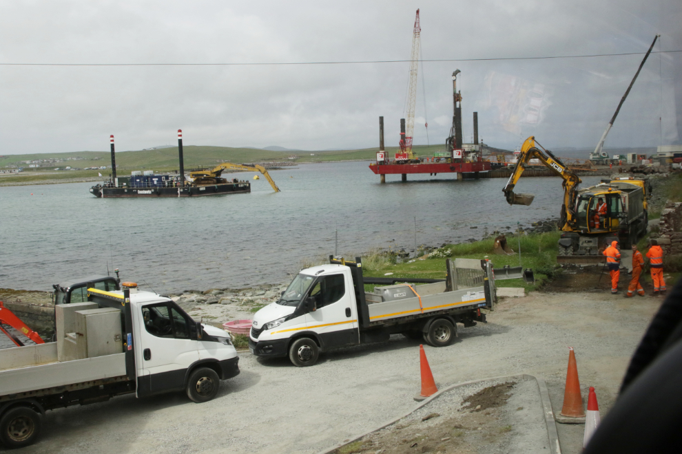
The dock construction has caused a corner that is extremely tight for a motorcoach!
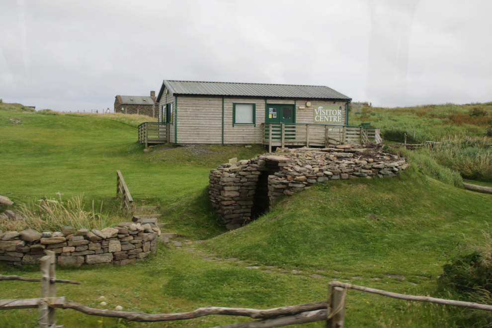
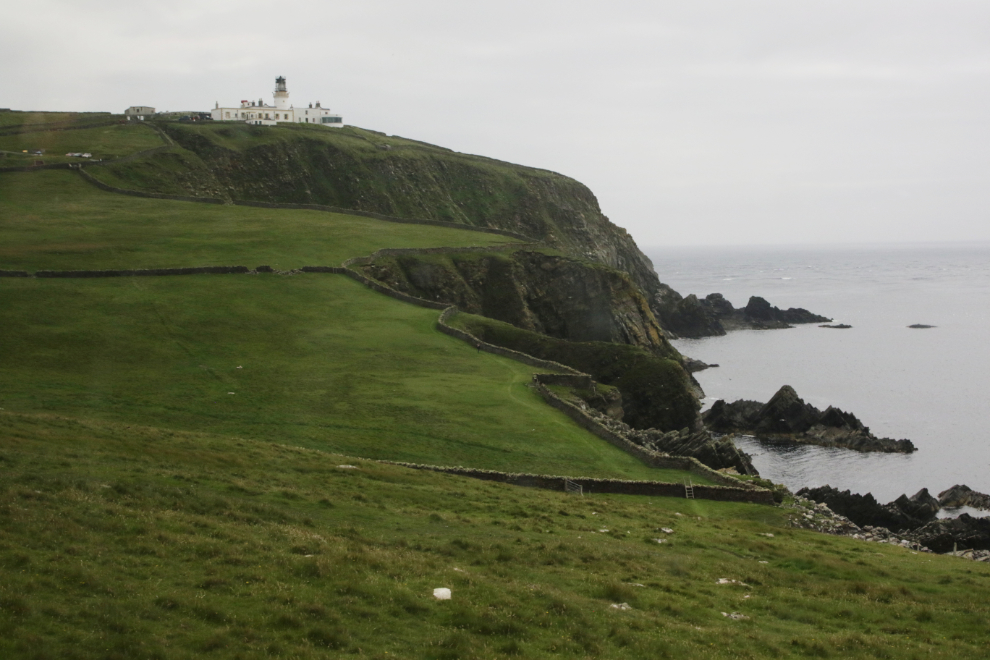
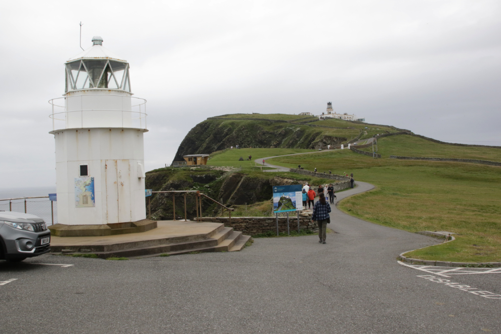
Our first view of our major stop of the day, Sumburgh Head Lighthouse, Visitor Centre & Nature Reserve.
The view from the parking lot.
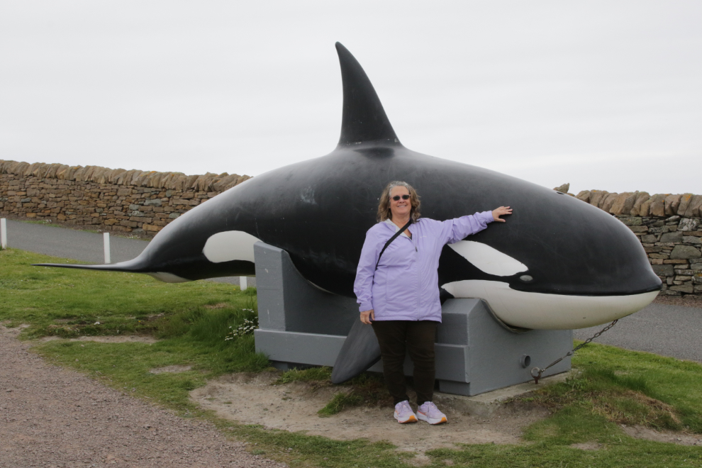
Cathy with the only whale we saw during 28 days at sea 🙁
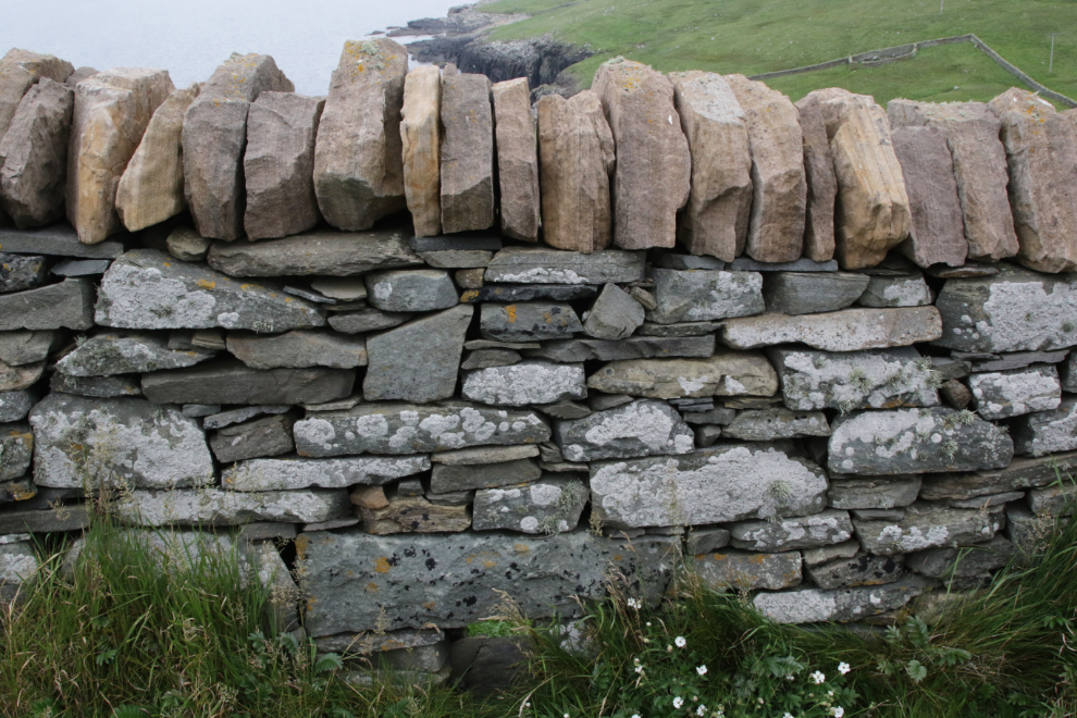
Another fine stone wall. Yes, I’m very impressed by them.
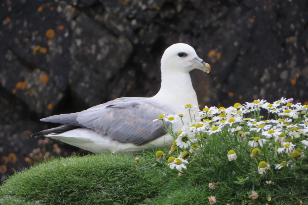
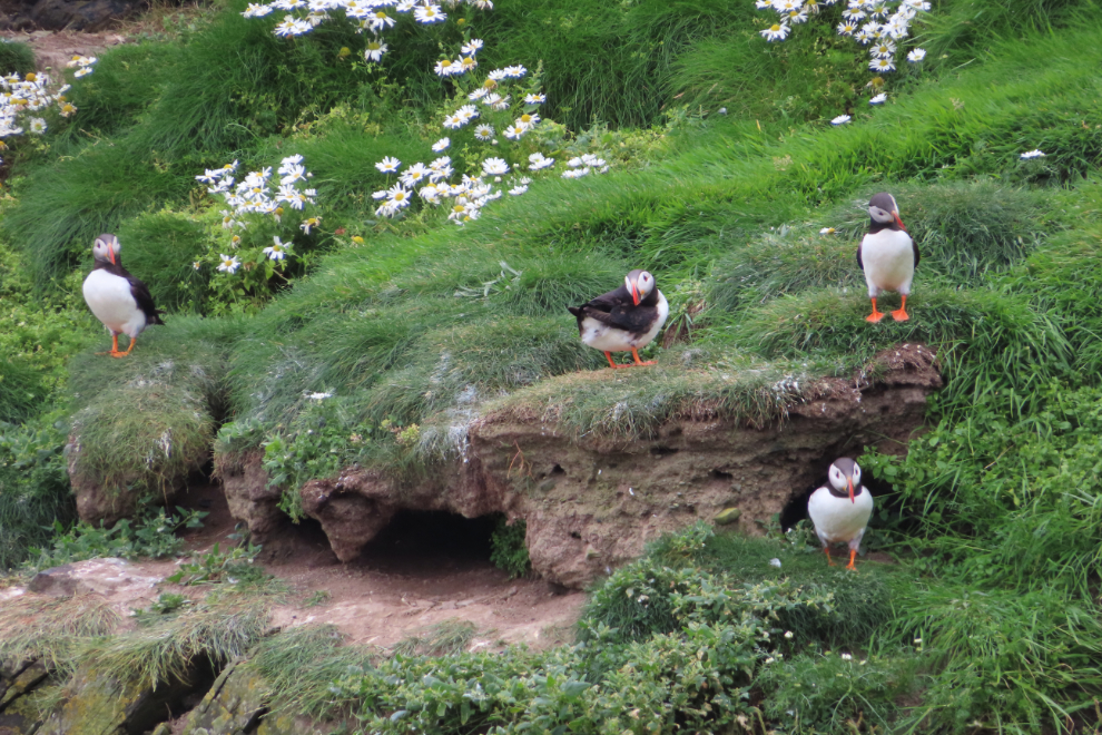
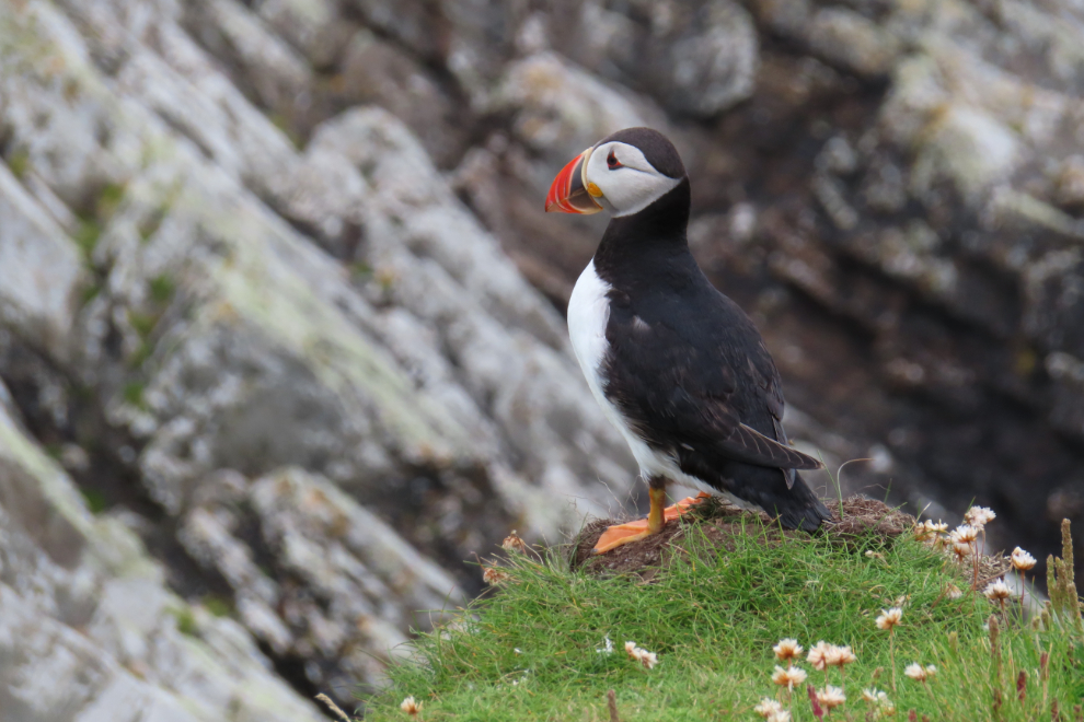
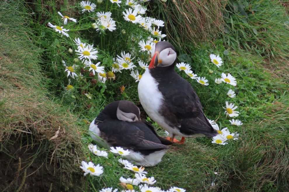
The birdwatching is incredible at Sumburgh Head. There are, in particular, Northern Fulmar
(Fulmarus glacialis)…
…and Atlantic puffins! (Fratercula arctica, meaning “little brother from the arctic”). The puffins are at Sumburgh Head from April to August each year.
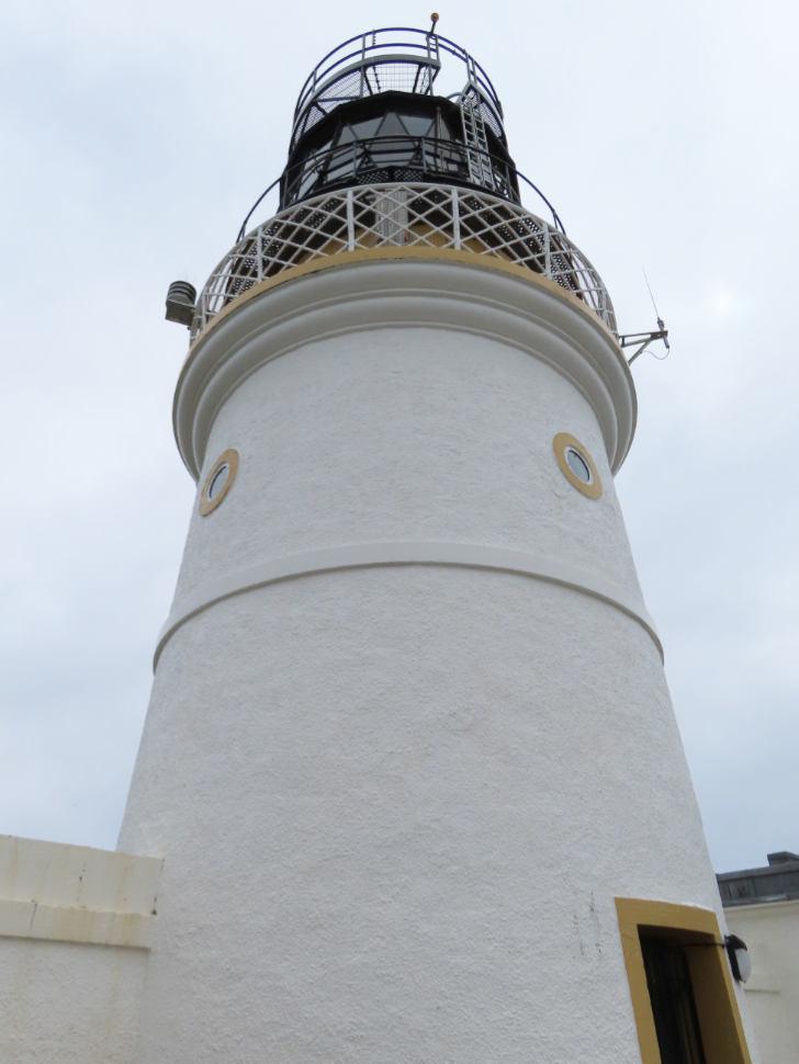
It’s a fair hike up to the lighthouse, but well worth the effort. The lighthouse, perched 91 meters above the sea, was built in 1821, and in 2014 the entire property was restored.
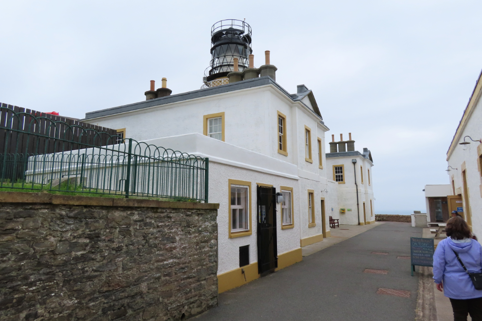
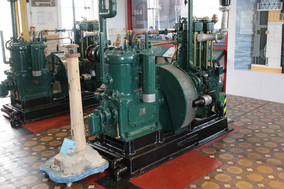
There is an excellent room for lighthouse history, and another area for marine environment education.
Unfortunately my day pretty much ended here. When I was in the marine environment area, my brain crashed badly. When Cathy found me, talking and walking were difficult, and I needed a lot of help from Cathy to make the long walk back to the bus.
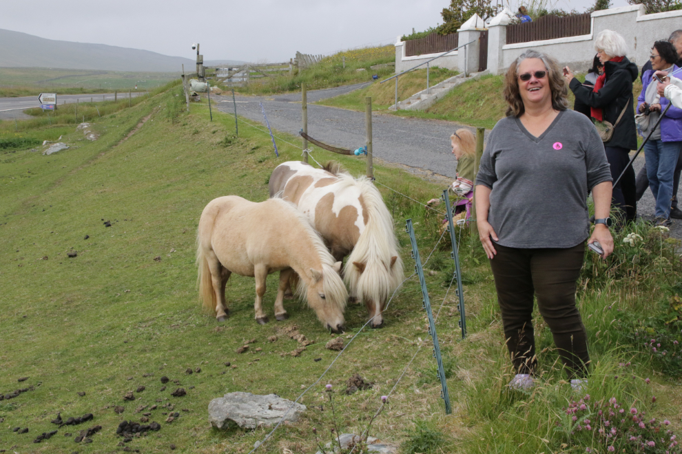
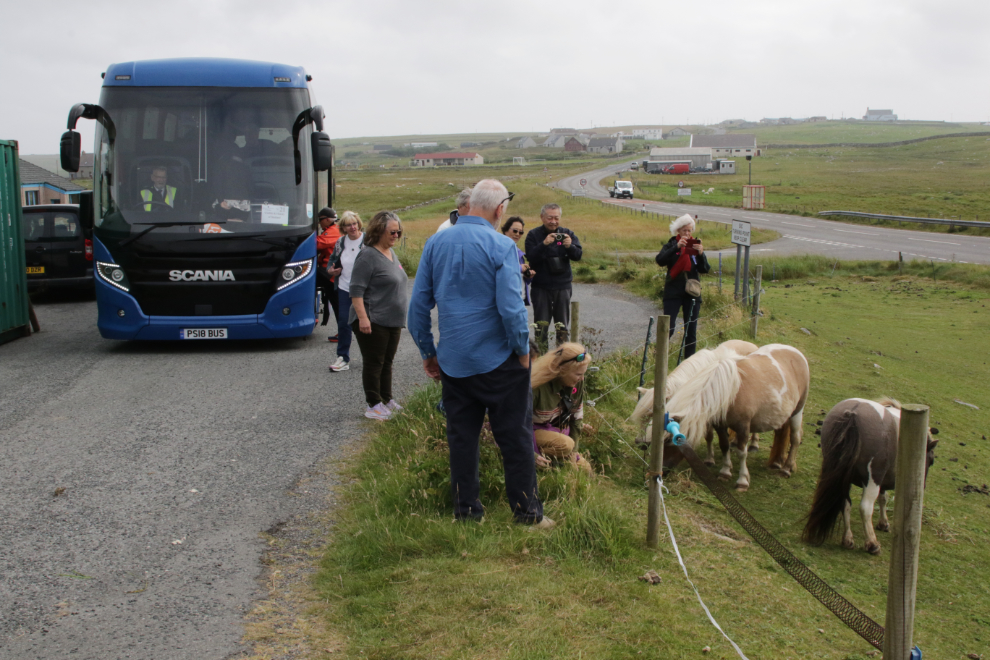
I remember little about the painful drive back to the tender dock, but we stopped to see some Shetland ponies, and this was a highlight for Cathy so I had to get some photos.
Despite the way it ended, our Shetland day was perhaps best summed up by my Facebook post that night: “Our day in Shetland was amazing. This is magical country, to the point that the 4-5 weeks in the Mediterranean in 2027 we’ve been talking about may get changed to Scotland and Orkney.”
We were now nearing The End. The next day, Friday, July 25th, we were at sea, then spent Saturday at Dover, England, and Sunday morning we disembarked back at Rotterdam.