Cruising Prince Christian Sound, Greenland
This is blog post #19 from our tour of northern Europe. On Sunday, July 13th, we sailed into Prins Christian Sund (Prince Christian Sound). I’ll begin by saying that this 62-mile-long fjord system provided the most spectacular cruising I have ever experienced, and my regular readers know that I’ve been to many incredible places.
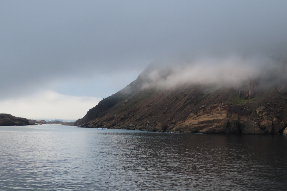
The day started badly – very badly. As we got closer and closer to the coast of Greenland, thick fog was all we saw 🙁
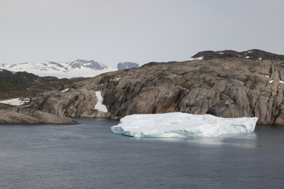
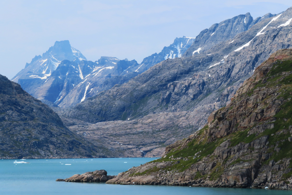
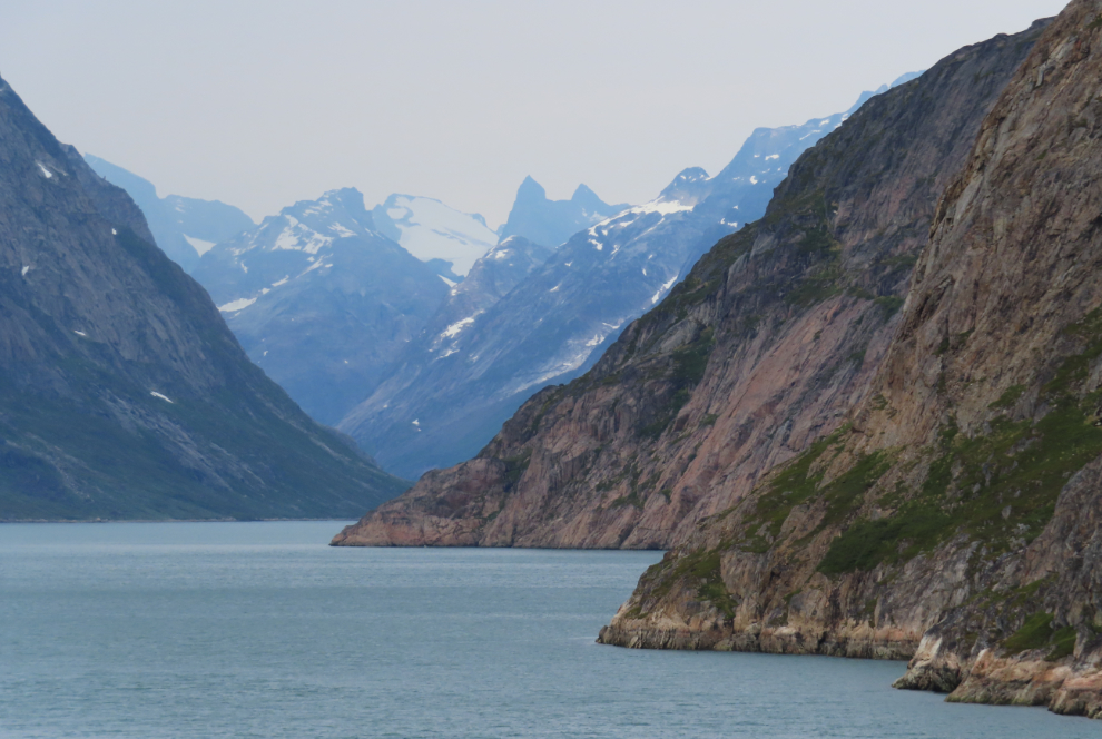
Suddenly, at 10:00, we were up very close to the shore, under mostly sunny skies! It was mind-blowing. I shot the first photo at 10:06. Over the next few hours I would shoot 338 more. As I started writing this, I said to Cathy “What in hell am I going to do with Prince Christian Sound??”
The view ahead at the same time.
Once I looked back, I understood what had happened. As we entered Prince Christian Sound, we had sailed out of a solid wall of thick fog.
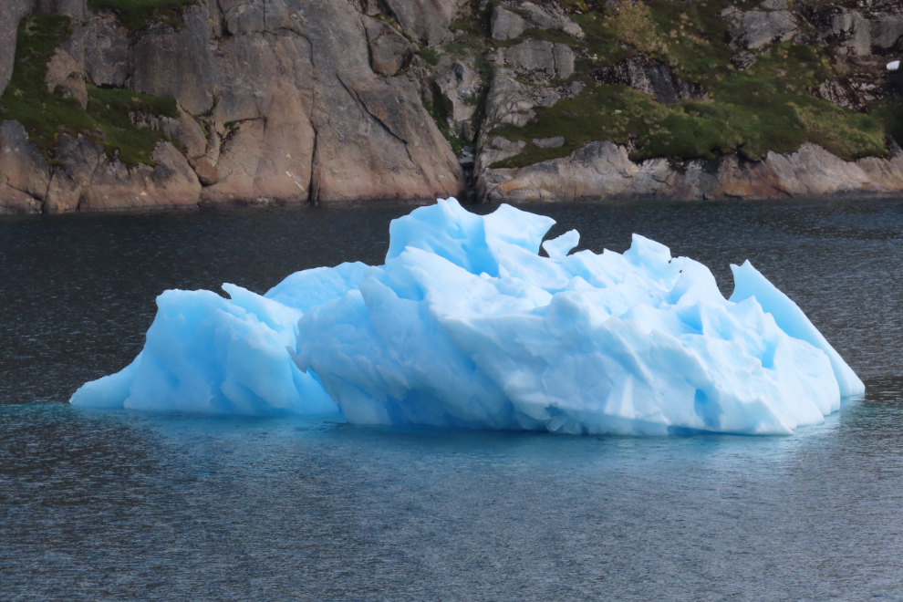
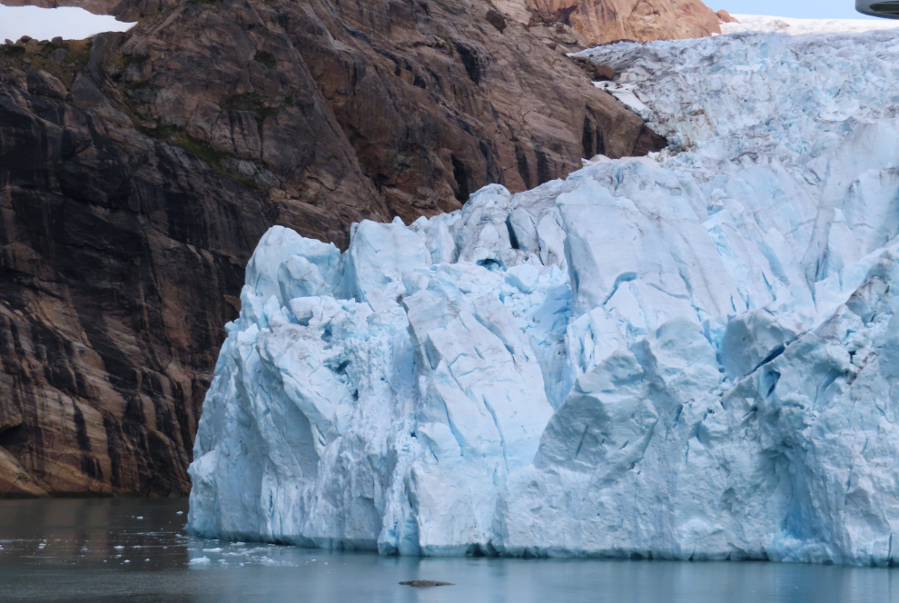
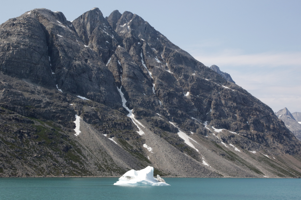
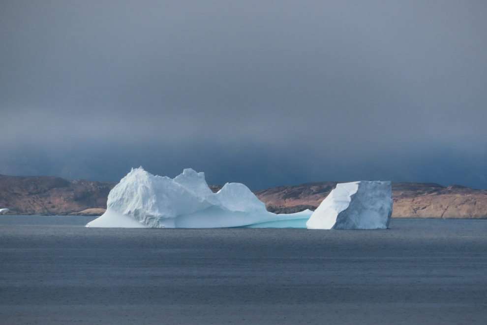
Some of the icebergs we slowly cruised past had the amazing blue of old glacial ice. I was using 3 cameras now, and they would shortly be joined by the fourth, the stereo/3D one.
The view ahead at about 250mm, at 10:27.
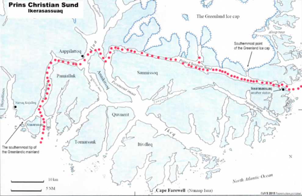
Here’s a map to give you an idea of the complexity of this country. This map was handed out on a previous sailing of the Nieuw Statendam, but on ours, Prince Christian Sound wasn’t even mentioned until the previous day. I expect that conditions have to be perfect for it to be navigable for large ships, so it’s best to not mention until you have a good indication that you can make it happen.
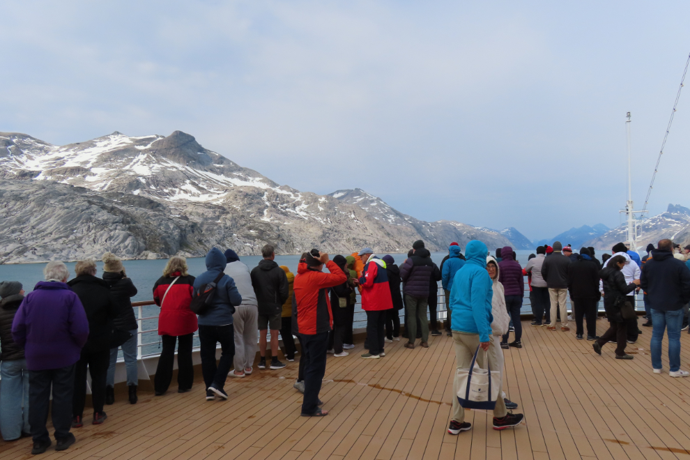
The bow was opened for viewing, and although I knew what to expect, I went up anyway. I didn’t last long.
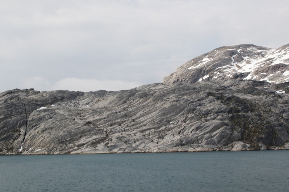
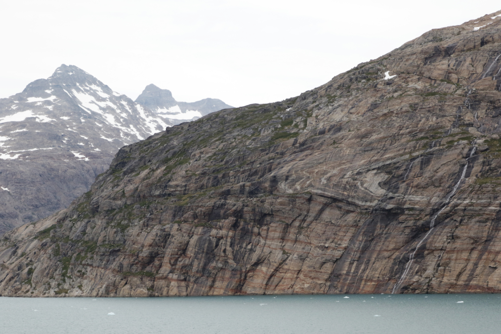
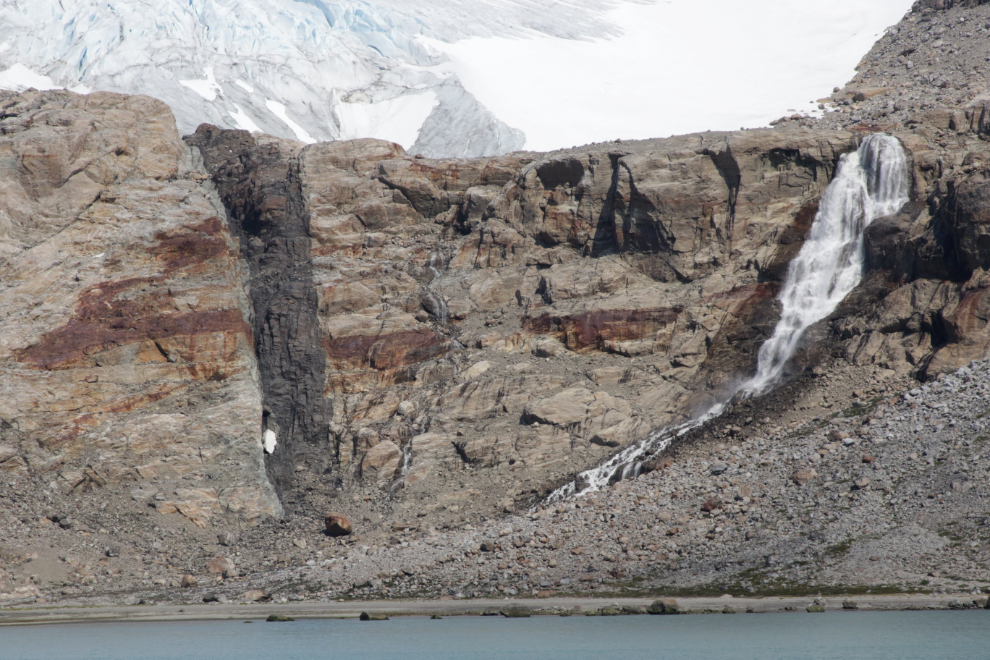
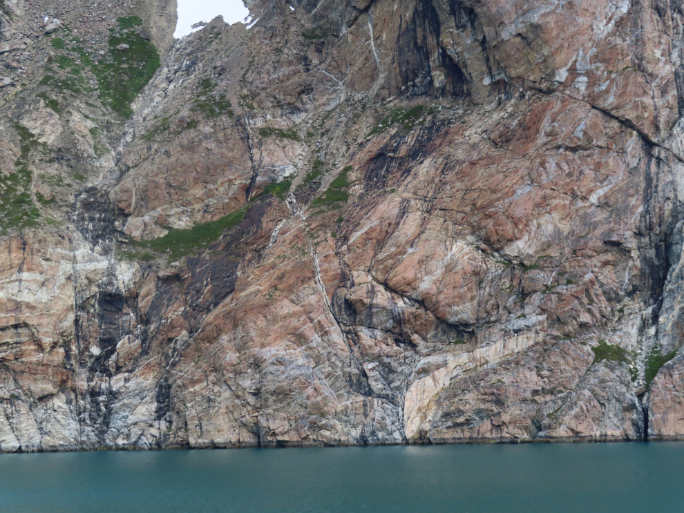
There is some fascinating geology on display in all its naked glory.
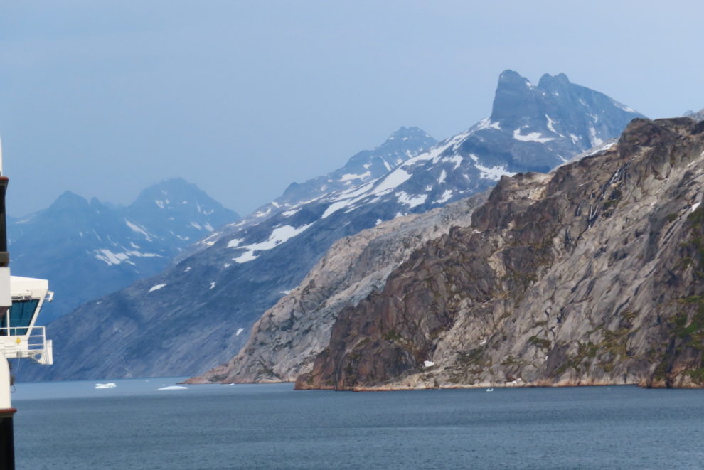
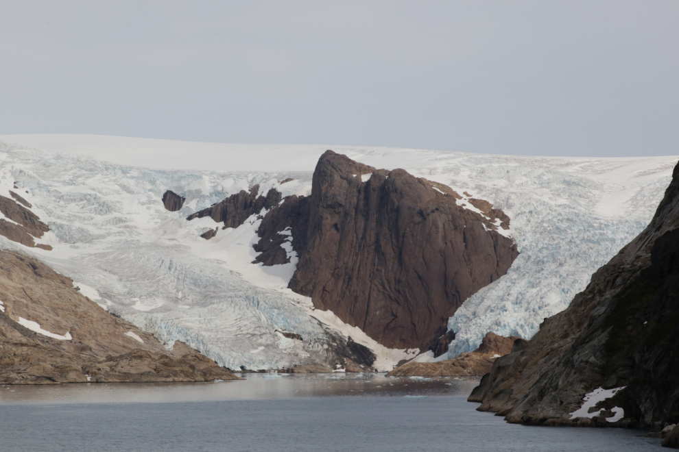
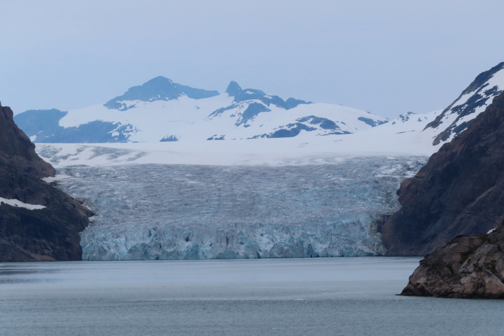
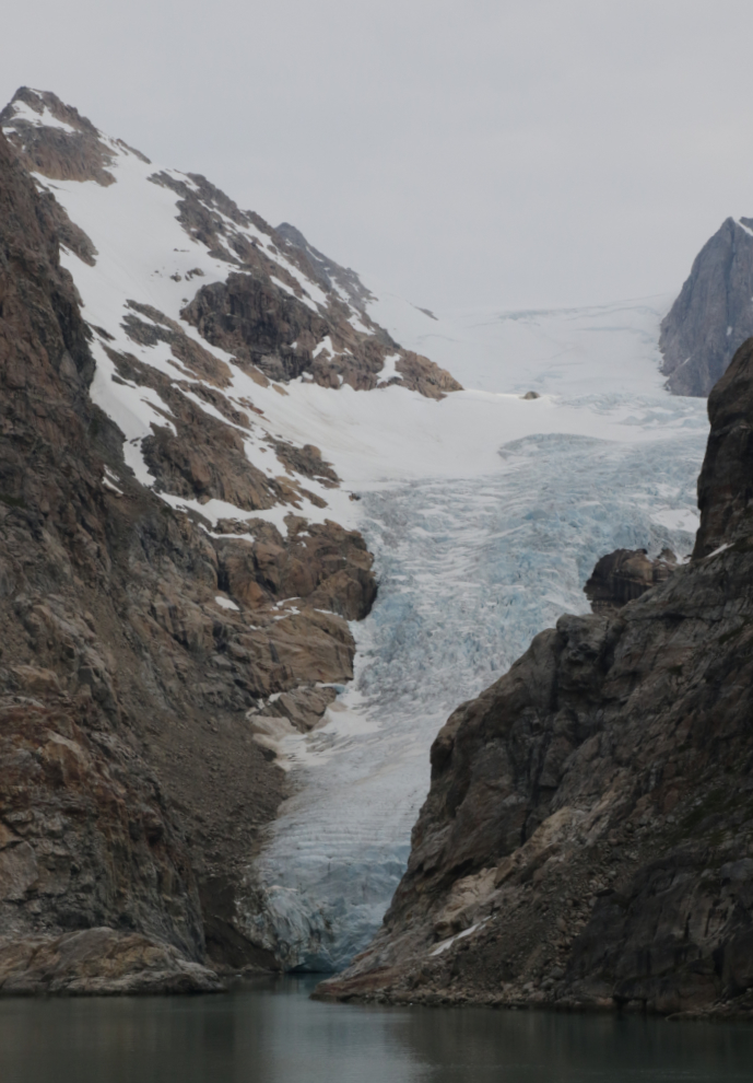
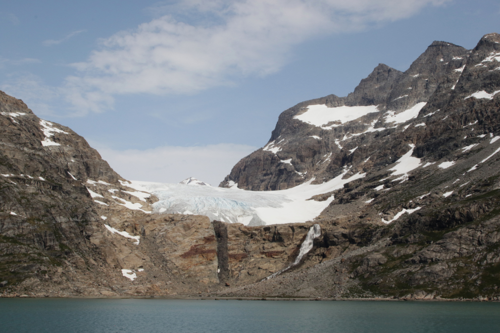
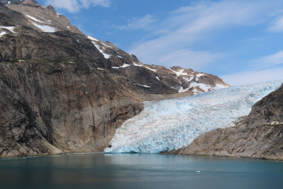
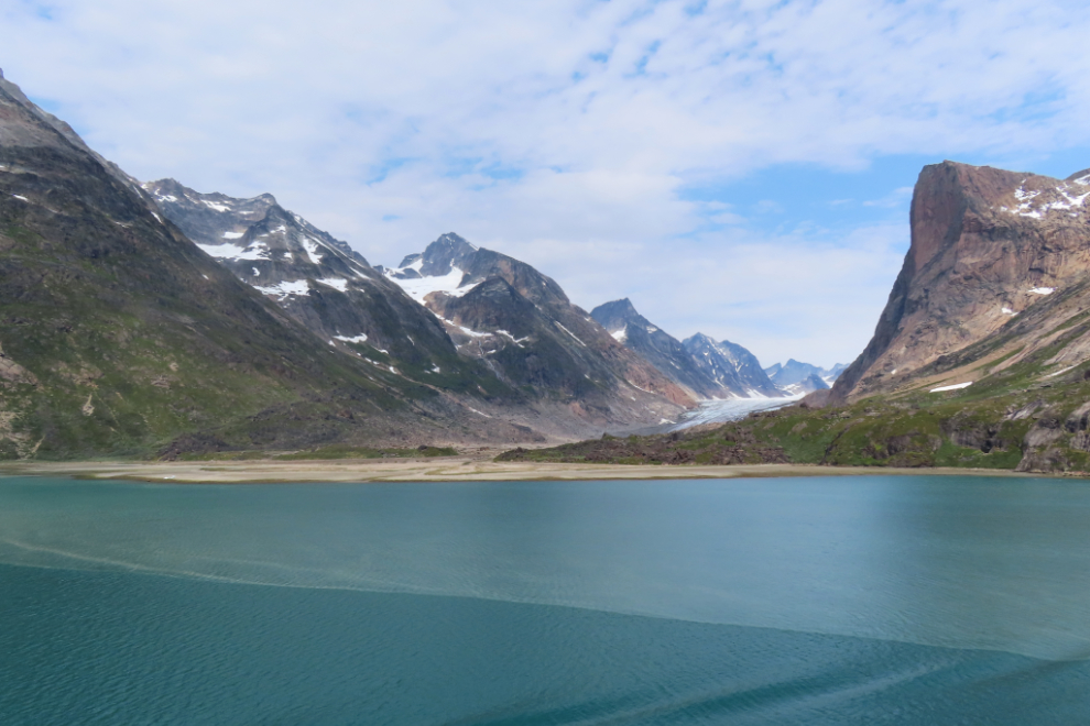
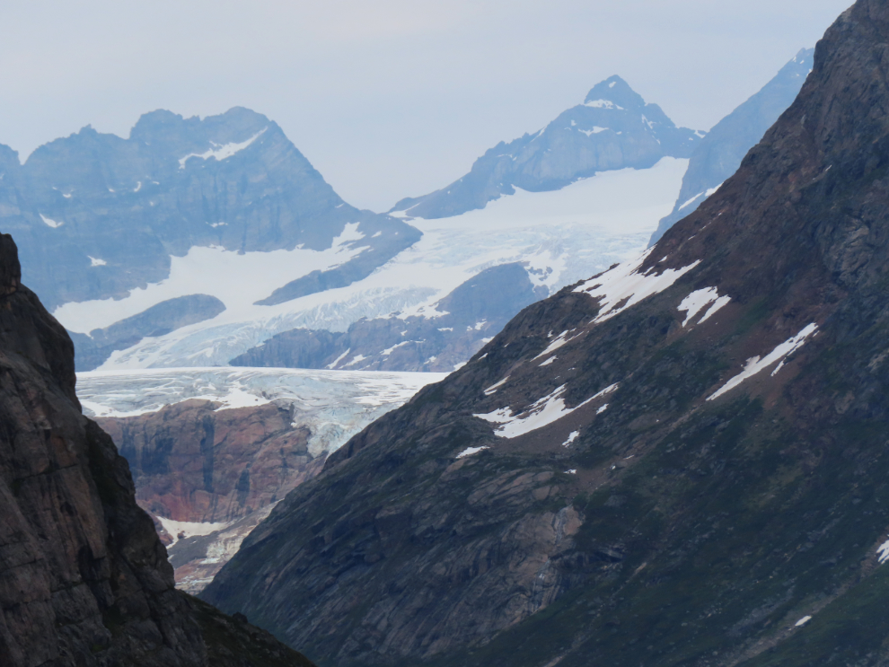
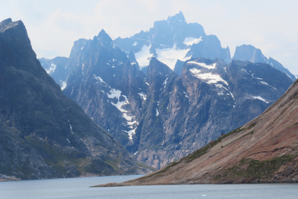
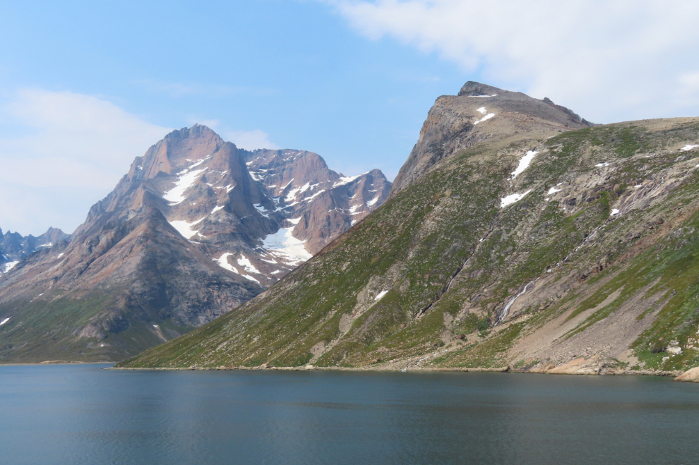
At 10:49 the first glacier came into sight, and it was magnificent. While the glaciers may each have names, I have found nothing except the note on the map above that they are arms of the Greenland ice cap.
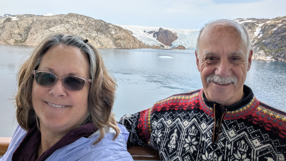
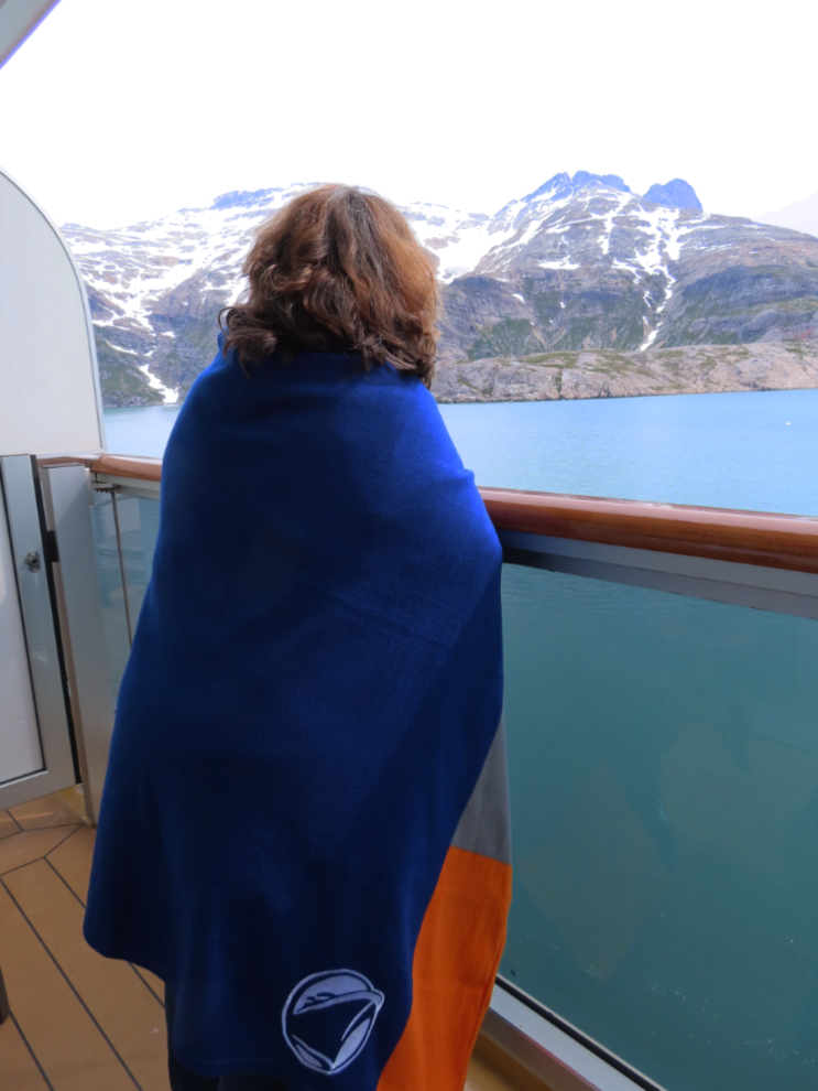
This was a great place for Cathy to shoot a selfie 🙂
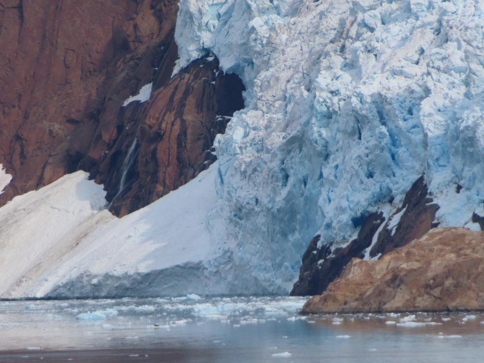
A close look with the little Powershot SX740 at its full 960mm zoom capability.
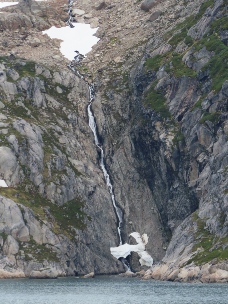
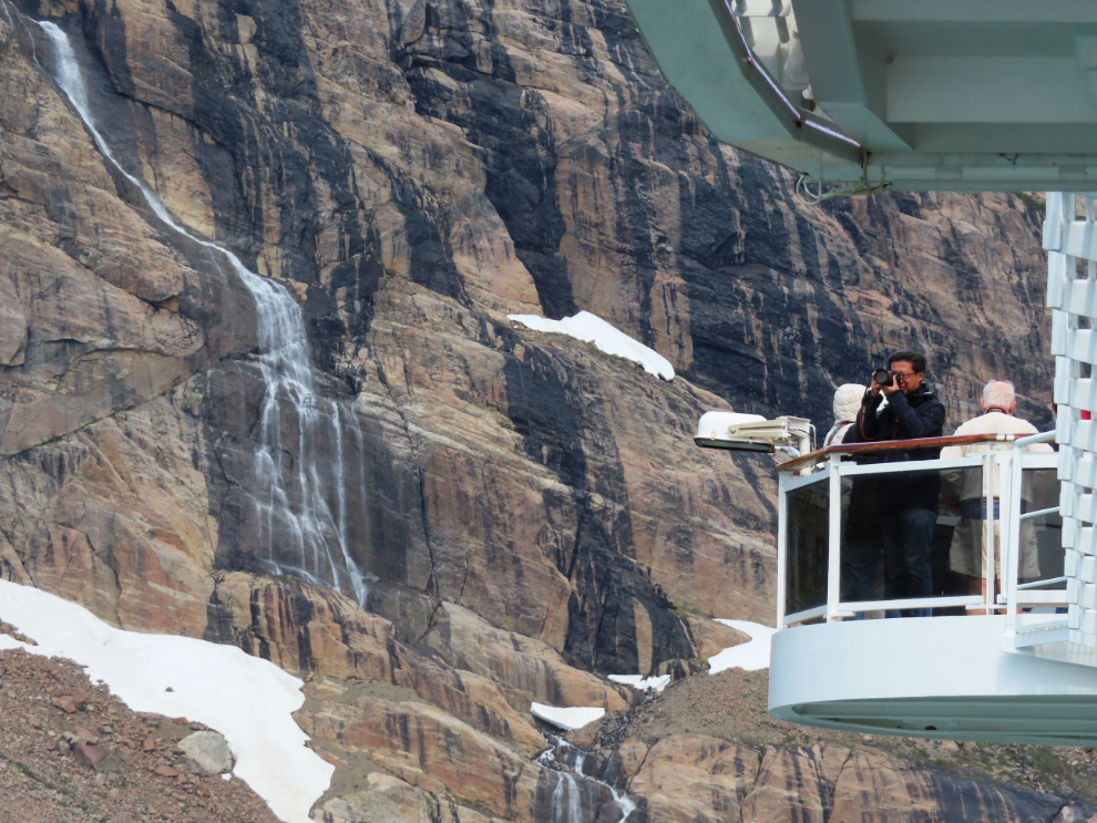
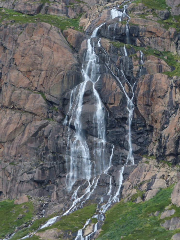
I focussed on small details like rock formations and waterfalls for half an hour, then we came to this view.
I have a lot of photos of waterfalls from this day. When they fall into little coves like this… wow.
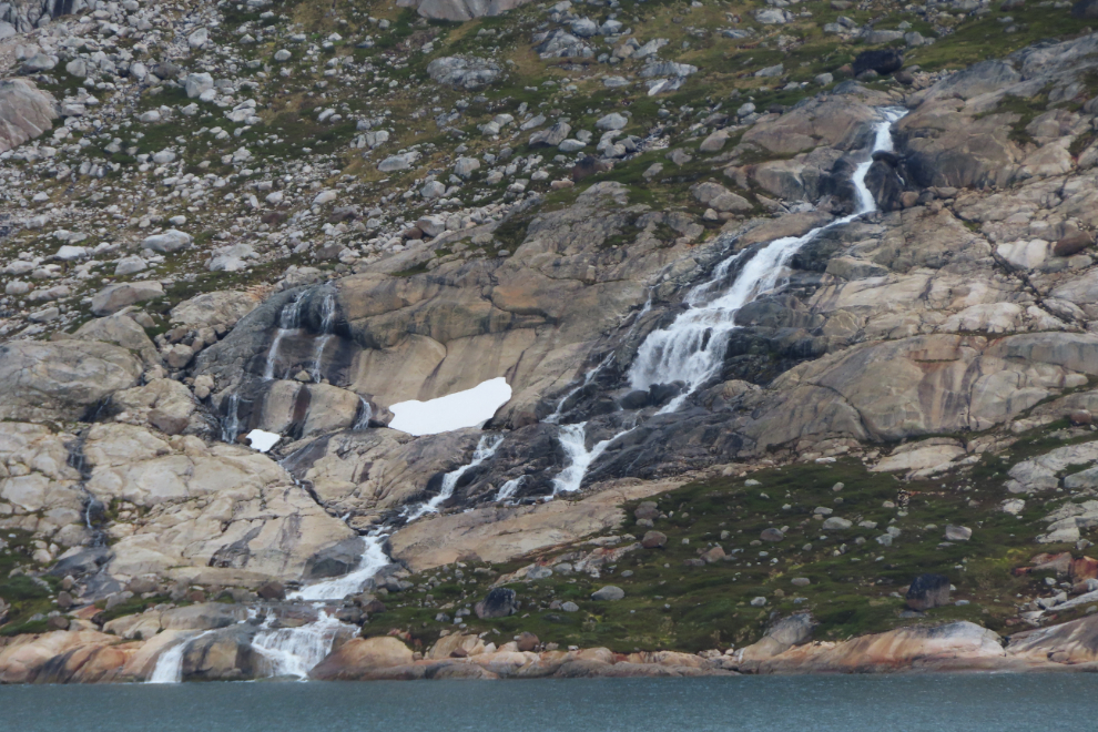
Much of the shoreline is not camping or hiking friendly, but places like the one shown in the next two photos had me wishing I was on an expedition ship with kayaks or a raft ready to launch.
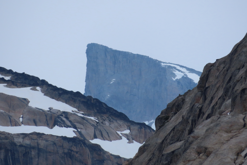
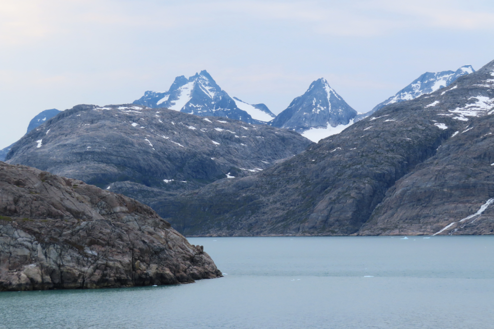
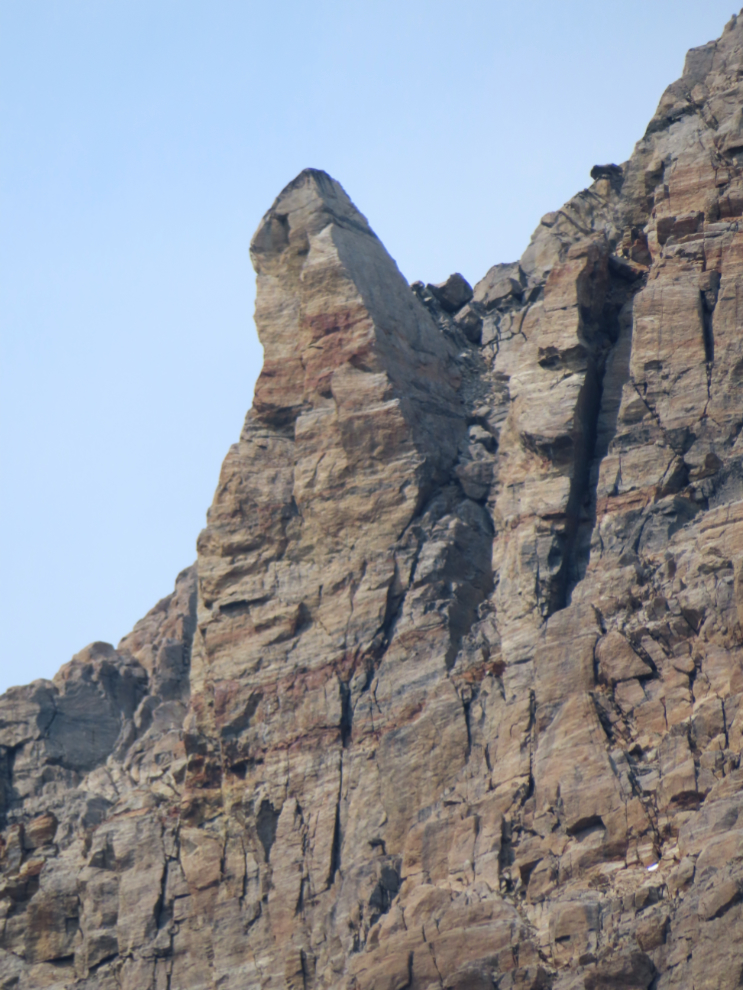
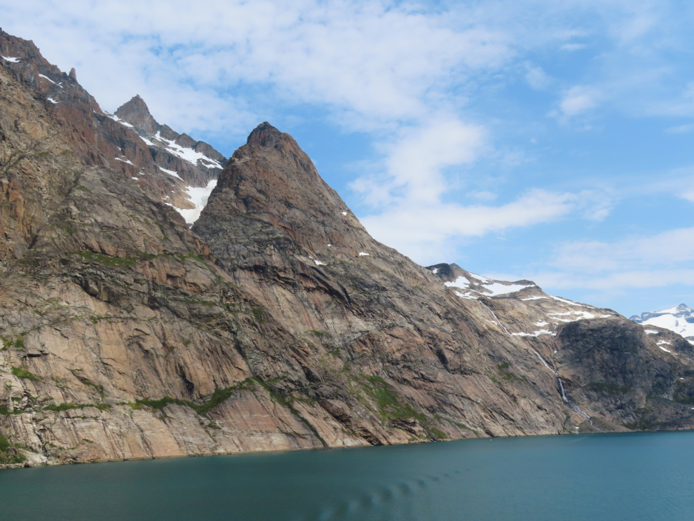
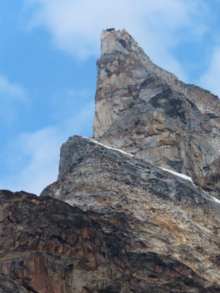
Cathy and I had briefly discussed what might be behind the rocks we were seeing, deciding that “more rocks” was the answer. A couple of minutes later, this peak was visible for about 10 seconds, to answer our question well.
What sort of forces can bend the earth to create folds/patterns like that?
It was now exactly noon. How long could Mother Nature keep up with a show like this?
It was very cold – I would guess about 3°C/37°F – and we made good use of the blankets provided 🙂
The variety in the icy fingers was wonderful. Not only the ice itself, but the rocks that surround it, or in many cases are surrounded by the ice. (12:28)
While an extreme telephoto can produce effects like this, this only took 280mm of zoom – that’s how close we were at 12:36.
This was shot just a few seconds later.
Fantastic rock shapes also caught my attention often.
12:53
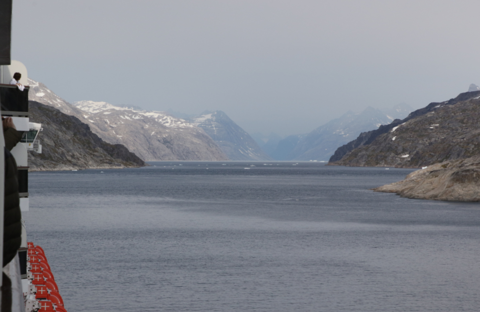
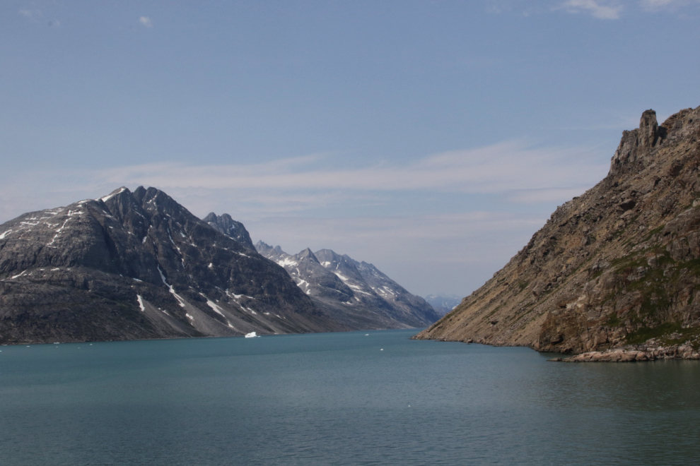
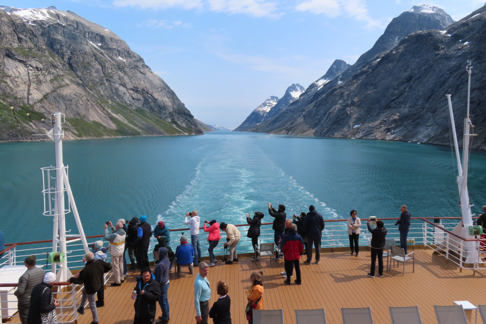
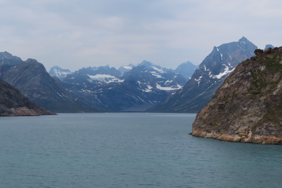
As the route got much more complicated, it was often impossible to guess which channel/fjord we’d be taking. (12:57)
As we continued west, dykes formed by the intrusion of magma into cracks became more common and more dramatic. (1:14)
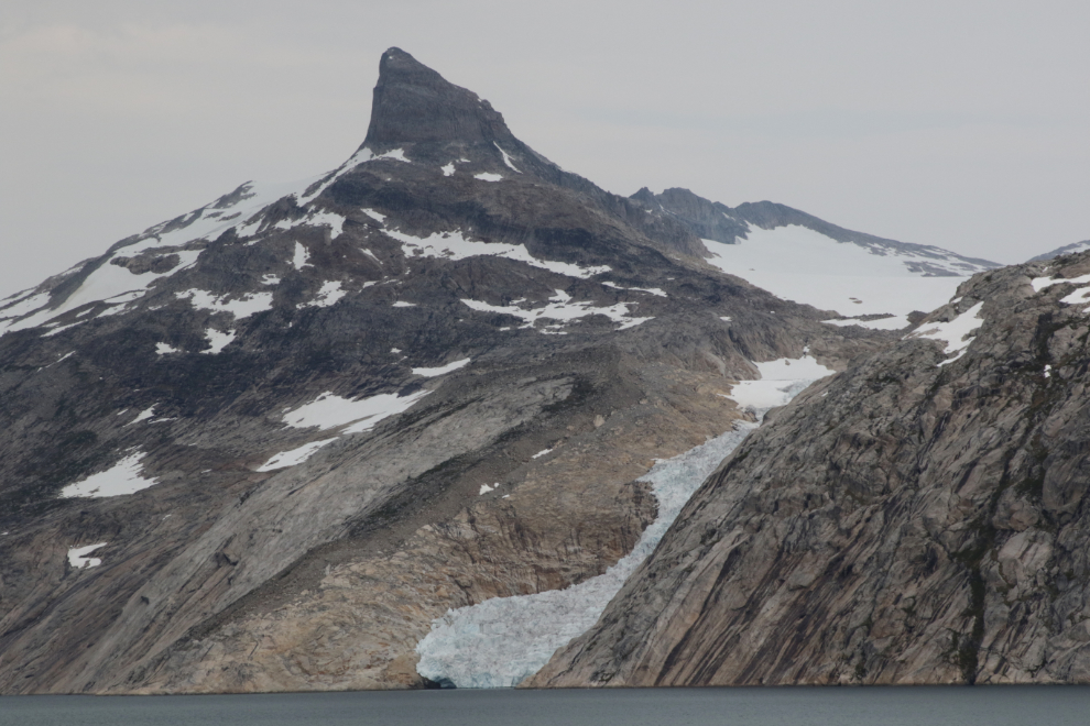
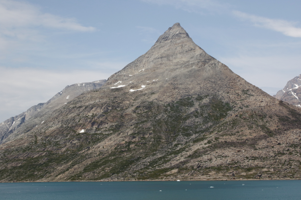
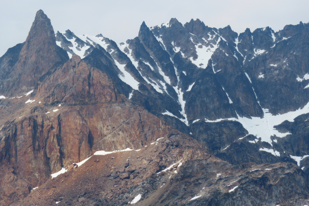
The Matterhorn of Greenland? (1:21)
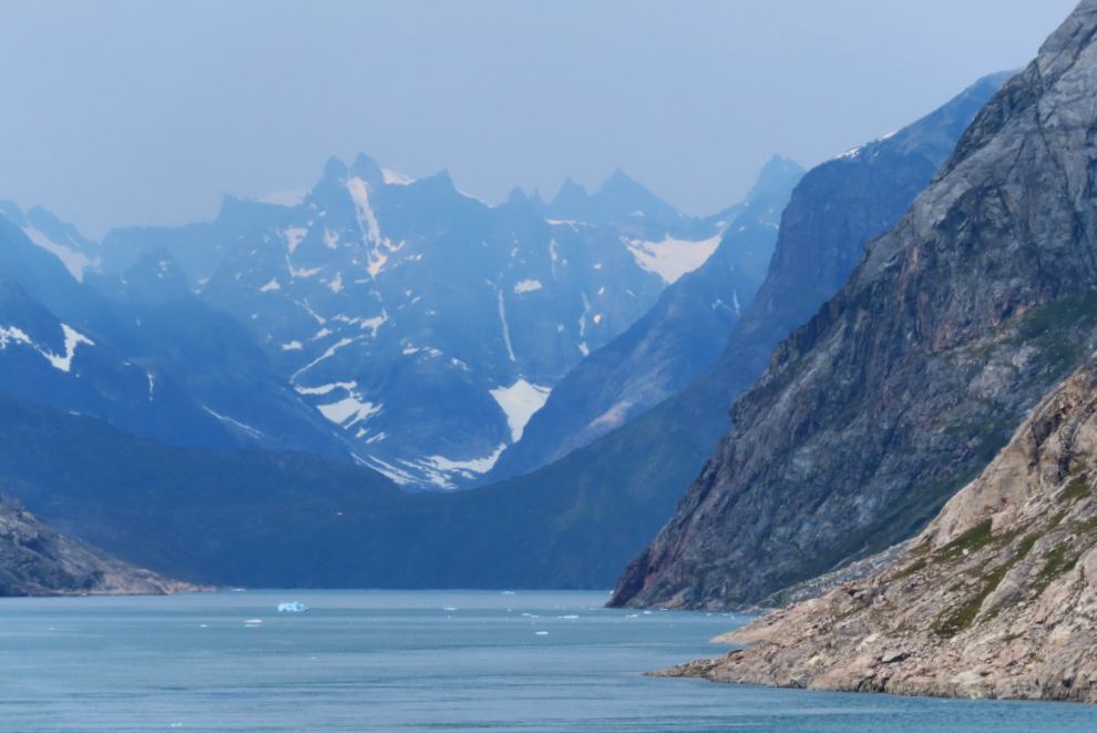
At 1:25 it was looking even wilder ahead.
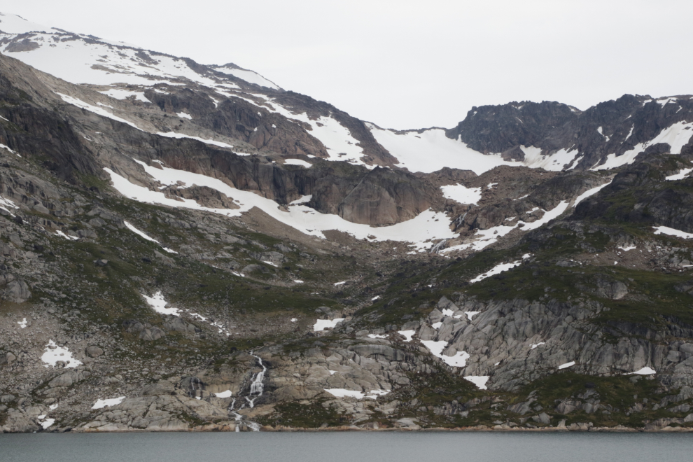
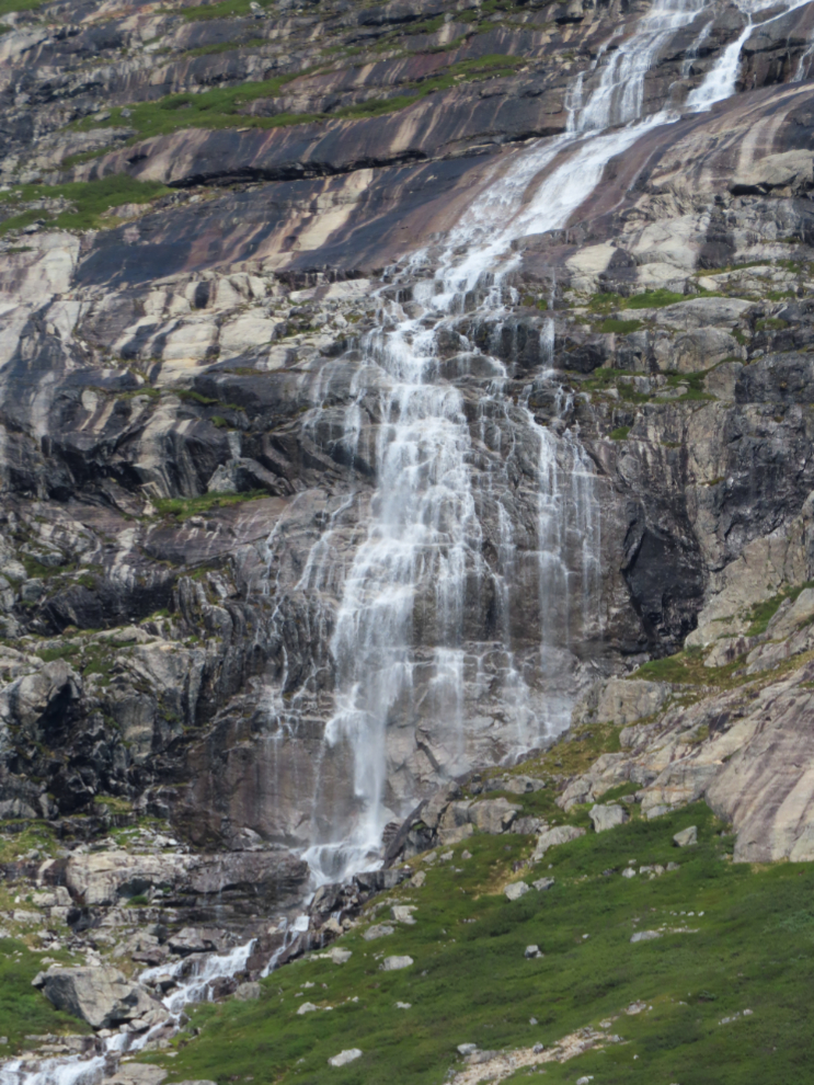
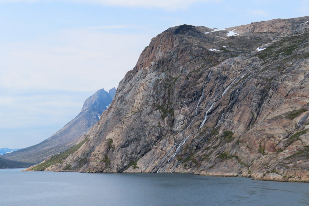
So many amazing waterfalls.
By about 1:40 I was getting very tired. My brain injury has been causing me increasing problems, and this day was overwhelming. Cathy wanted me to take a recovery nap. About here I said “right after that red rock I will.” (1:48)
But no, I didn’t lay down and close my eyes – I was in Greenland!!! At 2:09 there was another arm of the Greenland ice cap, and among the photos I shot of it, I got some of people’s reaction to it.
A look back at 2:22.
This is the image I’m using to define Prince Christian Sound. I figured some body must have come up with the name of this mountain, or fjord, or glacier, but Google Lens came up with nothing definitive. (2:26)
I’ll just share a waterfall every now and then 🙂
At 2:34, just O! M! G!
At 2:55 and 2:57, a look ahead, and a telephoto shot of that view. Two of several I shot within that short period.
The incredible complexity of that rock…
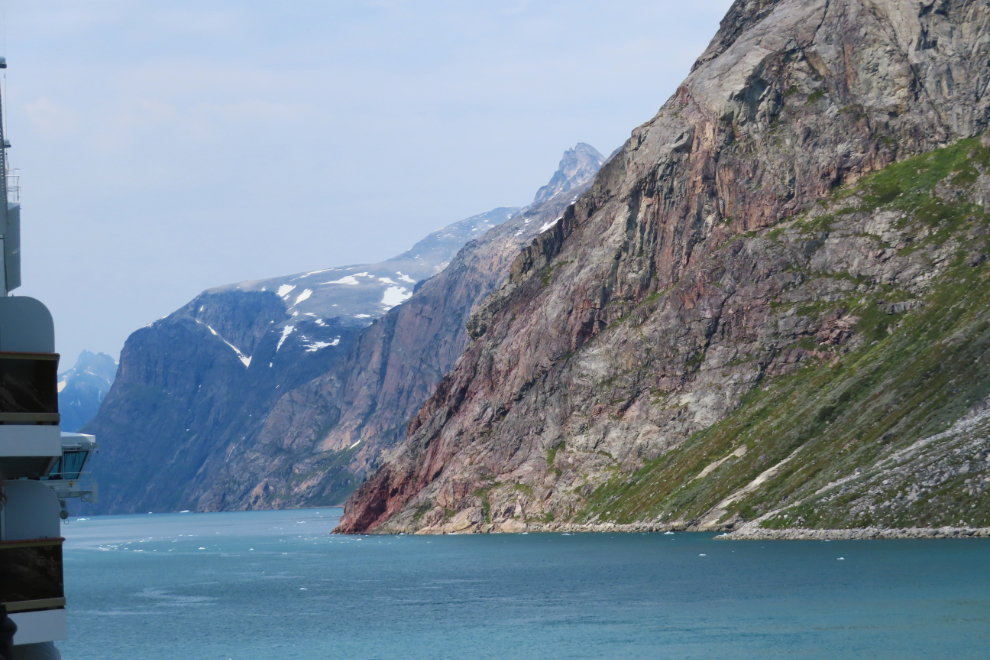
The face of the red cliffs on the left far above us was slowly peeling away, dropping millions of tons of debris on the slope below. (3:13)
A telephoto look at the next layer of rock and ice beyond the one we were sailing along.
I had never seen mountains with shapes quite like these. (3:24)
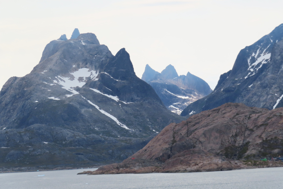
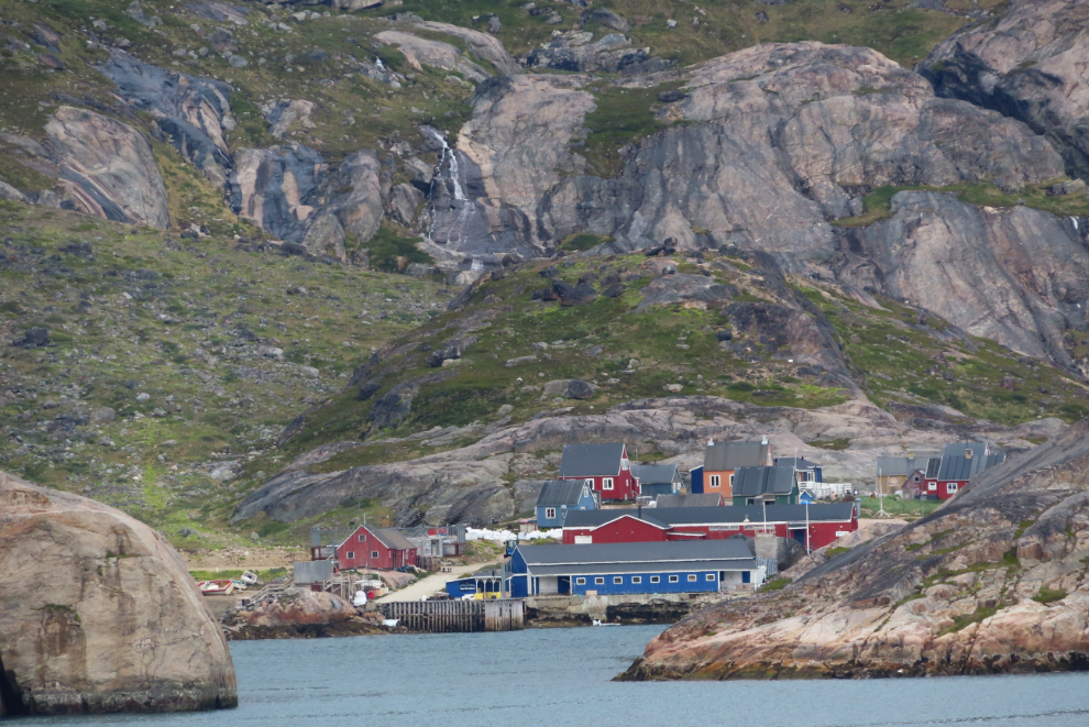
We had been promised a village for a long time, and finally at 3:27 Aappilattoq (Rødførde) came into view. It has a population of about 90. Wikipedia says “The name means ‘red’, after the red mountain rising above the settlement.”
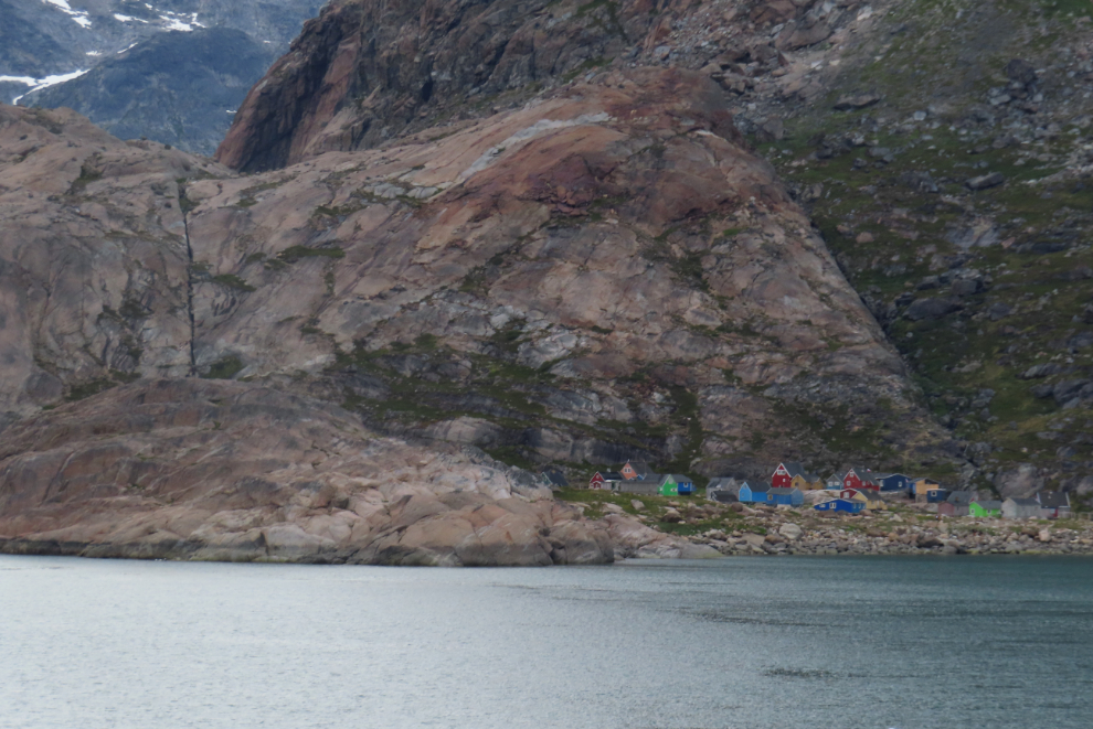
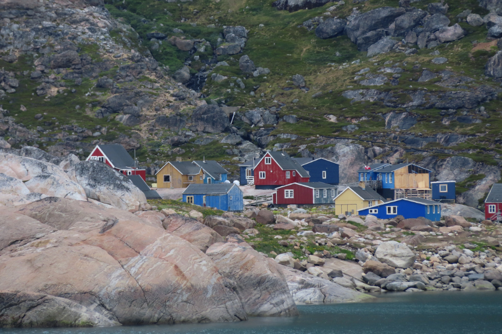
I shot a lot of photos at Aappilattoq as we passed very slowly by – of the village, and the surrounding terrain.
The very snug little harbour, at 3:36.
Looking ahead at 3:46.
I shot one last photo at 3:54, then crashed. I was in pain and had nothing left.
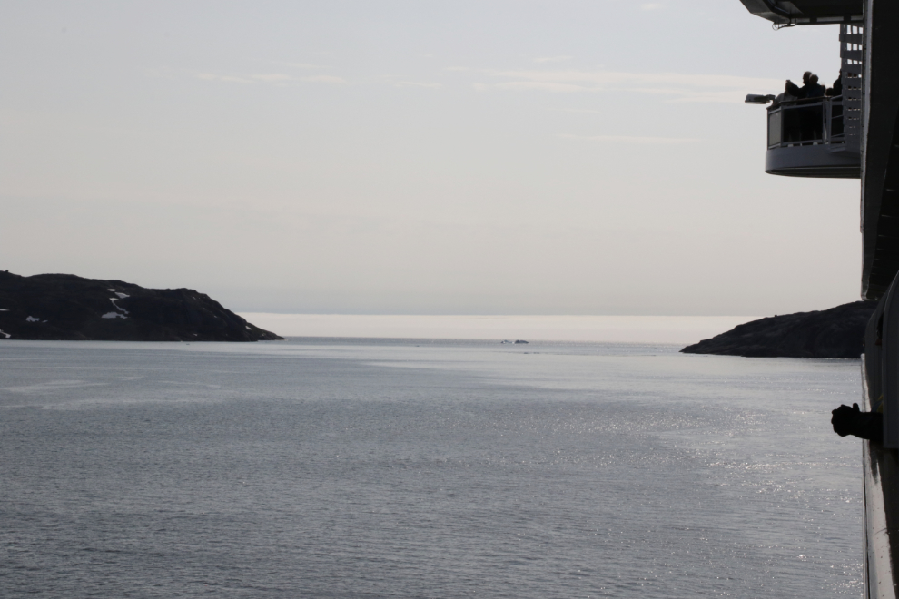
When I woke up, we had reached the open ocean again, so were back in fog, though not nearly as thick as it had been when we arrived. This was shot shot right at 5:00 pm.
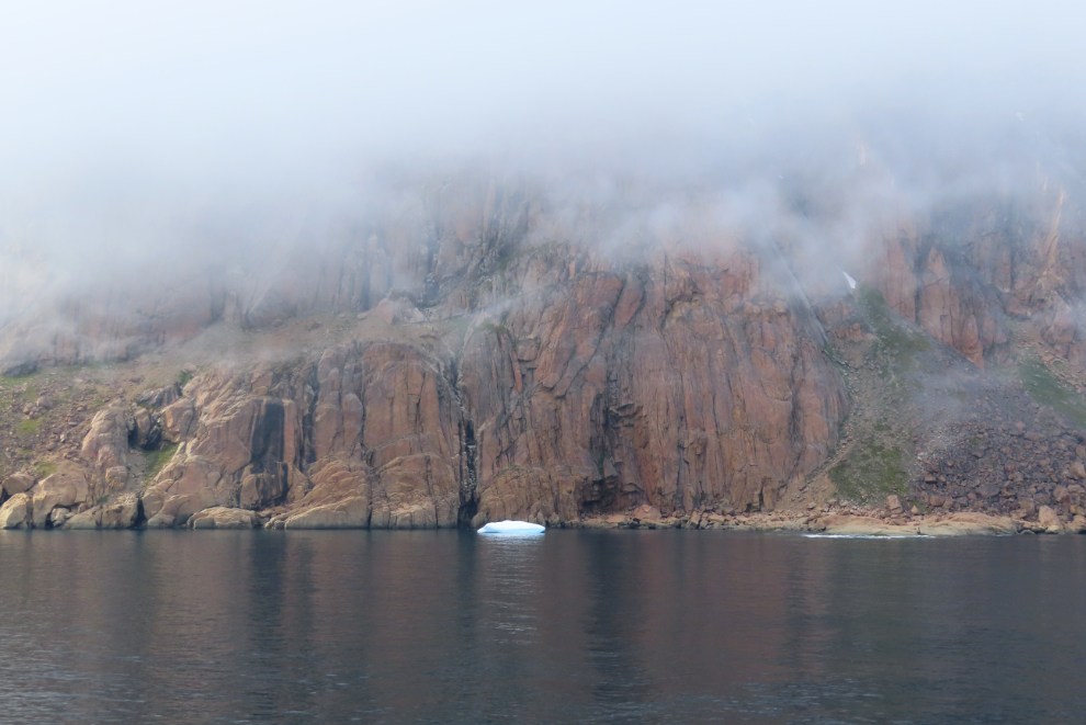
I got a couple of photos of large icebergs, then the world disappeared in the mist until the next morning. This final photo was shot at 5:14.
The next day – Monday, July 14th – we were again at sea, then on Tuesday, July 15th – we would tender ashore at Paamiut, Greenland. My goal at Paamiut was to take a good hike out onto the land by myself, perhaps to find some reindeer.