Hiking and biking the Stony Creek Trail
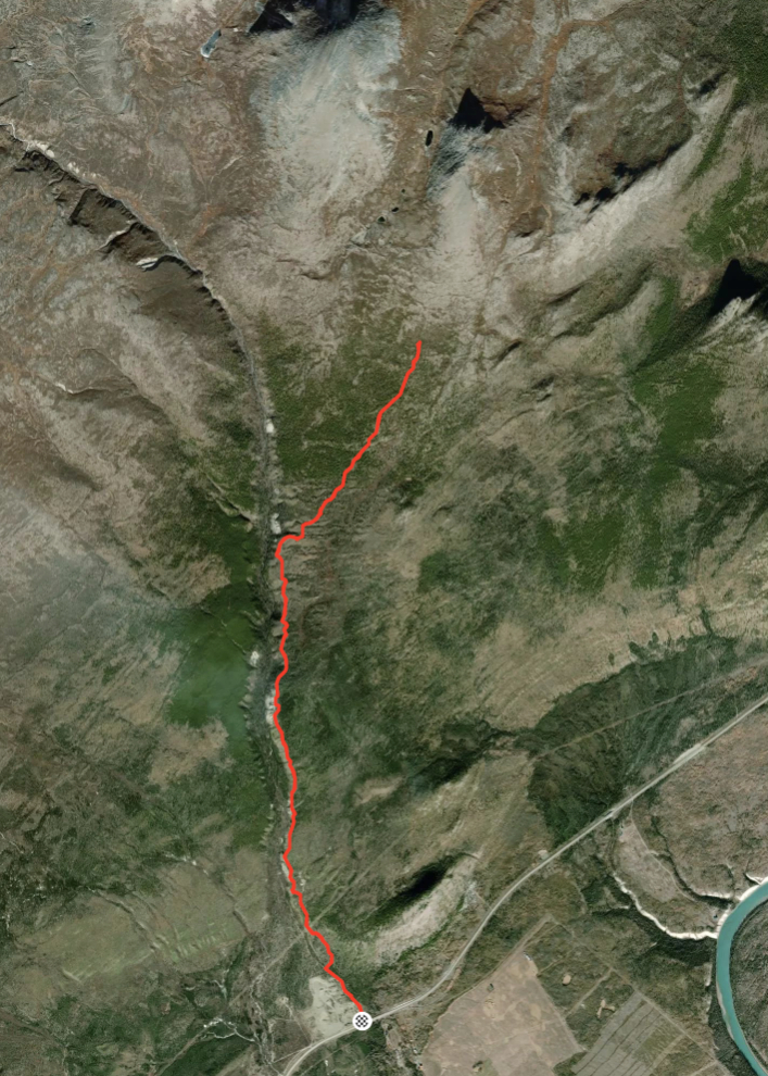
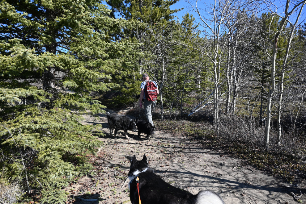
Today’s post covers two explorations of the Stony Creek Trail, located 61 km west of the Whitehorse airport. The first, on May 9th, was a hike with my friend Kevin, his dog Carbon, and Tucker. We hiked 8.2 km – I had to quit, but that was my longest hike in a very long time. The second trip was yesterday, May 23rd – with the e-bike, I covered 14.6 km. I noted on my Strava page (where the following map is), “Had to walk a fair bit due to steep, rough hills and mud/snow.” I almost made it to the summit – next time! 🙂
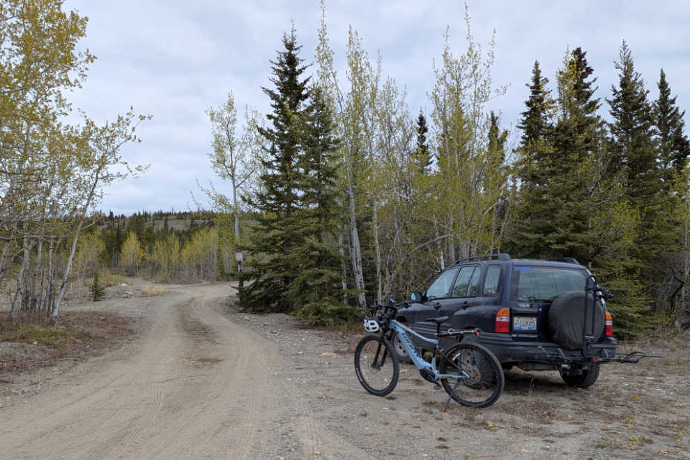
On the first trip, we parked here, just over 1 km from the highway.
For a few hundred meters, the road has quite a dip in the middle – I expect that at some point there was a creek running down it during the Spring snow melt.
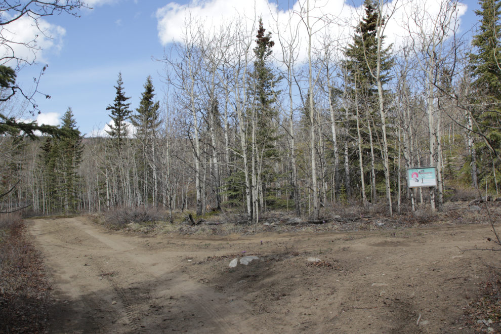
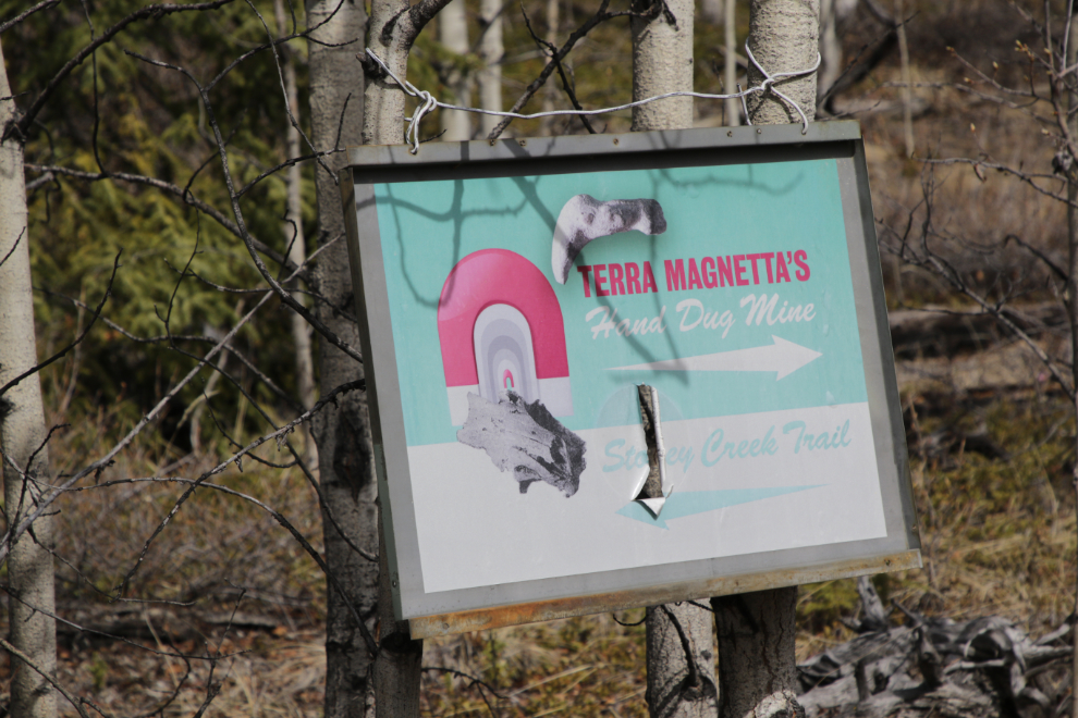
We soon came to a fork in the road. Off to the right is Terra Magnetta’s “Hand Dug Mine,” a small placer gold operation. The entire area is staked, and placer mining has gotten very controversial due to possible effects on water quality for residents of the area. I was very surprised to find when I started researching the creek that there was no mining until very recent years – the only mention of the creek historically was due to a roadhouse located where the Kluane Wagon Road crossed it. The current mining appears to have started in 2017.
We picked up a companion as we passed the mine – a very old dog who really became a nuisance, bothering both Carbon and Tucker and panting like a steam locomotive but refusing to drink anything. He stayed with us for the entire hike, though at a distance when we finally made it clear that none of us appreciated his company.
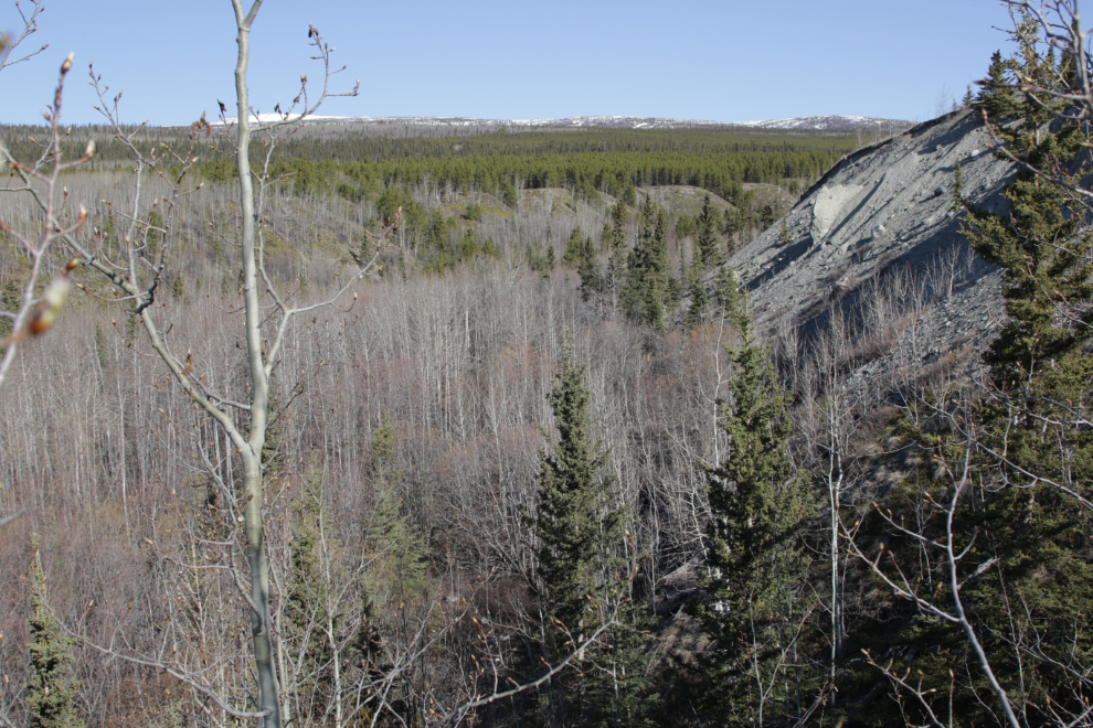
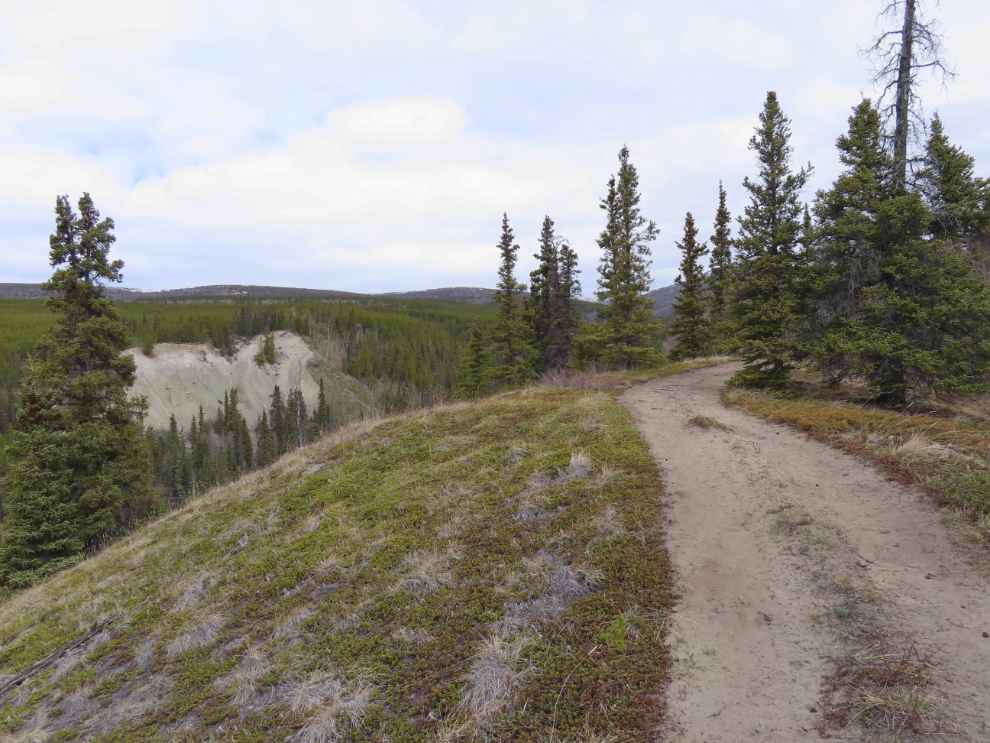
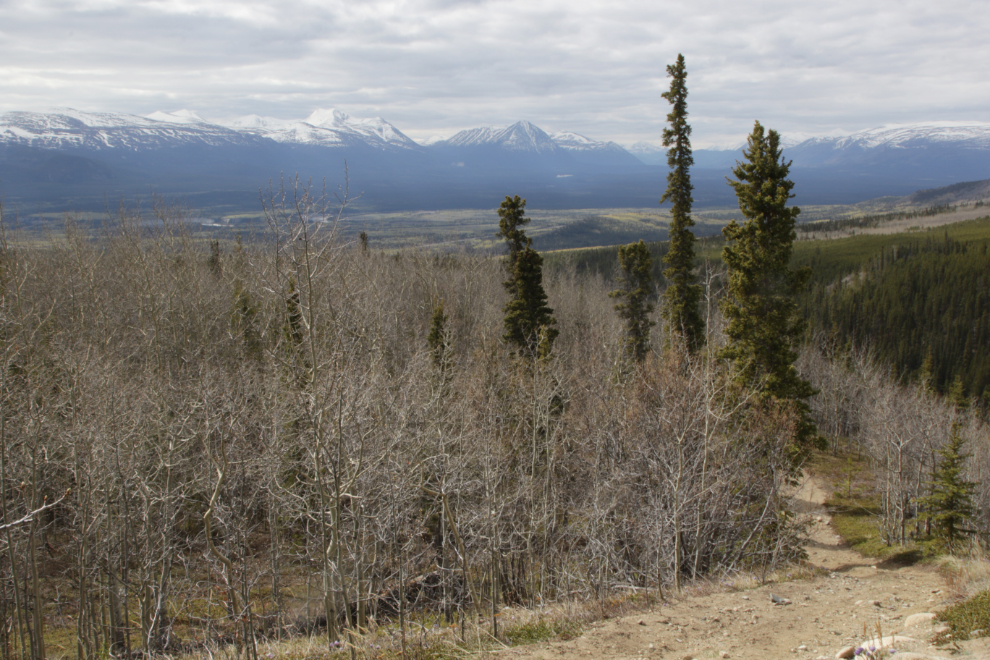
A look down into the valley. Occasional glimpses of the small creek are all you get, and they will soon disappear as the leaves come out on the trees. From here it’s not clear whether that slide is natural or from mining, but aerials make natural erosion likely.
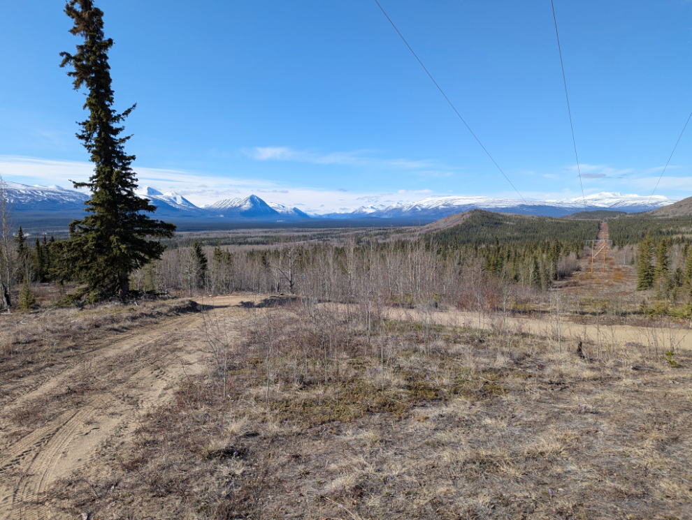
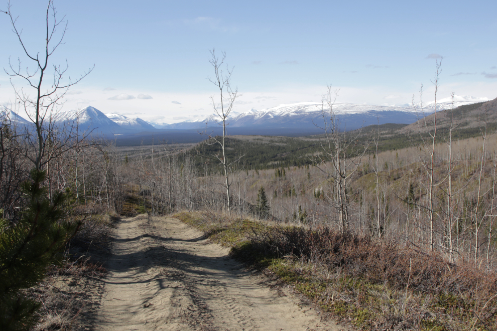
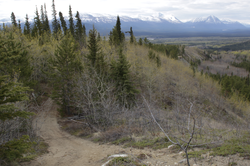
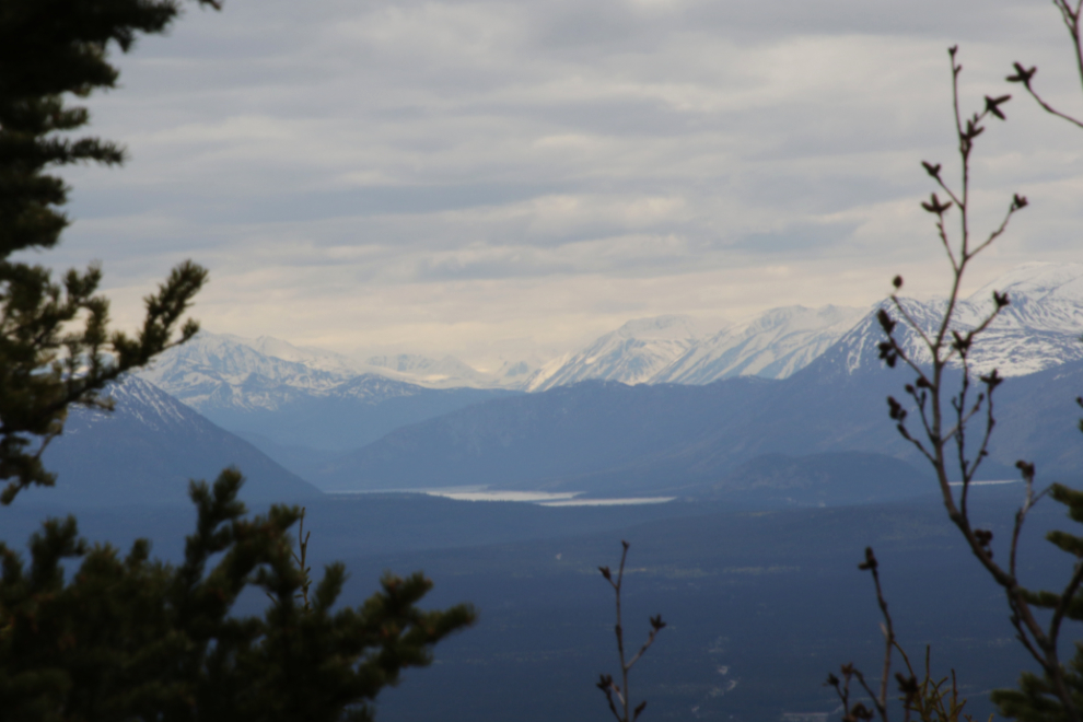
The views along much of the trail are wonderful, looking south towards Kusawa Lake.
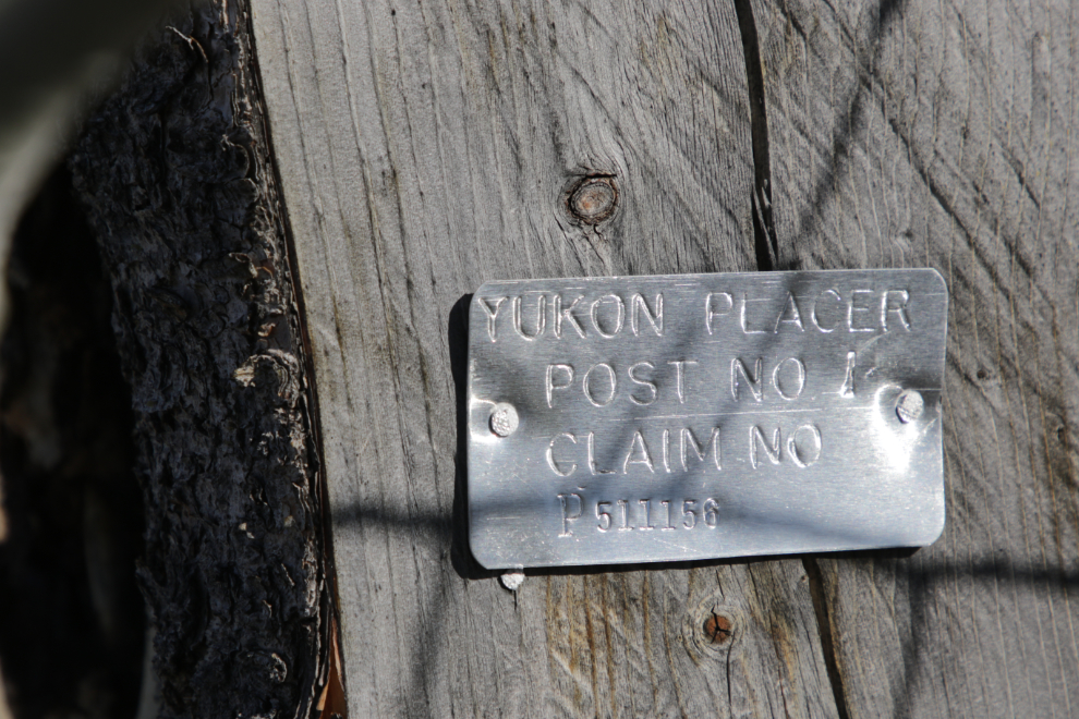
One of many claim posts.
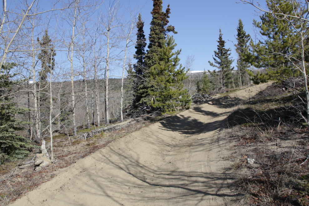
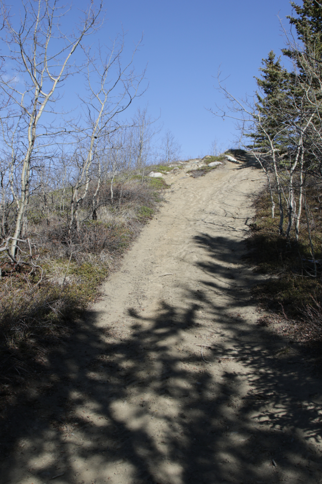
There are some very steep hills, and the surface of a few is soft sand, making them even more challenging.
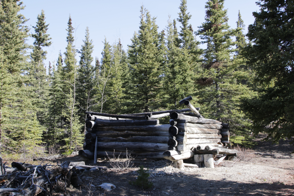
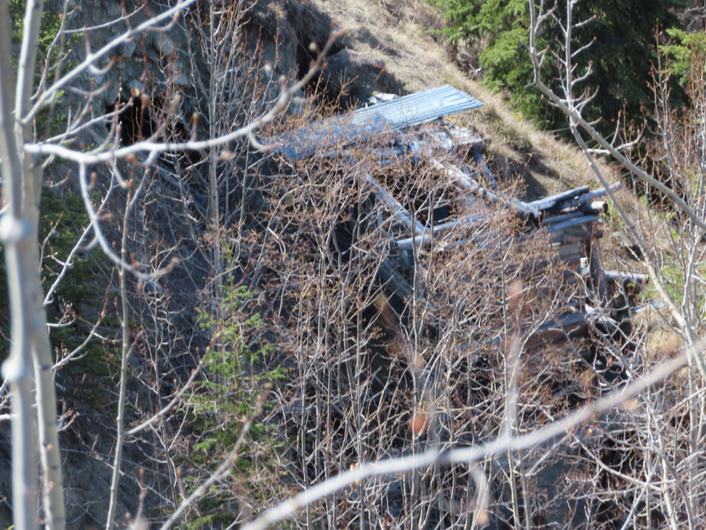
I can’t make any sense of this well-built log structure – there are no doors or windows. There are signs of a small camp just beyond it.
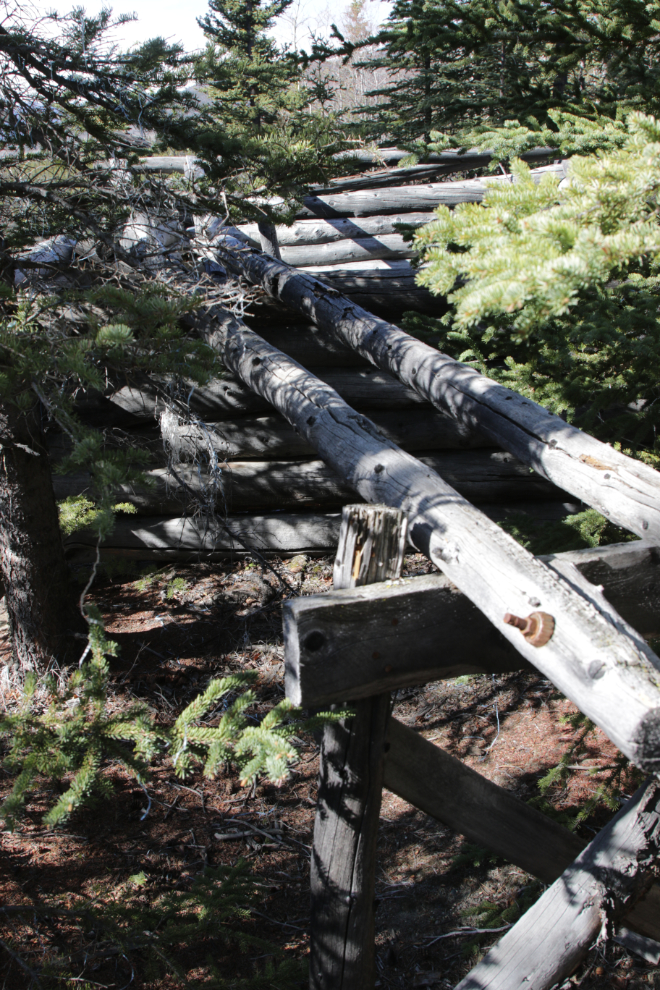
A long narrow ramp up to the top of a wall just adds to the mystery…
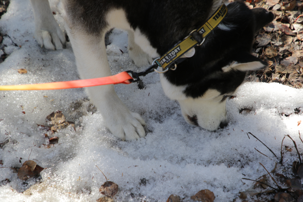
Only one of the three dogs enjoyed reaching snow – the husky, of course 🙂
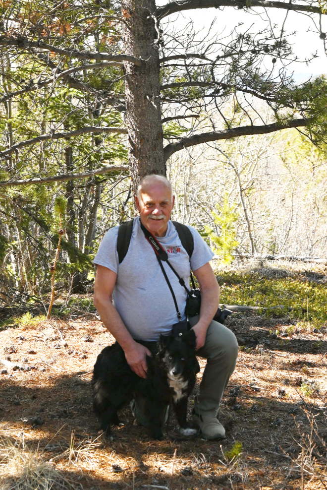
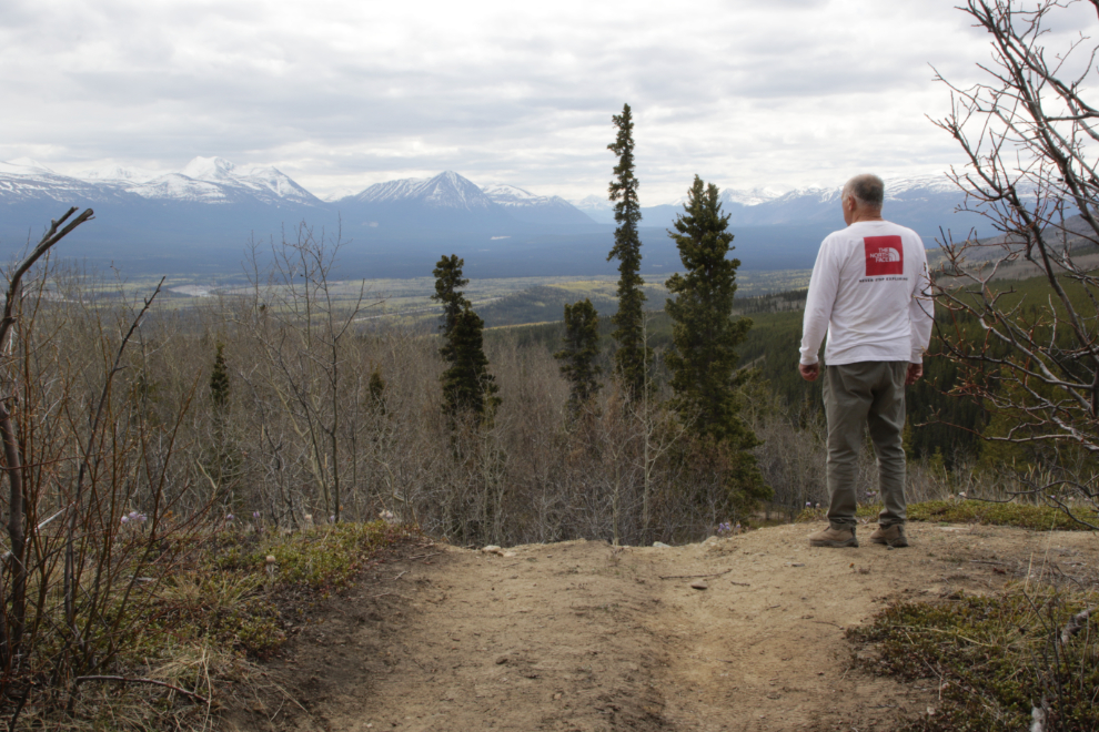
My little buddy and me.
Moose.
At the top of this hill, I had to call it quits. By the time I got back to the truck I knew that had been a good call.
On the way down, Kevin pointed out this barely-visible mine at the valley bottom. Exploring along the creek will be another trip.
With a good weather forecast, I actually drove out to Stony Creek on May 21st, but I got sucked in – it was cloudy, windy and cold at the trailhead, so the bike didn’t come off the rack. Yesterday, the forecast had again been great, but it clouded over half an hour past Whitehorse – this time I was determined to give the trail a try, though.
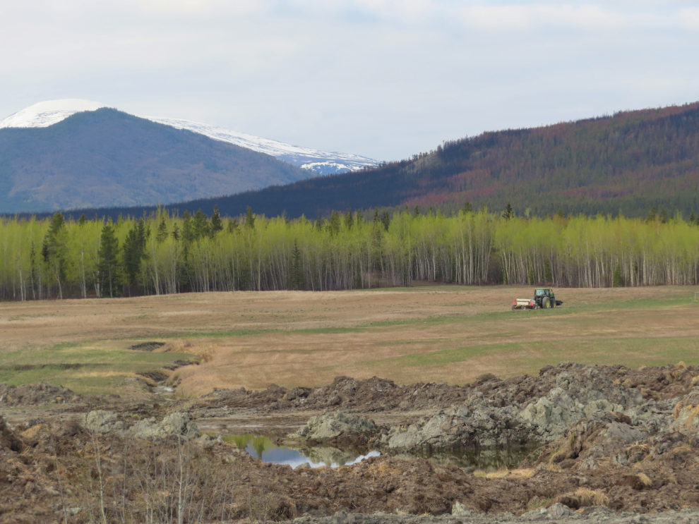
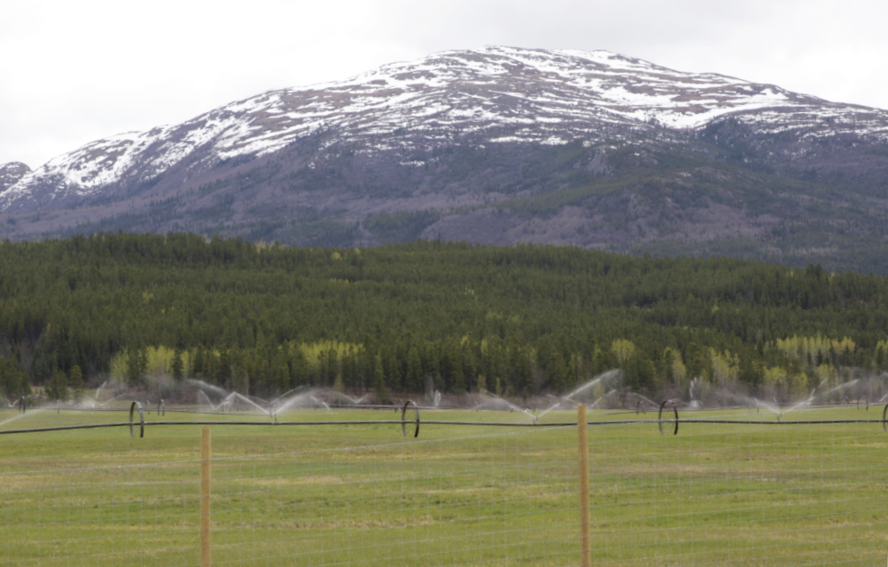
There is some really pretty country west of Whitehorse, and it’s one of the Yukon’s main agricultural areas.
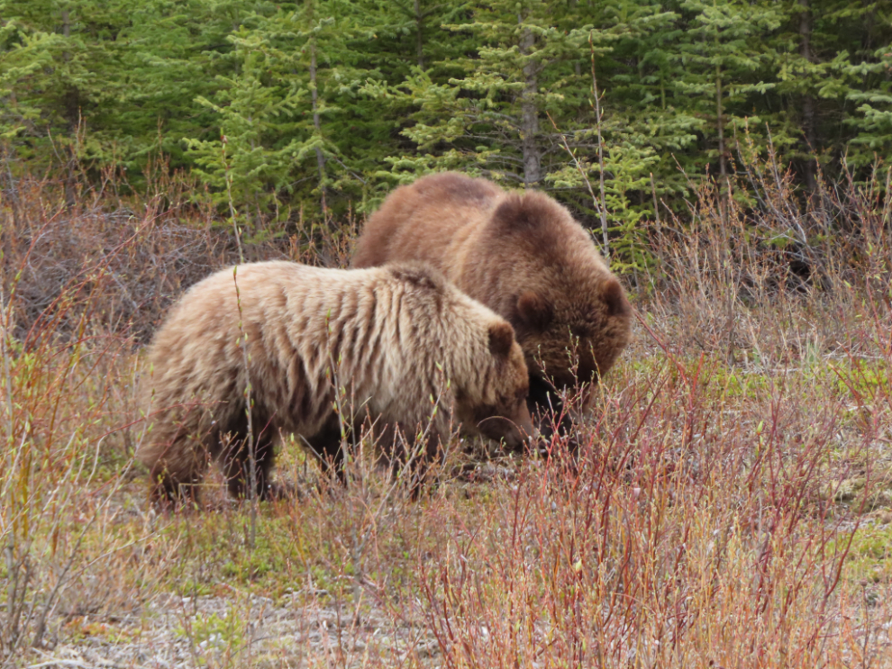
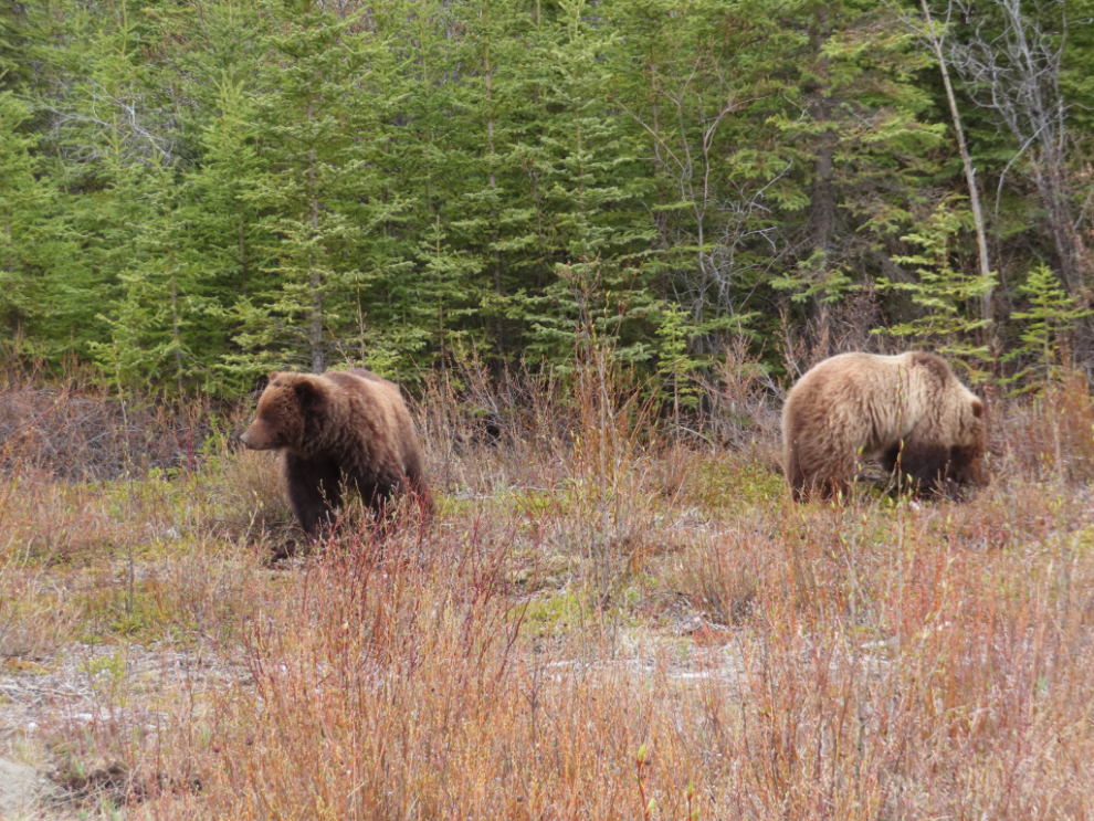
What a nice surprise as I neared Stony Creek to meet two grizzlies along the highway. They were completely unconcerned about my presence, so I spent a few minutes with them. I think they’re 2-year-old siblings starting their first summer away from mom.
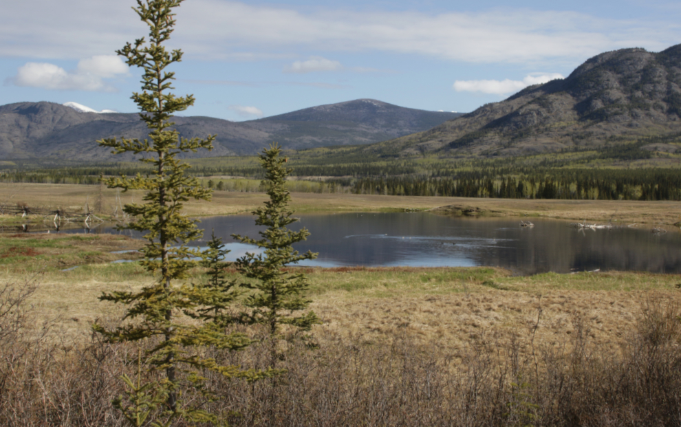
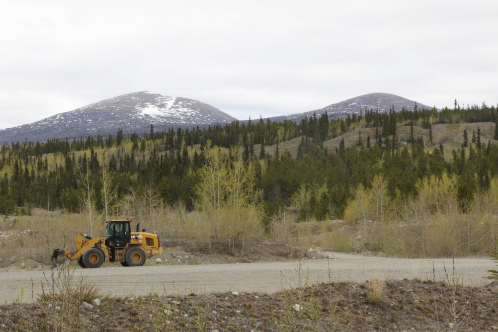
The road/trail starts at a large gravel pit right at Km 1484 of the highway. This spot provides a decent look at the two mountains up there – the trail I’d be following goes to the one on the right, but there are some interesting lakes between it and higher Stony Peak to the left.
From the gravel pit entrance, the Stony Creek road doubles back along the highway.
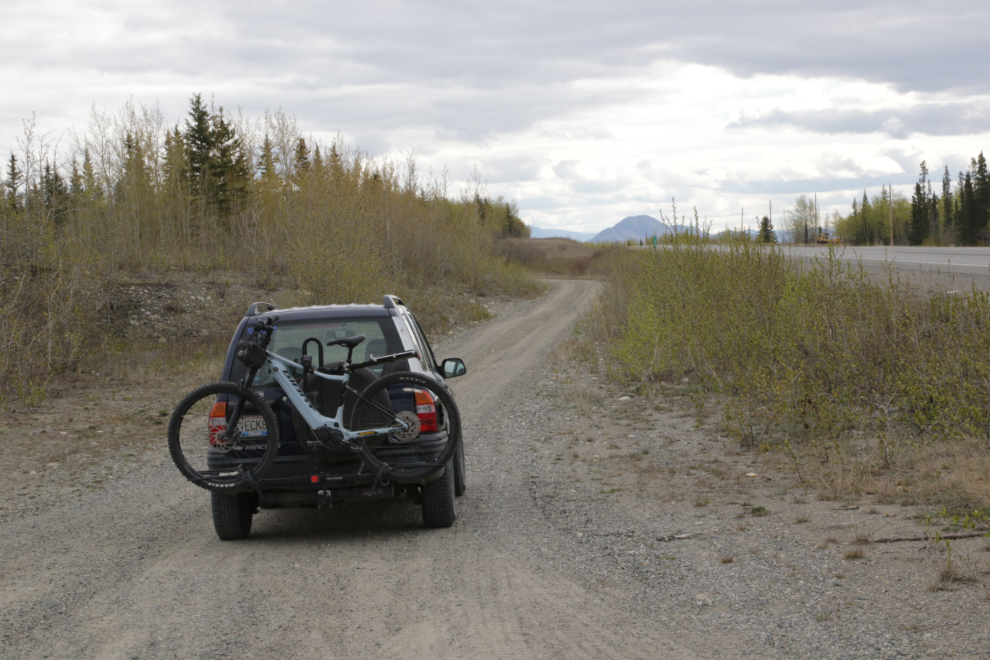
In a couple of hundred meters, the road starts uphill – I unloaded the bike there at 10:30.
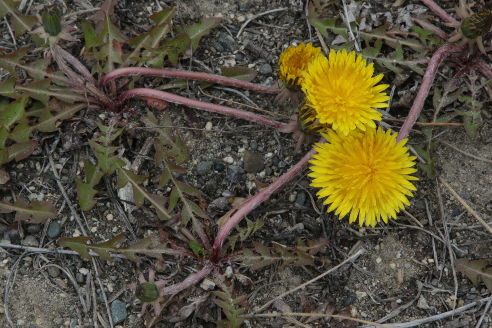
There was a very healthy little field of dandelions where I unloaded. Although there are a few flowers that look like dandelions to me, my Picture This app says that these actually are Taraxacum officinale.
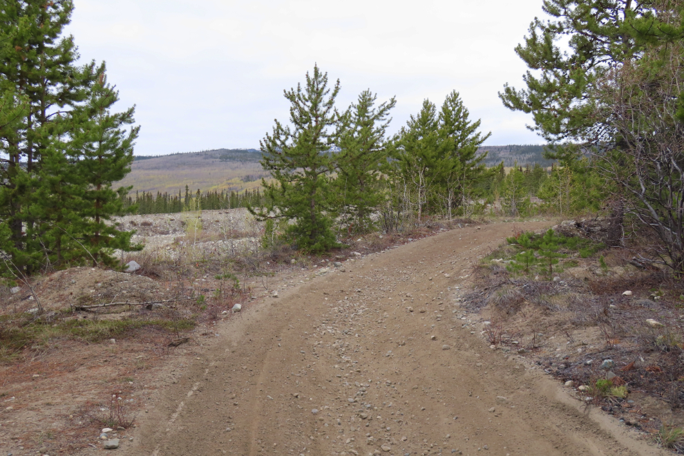
The start of the road as it goes by the gravel pits.
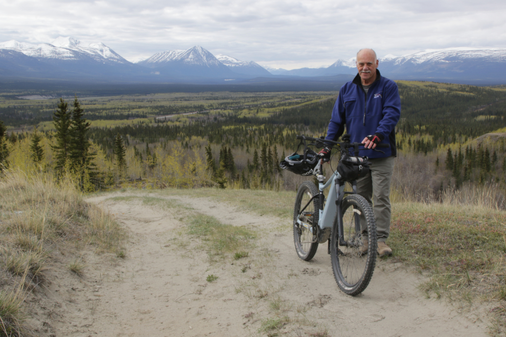
Taking a “selfie” the old way – taking off my cameras and backpack and setting up the tripod – is a pretty slow process. I shot this one at 10:54 – just 24 minutes from unloading the bike, the view had changed dramatically.
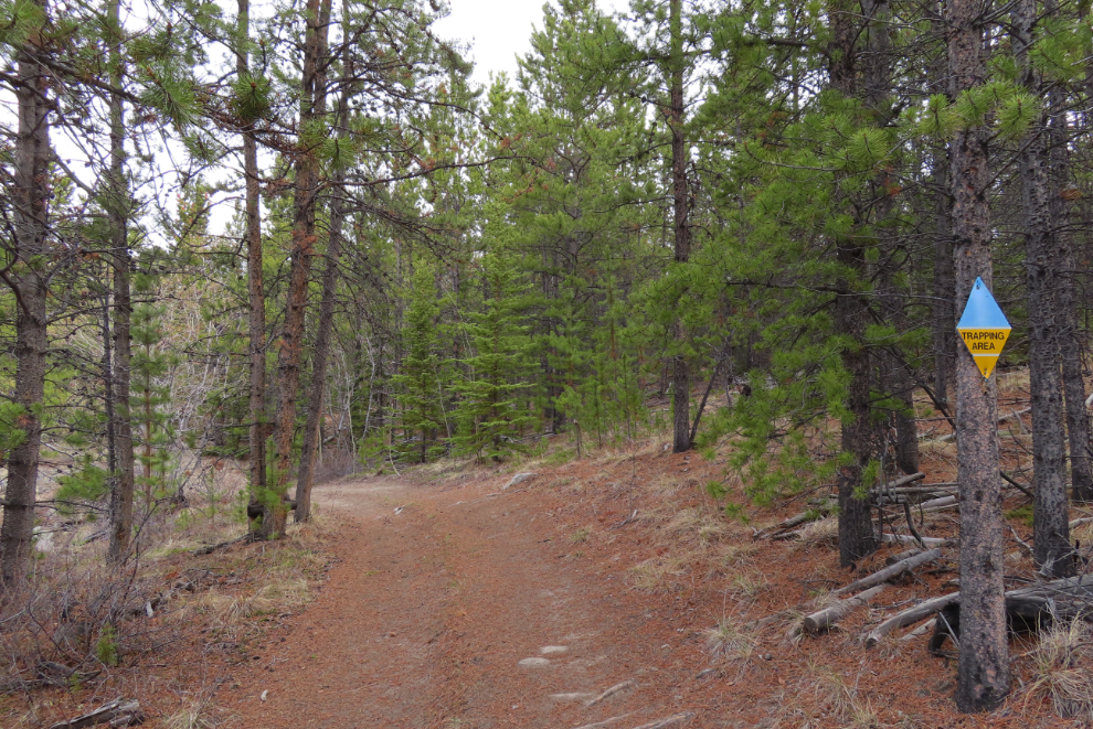
In theory, being in a trapping area is no big deal except in the winter, but I’m not going to risk my dog’s life betting that all the traps have been cleaned up, so our dogs were both on leash during our hike 2 weeks ago.
Each of these steep climbs improves the view, making them easier to deal with 🙂 – I’m getting pretty good with the bike in difficult terrain, but had to walk the bike up this one and a few more. Perhaps I should say I’m getting pretty good for being 74 years old 🙂
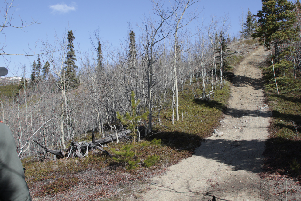
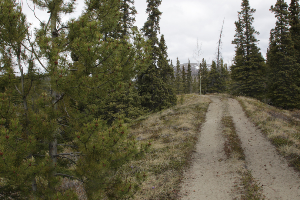
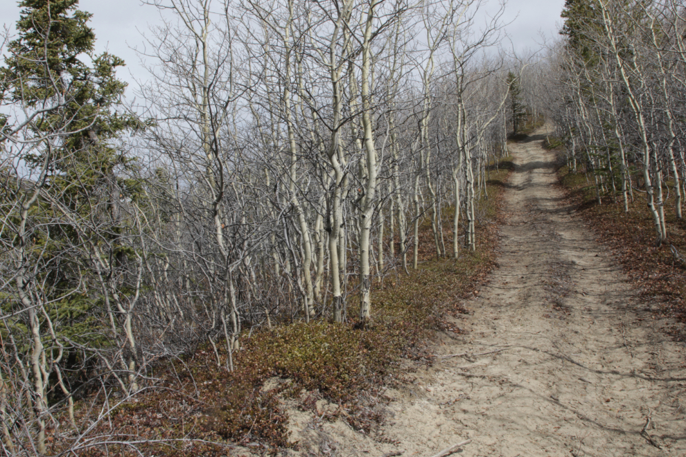
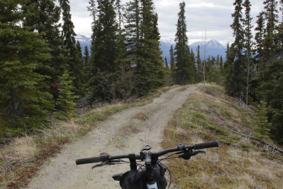
The trail is really nice riding between the hills.
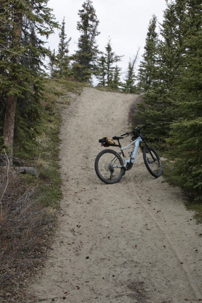
But some of the hills like this very steep one with loose sand, are beasts. A quick look at the trail profile at Strava shows grades of up to 37.2%. It was now 11:17.
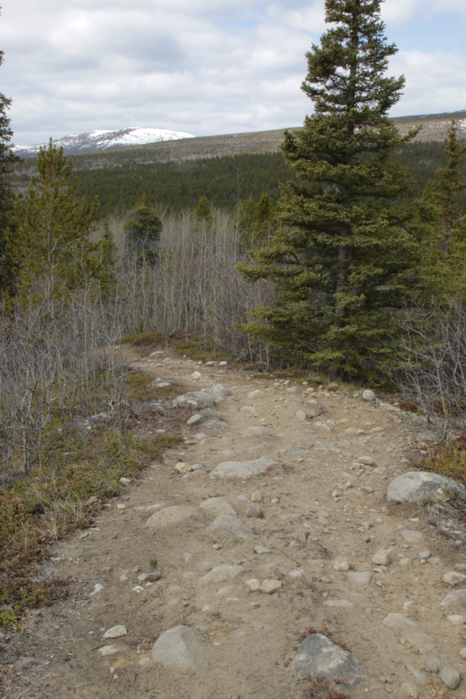
How perfect is this for an e-bike trail? Now that I’ve seen most of the trail, I’ll hold out for sunshine for the next ride.
The view looking back down the trail just kept getting better.
I was able to ride all but the last little bit of this hill.
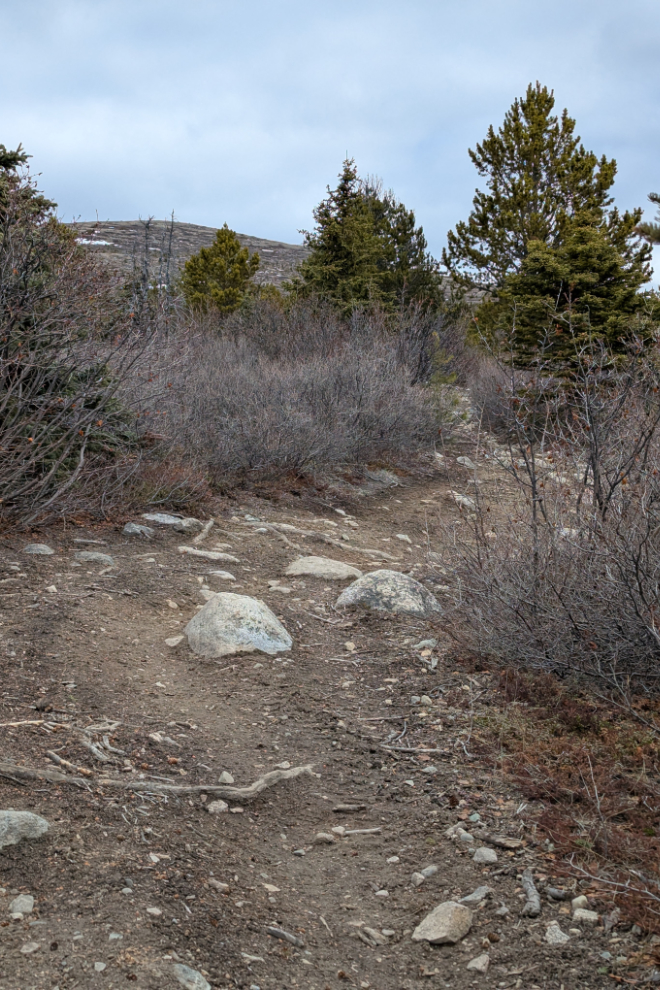
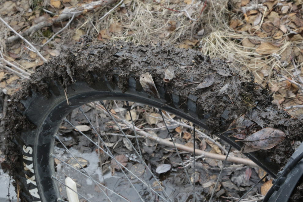
Just before noon, the trail surface started to get ugly. First it was rocks – they wouldn’t be bad on a level trail, but being on a hill compounds the problems.
Looking back down the trail at 11:58.
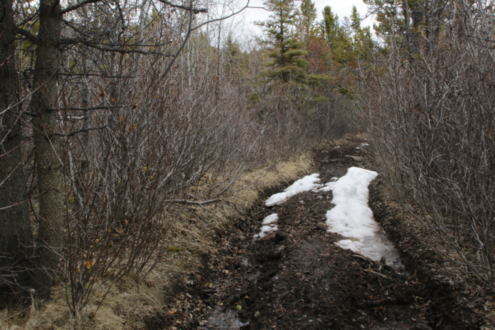
Mud and snow at 12:15.
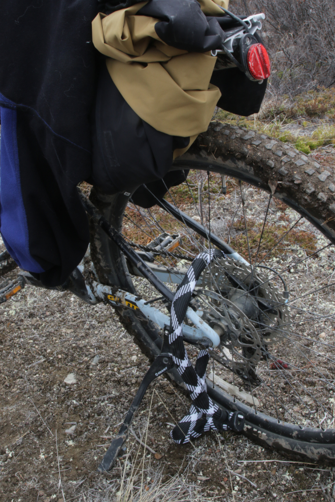
At 12:30, trail conditions made it useless having the bike so I decided to lock it up and see if I could walk to a good place. Although I figured the end of the ATV trail and the start of the summit hike couldn’t be far, all I could see was forest.
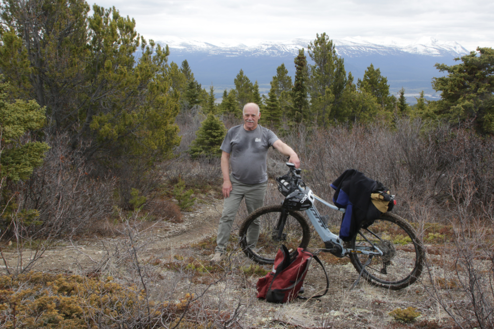
I only walked for a few minutes – I was physically and mentally too tired to continue, so at 12:45 I shot a final photo of the distant view of Kusawa Lake and started back down.
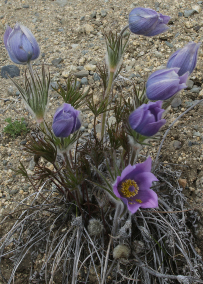
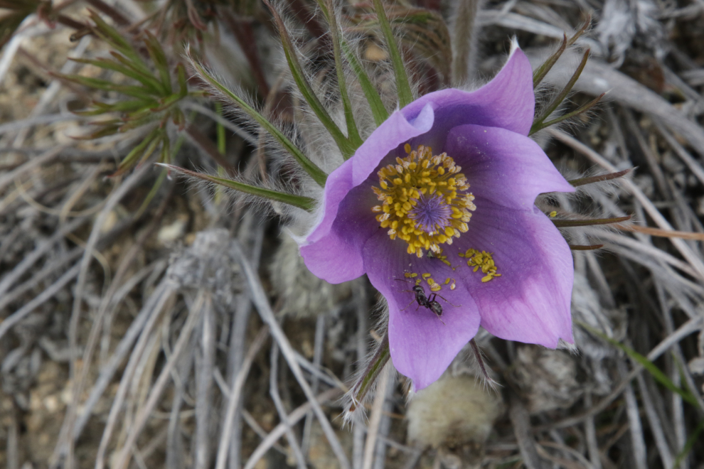
On the way down I found a level spot with a fine view and loads of Prairie crocuses and took a long break.
A final shot of the trail at 2:05. Though not without challenges (steep hills and rocks) the ride down was wonderful 🙂
By the time I got back to the car, I had been on the trail for 3 hours and 53 minutes. With better planning, I had plenty of time to get enough rest along the way to make the top. Next time 🙂
As I drove home, the irrigation system was going on one of the big farms I passed (yes, big by Yukon standards). I think most visitors are surprised by how dry the Yukon is. Annual precipitation in Whitehorse varies dramatically year to year, and the figures also vary dramatically depending on which website you look at, so I gave up trying to give you a figure.
One final stat – I’m determined to get my weight back down to 198 pounds, and I lost 1.6 pounds on this ride. Only 6 pounds to go 🙂
What a great trail report — that stretch of Stony Creek looks both challenging and incredibly rewarding.
The climb with the 37% grade and the final stretch of snow and mud makes it all the more real for anyone
thinking of giving it a try. I really appreciated the mix of trail detail and local
history (like the mining claims and that curious log structure). I’ve been working on
capturing stories and images like this from my own Yukon travels too — here’s one of
my latest explorations. Thanks for the inspiration, and hope you make that summit next ride!
Hi Murray, thanks for sharing! Several friends and I are doing a self supported bicycle tour of the Golden Circle in July and I came across this blog looking at the Stony Creek trail head as a possible wild camping site on our way to Whitehorse. What do you think about camping here? Or can you suggest other possible wild camping sites between here and Whitehorse? Do you know if the grizzly population in this area is so high that wild camping is insane even with standard precautions?
Thanks!
Hi Phil. First, I apologize for taking so long to reply – I don’t know how I missed your comment. The bottom mile or so of the trail in particular offers a few good locations for the sort of camping you’re looking for. Grizzlies are a reality everywhere in the southern Yukon, but camping with standard bear precautions is perfectly reasonable.
I hope you have an amazing trip.
Murray
Awesome Murray!! Thanks for sharing!