The Pine Creek dredge and flume at Atlin
On Sunday, September 8th, I left my cozy cabin in Atlin with the plan of spending a long day exploring Ruby Creek and Ruby Mountain. But I got distracted, and this post is about the reason for that 🙂
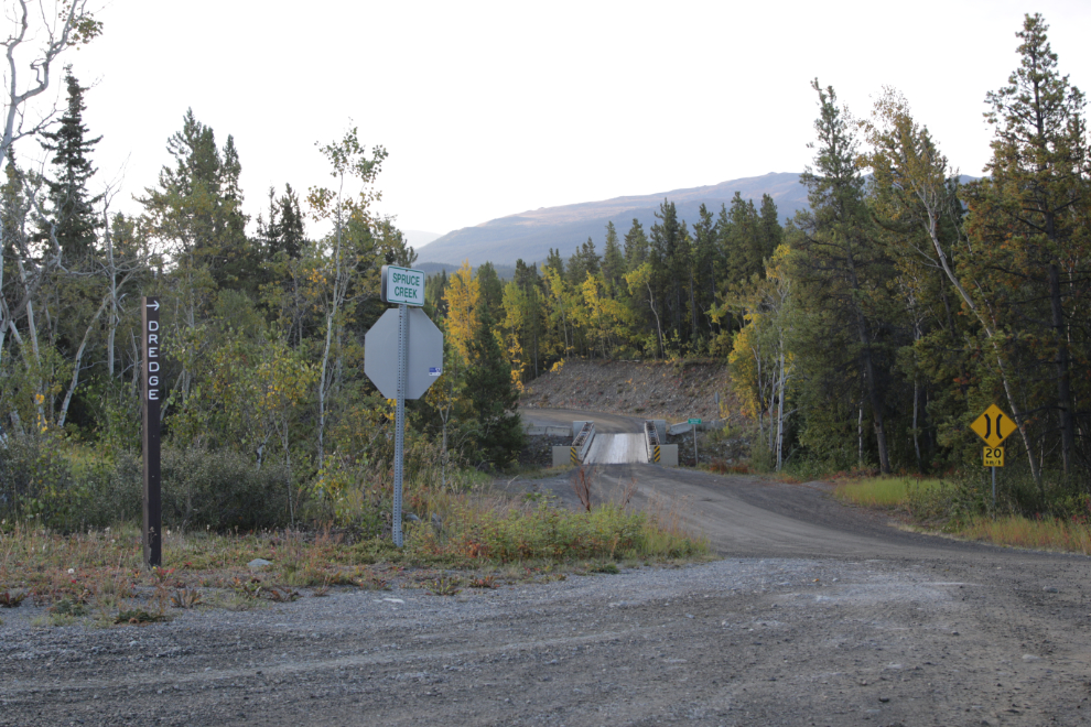
I got an early start and was driving up Surprise Lake Road at 08:25 when I spotted a little sign at the Spruce Creek Road that just said “DREDGE.” It took me a couple of seconds to process that and stop. I backed up and shot the first photo, then was on my way to a site I had always run out of time to see before (there’s a lot to see in the Atlin backcountry!).
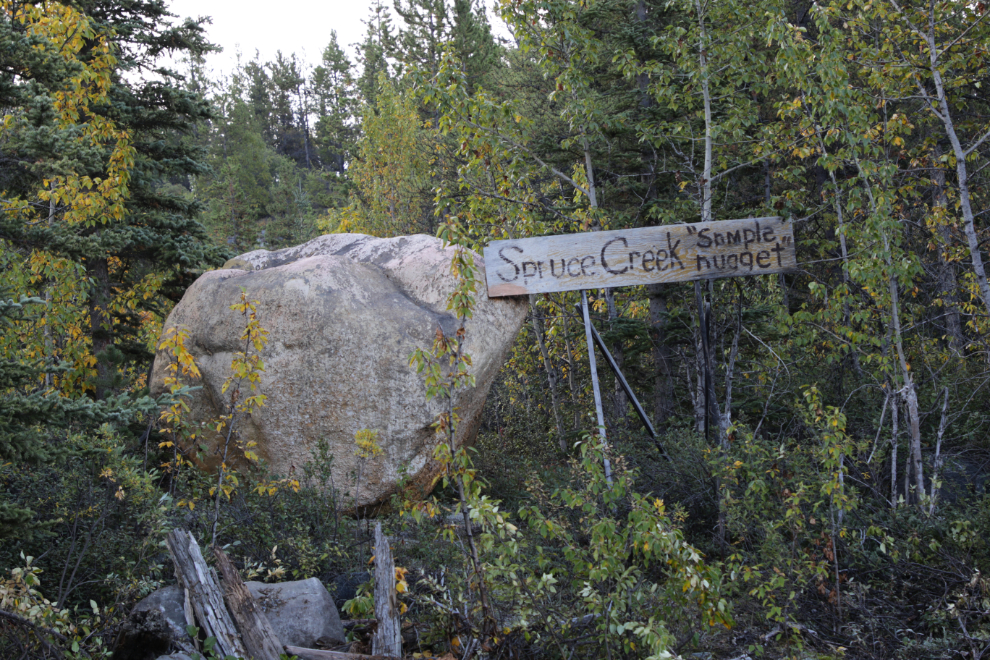
The Spruce Creek sample gold nugget (4-5 feet high) along the road was getting quite overgrown the last time I was by, but it’s been cleared now 🙂
The little sign at the far right of the next photo indicated a 120-degree turn to the left, at 08:32.
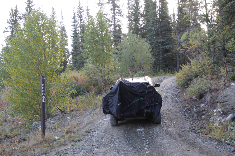
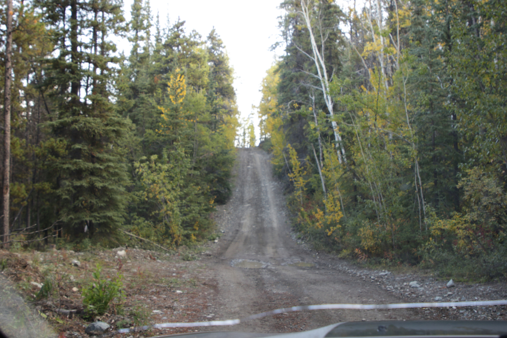
A couple of minutes later, another turn put me on a smaller and rougher road. I would take the raincover off the e-bike shortly – with both my rear window and taillights blocked it’s certainly not very safe.
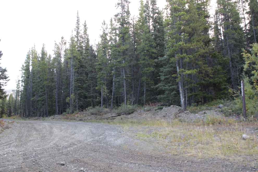
In another minute or so the steepest hill on the road is reached.
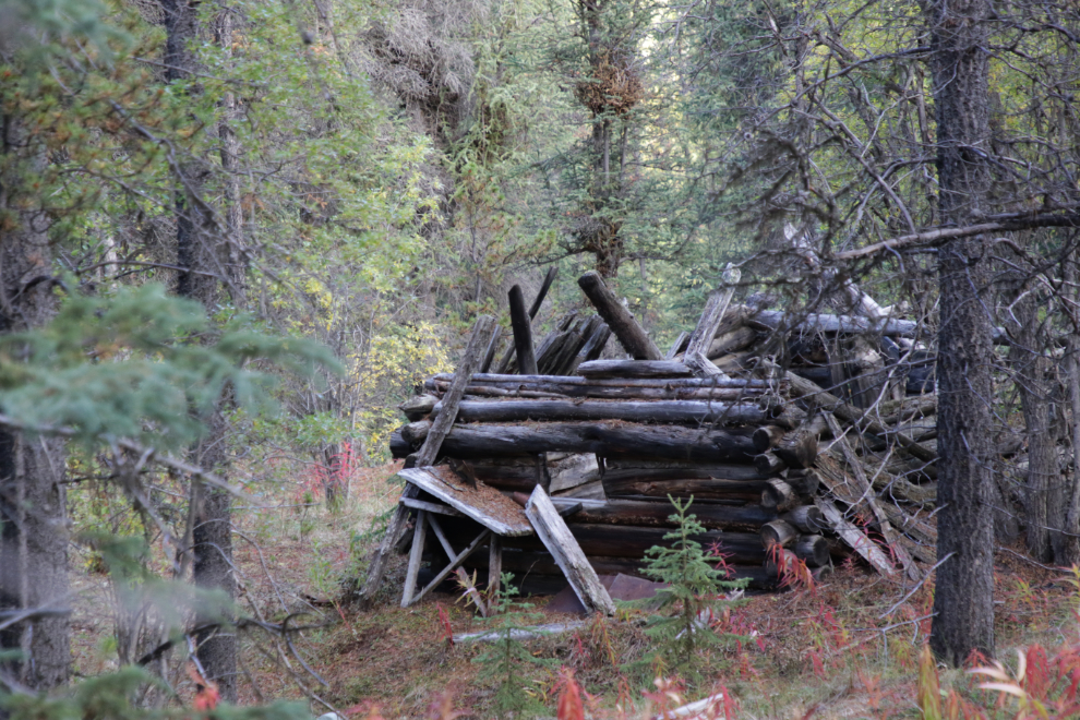
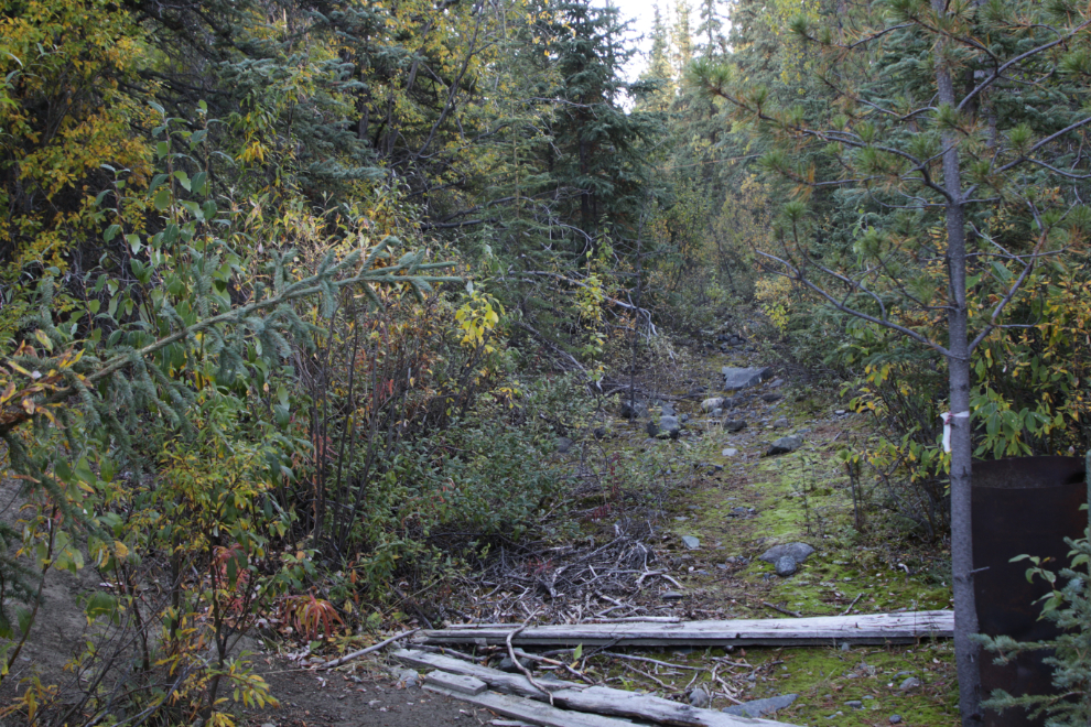
A cabin a hundred meters or so off to the side. I would soon learn that the entire 5-mile length of the flume I was about to see is worth exploring – some day.
At 08:46 (only 20 minutes from the Surprise Lake Road even with a few photo stops) I reached the Dredge and Flume Recreation Site.
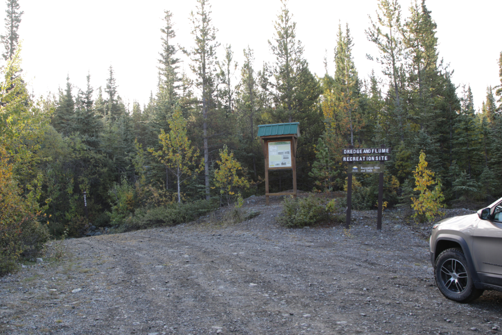
The interpretive sign gives a very brief history of the 1907-08 project I was about to see.
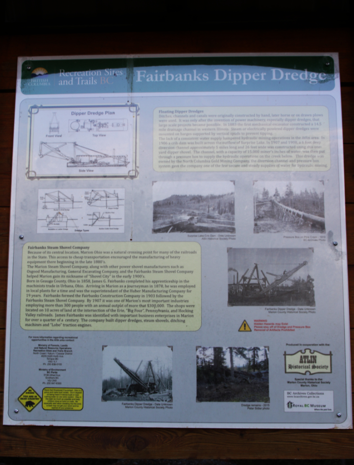
Floating Dipper Dredges
Ditches, channels and canals were originally constructed by hand, later horse or ox drawn plows were used. It was only after the invention of power machinery, especially dipper dredges, that large scale projects became possible. In 1883 the first mechanical excavator constructed a 14.5 mile drainage channel in western Illinois. Steam or electrically powered dipper dredges were mounted on barges supported by vertical spuds to prevent tipping.
The lack of a consistent water supply hampered hydraulic mining operations in the Atlin area. In 1906 a crib dam was built across the outflow of Surprise Lake. In 1907 and 1908, a 6 foot deep diversion channel approximately 5 miles long and 26 feet wide was constructed using this one-yard dipper shovel. The channel, with a capacity of 15,000 miner’s inches of water, was then put through a pressure box to supply the hydraulic operations on the creek below. This dredge was owned by the North Columbia Gold Mining Company, the diversion channel and pressure box system gave the company one of the few secure and steady supplies of water for hydraulic mining.
Fairbanks Steam Shovel Company
Because of its central location, Marion, Ohio, was a natural crossing point for many of the railroads in the State. This access to cheap transportation encouraged the manufacturing of heavy equipment there beginning in the late 1880s.
The Marion Steam Shovel Company, along with other power shovel manufacturers such as Osgood Manufacturing, General Excavating Company, and the Fairbanks Steam Shovel Company helped Marion gain its nickname of “Shovel City” in the early 1900s.
Born in Geauga County, Ohio in 1858, James G. Fairbanks completed his apprenticeship in the machinists trade in Urbana, Ohio. Arriving in Marion as a journeyman in 1878, he was employed in local plants for a time and was the superintendant of the Huber Manufacturing Company for 19 years. Fairbanks formed the Fairbanks Construction Company in 1903 followed by the Fairbanks Steam Shovel Company. By 1907 it was one of Marion’s most important industries, employing more than 300 people with an annual output of more that $300,000. The shops were located on 10 acres of land at the intersection of the Erie, “Big Four”, Pennsylvania, and Hocking Valley railroads. James Fairbanks was identified with important business enterprises in Marion for over a quarter of a century. The company built dredges, steam shovels, ditching machines and “Lobo” traction engines.
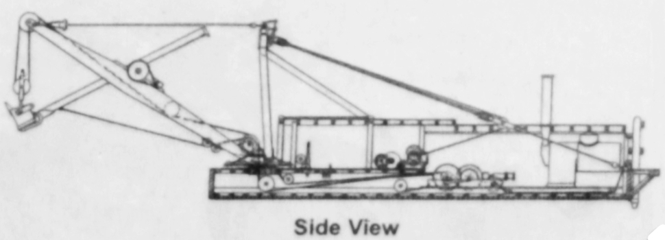
The schematics on the sign didn’t process well but I managed to save the side view, an important view to understand what is left here now. This was all a surprise to me – I had expected one of the bucketline dredges for processing gold, not a ditch-digger.
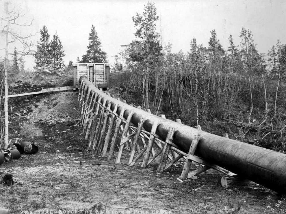
This photo on the panel shows the pressure box mentioned above – by reducing the size of the water flow from the ditch to the pipe, the pressure was greatly increased for use by the hydraulic monitors.
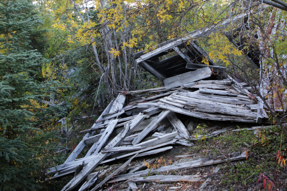
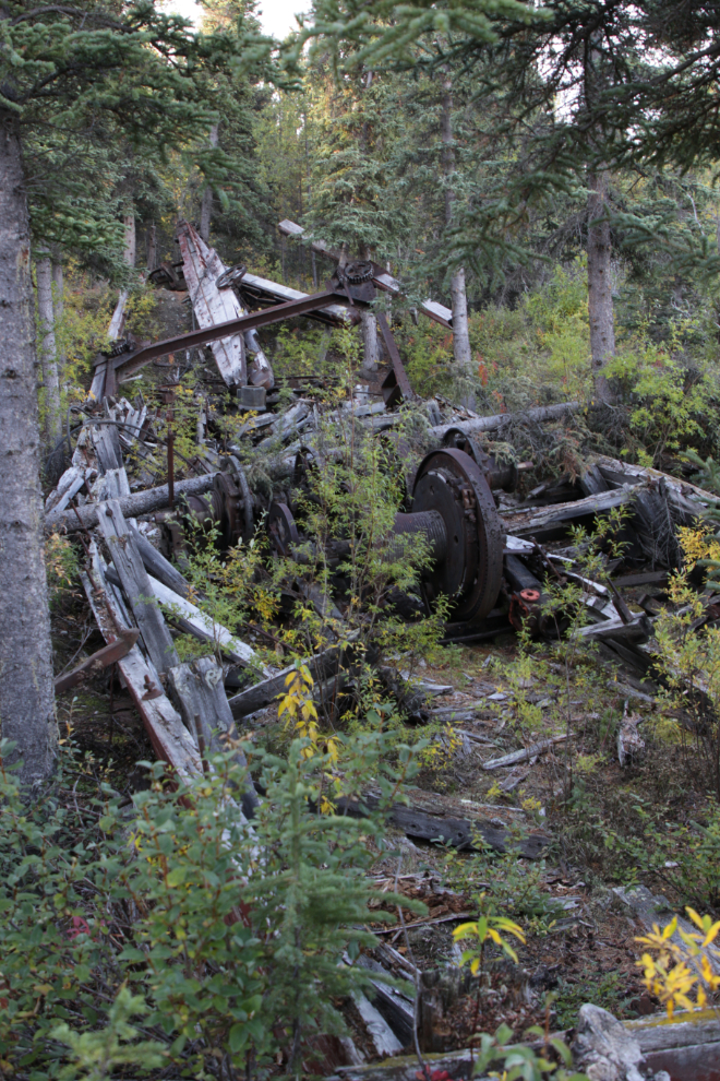
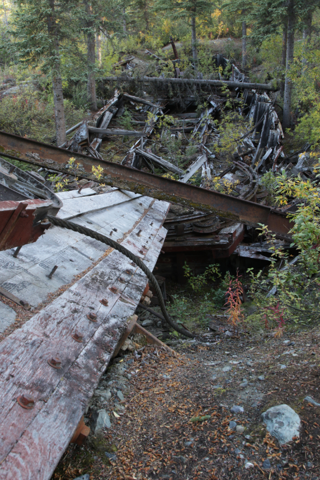
Walking up the short trail, this was my first sight of an old structure of some sort. I didn’t know what to make of it.
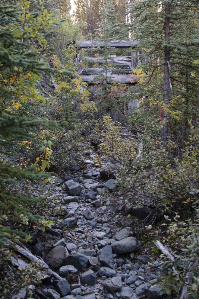
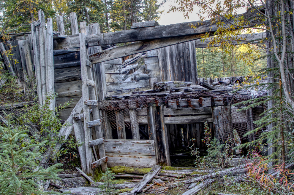
I soon saw that it was a dam, or more accurately a “control structure” for the ditch flow.
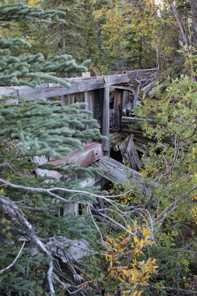
Judging by its location, this wreckage was the house where the person controlling the dam was stationed.
A couple of photos of the control structure from down in the ditch/reservoir. The second is HDR-enhanced to bring out the details.
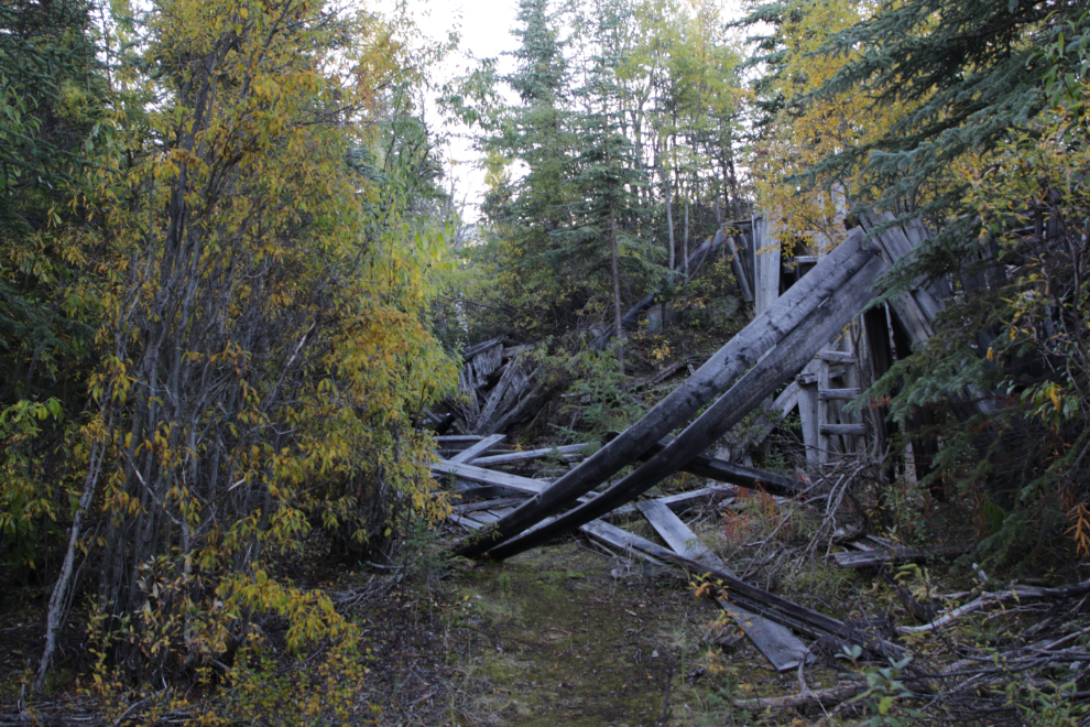
Looking up the 6-foot-deep ditch.
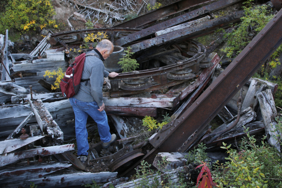
First impression: “Wow, it’s huge!”
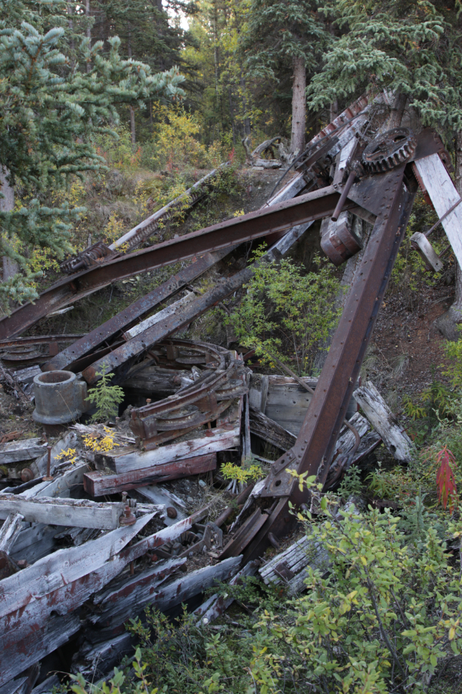
Part of the bow gantry and its circular mount.
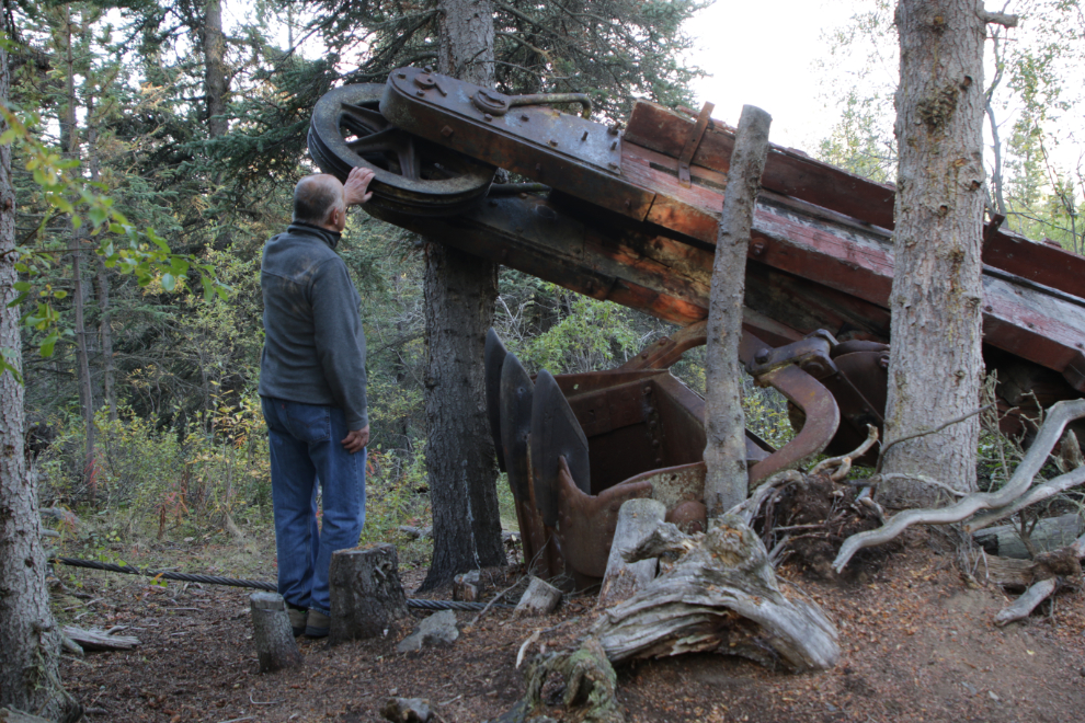
Me at the working end, with the single one-cubic-yard bucket, equipped with massive teeth to handle the frequent boulders that would have been encountered.
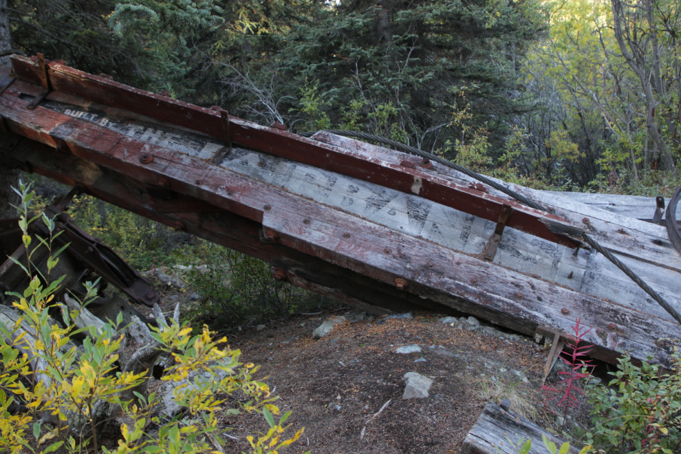
The faded sign on the side of the bow gantry: “Built By The Fairbanks…” [Steam Shovel Company].
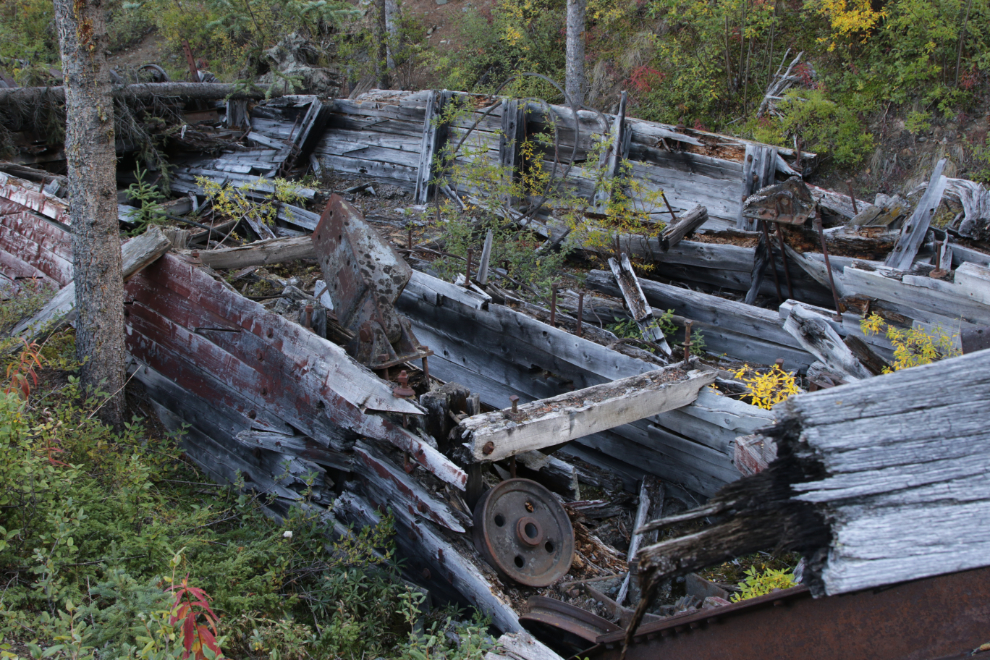
Looking back down at the machinery and hull.
Having a close look at the machinery and hull.
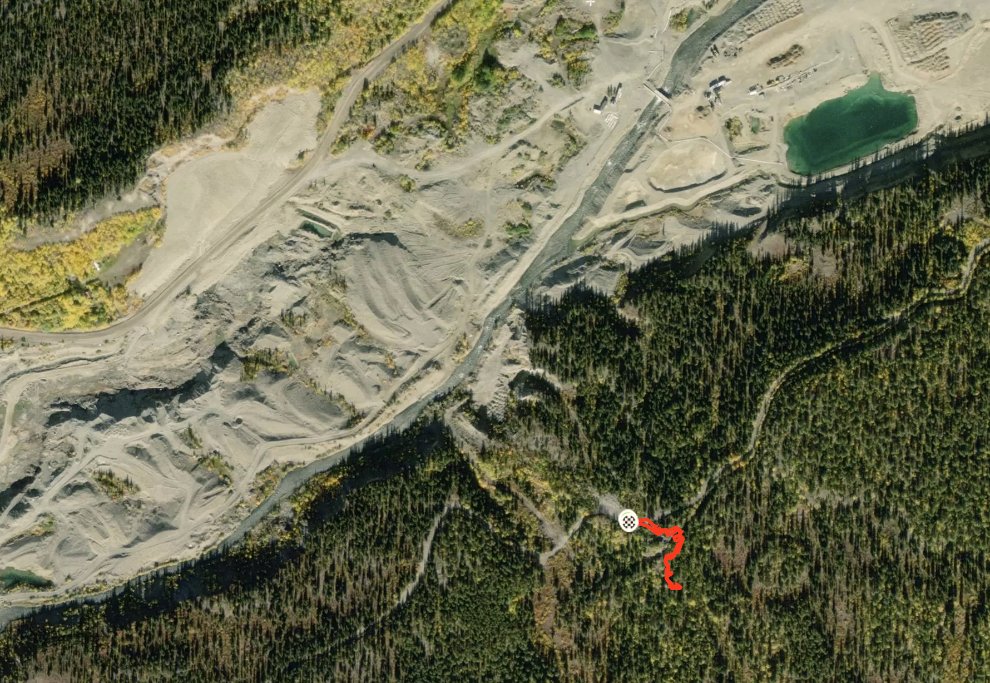
An aerial view of the 330-meter walk (the red squiggle), and Pine Creek to the north. You can find an interactive map at my Strava account.
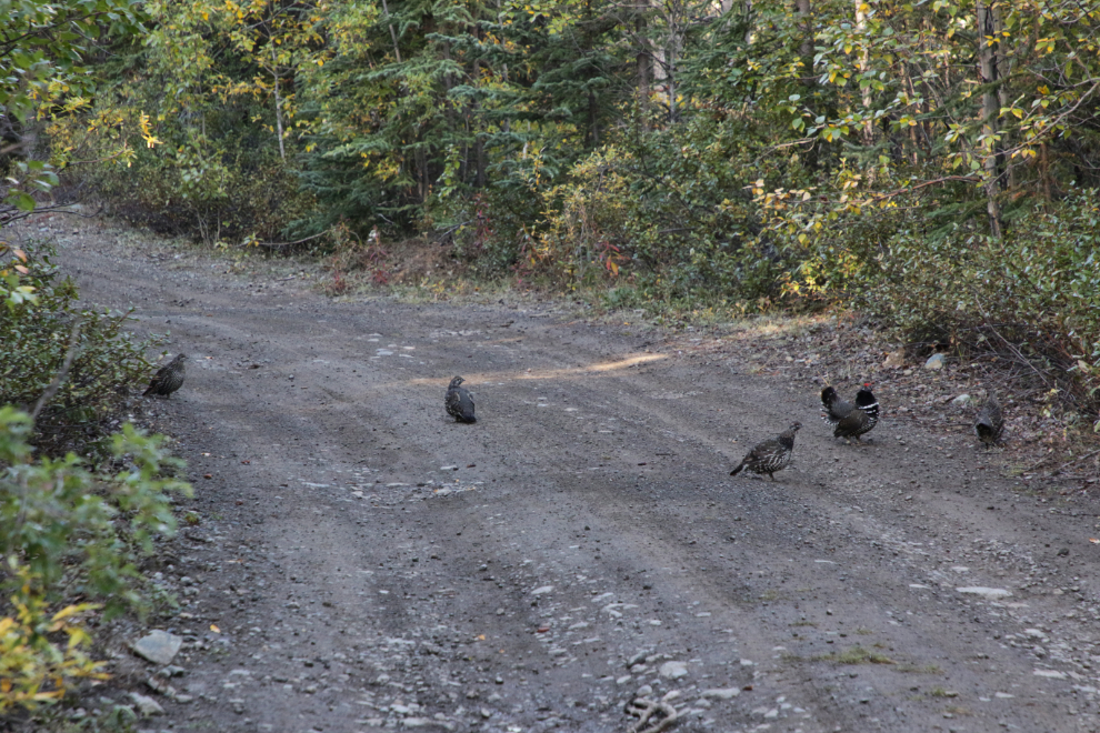
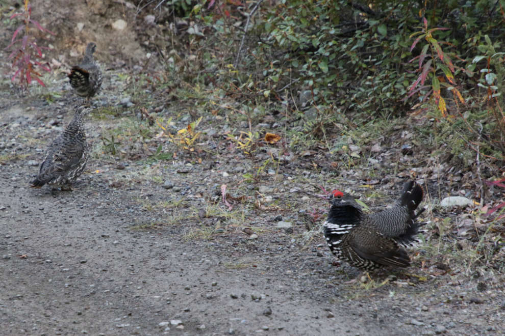
Shortly after leaving the dredge, I met a puffed-up male Spruce grouse (Falcipennis canadenis) and his harem of 7 hens!
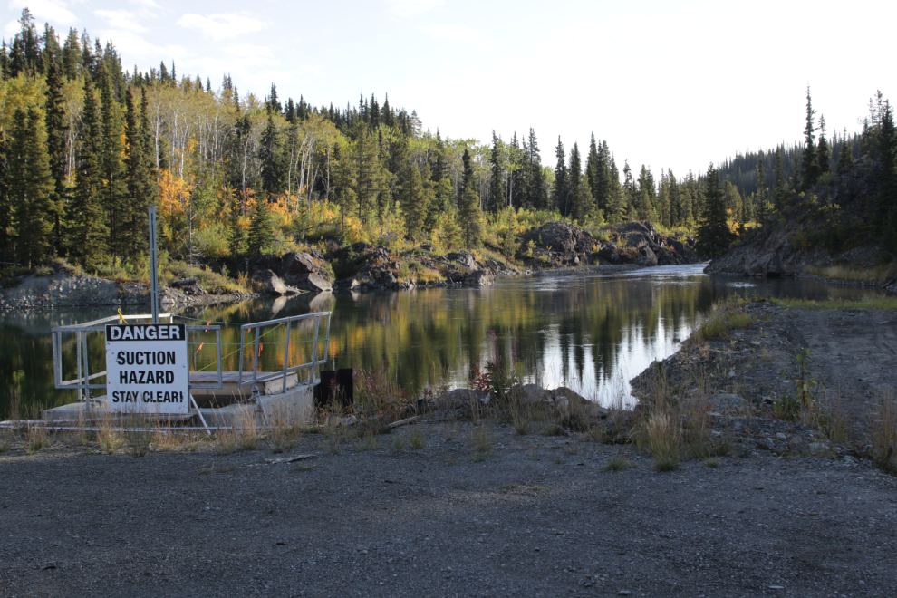
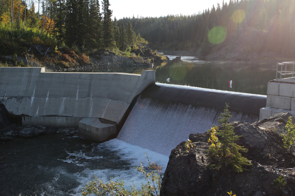
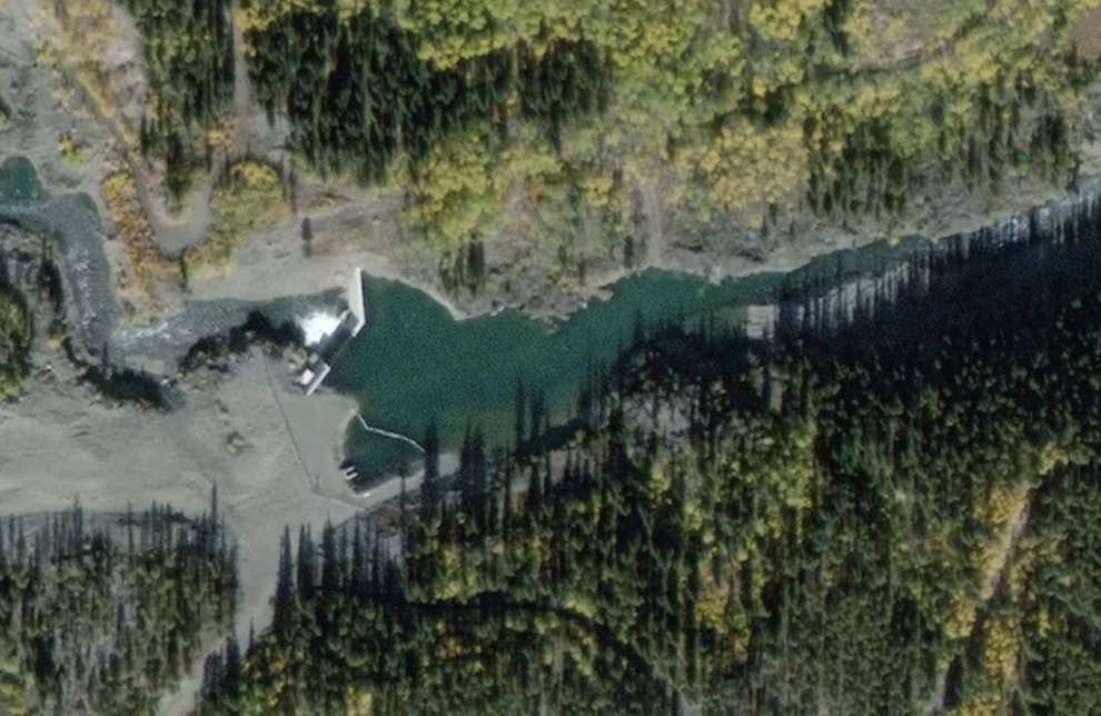
Driving out gave me a better view of a small concrete dam I had passed, and of course I had to go and check it out.

It backs up Pine Creek, but at that point I didn’t know why.
When I got back to Rick and Tina’s that evening, Tina explained that the dam creates a headpond for a power plant that supplies Atlin’s needs. Further research showed that the dam was built in 2009, the power plant initially produced 2.1 megawatts of power, and it is in the process of being greatly increased.
This aerial shows just how small the required reservoir currently is.
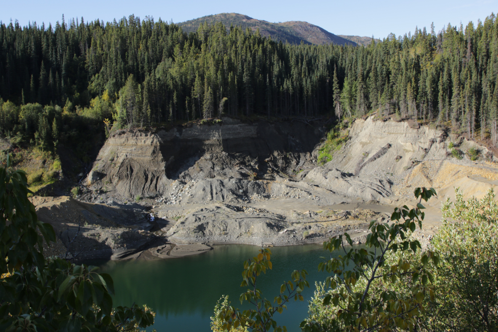
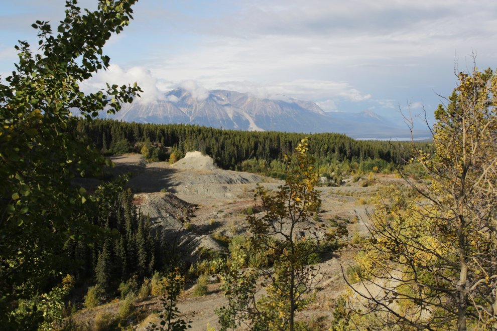
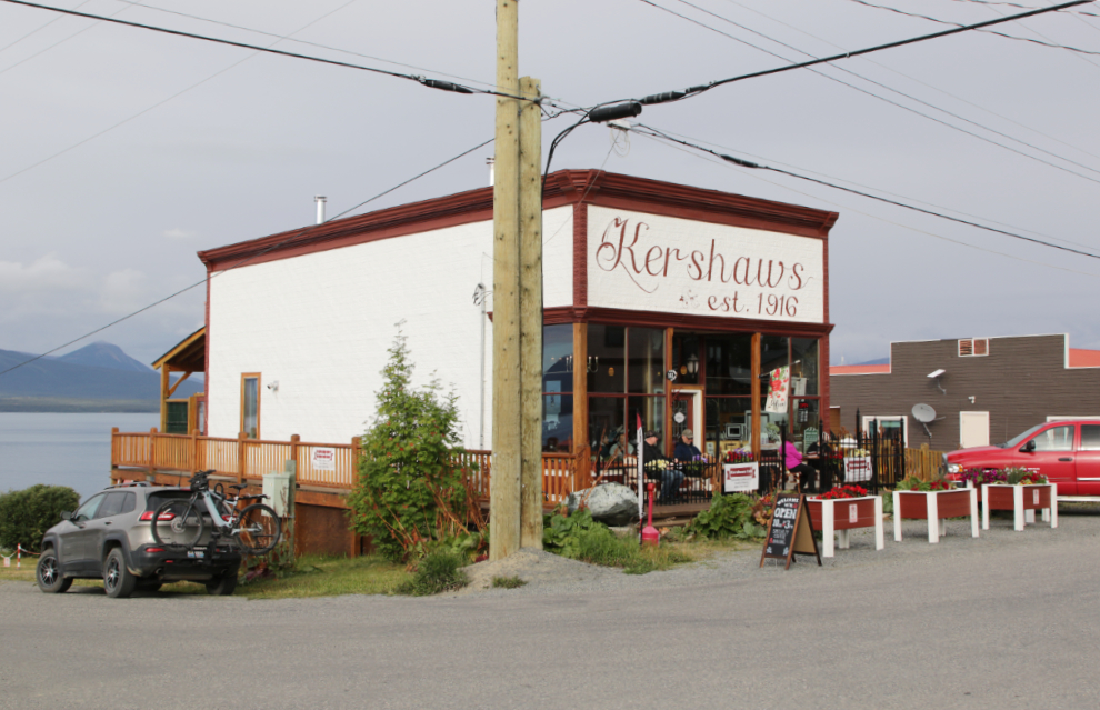
The timing was now right for me to return to Kershaws Café for another coffee and muffin (they open at 10:00). Along the way, I was above a particularly impressive placer mining operation, and stopped for a look, walking to a couple of good viewpoints.
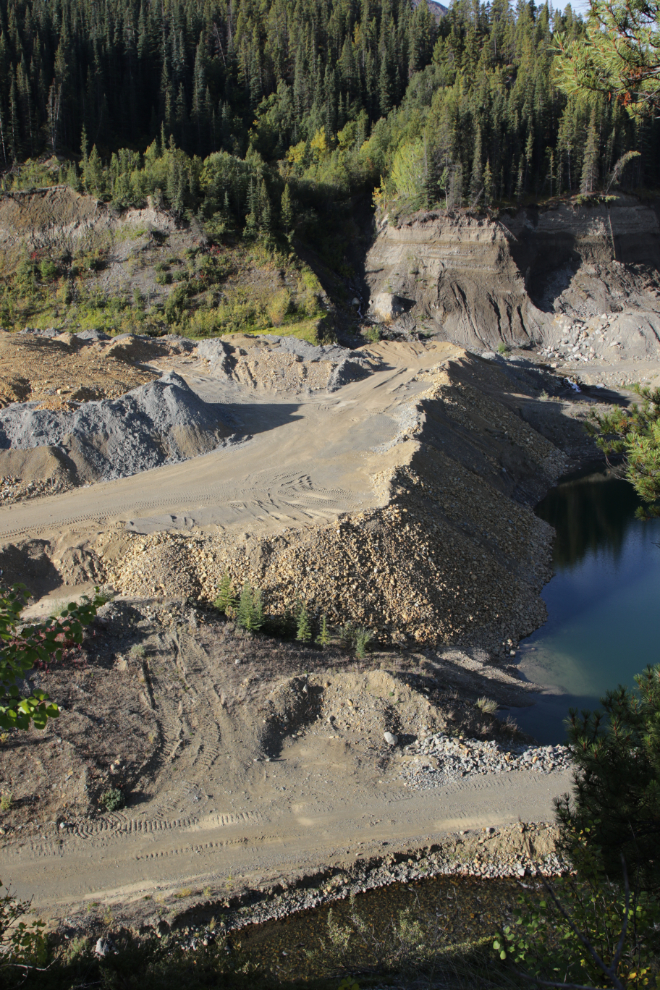
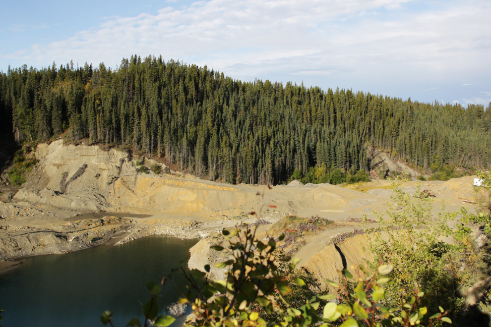
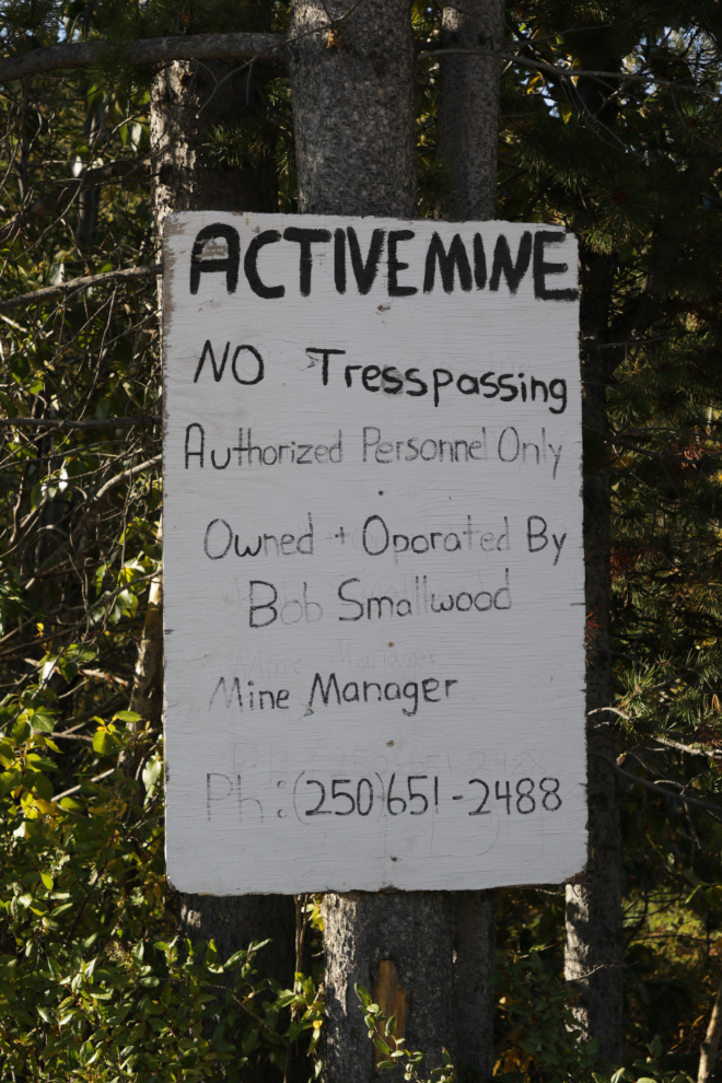
I had seen a sign about the mine shortly before stopping, and went back to get a photo of it for further research.
There had been a massive amount of work done, but I haven’t yet looked to find out when (fairly recently, though).
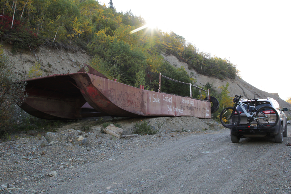
If you want to build your own large dredge, Bob’s the guy to call! Another sign indicates that he’ll sell it as scrap steel.
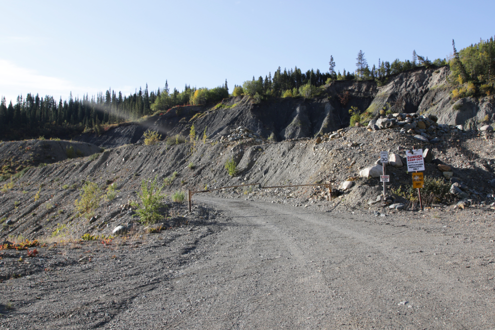
OH! A gate! Hmmmmm… It didn’t take me long to understand that I was lost. I had only the vaguest idea where I was. I never get lost, even in trail-less wilderness.
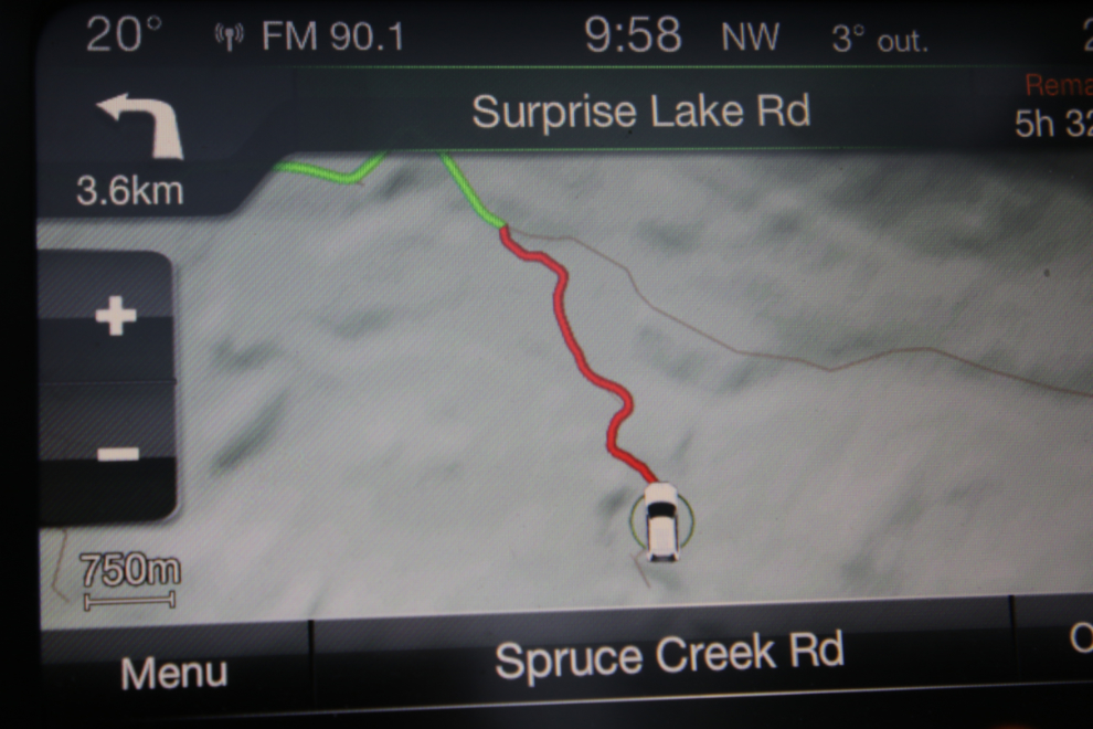
But lost I was, and finally had to turn on the Jeep’s nav system 🙁
Just 2 minutes later, I saw Atlin’s famous rock glacier, and knew where I was. It’s only while I was writing this post, though, that I figured out that it was Spruce Creek I had been driving up, and found the wrong turn I had made.
A little while at Kershaw’s and I was ready to get back to exploring 🙂
The final post from this trip will be about Ruby Creek and Ruby Mountain.
Reading and seeing photos in North country books my father had by the dozens… my first exposure to a dredge was in Chicken AK where I think you have also visited. Impressive machinery. Atlin just looks like great country to explore and noodle about in. Glad you found the time to return.